Hastings is a town in Jefferson County, Oklahoma, United States. The population was 143 at the 2010 census, a decline of 7.8 percent from the figure of 155 in 2000.
| Name: | Hastings town |
|---|---|
| LSAD Code: | 43 |
| LSAD Description: | town (suffix) |
| State: | Oklahoma |
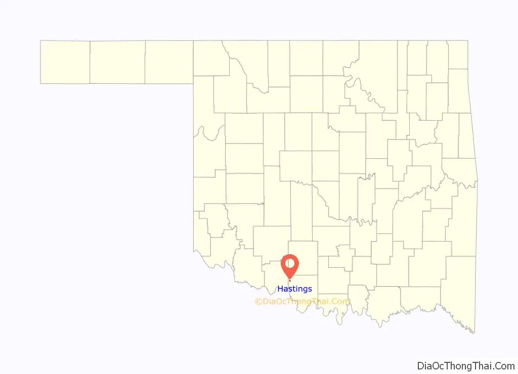
| County: | Jefferson County |
| Elevation: | 1,004 ft (306 m) |
| Total Area: | 0.48 sq mi (1.25 km²) |
| Land Area: | 0.48 sq mi (1.25 km²) |
| Water Area: | 0.00 sq mi (0.00 km²) |
| Total Population: | 104 |
| Population Density: | 215.77/sq mi (83.23/km²) |
| ZIP code: | 73548 |
| Area code: | 580 |
| FIPS code: | 4033000 |
| GNISfeature ID: | 1093597 |
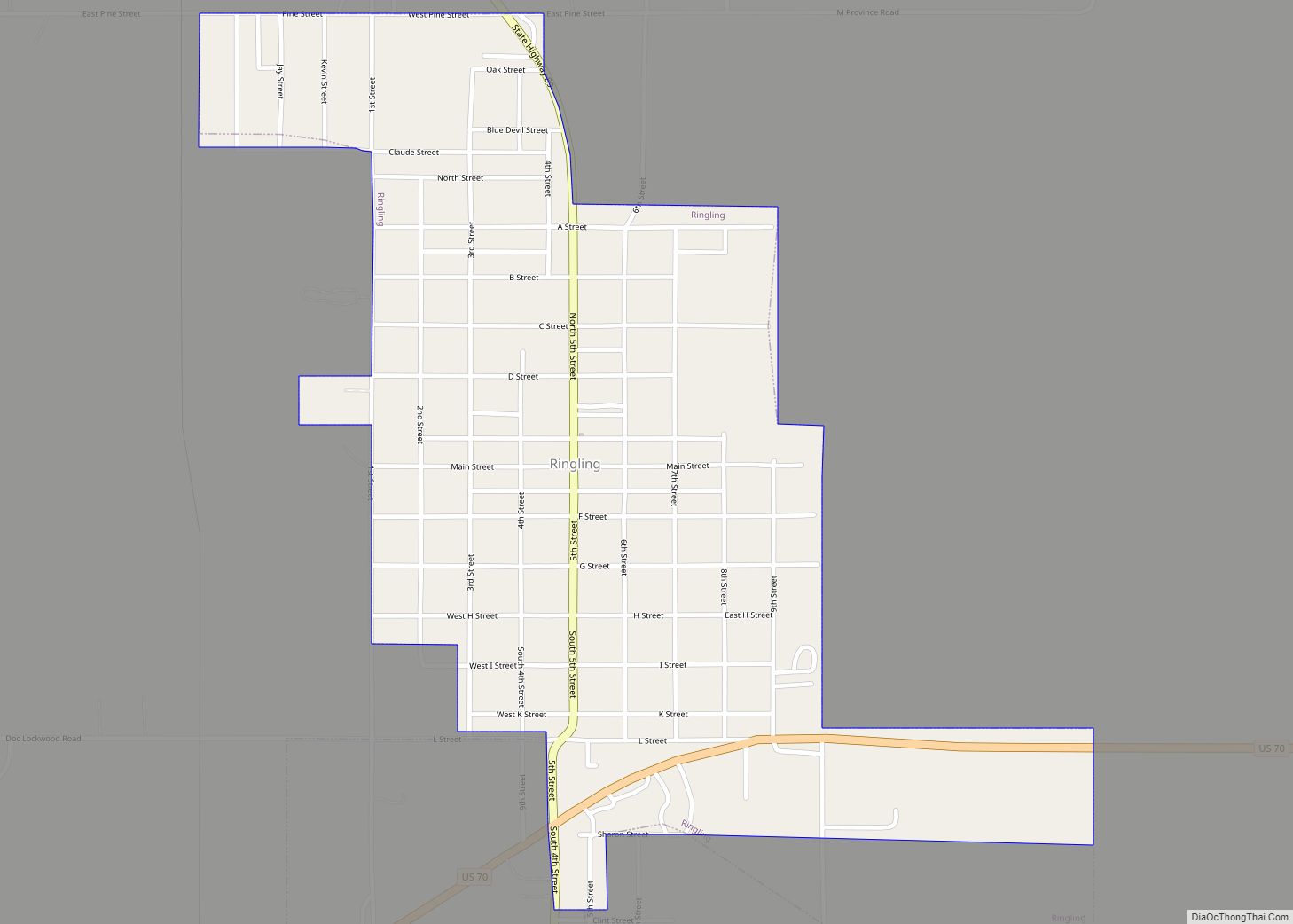
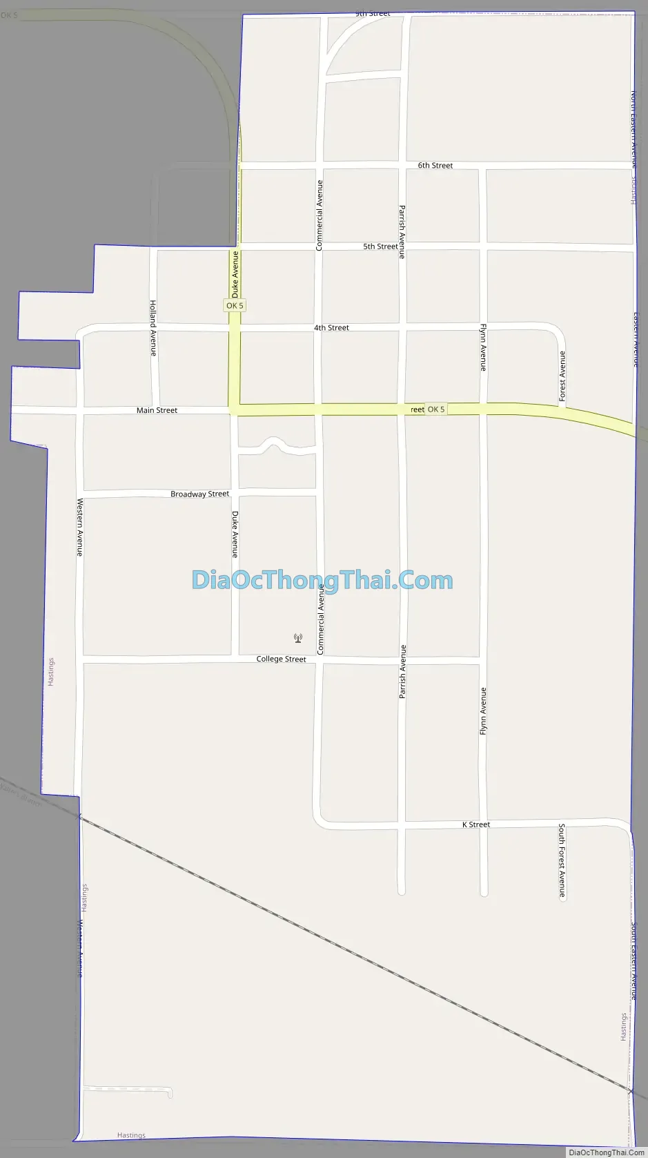
Online Interactive Map
Click on ![]() to view map in "full screen" mode.
to view map in "full screen" mode.
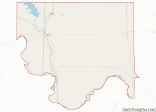
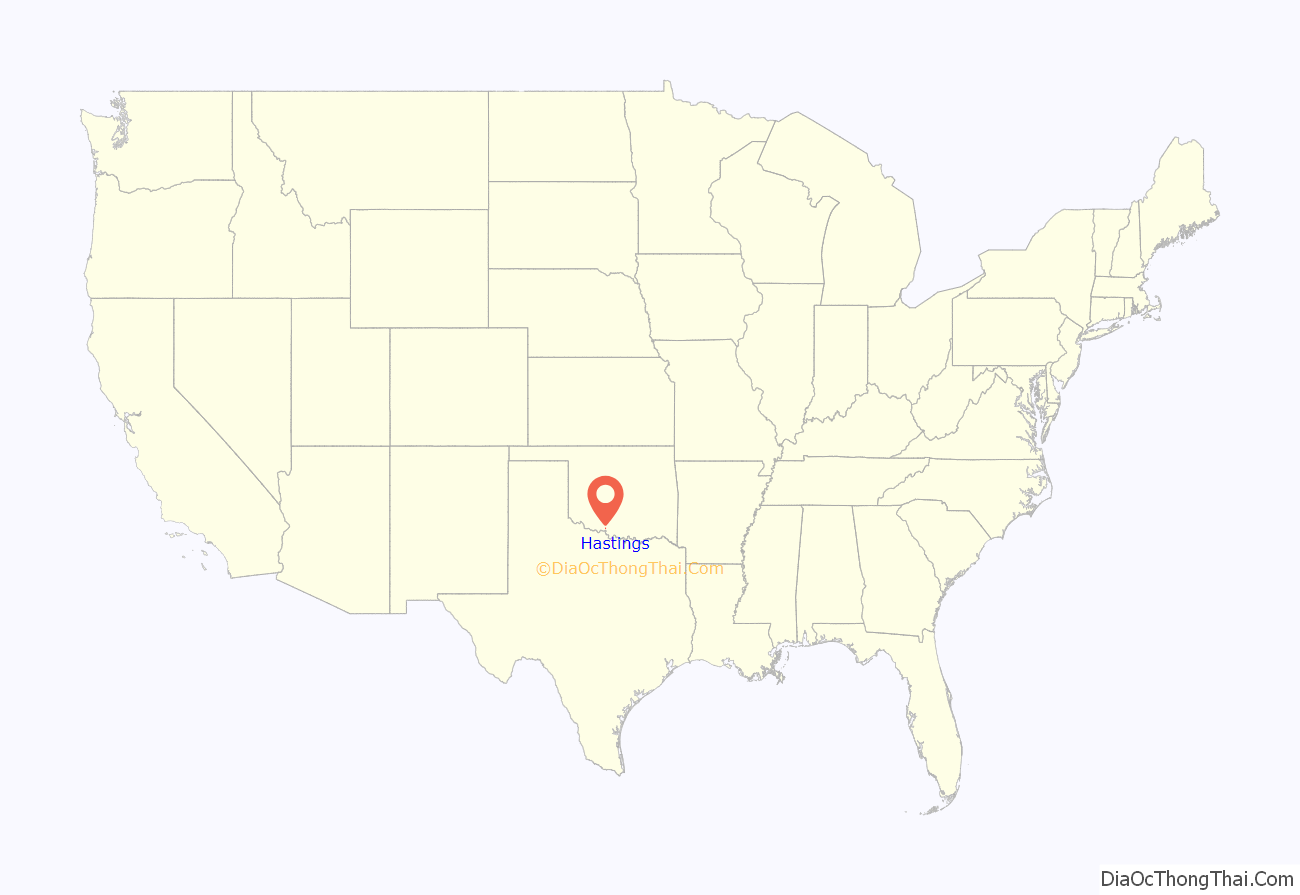
Hastings location map. Where is Hastings town?
History
A community called Bayard existed at the site of present-day Hastings until the Kiowa, Comanche, and Apache Reservation was opened to new settlers on August 6, 1901. Since Indian Territory already had a post office named “Baird”, the postal department named the station it established at this location. A couple of residents had suggested naming it for their hometown of Hastings, Nebraska. That was accepted by postal officials.
In 1902, a railroad line called the Enid and Anadarko built tracks through Hastings. The population was 560 in 1907 and 727 in 1910. The population has declined nearly continuously from 1910 until the present.
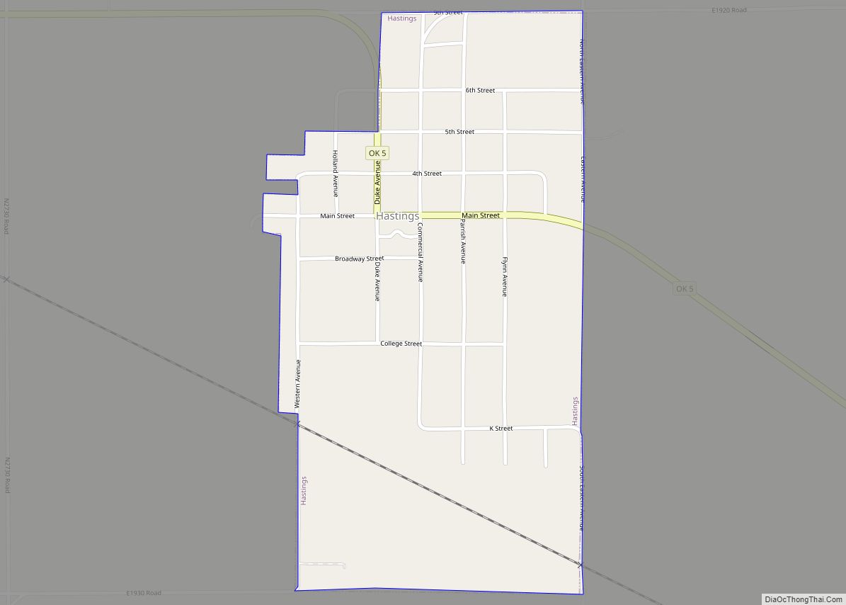
Hastings Road Map
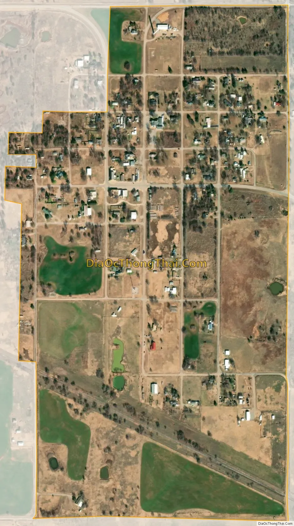
Hastings city Satellite Map
Geography
Hastings is located in northwestern Jefferson County at 34°13′39″N 98°06′31″W / 34.2275°N 98.1086°W / 34.2275; -98.1086. It is 9 miles (14 km) northwest of Waurika along Oklahoma State Highway 5 and 5 miles (8.0 km) north of the Red River.
According to the United States Census Bureau, the town has a total area of 0.48 square miles (1.24 km), all land.
See also
Map of Oklahoma State and its subdivision:- Adair
- Alfalfa
- Atoka
- Beaver
- Beckham
- Blaine
- Bryan
- Caddo
- Canadian
- Carter
- Cherokee
- Choctaw
- Cimarron
- Cleveland
- Coal
- Comanche
- Cotton
- Craig
- Creek
- Custer
- Delaware
- Dewey
- Ellis
- Garfield
- Garvin
- Grady
- Grant
- Greer
- Harmon
- Harper
- Haskell
- Hughes
- Jackson
- Jefferson
- Johnston
- Kay
- Kingfisher
- Kiowa
- Latimer
- Le Flore
- Lincoln
- Logan
- Love
- Major
- Marshall
- Mayes
- McClain
- McCurtain
- McIntosh
- Murray
- Muskogee
- Noble
- Nowata
- Okfuskee
- Oklahoma
- Okmulgee
- Osage
- Ottawa
- Pawnee
- Payne
- Pittsburg
- Pontotoc
- Pottawatomie
- Pushmataha
- Roger Mills
- Rogers
- Seminole
- Sequoyah
- Stephens
- Texas
- Tillman
- Tulsa
- Wagoner
- Washington
- Washita
- Woods
- Woodward
- Alabama
- Alaska
- Arizona
- Arkansas
- California
- Colorado
- Connecticut
- Delaware
- District of Columbia
- Florida
- Georgia
- Hawaii
- Idaho
- Illinois
- Indiana
- Iowa
- Kansas
- Kentucky
- Louisiana
- Maine
- Maryland
- Massachusetts
- Michigan
- Minnesota
- Mississippi
- Missouri
- Montana
- Nebraska
- Nevada
- New Hampshire
- New Jersey
- New Mexico
- New York
- North Carolina
- North Dakota
- Ohio
- Oklahoma
- Oregon
- Pennsylvania
- Rhode Island
- South Carolina
- South Dakota
- Tennessee
- Texas
- Utah
- Vermont
- Virginia
- Washington
- West Virginia
- Wisconsin
- Wyoming