Ketchum is a town in Craig and Mayes counties, Oklahoma, United States. The population was 442 at the 2010 census, a 27 percent gain from 286 at the 2000 census.
| Name: | Ketchum town |
|---|---|
| LSAD Code: | 43 |
| LSAD Description: | town (suffix) |
| State: | Oklahoma |
| County: | Craig County, Delaware County, Mayes County |
| Elevation: | 771 ft (235 m) |
| Total Area: | 2.07 sq mi (5.37 km²) |
| Land Area: | 2.07 sq mi (5.36 km²) |
| Water Area: | 0.00 sq mi (0.01 km²) |
| Total Population: | 471 |
| Population Density: | 227.43/sq mi (87.80/km²) |
| FIPS code: | 4039550 |
| GNISfeature ID: | 1094351 |
Online Interactive Map
Click on ![]() to view map in "full screen" mode.
to view map in "full screen" mode.
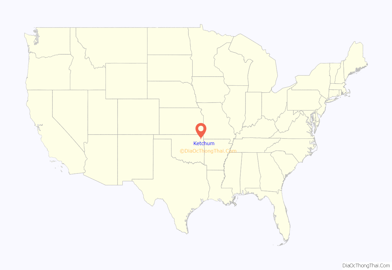
Ketchum location map. Where is Ketchum town?
History
Ketchum was named for a prominent member of the Delaware tribe and Methodist minister named James Ketchum who helped found the town in 1899. Ketchum was originally located in northeastern Mayes County, on the bank of the Grand River (Neosho River). It was relocated to southeastern Craig County around 1912 when the Kansas, Oklahoma, and Gulf Railroad (KO&G) was being constructed from southeastern Kansas to Texas. The original townsite sat in an area that was later filled in by the creation of Grand Lake o’ the Cherokees.
The economy of Ketchum was based on agriculture until Pensacola Dam was built in 1937-1939, creating Grand Lake. Since then, the local economy has largely been dominated by tourism and other businesses related to the lake.
Construction is currently underway to upgrade the town’s airport which was formerly known as the Craig County South Grand Lake Airport. A group of private investors is funding the new airport which includes paving the former grass runway. When the new airport is completed it will be a full service regional airport and will be named the South Grand Lake Regional Airport.
Ketchum Road Map
Ketchum city Satellite Map
Geography
Ketchum is located in the southeast corner of Craig County at 36°31′32″N 95°01′33″W / 36.525627°N 95.025720°W / 36.525627; -95.025720. A portion of the town extends south into Mayes County and borders a small arm of Grand Lake.
Oklahoma State Highway 85 passes through Ketchum, leading 2 miles (3 km) west to Highway 82. Via Highways 85, 82, and U.S. 60, it is 14 miles (23 km) northwest to Vinita, the Craig County seat. Highway 85 leads northeast parallel to Grand Lake, 12 miles (19 km) to Bernice.
According to the United States Census Bureau, the town of Ketchum has a total area of 1.3 square miles (3.3 km), all land.
See also
Map of Oklahoma State and its subdivision:- Adair
- Alfalfa
- Atoka
- Beaver
- Beckham
- Blaine
- Bryan
- Caddo
- Canadian
- Carter
- Cherokee
- Choctaw
- Cimarron
- Cleveland
- Coal
- Comanche
- Cotton
- Craig
- Creek
- Custer
- Delaware
- Dewey
- Ellis
- Garfield
- Garvin
- Grady
- Grant
- Greer
- Harmon
- Harper
- Haskell
- Hughes
- Jackson
- Jefferson
- Johnston
- Kay
- Kingfisher
- Kiowa
- Latimer
- Le Flore
- Lincoln
- Logan
- Love
- Major
- Marshall
- Mayes
- McClain
- McCurtain
- McIntosh
- Murray
- Muskogee
- Noble
- Nowata
- Okfuskee
- Oklahoma
- Okmulgee
- Osage
- Ottawa
- Pawnee
- Payne
- Pittsburg
- Pontotoc
- Pottawatomie
- Pushmataha
- Roger Mills
- Rogers
- Seminole
- Sequoyah
- Stephens
- Texas
- Tillman
- Tulsa
- Wagoner
- Washington
- Washita
- Woods
- Woodward
- Alabama
- Alaska
- Arizona
- Arkansas
- California
- Colorado
- Connecticut
- Delaware
- District of Columbia
- Florida
- Georgia
- Hawaii
- Idaho
- Illinois
- Indiana
- Iowa
- Kansas
- Kentucky
- Louisiana
- Maine
- Maryland
- Massachusetts
- Michigan
- Minnesota
- Mississippi
- Missouri
- Montana
- Nebraska
- Nevada
- New Hampshire
- New Jersey
- New Mexico
- New York
- North Carolina
- North Dakota
- Ohio
- Oklahoma
- Oregon
- Pennsylvania
- Rhode Island
- South Carolina
- South Dakota
- Tennessee
- Texas
- Utah
- Vermont
- Virginia
- Washington
- West Virginia
- Wisconsin
- Wyoming
