Kingston is a town in Marshall County, Oklahoma, United States, in the central southern portion of the state close to the border. The population was 1,601 at the 2010 census.
| Name: | Kingston town |
|---|---|
| LSAD Code: | 43 |
| LSAD Description: | town (suffix) |
| State: | Oklahoma |
| County: | Marshall County |
| Elevation: | 810 ft (247 m) |
| Total Area: | 2.19 sq mi (5.68 km²) |
| Land Area: | 2.19 sq mi (5.68 km²) |
| Water Area: | 0.00 sq mi (0.00 km²) |
| Total Population: | 1,431 |
| Population Density: | 652.23/sq mi (251.88/km²) |
| ZIP code: | 73439 |
| Area code: | 580 |
| FIPS code: | 4039900 |
| GNISfeature ID: | 1102958 |
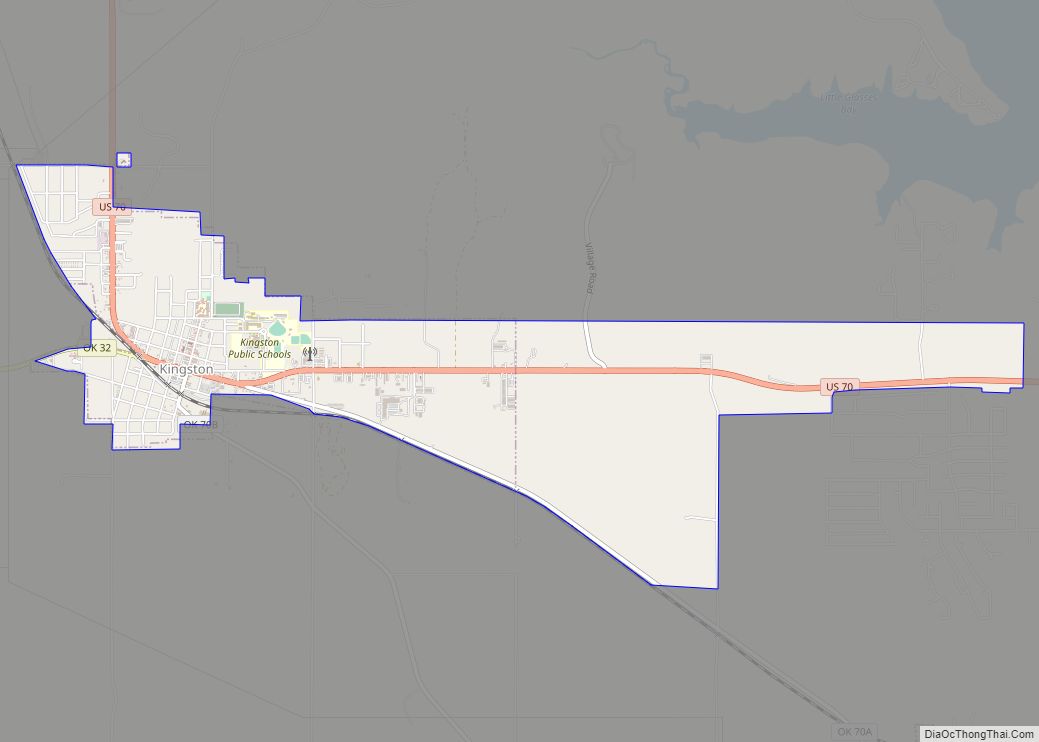
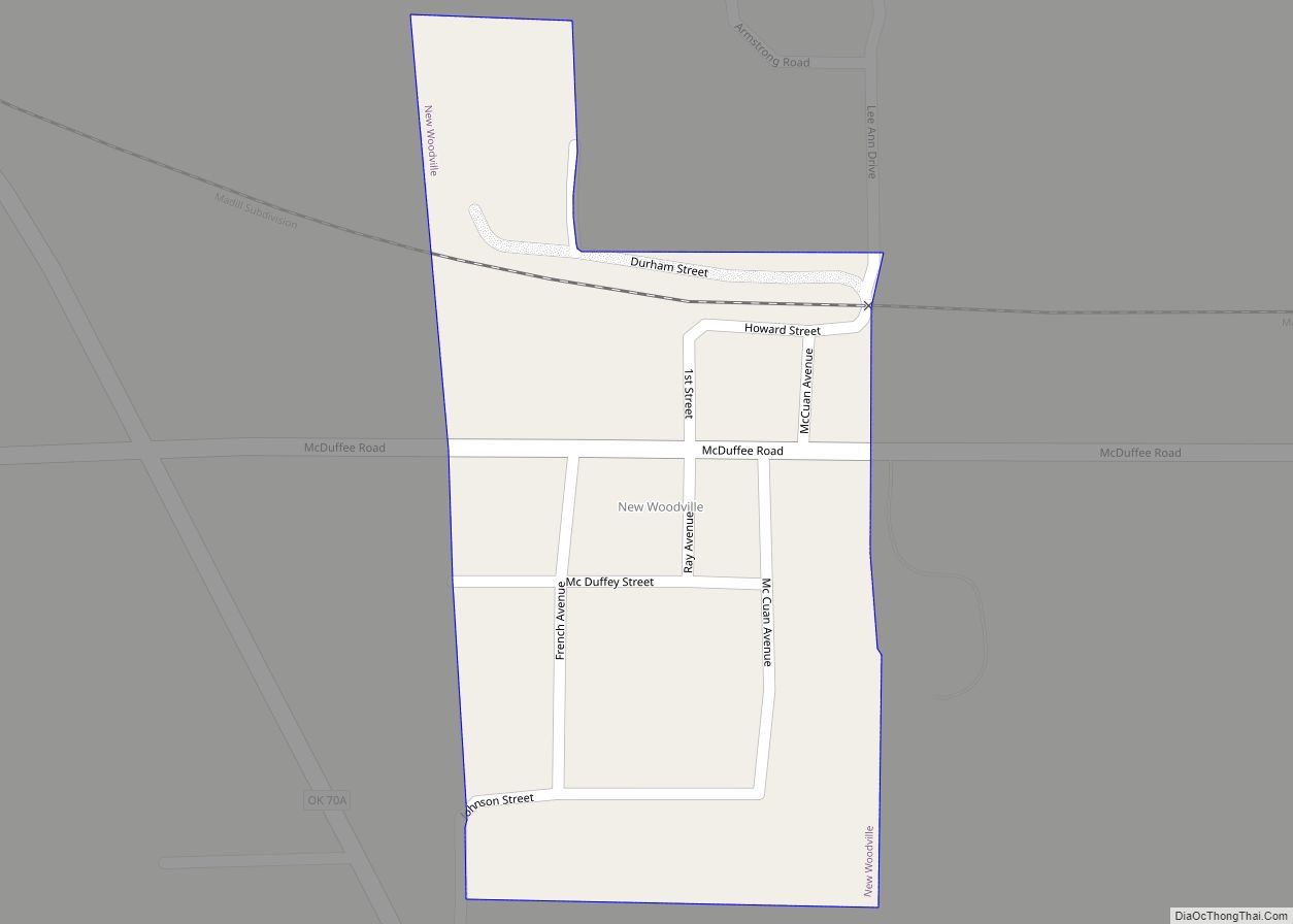
Online Interactive Map
Click on ![]() to view map in "full screen" mode.
to view map in "full screen" mode.
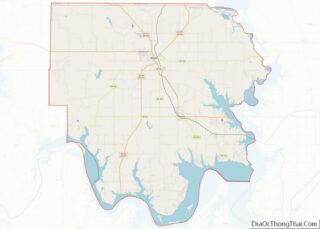
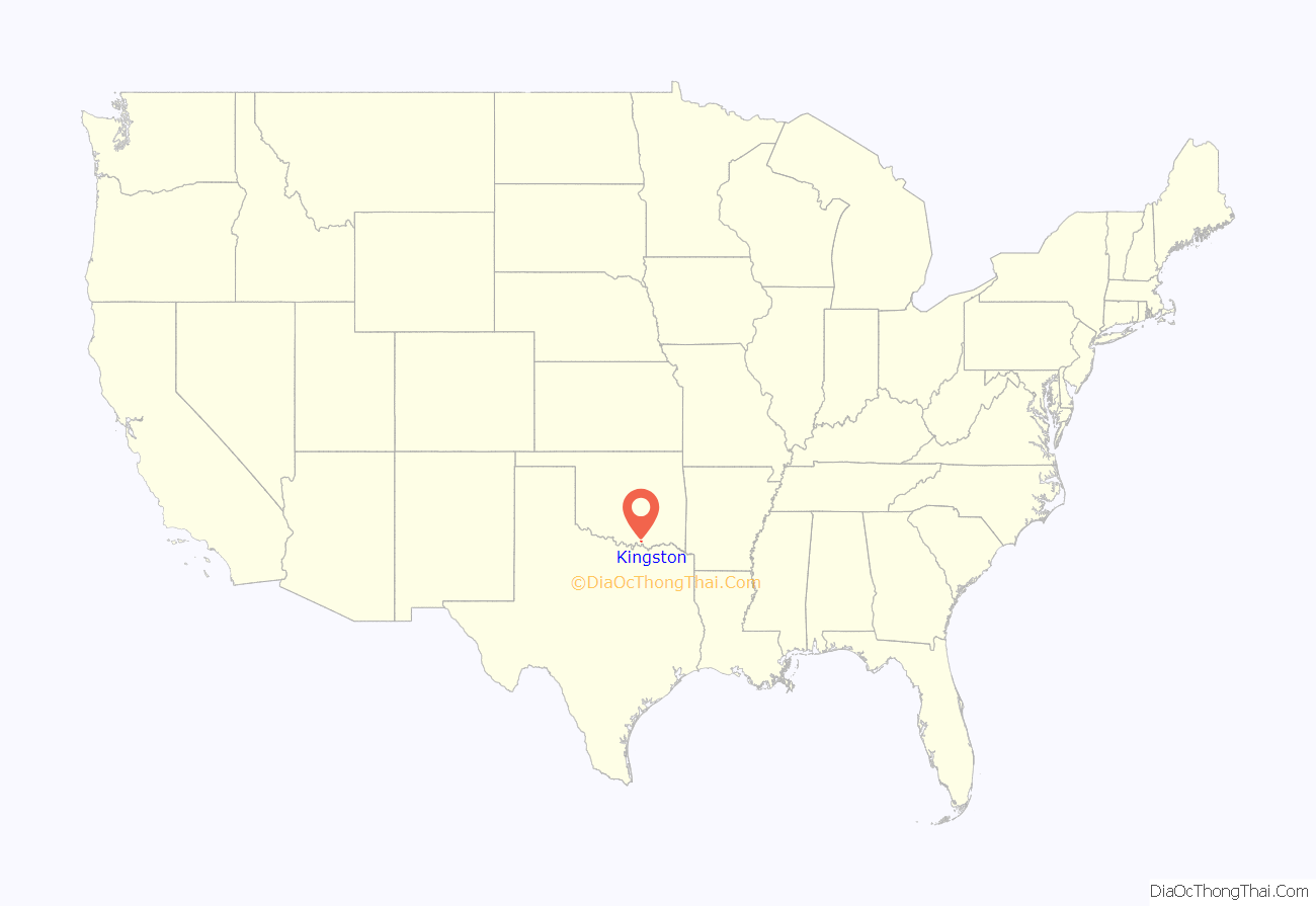
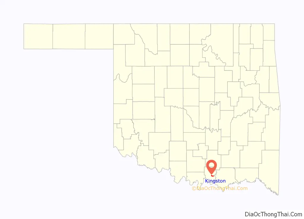
Kingston location map. Where is Kingston town?
History
Kingston was originally known as Helen. The community was named for Helen Willis, daughter of J.H. Willis, a prominent early-day resident. On April 4, 1894 a post office was established at Helen and was called Kingston, Indian Territory. The post office took its name from Jeff King, a longtime local resident.
At the time of its founding, Helen, later Kingston, was located in Pickens County, Chickasaw Nation, in Indian Territory. This was one of the Five Civilized Tribes required to remove to this area from the Southeast United States in the 1830s.
The early settlement included a general store, cotton gin, and a schoolhouse that doubled as a church.
Several of the older buildings in Kingston were torn down in the late 1980s for redevelopment of the area for a new hardware store and lumberyard. The town constructed a new multipurpose activity building, which is located on the high school campus. The oldest remaining building in Kingston, which originally was the town bank, has been adapted for retail use as Dee’s Creative Corner.
Kingston’s High School Alumni Association, founded in 1911 soon after statehood, is the oldest active alumni association in the state of Oklahoma. Each year graduates of Kingston High School are given the opportunity to join the association. Through their donations and fund raisers, the Alumni Association helps to send local students to college.
Notable figures include country music singer, Dale Lay, and rock and roll drummer Greg Upchurch. Lay released several country albums, several radio singles, and performed at the Grand Ole Opry in Nashville, Tennessee. He developed and supported the Kingston High School band. For several years, Lay raised money to buy new instruments and band uniforms at his annual benefit concert.
Dale’s son, Anthony Lay, is a nationally syndicated radio personality. He goes by the moniker “The AntMan” and hosts a syndicated Saturday night show, “Country House Party”, broadcast on more than 80 iHeart Country radio stations across the nation.
Greg Upchurch began his rock career with the band Puddle of Mudd. Since 2005 he has been the drummer for 3 Doors Down. Upchurch first developed his percussion skills in the Kingston High School band.
On March 21, 2022, an EF2 tornado caused significant damage to structures.
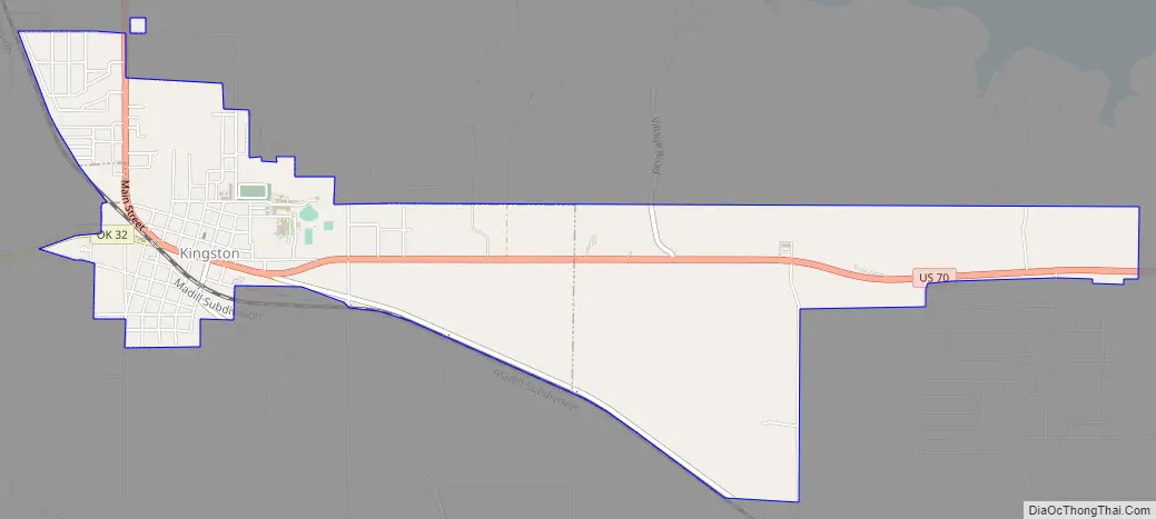
Kingston Road Map
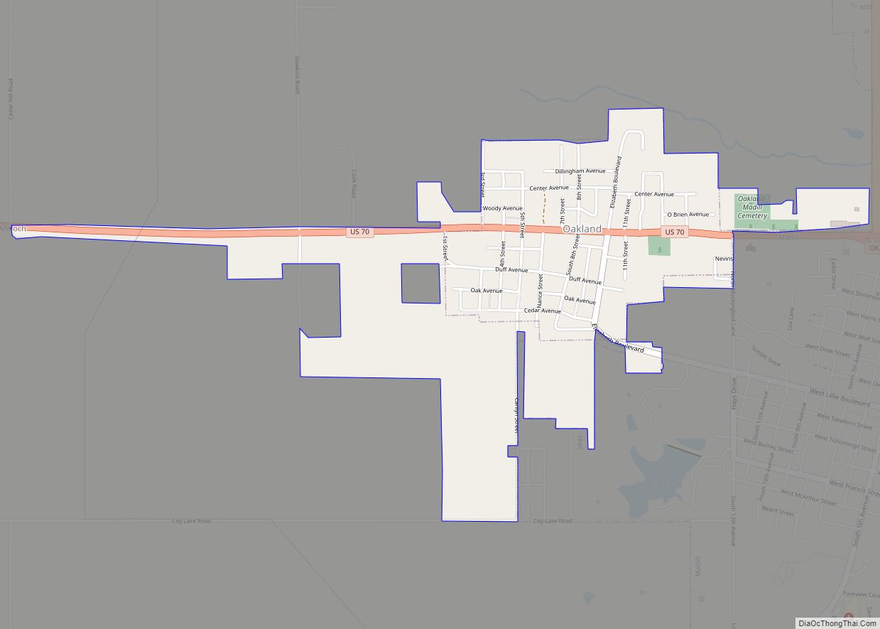
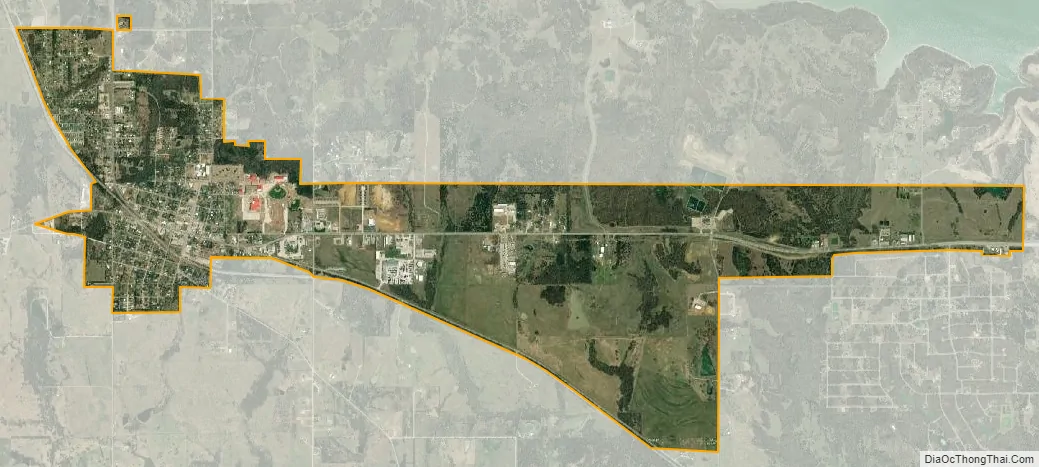
Kingston city Satellite Map
Geography
Kingston is located at 34°0′1″N 96°43′16″W / 34.00028°N 96.72111°W / 34.00028; -96.72111 (34.000146, -96.721133).
According to the United States Census Bureau, the town has a total area of 1.8 square miles (4.7 km), all land.
See also
Map of Oklahoma State and its subdivision:- Adair
- Alfalfa
- Atoka
- Beaver
- Beckham
- Blaine
- Bryan
- Caddo
- Canadian
- Carter
- Cherokee
- Choctaw
- Cimarron
- Cleveland
- Coal
- Comanche
- Cotton
- Craig
- Creek
- Custer
- Delaware
- Dewey
- Ellis
- Garfield
- Garvin
- Grady
- Grant
- Greer
- Harmon
- Harper
- Haskell
- Hughes
- Jackson
- Jefferson
- Johnston
- Kay
- Kingfisher
- Kiowa
- Latimer
- Le Flore
- Lincoln
- Logan
- Love
- Major
- Marshall
- Mayes
- McClain
- McCurtain
- McIntosh
- Murray
- Muskogee
- Noble
- Nowata
- Okfuskee
- Oklahoma
- Okmulgee
- Osage
- Ottawa
- Pawnee
- Payne
- Pittsburg
- Pontotoc
- Pottawatomie
- Pushmataha
- Roger Mills
- Rogers
- Seminole
- Sequoyah
- Stephens
- Texas
- Tillman
- Tulsa
- Wagoner
- Washington
- Washita
- Woods
- Woodward
- Alabama
- Alaska
- Arizona
- Arkansas
- California
- Colorado
- Connecticut
- Delaware
- District of Columbia
- Florida
- Georgia
- Hawaii
- Idaho
- Illinois
- Indiana
- Iowa
- Kansas
- Kentucky
- Louisiana
- Maine
- Maryland
- Massachusetts
- Michigan
- Minnesota
- Mississippi
- Missouri
- Montana
- Nebraska
- Nevada
- New Hampshire
- New Jersey
- New Mexico
- New York
- North Carolina
- North Dakota
- Ohio
- Oklahoma
- Oregon
- Pennsylvania
- Rhode Island
- South Carolina
- South Dakota
- Tennessee
- Texas
- Utah
- Vermont
- Virginia
- Washington
- West Virginia
- Wisconsin
- Wyoming