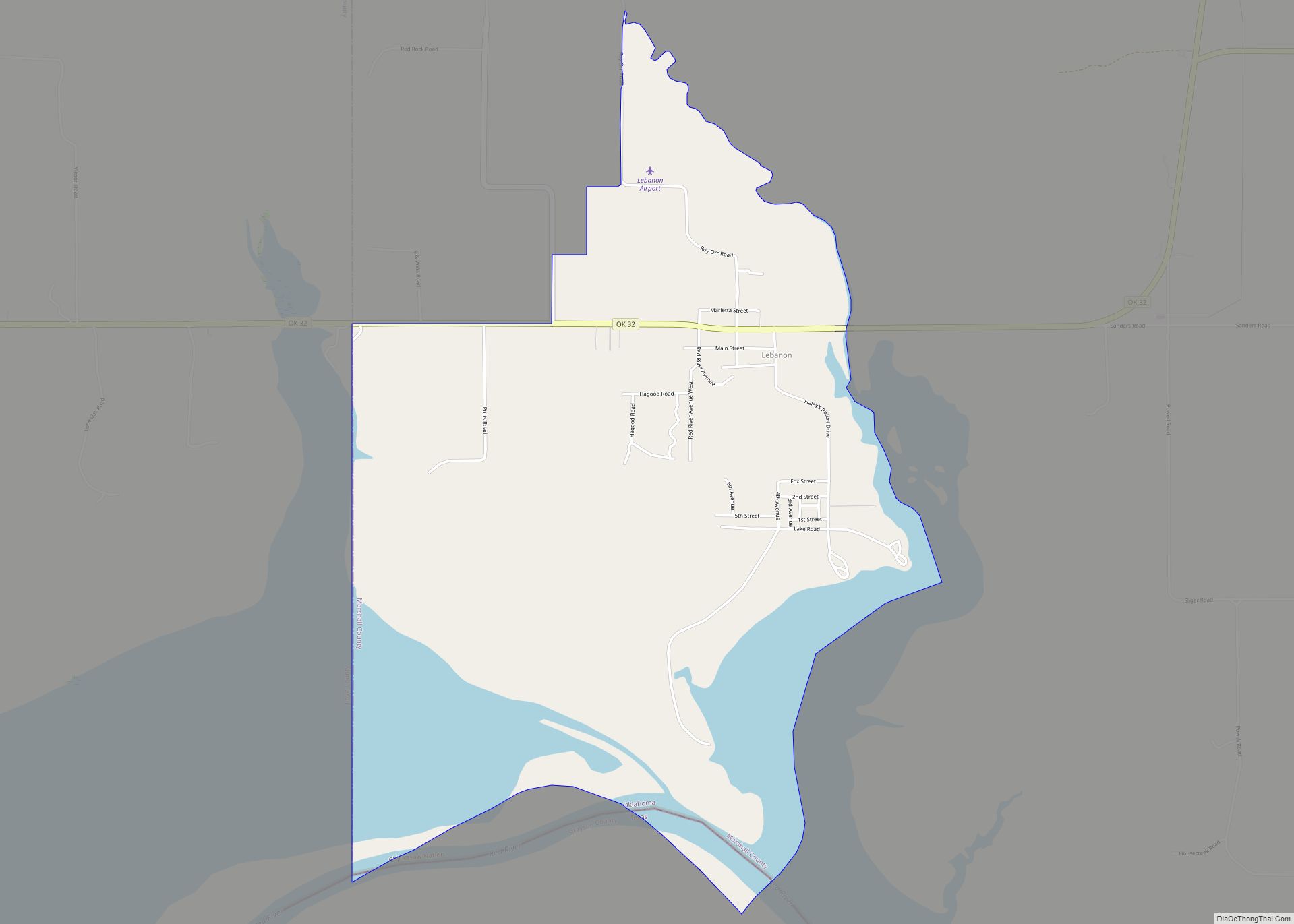
Lebanon is census-designated place (CDP) and unincorporated community in Marshall County, Oklahoma, United States. It has a post office with the ZIP code 73440.
| Name: | Lebanon CDP |
|---|---|
| LSAD Code: | 57 |
| LSAD Description: | CDP (suffix) |
| State: | Oklahoma |
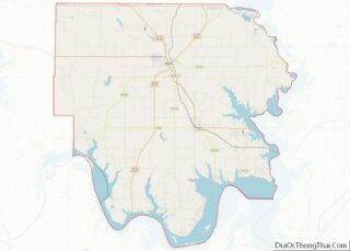
| County: | Marshall County |
| Elevation: | 676 ft (206 m) |
| Total Area: | 4.07 sq mi (10.55 km²) |
| Land Area: | 3.09 sq mi (8.01 km²) |
| Water Area: | 0.98 sq mi (2.54 km²) |
| Total Population: | 210 |
| Population Density: | 67.92/sq mi (26.22/km²) |
| ZIP code: | 73440 |
| Area code: | 580 |
| FIPS code: | 4041950 |
| GNISfeature ID: | 1094549 |
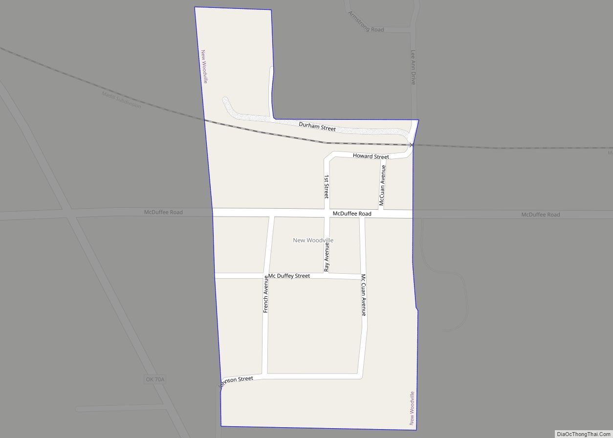
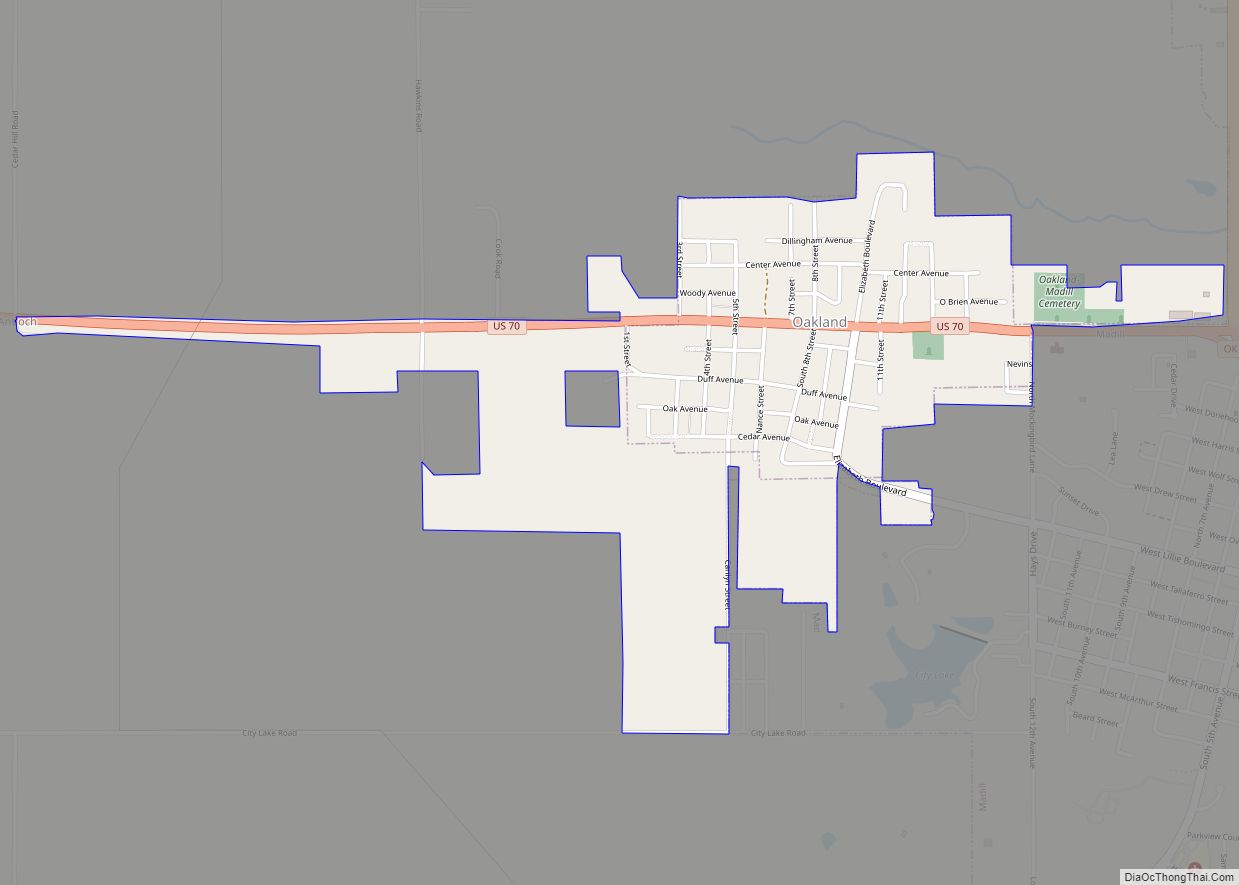
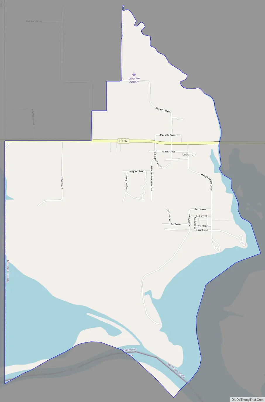
Online Interactive Map
Click on ![]() to view map in "full screen" mode.
to view map in "full screen" mode.
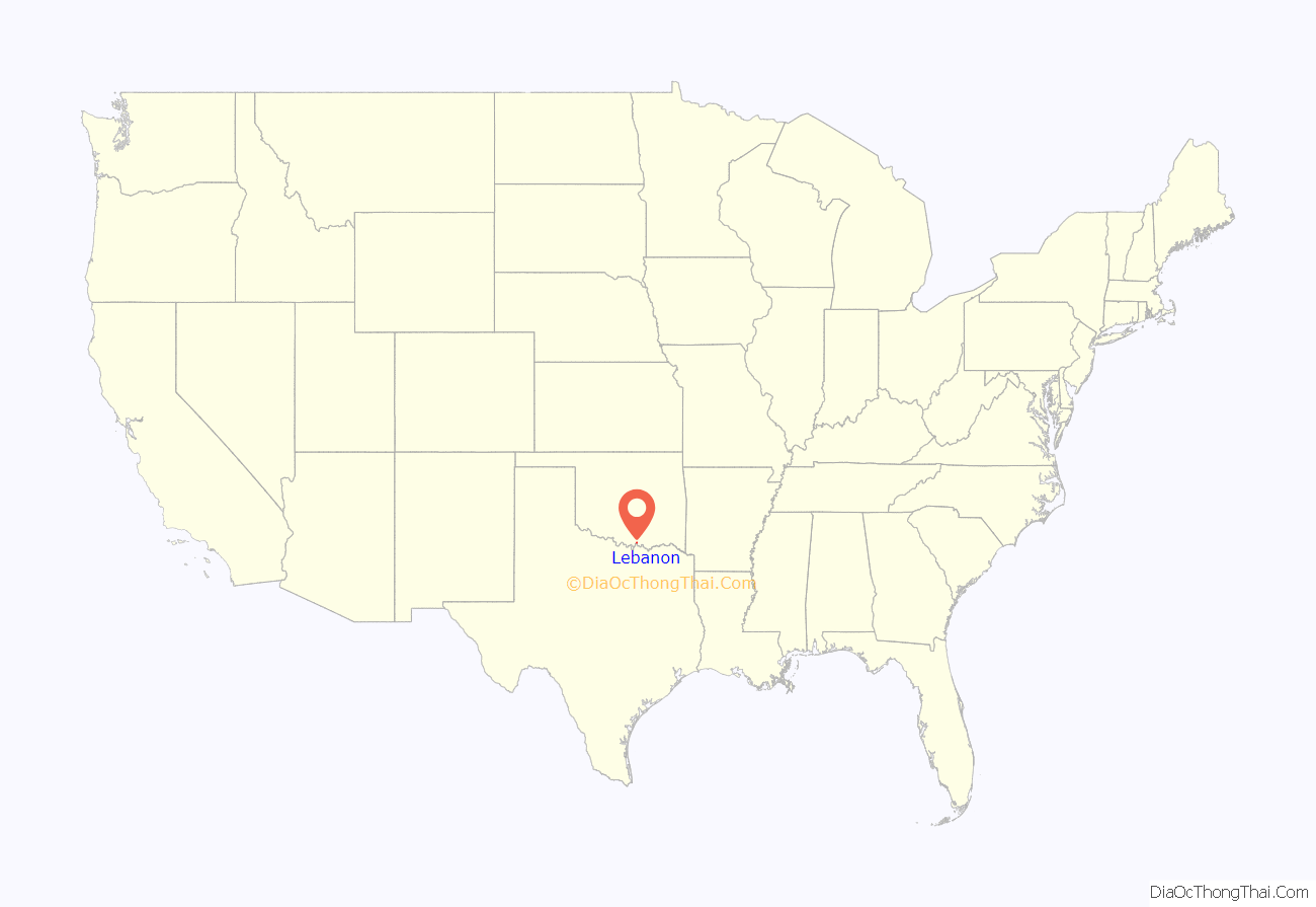
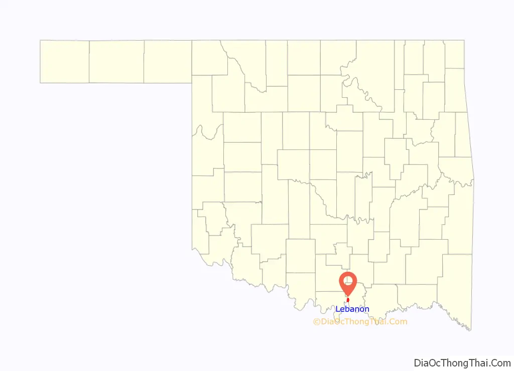
Lebanon location map. Where is Lebanon CDP?
History
Lebanon was settled in the late 19th century as part of the Chickasaw Indian Nation and was part of Pickens County. A Chickasaw Tribal Courthouse was located in Lebanon. About a mile to the east of Hauani Creek is the remains of the Burney School, a tribal school operated by the Chickasaws.
Lebanon Road Map
Lebanon city Satellite Map
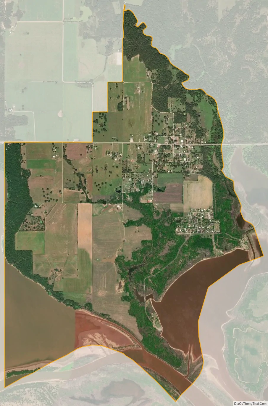
Geography
Lebanon is located on the western end of Lake Texoma, near where the Red River and Hauani Creek enters the lake at 33°58′56″N 96°54′27″W / 33.98222°N 96.90750°W / 33.98222; -96.90750 (33.982222, -96.9075).
See also
Map of Oklahoma State and its subdivision:- Adair
- Alfalfa
- Atoka
- Beaver
- Beckham
- Blaine
- Bryan
- Caddo
- Canadian
- Carter
- Cherokee
- Choctaw
- Cimarron
- Cleveland
- Coal
- Comanche
- Cotton
- Craig
- Creek
- Custer
- Delaware
- Dewey
- Ellis
- Garfield
- Garvin
- Grady
- Grant
- Greer
- Harmon
- Harper
- Haskell
- Hughes
- Jackson
- Jefferson
- Johnston
- Kay
- Kingfisher
- Kiowa
- Latimer
- Le Flore
- Lincoln
- Logan
- Love
- Major
- Marshall
- Mayes
- McClain
- McCurtain
- McIntosh
- Murray
- Muskogee
- Noble
- Nowata
- Okfuskee
- Oklahoma
- Okmulgee
- Osage
- Ottawa
- Pawnee
- Payne
- Pittsburg
- Pontotoc
- Pottawatomie
- Pushmataha
- Roger Mills
- Rogers
- Seminole
- Sequoyah
- Stephens
- Texas
- Tillman
- Tulsa
- Wagoner
- Washington
- Washita
- Woods
- Woodward
- Alabama
- Alaska
- Arizona
- Arkansas
- California
- Colorado
- Connecticut
- Delaware
- District of Columbia
- Florida
- Georgia
- Hawaii
- Idaho
- Illinois
- Indiana
- Iowa
- Kansas
- Kentucky
- Louisiana
- Maine
- Maryland
- Massachusetts
- Michigan
- Minnesota
- Mississippi
- Missouri
- Montana
- Nebraska
- Nevada
- New Hampshire
- New Jersey
- New Mexico
- New York
- North Carolina
- North Dakota
- Ohio
- Oklahoma
- Oregon
- Pennsylvania
- Rhode Island
- South Carolina
- South Dakota
- Tennessee
- Texas
- Utah
- Vermont
- Virginia
- Washington
- West Virginia
- Wisconsin
- Wyoming