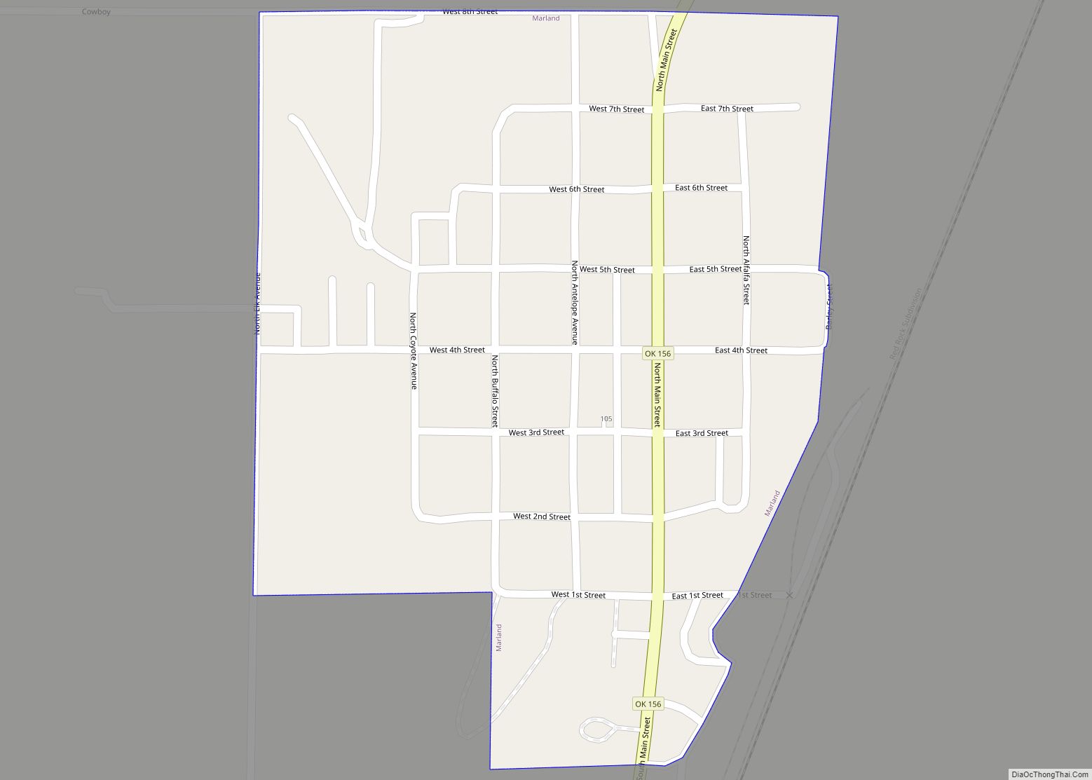
Marland is a town in Noble County, Oklahoma, United States. The population was 225 at the 2010 census. It was named for Ernest W. Marland, an oilman from nearby Ponca City who later became a governor of Oklahoma. Marland is on SH-156, south-southwest of Ponca City.
| Name: | Marland town |
|---|---|
| LSAD Code: | 43 |
| LSAD Description: | town (suffix) |
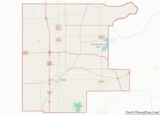
| State: | Oklahoma |
| County: | Noble County |
| Elevation: | 1,017 ft (310 m) |
| Total Area: | 0.27 sq mi (0.70 km²) |
| Land Area: | 0.27 sq mi (0.70 km²) |
| Water Area: | 0.00 sq mi (0.00 km²) |
| Total Population: | 184 |
| Population Density: | 676.47/sq mi (261.13/km²) |
| ZIP code: | 74644 |
| Area code: | 580 |
| FIPS code: | 4046550 |
| GNISfeature ID: | 1102139 |
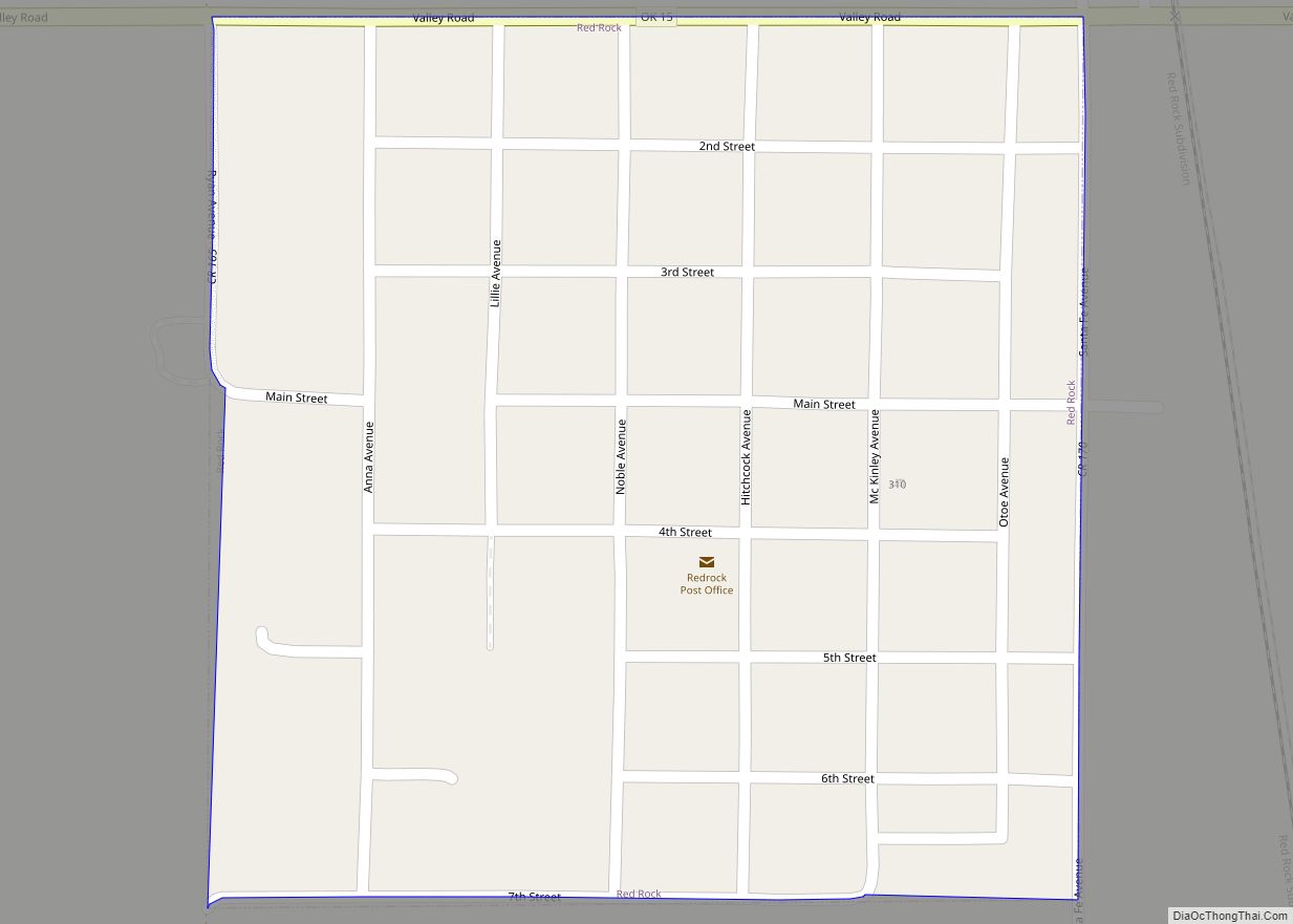
Online Interactive Map
Click on ![]() to view map in "full screen" mode.
to view map in "full screen" mode.
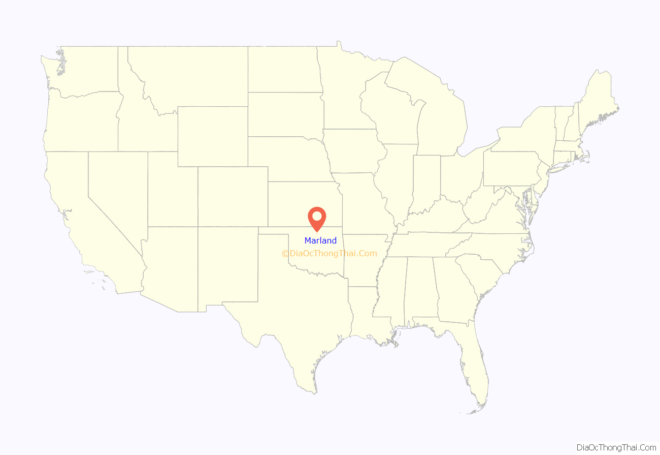
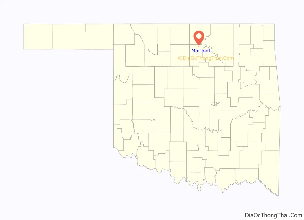
Marland location map. Where is Marland town?
History
Marland began as a community named “Bliss,” a shipping point on the Atchison, Topeka and Santa Fe Railway (often called simply the Santa Fe). The surrounding countryside, formerly part of the Ponca reservation, had been leased for cattle grazing and was part of the Miller Brothers 101 Ranch. The brothers built stockyards adjacent to the railroad on the south side of their ranch for shipping cattle. A community began forming nearby, with grain elevator, a lumber yard and a general store. The Millers platted a town on the east side of the tracks in 1906 and began selling lots.
In 1917, the Millers decided to move the town to the other side of the tracks, about 1 mile (1.6 km) north. The population continued to grow, reaching 250 residents.
In the 1920s, oil discovered by Ernest W. Marland in the nearby Three Sands Field helped the town, leading to the April 1922 election and town name change to Marland. But the Great Depression of the 1930s bankrupted the Miller Brothers ranch, and the Three Sands Field went dry, stunting further town growth.
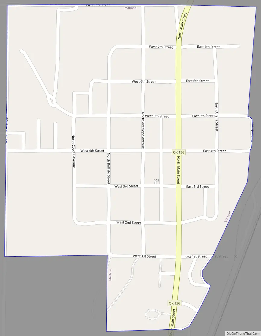
Marland Road Map
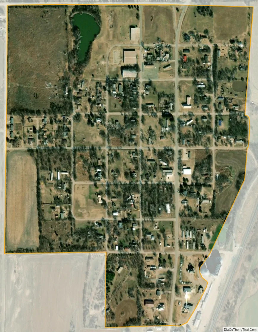
Marland city Satellite Map
Geography
Marland is located at 36°33′37″N 97°9′6″W / 36.56028°N 97.15167°W / 36.56028; -97.15167 (36.560363, -97.151777). According to the United States Census Bureau, the town has a total area of 0.3 square miles (0.78 km), all land.
See also
Map of Oklahoma State and its subdivision:- Adair
- Alfalfa
- Atoka
- Beaver
- Beckham
- Blaine
- Bryan
- Caddo
- Canadian
- Carter
- Cherokee
- Choctaw
- Cimarron
- Cleveland
- Coal
- Comanche
- Cotton
- Craig
- Creek
- Custer
- Delaware
- Dewey
- Ellis
- Garfield
- Garvin
- Grady
- Grant
- Greer
- Harmon
- Harper
- Haskell
- Hughes
- Jackson
- Jefferson
- Johnston
- Kay
- Kingfisher
- Kiowa
- Latimer
- Le Flore
- Lincoln
- Logan
- Love
- Major
- Marshall
- Mayes
- McClain
- McCurtain
- McIntosh
- Murray
- Muskogee
- Noble
- Nowata
- Okfuskee
- Oklahoma
- Okmulgee
- Osage
- Ottawa
- Pawnee
- Payne
- Pittsburg
- Pontotoc
- Pottawatomie
- Pushmataha
- Roger Mills
- Rogers
- Seminole
- Sequoyah
- Stephens
- Texas
- Tillman
- Tulsa
- Wagoner
- Washington
- Washita
- Woods
- Woodward
- Alabama
- Alaska
- Arizona
- Arkansas
- California
- Colorado
- Connecticut
- Delaware
- District of Columbia
- Florida
- Georgia
- Hawaii
- Idaho
- Illinois
- Indiana
- Iowa
- Kansas
- Kentucky
- Louisiana
- Maine
- Maryland
- Massachusetts
- Michigan
- Minnesota
- Mississippi
- Missouri
- Montana
- Nebraska
- Nevada
- New Hampshire
- New Jersey
- New Mexico
- New York
- North Carolina
- North Dakota
- Ohio
- Oklahoma
- Oregon
- Pennsylvania
- Rhode Island
- South Carolina
- South Dakota
- Tennessee
- Texas
- Utah
- Vermont
- Virginia
- Washington
- West Virginia
- Wisconsin
- Wyoming