Medford is a city in and the county seat of Grant County, Oklahoma, United States. As of the 2010 census, the city population was 996.
| Name: | Medford city |
|---|---|
| LSAD Code: | 25 |
| LSAD Description: | city (suffix) |
| State: | Oklahoma |
| County: | Grant County |
| Elevation: | 1,093 ft (333 m) |
| Total Area: | 1.08 sq mi (2.80 km²) |
| Land Area: | 1.08 sq mi (2.80 km²) |
| Water Area: | 0.00 sq mi (0.00 km²) |
| Total Population: | 932 |
| Population Density: | 863.76/sq mi (333.40/km²) |
| ZIP code: | 73759 |
| Area code: | 580 |
| FIPS code: | 4047300 |
| GNISfeature ID: | 1095284 |
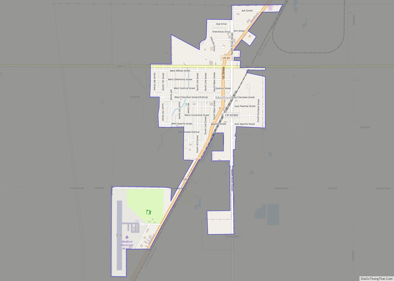
Online Interactive Map
Click on ![]() to view map in "full screen" mode.
to view map in "full screen" mode.
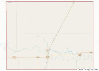
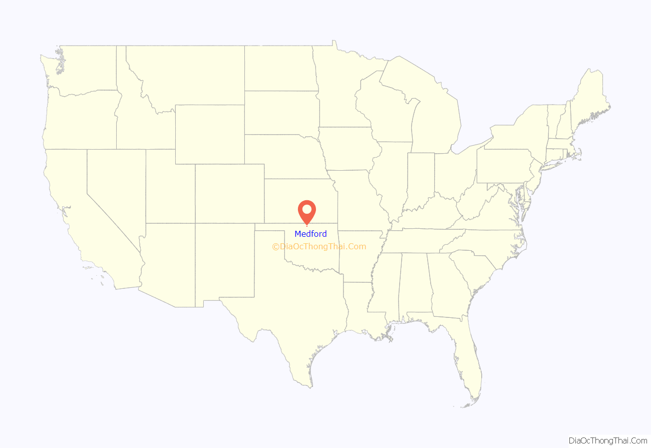
Medford location map. Where is Medford city?

History
The Encyclopedia of Oklahoma History and Culture states only that the town name was for Medford, Massachusetts, which it says was the home town of a railroad official.
Before the opening of the Cherokee Outlet to non-Indian settlement on September 16, 1893, the Chicago, Kansas and Nebraska Railway (later the Chicago, Rock Island and Pacific Railroad) built a line from southern Kansas that passed through the future Medford townsite in a north–south direction. A post office was established October 31, 1893. The townsfolk voted to incorporate on March 10, 1894. In 1897 the Gulf Railroad (later the Atchison, Topeka and Santa Fe Railway) built a line that passed through Medford from northwest to southeast. Located in a wheat-growing region, Medford served as an agricultural trade center with a flour mill and several grain elevators. By 1909 the local economy supported three banks and three weekly newspapers.
Voters in Grant County chose Medford as the county seat by an election on May 27, 1908. A courthouse was dedicated July 4, 1910. A fire destroyed five blocks of businesses and residences on June 25, 1911.
On July 9, 2022 at about 2:30 PM an explosion and fire in the ONEOK plant one mile north of the city caused an evacuation of a two mile radius around the plant. On July 11, the evacuation zone was decreased to one mile around the plant.
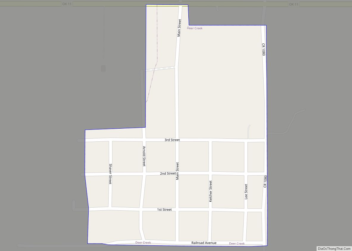
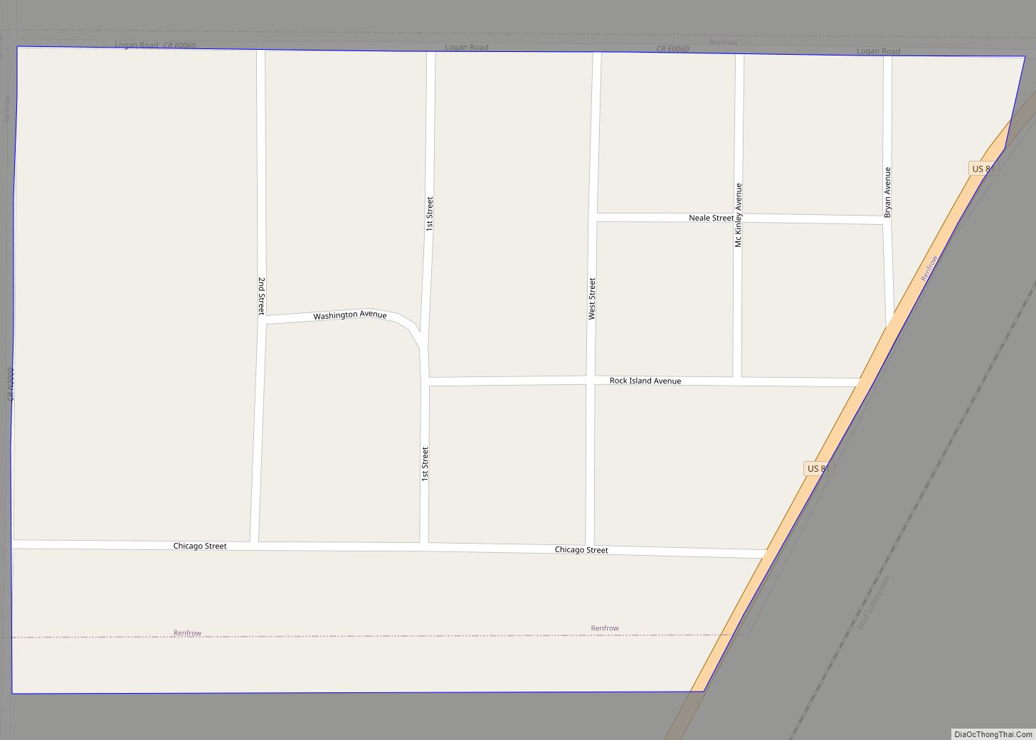
Medford Road Map

Medford city Satellite Map

Geography
Medford is located at 36°48′23″N 97°44′13″W / 36.80639°N 97.73694°W / 36.80639; -97.73694 (36.806457, −97.736918). It is situated at the intersection of U.S. Highway 81 (Chisholm Trail Highway) and State Highway 11. According to the United States Census Bureau, the city has a total area of 1.1 square miles (2.8 km), all land.
See also
Map of Oklahoma State and its subdivision:- Adair
- Alfalfa
- Atoka
- Beaver
- Beckham
- Blaine
- Bryan
- Caddo
- Canadian
- Carter
- Cherokee
- Choctaw
- Cimarron
- Cleveland
- Coal
- Comanche
- Cotton
- Craig
- Creek
- Custer
- Delaware
- Dewey
- Ellis
- Garfield
- Garvin
- Grady
- Grant
- Greer
- Harmon
- Harper
- Haskell
- Hughes
- Jackson
- Jefferson
- Johnston
- Kay
- Kingfisher
- Kiowa
- Latimer
- Le Flore
- Lincoln
- Logan
- Love
- Major
- Marshall
- Mayes
- McClain
- McCurtain
- McIntosh
- Murray
- Muskogee
- Noble
- Nowata
- Okfuskee
- Oklahoma
- Okmulgee
- Osage
- Ottawa
- Pawnee
- Payne
- Pittsburg
- Pontotoc
- Pottawatomie
- Pushmataha
- Roger Mills
- Rogers
- Seminole
- Sequoyah
- Stephens
- Texas
- Tillman
- Tulsa
- Wagoner
- Washington
- Washita
- Woods
- Woodward
- Alabama
- Alaska
- Arizona
- Arkansas
- California
- Colorado
- Connecticut
- Delaware
- District of Columbia
- Florida
- Georgia
- Hawaii
- Idaho
- Illinois
- Indiana
- Iowa
- Kansas
- Kentucky
- Louisiana
- Maine
- Maryland
- Massachusetts
- Michigan
- Minnesota
- Mississippi
- Missouri
- Montana
- Nebraska
- Nevada
- New Hampshire
- New Jersey
- New Mexico
- New York
- North Carolina
- North Dakota
- Ohio
- Oklahoma
- Oregon
- Pennsylvania
- Rhode Island
- South Carolina
- South Dakota
- Tennessee
- Texas
- Utah
- Vermont
- Virginia
- Washington
- West Virginia
- Wisconsin
- Wyoming