Pocola is a town in Le Flore County, Oklahoma, United States. It is part of the Fort Smith, Arkansas-Oklahoma metropolitan area. The population was 4,056 in 2010, a gain of 1.6 percent over the figure of 3,994 recorded in 2000. Pocola is a Choctaw word meaning “ten”, the approximate distance in miles from Fort Smith, Arkansas.
| Name: | Pocola town |
|---|---|
| LSAD Code: | 43 |
| LSAD Description: | town (suffix) |
| State: | Oklahoma |
| County: | Le Flore County |
| Elevation: | 482 ft (147 m) |
| Total Area: | 30.56 sq mi (79.16 km²) |
| Land Area: | 30.31 sq mi (78.50 km²) |
| Water Area: | 0.26 sq mi (0.66 km²) |
| Total Population: | 4,255 |
| Population Density: | 140.40/sq mi (54.21/km²) |
| ZIP code: | 74902 |
| Area code: | 539/918 |
| FIPS code: | 4059750 |
| GNISfeature ID: | 1100754 |
| Website: | www.townofpocola.com |
Online Interactive Map
Click on ![]() to view map in "full screen" mode.
to view map in "full screen" mode.
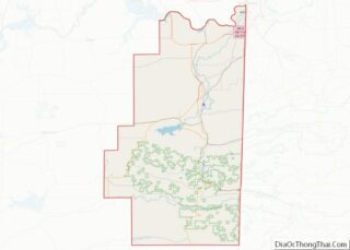
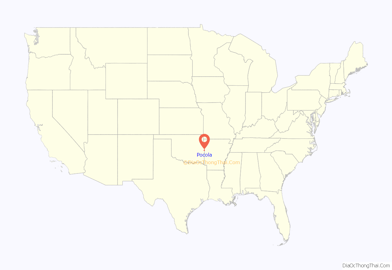
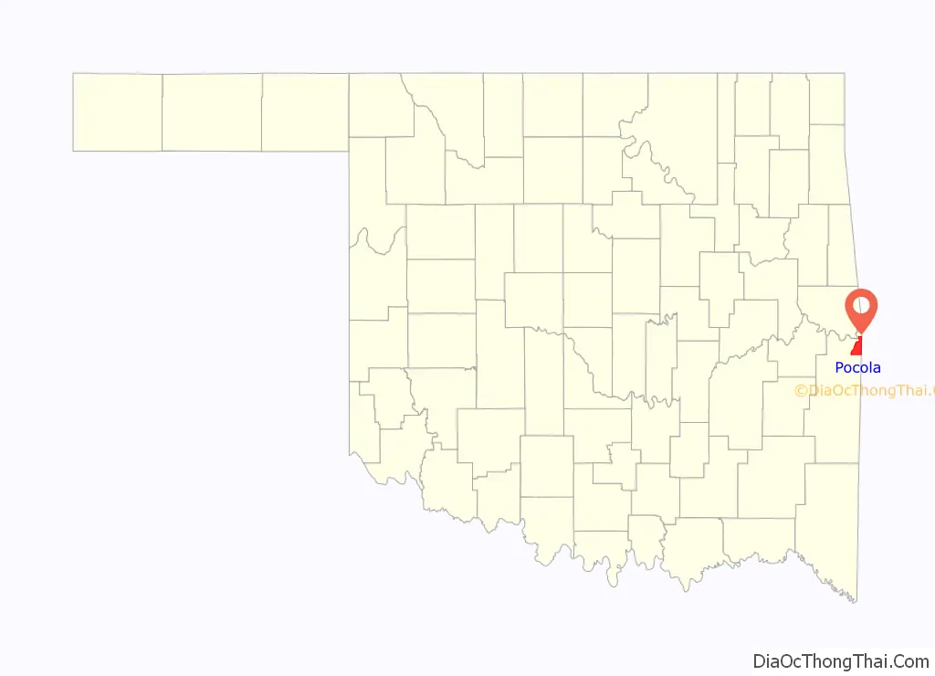
Pocola location map. Where is Pocola town?
History
The Battle of Devil’s Backbone took place nearby on September 1, 1863 and resulted in a victory for the Union Army.
A post office was established at Pocola, Indian Territory on February 15, 1881. The community took its name from the Choctaw word for the number ten, as the site was ten miles from Fort Smith, Arkansas. At the time of its founding the settlement was located in Skullyville County, a part of the Moshulatubbee District of the Choctaw Nation.
Will Hartshorne began operating a small coal mine in this area during the 1880s. By 1895, he employed six men, and sold the mine to the Fort Smith and Western Coal and Railway in the following year. The population of Pocola was estimated at 200 in 1900, but the number declined to about 75 in 1918. The post office closed in 1916.
The community did not incorporate until 1963, allowing it to gain water rights along the McClellan-Kerr Arkansas River Navigation System and to ensure that the area was not annexed by other Le Flore County communities. The town began annexing land, enlarging itself to about 30 square miles. By 1970, the population had grown to 1,840. In 1980, the census recorded 3,268 residents. A post office was reestablished in 1986.
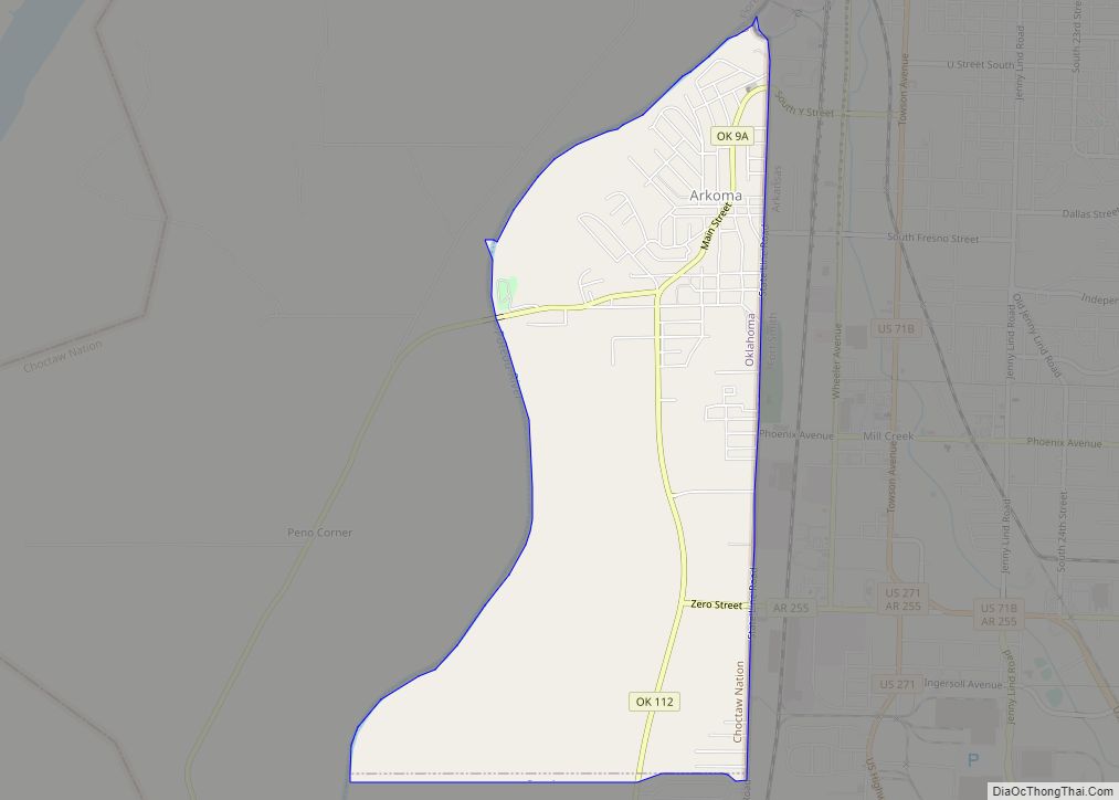
Pocola Road Map
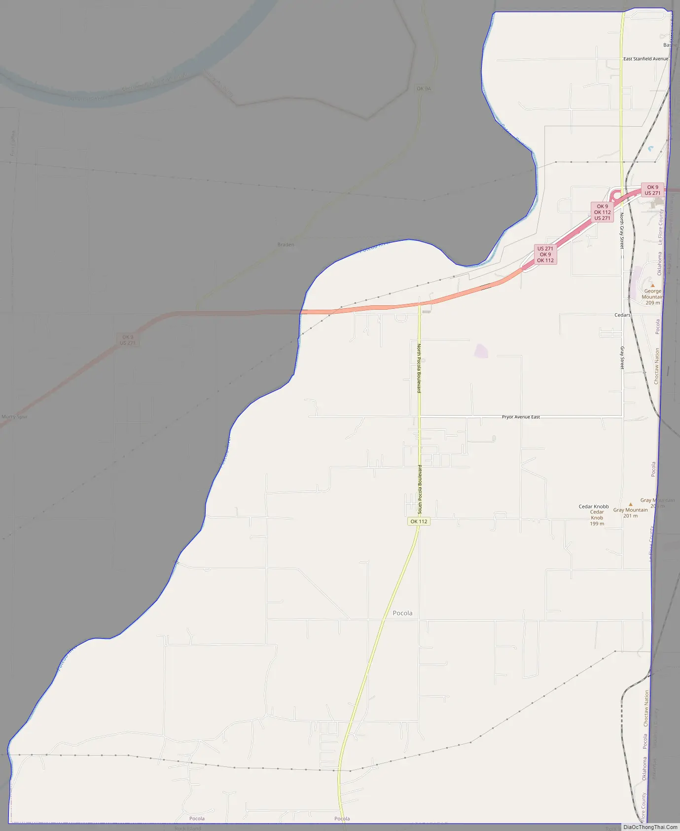
Pocola city Satellite Map
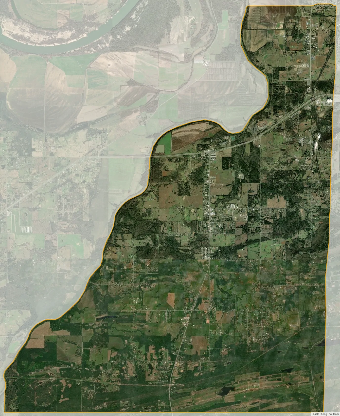
Geography
Pocola is located at 35°15′29″N 94°28′26″W / 35.25806°N 94.47389°W / 35.25806; -94.47389 (35.257983, -94.473959).
According to the United States Census Bureau, the town has a total area of 30.5 square miles (79 km), of which 30.3 square miles (78 km) is land and 0.2 square miles (0.52 km) (0.69%) is water.
The Poteau River constitutes the western boundary of the town.
See also
Map of Oklahoma State and its subdivision:- Adair
- Alfalfa
- Atoka
- Beaver
- Beckham
- Blaine
- Bryan
- Caddo
- Canadian
- Carter
- Cherokee
- Choctaw
- Cimarron
- Cleveland
- Coal
- Comanche
- Cotton
- Craig
- Creek
- Custer
- Delaware
- Dewey
- Ellis
- Garfield
- Garvin
- Grady
- Grant
- Greer
- Harmon
- Harper
- Haskell
- Hughes
- Jackson
- Jefferson
- Johnston
- Kay
- Kingfisher
- Kiowa
- Latimer
- Le Flore
- Lincoln
- Logan
- Love
- Major
- Marshall
- Mayes
- McClain
- McCurtain
- McIntosh
- Murray
- Muskogee
- Noble
- Nowata
- Okfuskee
- Oklahoma
- Okmulgee
- Osage
- Ottawa
- Pawnee
- Payne
- Pittsburg
- Pontotoc
- Pottawatomie
- Pushmataha
- Roger Mills
- Rogers
- Seminole
- Sequoyah
- Stephens
- Texas
- Tillman
- Tulsa
- Wagoner
- Washington
- Washita
- Woods
- Woodward
- Alabama
- Alaska
- Arizona
- Arkansas
- California
- Colorado
- Connecticut
- Delaware
- District of Columbia
- Florida
- Georgia
- Hawaii
- Idaho
- Illinois
- Indiana
- Iowa
- Kansas
- Kentucky
- Louisiana
- Maine
- Maryland
- Massachusetts
- Michigan
- Minnesota
- Mississippi
- Missouri
- Montana
- Nebraska
- Nevada
- New Hampshire
- New Jersey
- New Mexico
- New York
- North Carolina
- North Dakota
- Ohio
- Oklahoma
- Oregon
- Pennsylvania
- Rhode Island
- South Carolina
- South Dakota
- Tennessee
- Texas
- Utah
- Vermont
- Virginia
- Washington
- West Virginia
- Wisconsin
- Wyoming