Ramona is a town in Washington County, Oklahoma, United States. The population was 535 at the 2010 census. The town began as Bon-Ton, but changed its name to Ramona in 1899 in honor of the Helen Hunt Jackson novel of the same name. The town is one of four communities that makes up the consolidated Caney Valley School District.
Ramona was an oil town and was also a stop for the Santa Fe railroad. When the oil dried up, there was no other industry to support Ramona, so the town began to die out. Very little business remains in the town, aside from a garage, a bank, a medical clinic, a small grocery, and sundry other small businesses. For 30 years the town was under the jurisdiction of the Washington County Sheriff’s Office, after the police department disbanded and the Chief of Police was sentenced to prison. Under the leadership of the former mayor, the late Robert Fiddler, the police department was reinstated, the water lines were repaired/replaced, and a grant was accepted from the Cherokee Nation to repave the streets. The town also supplies natural gas service to the Wal-Mart distribution center five miles north of town.
Recently, under the mayoralty of Cyle Miller, the Cherokee Nation opened the Cherokee Casino Ramona off U.S. Route 75 and Road 3200, which is a significant boom to the local economy. This led to Ramona annexing a considerable portion of land and greatly increasing the size of Ramona proper.
| Name: | Ramona town |
|---|---|
| LSAD Code: | 43 |
| LSAD Description: | town (suffix) |
| State: | Oklahoma |
| County: | Washington County |
| Elevation: | 666 ft (203 m) |
| Total Area: | 0.82 sq mi (2.13 km²) |
| Land Area: | 0.82 sq mi (2.12 km²) |
| Water Area: | 0.00 sq mi (0.00 km²) |
| Total Population: | 524 |
| Population Density: | 639.02/sq mi (246.60/km²) |
| ZIP code: | 74061 |
| Area code: | 539/918 |
| FIPS code: | 4061700 |
| GNISfeature ID: | 1097023 |
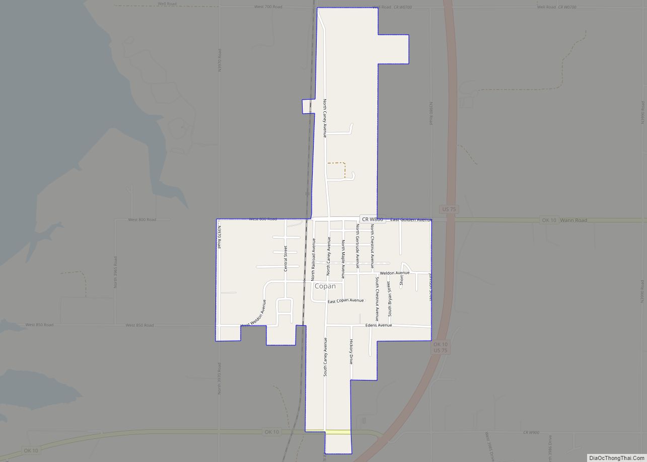
Online Interactive Map
Click on ![]() to view map in "full screen" mode.
to view map in "full screen" mode.
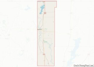
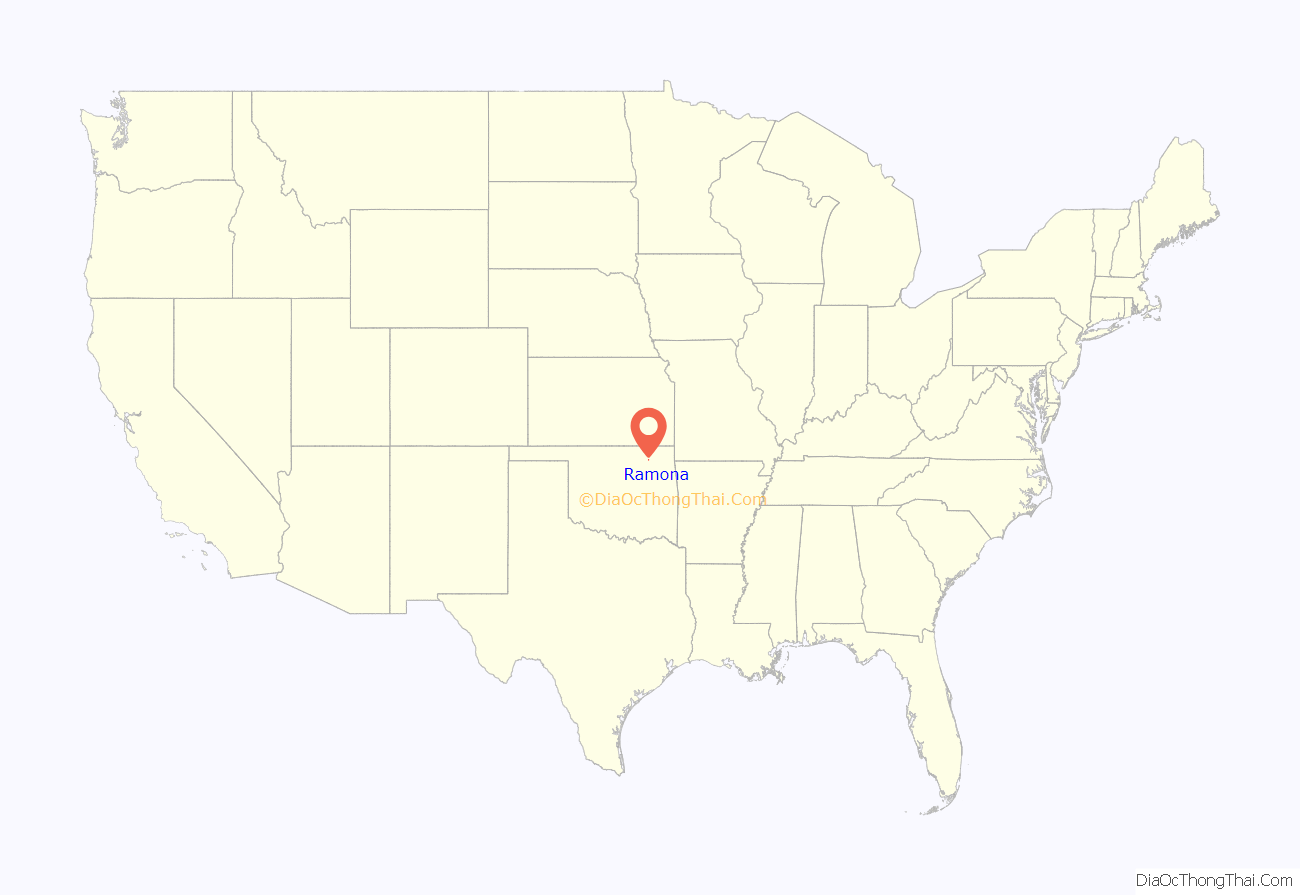
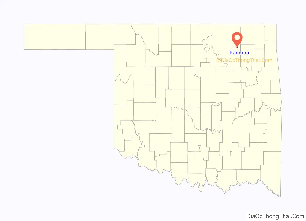
Ramona location map. Where is Ramona town?
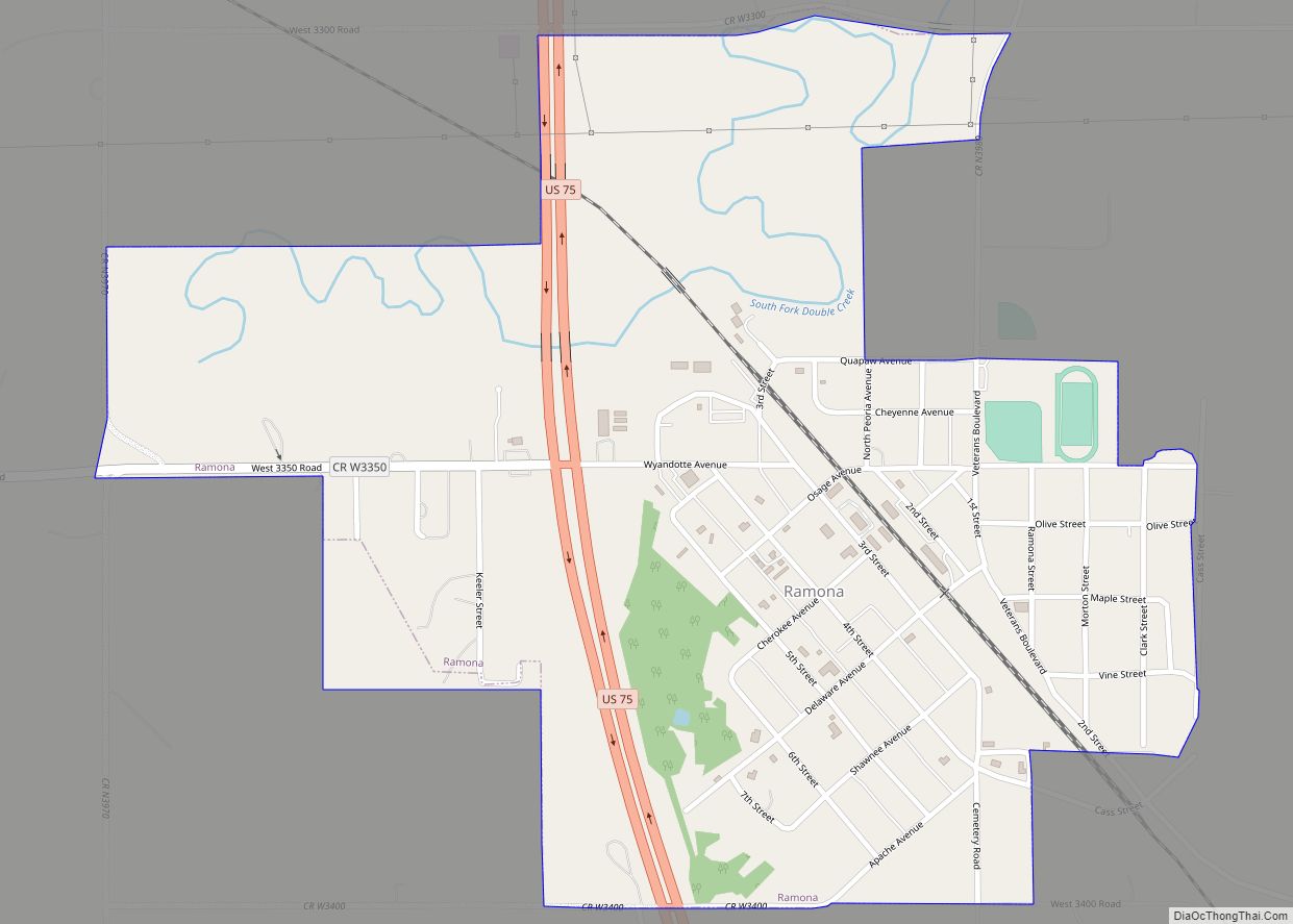
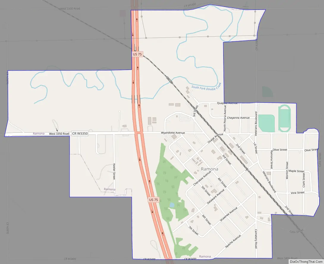
Ramona Road Map
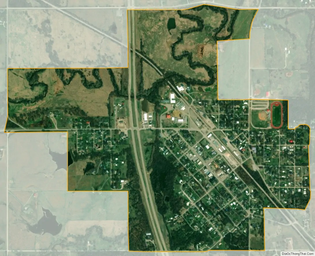
Ramona city Satellite Map
Geography
Ramona is located at 36°31′52″N 95°55′25″W / 36.53111°N 95.92361°W / 36.53111; -95.92361 (36.531102, -95.923632).
According to the United States Census Bureau, the town has a total area of 0.8 square miles (2.1 km), all land.
See also
Map of Oklahoma State and its subdivision:- Adair
- Alfalfa
- Atoka
- Beaver
- Beckham
- Blaine
- Bryan
- Caddo
- Canadian
- Carter
- Cherokee
- Choctaw
- Cimarron
- Cleveland
- Coal
- Comanche
- Cotton
- Craig
- Creek
- Custer
- Delaware
- Dewey
- Ellis
- Garfield
- Garvin
- Grady
- Grant
- Greer
- Harmon
- Harper
- Haskell
- Hughes
- Jackson
- Jefferson
- Johnston
- Kay
- Kingfisher
- Kiowa
- Latimer
- Le Flore
- Lincoln
- Logan
- Love
- Major
- Marshall
- Mayes
- McClain
- McCurtain
- McIntosh
- Murray
- Muskogee
- Noble
- Nowata
- Okfuskee
- Oklahoma
- Okmulgee
- Osage
- Ottawa
- Pawnee
- Payne
- Pittsburg
- Pontotoc
- Pottawatomie
- Pushmataha
- Roger Mills
- Rogers
- Seminole
- Sequoyah
- Stephens
- Texas
- Tillman
- Tulsa
- Wagoner
- Washington
- Washita
- Woods
- Woodward
- Alabama
- Alaska
- Arizona
- Arkansas
- California
- Colorado
- Connecticut
- Delaware
- District of Columbia
- Florida
- Georgia
- Hawaii
- Idaho
- Illinois
- Indiana
- Iowa
- Kansas
- Kentucky
- Louisiana
- Maine
- Maryland
- Massachusetts
- Michigan
- Minnesota
- Mississippi
- Missouri
- Montana
- Nebraska
- Nevada
- New Hampshire
- New Jersey
- New Mexico
- New York
- North Carolina
- North Dakota
- Ohio
- Oklahoma
- Oregon
- Pennsylvania
- Rhode Island
- South Carolina
- South Dakota
- Tennessee
- Texas
- Utah
- Vermont
- Virginia
- Washington
- West Virginia
- Wisconsin
- Wyoming