Seminole (Meskwaki: Sheminônîheki) is a city in Seminole County, Oklahoma, United States. The population was 7,488 at the 2010 census. Seminole experienced a large population growth in the 1920s due to an oil boom.
| Name: | Seminole city |
|---|---|
| LSAD Code: | 25 |
| LSAD Description: | city (suffix) |
| State: | Oklahoma |
| County: | Seminole County |
| Elevation: | 892 ft (272 m) |
| Total Area: | 14.25 sq mi (36.91 km²) |
| Land Area: | 13.70 sq mi (35.48 km²) |
| Water Area: | 0.55 sq mi (1.43 km²) |
| Total Population: | 7,146 |
| Population Density: | 521.61/sq mi (201.40/km²) |
| ZIP code: | 74818, 74868 |
| Area code: | 405 |
| FIPS code: | 4066350 |
| GNISfeature ID: | 1097908 |
| Website: | www.seminole-oklahoma.net |
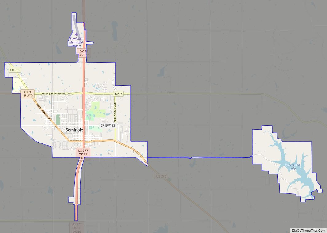
Online Interactive Map
Click on ![]() to view map in "full screen" mode.
to view map in "full screen" mode.
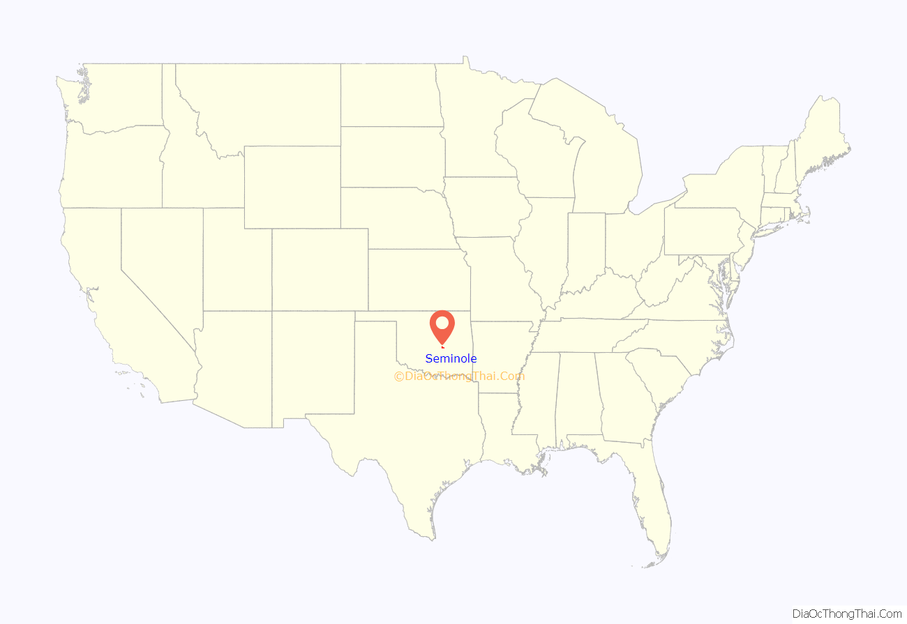
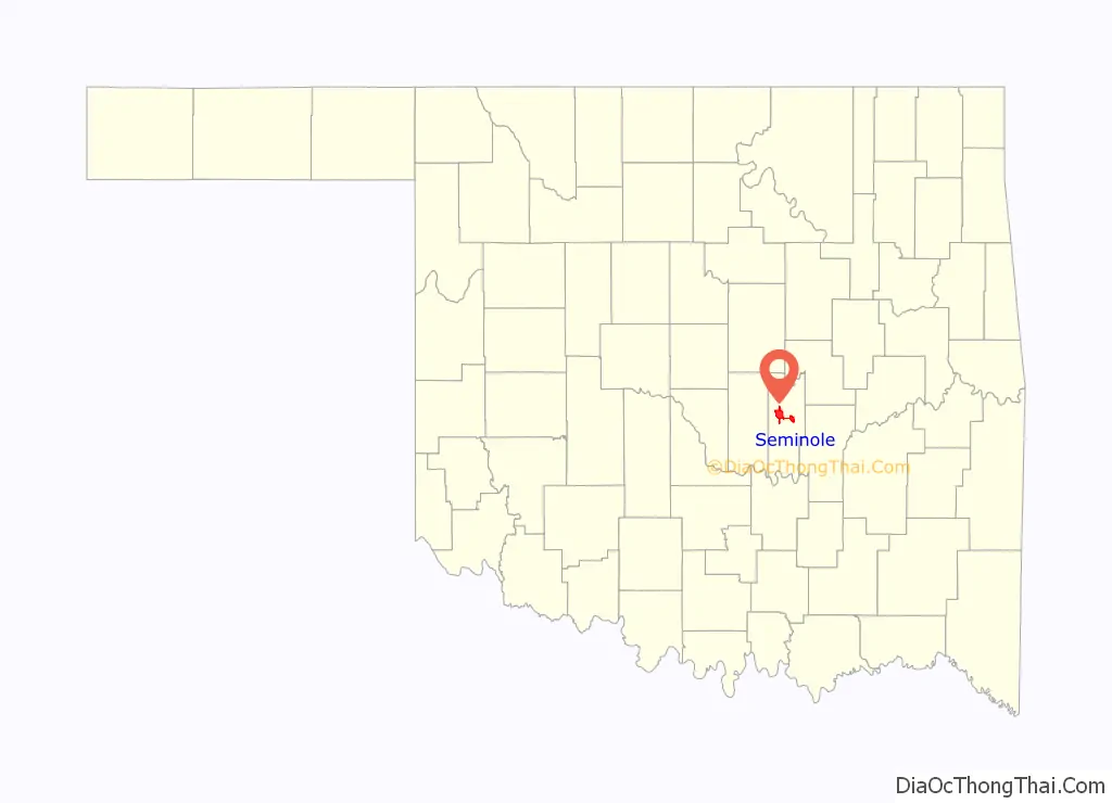
Seminole location map. Where is Seminole city?
History
The city was platted in 1906 as a relocation setting for the residents of Tidmore, when the railroad line was placed north of the town. When Oklahoma Territory and Indian Territory merged to become the U.S. state of Oklahoma in 1907, there were 206 residents.
Seminole competed to be the county seat of Seminole County, but lost out to Wewoka.
Upon the discovery of a high-producing oil well in the city in 1926, Seminole transformed from a town of 854 to a boom town of 25,000 to 30,000 residents. In August 1970 Seminole hosted its first All-Night Gospel Singing. During its heyday an estimated twenty-five thousand people attended the annual event. After the boom, the population declined to about 11,000 and remained that way until 1970.
There are multiple structures in the Seminole area listed on the National Register of Historic Places. They include the Home Stake Oil and Gas Company Building, Mekasukey Academy, the Seminole Municipal Building, the Sinclair Loading Rack, Strother Memorial Chapel, and the W.E. Grisso Mansion.
The town was heavily damaged by an EF2 tornado on May 4, 2022.
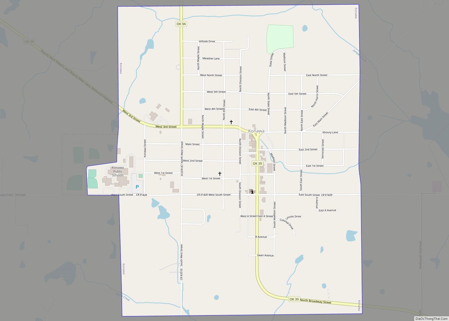
Seminole Road Map
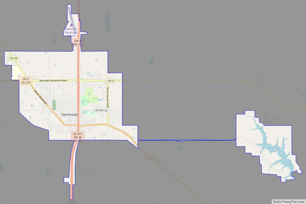
Seminole city Satellite Map

Geography
Seminole is located at 35°14′28″N 96°40′6″W / 35.24111°N 96.66833°W / 35.24111; -96.66833 (35.241132, -96.668419).
According to the United States Census Bureau, the city has a total area of 14.5 square miles (38 km), of which 13.9 square miles (36 km) is land and 0.6 square miles (1.6 km) (3.93%) is water.
See also
Map of Oklahoma State and its subdivision:- Adair
- Alfalfa
- Atoka
- Beaver
- Beckham
- Blaine
- Bryan
- Caddo
- Canadian
- Carter
- Cherokee
- Choctaw
- Cimarron
- Cleveland
- Coal
- Comanche
- Cotton
- Craig
- Creek
- Custer
- Delaware
- Dewey
- Ellis
- Garfield
- Garvin
- Grady
- Grant
- Greer
- Harmon
- Harper
- Haskell
- Hughes
- Jackson
- Jefferson
- Johnston
- Kay
- Kingfisher
- Kiowa
- Latimer
- Le Flore
- Lincoln
- Logan
- Love
- Major
- Marshall
- Mayes
- McClain
- McCurtain
- McIntosh
- Murray
- Muskogee
- Noble
- Nowata
- Okfuskee
- Oklahoma
- Okmulgee
- Osage
- Ottawa
- Pawnee
- Payne
- Pittsburg
- Pontotoc
- Pottawatomie
- Pushmataha
- Roger Mills
- Rogers
- Seminole
- Sequoyah
- Stephens
- Texas
- Tillman
- Tulsa
- Wagoner
- Washington
- Washita
- Woods
- Woodward
- Alabama
- Alaska
- Arizona
- Arkansas
- California
- Colorado
- Connecticut
- Delaware
- District of Columbia
- Florida
- Georgia
- Hawaii
- Idaho
- Illinois
- Indiana
- Iowa
- Kansas
- Kentucky
- Louisiana
- Maine
- Maryland
- Massachusetts
- Michigan
- Minnesota
- Mississippi
- Missouri
- Montana
- Nebraska
- Nevada
- New Hampshire
- New Jersey
- New Mexico
- New York
- North Carolina
- North Dakota
- Ohio
- Oklahoma
- Oregon
- Pennsylvania
- Rhode Island
- South Carolina
- South Dakota
- Tennessee
- Texas
- Utah
- Vermont
- Virginia
- Washington
- West Virginia
- Wisconsin
- Wyoming