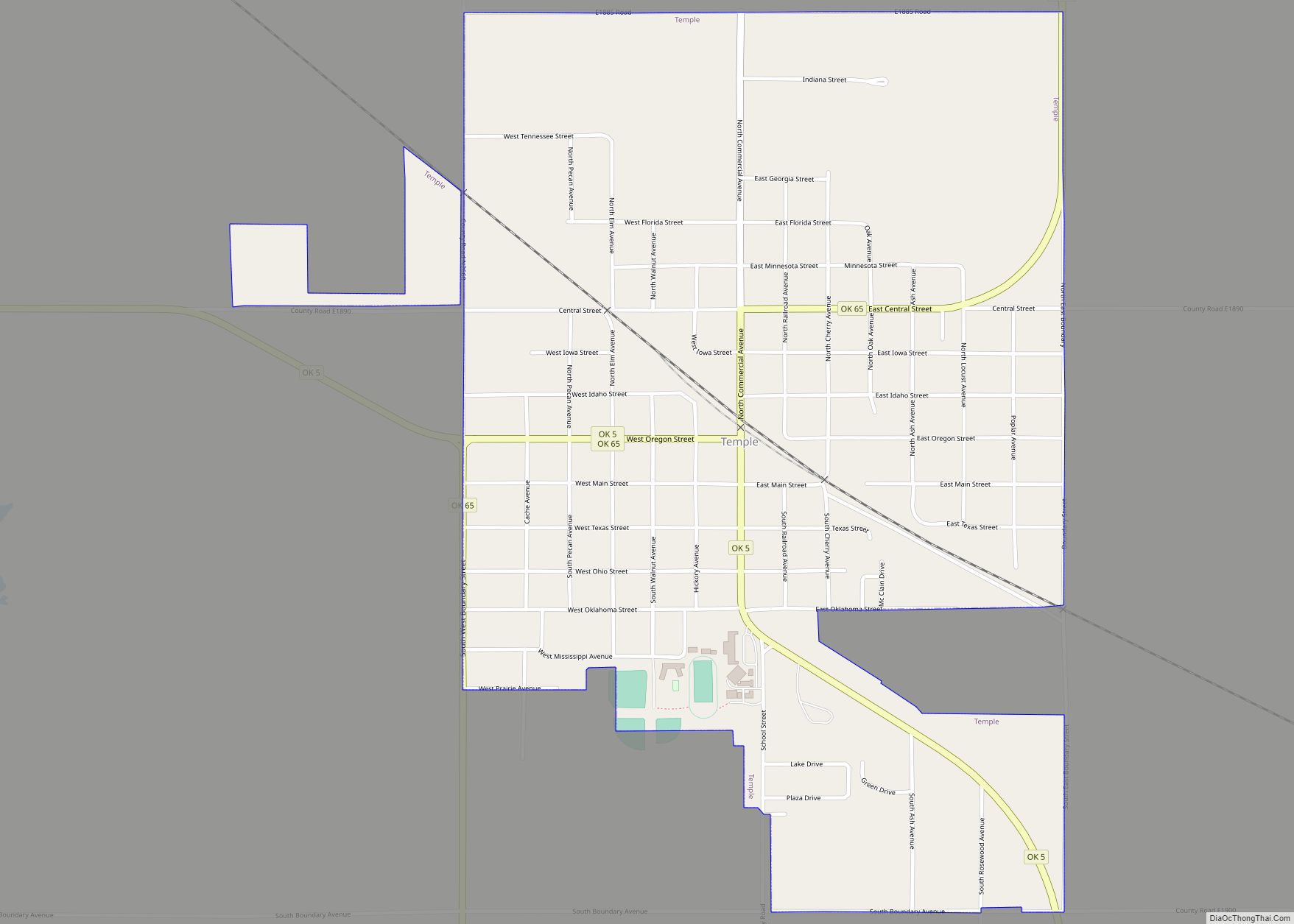
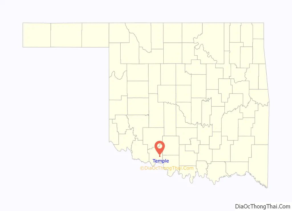
Temple is a town in Cotton County, Oklahoma, United States. It is 5 miles (8.0 km) south and 5 miles (8.0 km) east of Walters, the county seat. The population was 1,002 at the 2010 census, a decline of 12.6 percent from 1,146 at the 2000 census. The town is named for the celebrated trial lawyer of Texas and Oklahoma Territory, Temple Lea Houston (1860–1905), the youngest son of General Sam Houston.
| Name: | Temple town |
|---|---|
| LSAD Code: | 43 |
| LSAD Description: | town (suffix) |
| State: | Oklahoma |
| County: | Cotton County |
| Elevation: | 1,007 ft (307 m) |
| Total Area: | 1.29 sq mi (3.33 km²) |
| Land Area: | 1.29 sq mi (3.33 km²) |
| Water Area: | 0.00 sq mi (0.00 km²) |
| Total Population: | 862 |
| Population Density: | 670.30/sq mi (258.71/km²) |
| ZIP code: | 73568 |
| Area code: | 580 |
| FIPS code: | 4072750 |
| GNISfeature ID: | 1098797 |
Online Interactive Map
Click on ![]() to view map in "full screen" mode.
to view map in "full screen" mode.
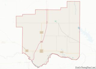
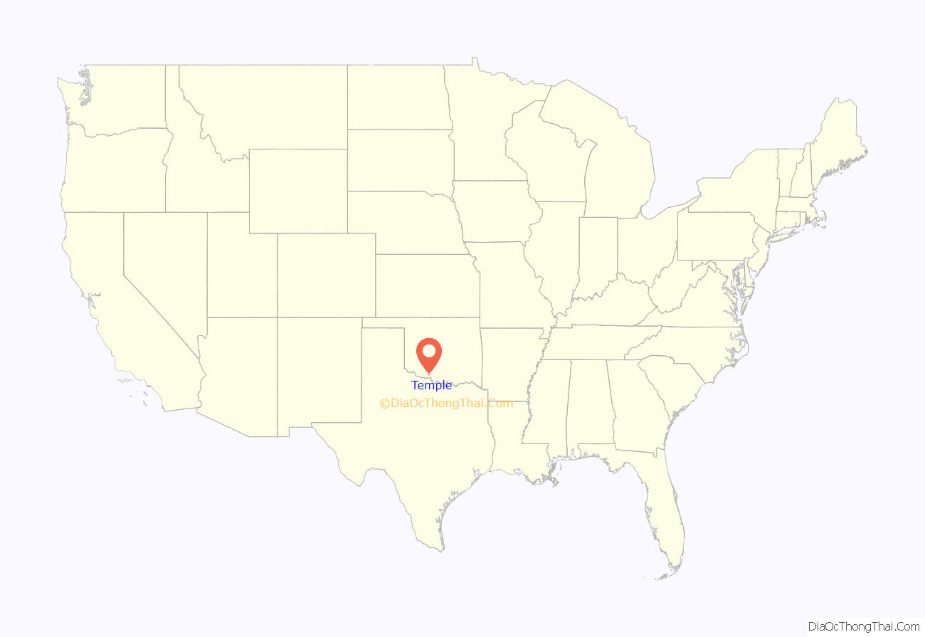
Temple location map. Where is Temple town?
Temple Road Map
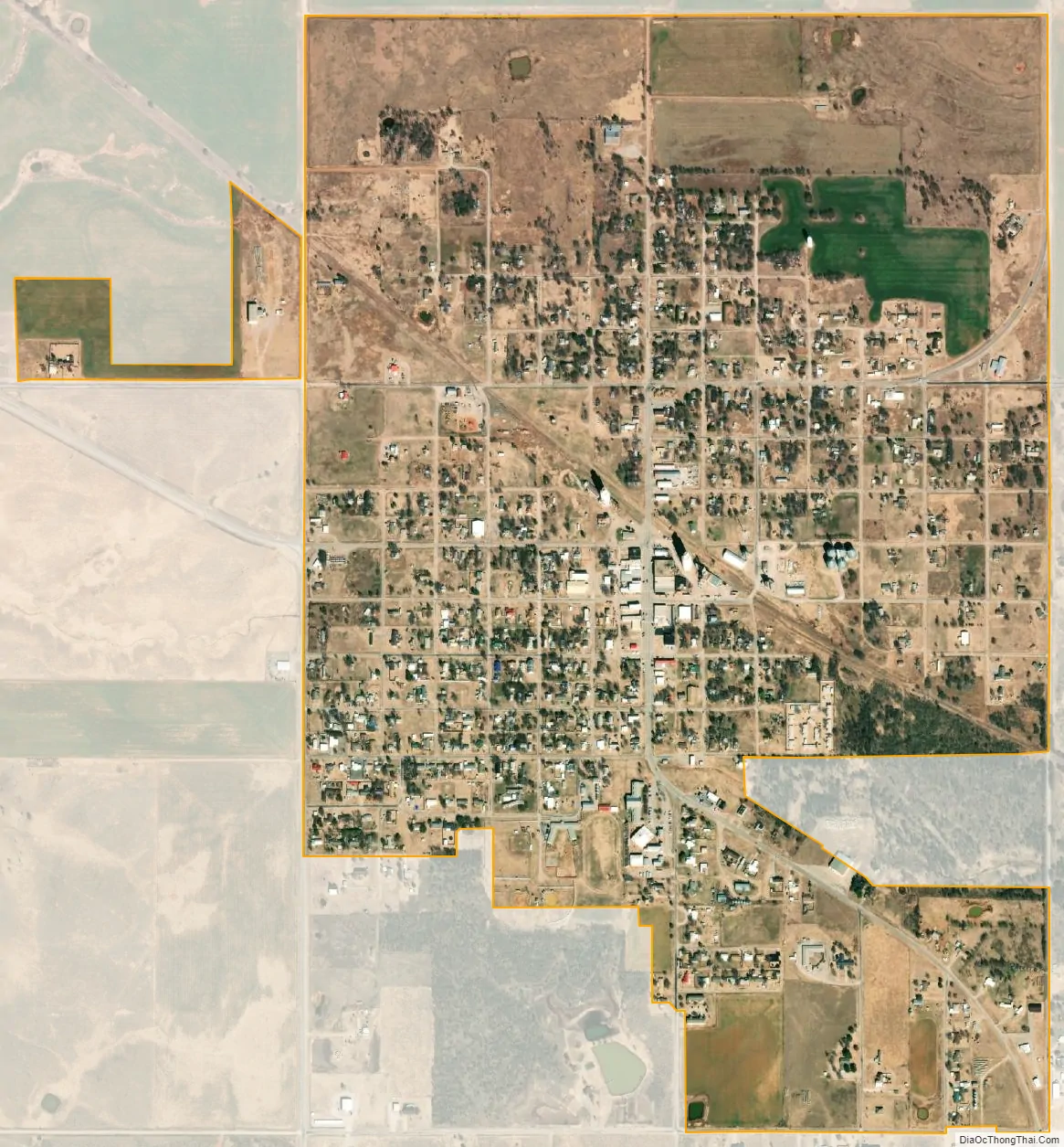
Temple city Satellite Map
Geography
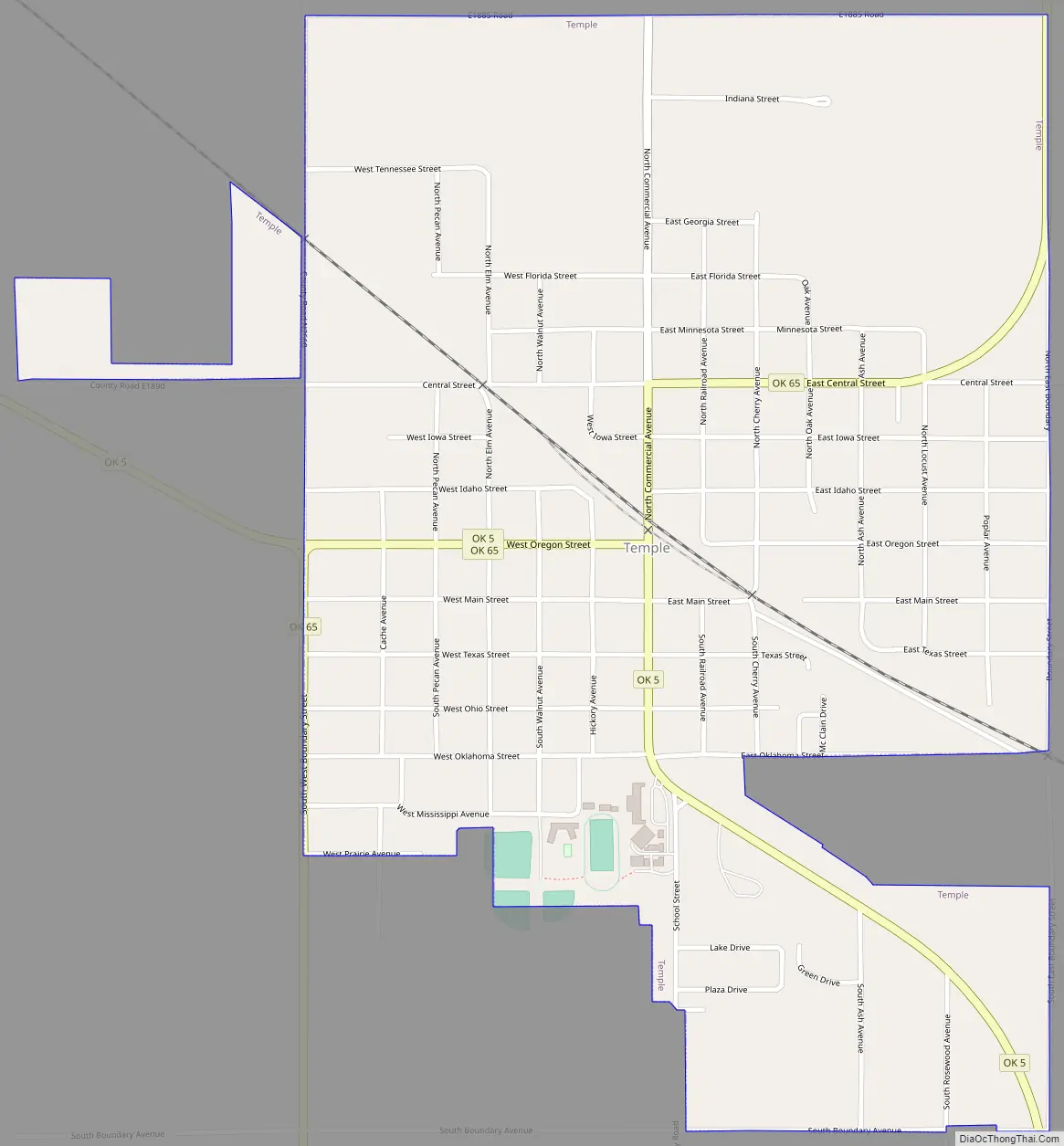
Temple is located at the intersection of Oklahoma State highways 5 and 65. Walters is approximately seven miles to the northwest.
According to the United States Census Bureau, the town has a total area of 1.3 square miles (3.4 km), all land.
See also
Map of Oklahoma State and its subdivision:- Adair
- Alfalfa
- Atoka
- Beaver
- Beckham
- Blaine
- Bryan
- Caddo
- Canadian
- Carter
- Cherokee
- Choctaw
- Cimarron
- Cleveland
- Coal
- Comanche
- Cotton
- Craig
- Creek
- Custer
- Delaware
- Dewey
- Ellis
- Garfield
- Garvin
- Grady
- Grant
- Greer
- Harmon
- Harper
- Haskell
- Hughes
- Jackson
- Jefferson
- Johnston
- Kay
- Kingfisher
- Kiowa
- Latimer
- Le Flore
- Lincoln
- Logan
- Love
- Major
- Marshall
- Mayes
- McClain
- McCurtain
- McIntosh
- Murray
- Muskogee
- Noble
- Nowata
- Okfuskee
- Oklahoma
- Okmulgee
- Osage
- Ottawa
- Pawnee
- Payne
- Pittsburg
- Pontotoc
- Pottawatomie
- Pushmataha
- Roger Mills
- Rogers
- Seminole
- Sequoyah
- Stephens
- Texas
- Tillman
- Tulsa
- Wagoner
- Washington
- Washita
- Woods
- Woodward
- Alabama
- Alaska
- Arizona
- Arkansas
- California
- Colorado
- Connecticut
- Delaware
- District of Columbia
- Florida
- Georgia
- Hawaii
- Idaho
- Illinois
- Indiana
- Iowa
- Kansas
- Kentucky
- Louisiana
- Maine
- Maryland
- Massachusetts
- Michigan
- Minnesota
- Mississippi
- Missouri
- Montana
- Nebraska
- Nevada
- New Hampshire
- New Jersey
- New Mexico
- New York
- North Carolina
- North Dakota
- Ohio
- Oklahoma
- Oregon
- Pennsylvania
- Rhode Island
- South Carolina
- South Dakota
- Tennessee
- Texas
- Utah
- Vermont
- Virginia
- Washington
- West Virginia
- Wisconsin
- Wyoming