Thomas is a city in Custer County, Oklahoma, United States. The population was 1,181 at the 2010 census.
| Name: | Thomas city |
|---|---|
| LSAD Code: | 25 |
| LSAD Description: | city (suffix) |
| State: | Oklahoma |
| County: | Custer County |
| Elevation: | 1,794 ft (547 m) |
| Total Area: | 1.15 sq mi (2.98 km²) |
| Land Area: | 1.15 sq mi (2.98 km²) |
| Water Area: | 0.00 sq mi (0.00 km²) |
| Total Population: | 1,143 |
| Population Density: | 994.78/sq mi (383.97/km²) |
| ZIP code: | 73669 |
| Area code: | 580 |
| FIPS code: | 4073450 |
| GNISfeature ID: | 1098845 |
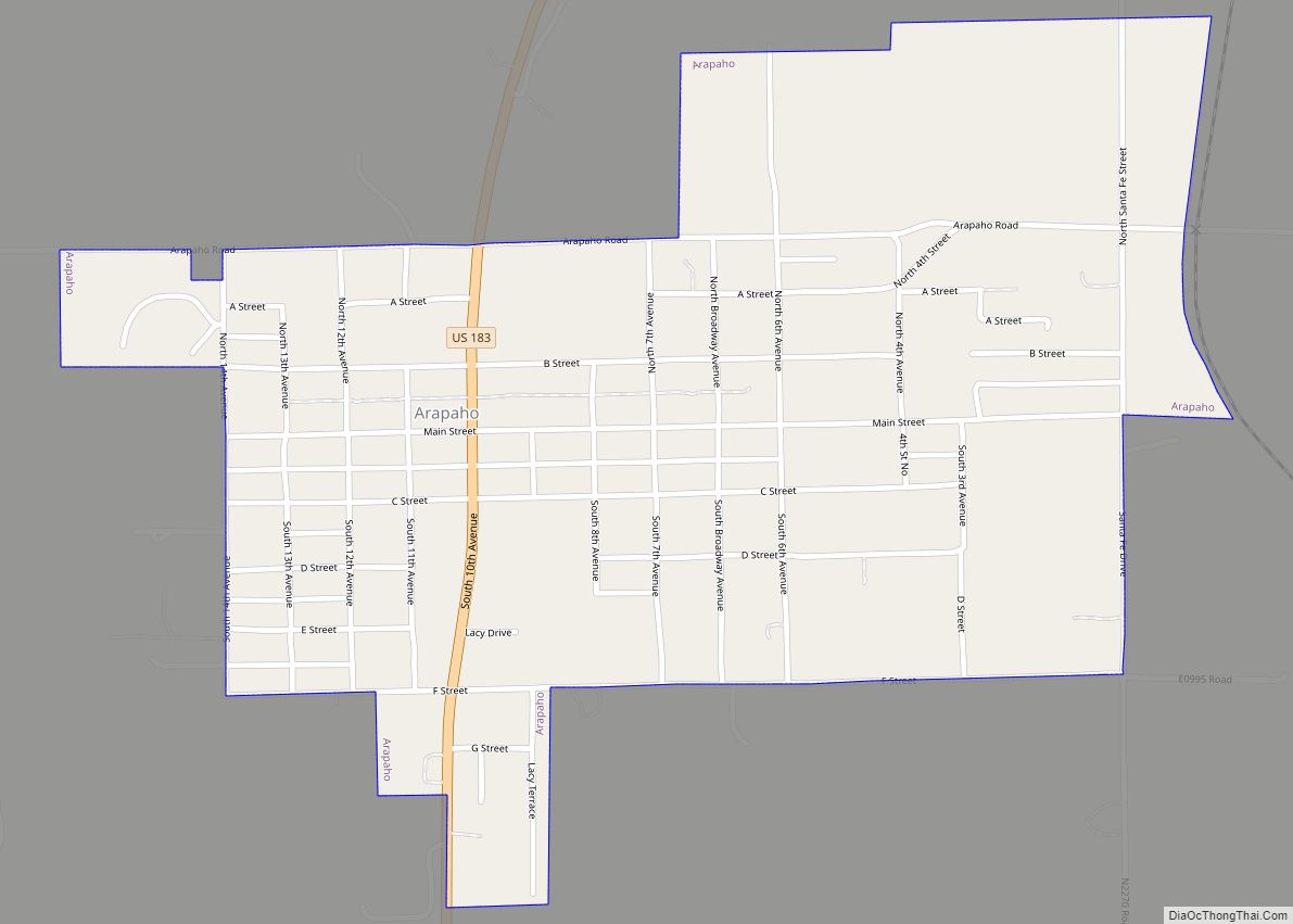
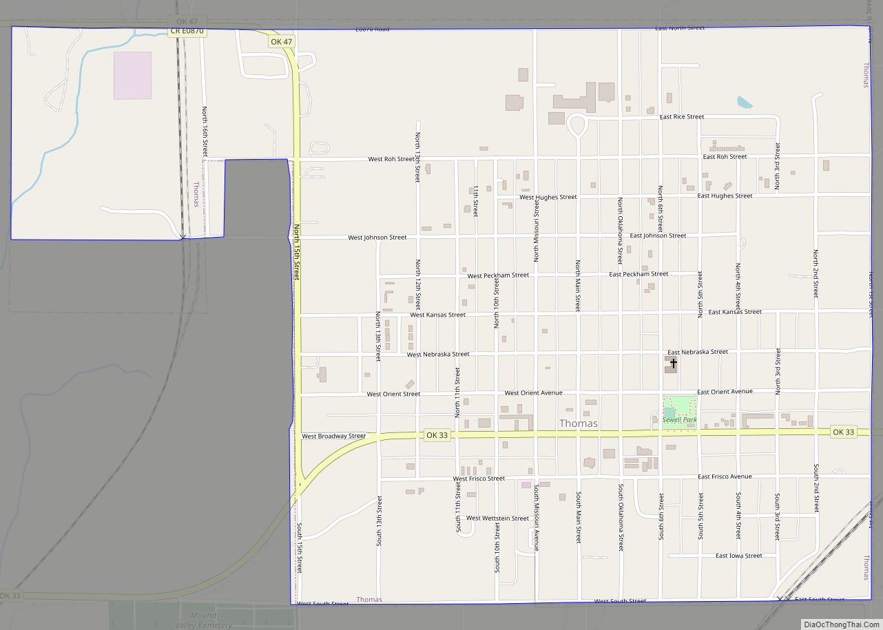
Online Interactive Map
Click on ![]() to view map in "full screen" mode.
to view map in "full screen" mode.
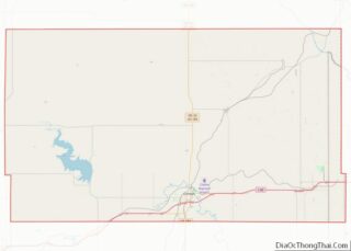
Thomas location map. Where is Thomas city?


History
Thomas was named for William Thomas, who owned a general store and served as postmaster, when the first post office was established at the store on February 12, 1894, while this area was part of Oklahoma Territory. Joseph W. Morris claimed a homestead at the site during the Cheyenne-Arapaho opening in 1892. The Oklahoma Railway Townsite platted Morris’ land in 1902, the same year that the Blackwell, Enid and Southwestern Railroad (later the St. Louis and San Francisco Railway) constructed a line through Thomas. In 1906, the Kansas City, Mexico and Orient Railway (later the Atchison, Topeka and Santa Fe Railway) also built a line through the town. Most of the early settlers were members of the Amish, the Dunkards, and the Church of the United Brethren in Christ religious groups.
Thomas Road Map

Thomas city Satellite Map

Geography
Thomas is located at 35°44′47″N 98°44′54″W / 35.74639°N 98.74833°W / 35.74639; -98.74833 (35.746419, -98.748264). According to the United States Census Bureau, the city has a total area of 1.2 square miles (3.1 km), all land.
See also
Map of Oklahoma State and its subdivision:- Adair
- Alfalfa
- Atoka
- Beaver
- Beckham
- Blaine
- Bryan
- Caddo
- Canadian
- Carter
- Cherokee
- Choctaw
- Cimarron
- Cleveland
- Coal
- Comanche
- Cotton
- Craig
- Creek
- Custer
- Delaware
- Dewey
- Ellis
- Garfield
- Garvin
- Grady
- Grant
- Greer
- Harmon
- Harper
- Haskell
- Hughes
- Jackson
- Jefferson
- Johnston
- Kay
- Kingfisher
- Kiowa
- Latimer
- Le Flore
- Lincoln
- Logan
- Love
- Major
- Marshall
- Mayes
- McClain
- McCurtain
- McIntosh
- Murray
- Muskogee
- Noble
- Nowata
- Okfuskee
- Oklahoma
- Okmulgee
- Osage
- Ottawa
- Pawnee
- Payne
- Pittsburg
- Pontotoc
- Pottawatomie
- Pushmataha
- Roger Mills
- Rogers
- Seminole
- Sequoyah
- Stephens
- Texas
- Tillman
- Tulsa
- Wagoner
- Washington
- Washita
- Woods
- Woodward
- Alabama
- Alaska
- Arizona
- Arkansas
- California
- Colorado
- Connecticut
- Delaware
- District of Columbia
- Florida
- Georgia
- Hawaii
- Idaho
- Illinois
- Indiana
- Iowa
- Kansas
- Kentucky
- Louisiana
- Maine
- Maryland
- Massachusetts
- Michigan
- Minnesota
- Mississippi
- Missouri
- Montana
- Nebraska
- Nevada
- New Hampshire
- New Jersey
- New Mexico
- New York
- North Carolina
- North Dakota
- Ohio
- Oklahoma
- Oregon
- Pennsylvania
- Rhode Island
- South Carolina
- South Dakota
- Tennessee
- Texas
- Utah
- Vermont
- Virginia
- Washington
- West Virginia
- Wisconsin
- Wyoming