Glenwood is a town in Sevier County, Utah, United States. The population was 464 at the 2010 census.
| Name: | Glenwood town |
|---|---|
| LSAD Code: | 43 |
| LSAD Description: | town (suffix) |
| State: | Utah |
| County: | Sevier County |
| Founded: | 1863 |
| Elevation: | 5,272 ft (1,607 m) |
| Total Area: | 0.52 sq mi (1.35 km²) |
| Land Area: | 0.52 sq mi (1.35 km²) |
| Water Area: | 0.00 sq mi (0.00 km²) |
| Total Population: | 464 |
| Population Density: | 913.63/sq mi (352.84/km²) |
| ZIP code: | 84730 |
| Area code: | 435 |
| FIPS code: | 4929580 |
| GNISfeature ID: | 1441332 |
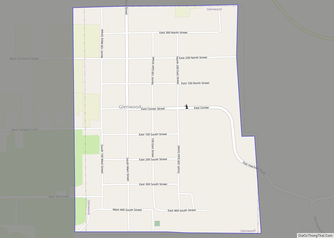
Online Interactive Map
Click on ![]() to view map in "full screen" mode.
to view map in "full screen" mode.
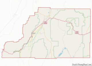
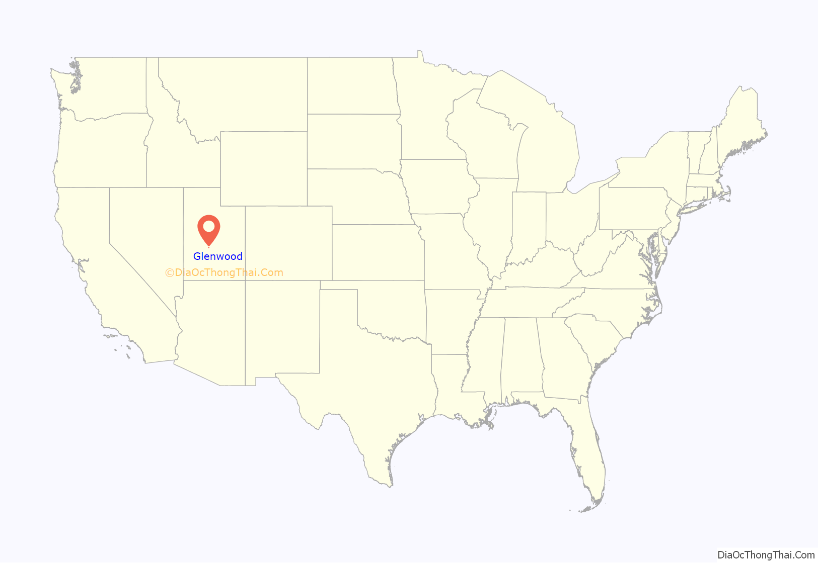
Glenwood location map. Where is Glenwood town?
History
Glenwood was established in 1863 by Mormon pioneers. It was named for an early pioneer, Robert Wilson Glenn. The settlement’s original name was Glencoe or Glen Cove but was changed in November 1864 when Orson Hyde (an LDS Church leader) visited the settlement and recommended Glenwood. A stone fort was constructed in April 1866.
The Black Hawk War of 1867 between the settlers and the local Indians left Glenwood deserted for one year, but it was later resettled in 1868 after peace resumed.
Glenwood was an excellent site for a settlement, owing to fresh springs that naturally bubbled from the hills east of town. The springs still feed Glenwood’s culinary water supply and supply water for the State of Utah fish hatchery southeast of town. A gristmill was built in Glenwood that became the first of its kind in the county.
A ZCMI co-operative building was built at the intersection of Main and Center streets in 1878. For several years it was the largest building in the county. As families moved out of Glenwood, Isaac Washington Pierce Jr., a resident of Glenwood, bought out all shares in the store and ran the store as a privately owned business for many years.(). It still stands as the main historical landmark in town, although it is currently abandoned.
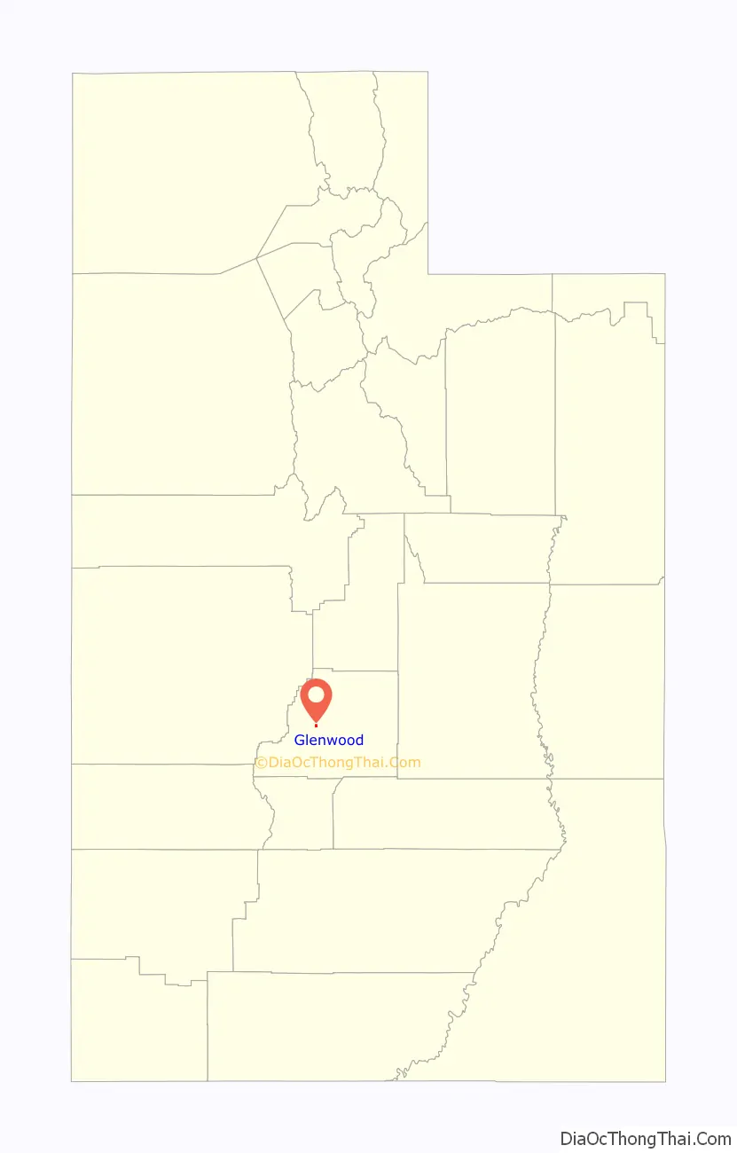
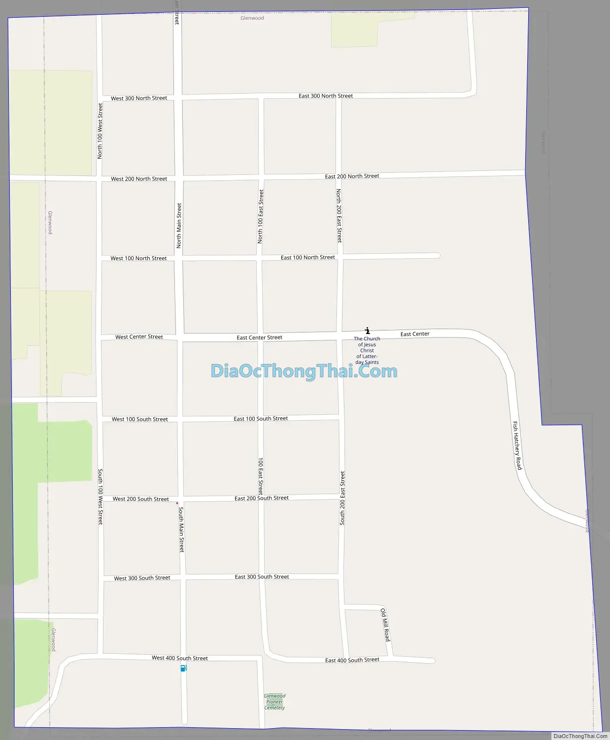
Glenwood Road Map
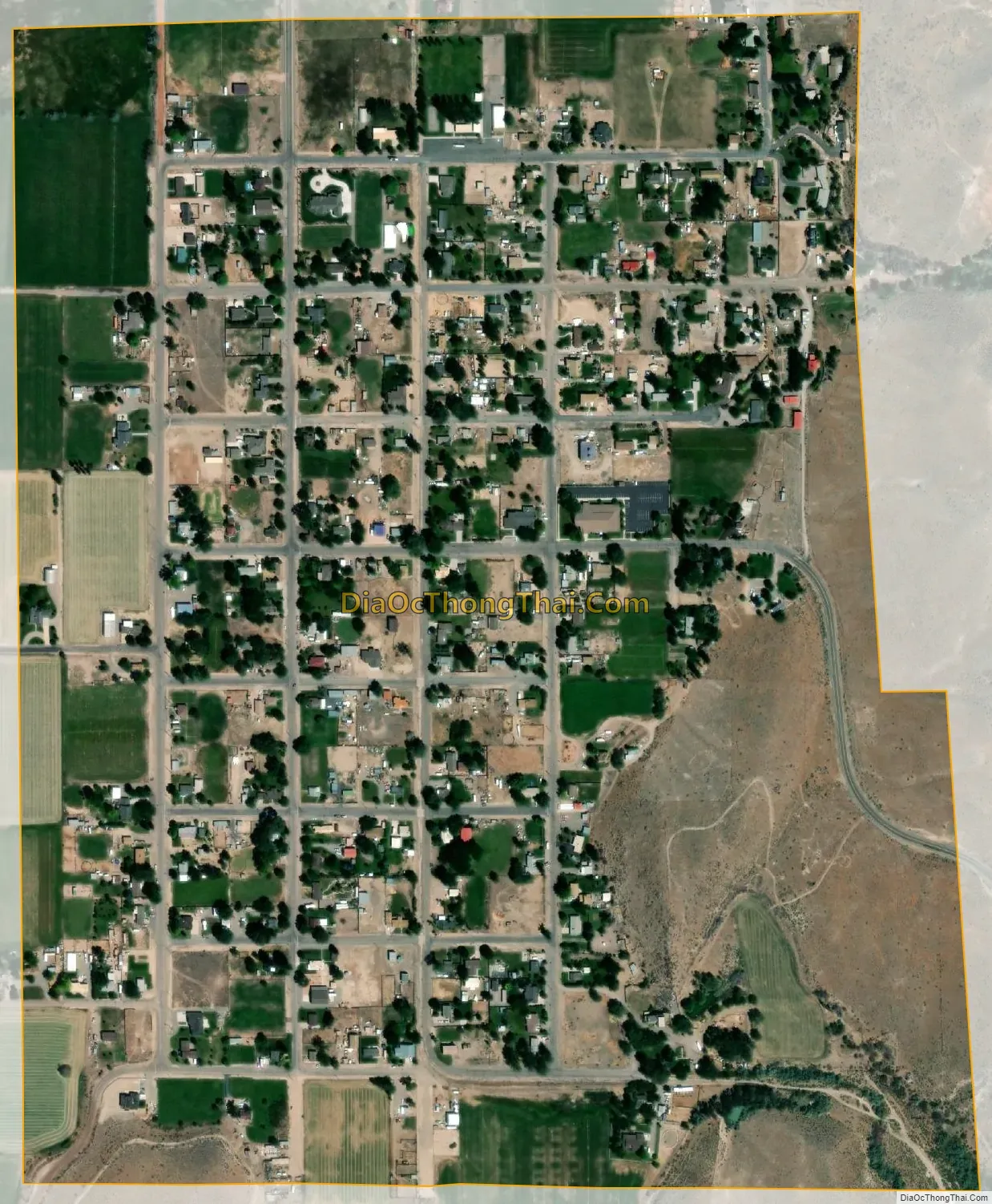
Glenwood city Satellite Map
Geography
According to the United States Census Bureau, the town has a total area of 0.5 square mile (1.4 km), all land. The ZIP Code for the town is 84730.
The Mill Canyon-Sage Flat Watershed Project located in the drainage above Glenwood is designed to reduce flood damage in the area. Completed in 1959, this was the first project in the United States under the Watershed Protection and Flood Prevention Act. A major flood occurred during the final stages of completion, and residents claimed the project paid for itself by controlling this one flood.
Climate
Large seasonal temperature differences typify this climatic region, with warm to hot (and often humid) summers and cold (sometimes severely cold) winters. According to the Köppen Climate Classification system, Glenwood has a humid continental climate, abbreviated “Dfb” on climate maps.
See also
Map of Utah State and its subdivision: Map of other states:- Alabama
- Alaska
- Arizona
- Arkansas
- California
- Colorado
- Connecticut
- Delaware
- District of Columbia
- Florida
- Georgia
- Hawaii
- Idaho
- Illinois
- Indiana
- Iowa
- Kansas
- Kentucky
- Louisiana
- Maine
- Maryland
- Massachusetts
- Michigan
- Minnesota
- Mississippi
- Missouri
- Montana
- Nebraska
- Nevada
- New Hampshire
- New Jersey
- New Mexico
- New York
- North Carolina
- North Dakota
- Ohio
- Oklahoma
- Oregon
- Pennsylvania
- Rhode Island
- South Carolina
- South Dakota
- Tennessee
- Texas
- Utah
- Vermont
- Virginia
- Washington
- West Virginia
- Wisconsin
- Wyoming