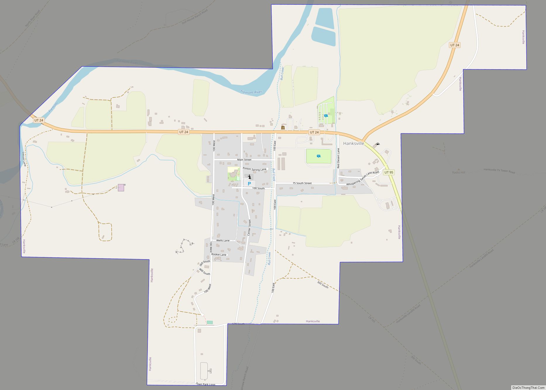
Hanksville is a small town in Wayne County, Utah, United States, at the junction of State Routes 24 and 95. The population was 219 at the 2010 census.
Situated in the Colorado Plateau’s cold desert ecological region, the town is just south of the confluence of the Fremont River and Muddy Creek, which together form the Dirty Devil River, which then flows southeast to the Colorado River. The Hanksville-Burpee Quarry is located nearby, and the Mars Desert Research Station is 7 miles (11 km) northwest of town. The Bureau of Land Management’s Henry Mountains field station is located in Hanksville.
| Name: | Hanksville town |
|---|---|
| LSAD Code: | 43 |
| LSAD Description: | town (suffix) |
| State: | Utah |
| County: | Wayne County |
| Incorporated: | January 6, 1999 |
| Elevation: | 4,295 ft (1,309 m) |
| Total Area: | 1.72 sq mi (4.45 km²) |
| Land Area: | 1.69 sq mi (4.36 km²) |
| Water Area: | 0.03 sq mi (0.09 km²) |
| Total Population: | 219 |
| Population Density: | 130.56/sq mi (50.42/km²) |
| ZIP code: | 84734 |
| Area code: | 435 |
| FIPS code: | 4933100 |
| GNISfeature ID: | 2412723 |
| Website: | www.hanksvilleutah.gov |
Online Interactive Map
Click on ![]() to view map in "full screen" mode.
to view map in "full screen" mode.
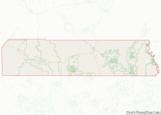
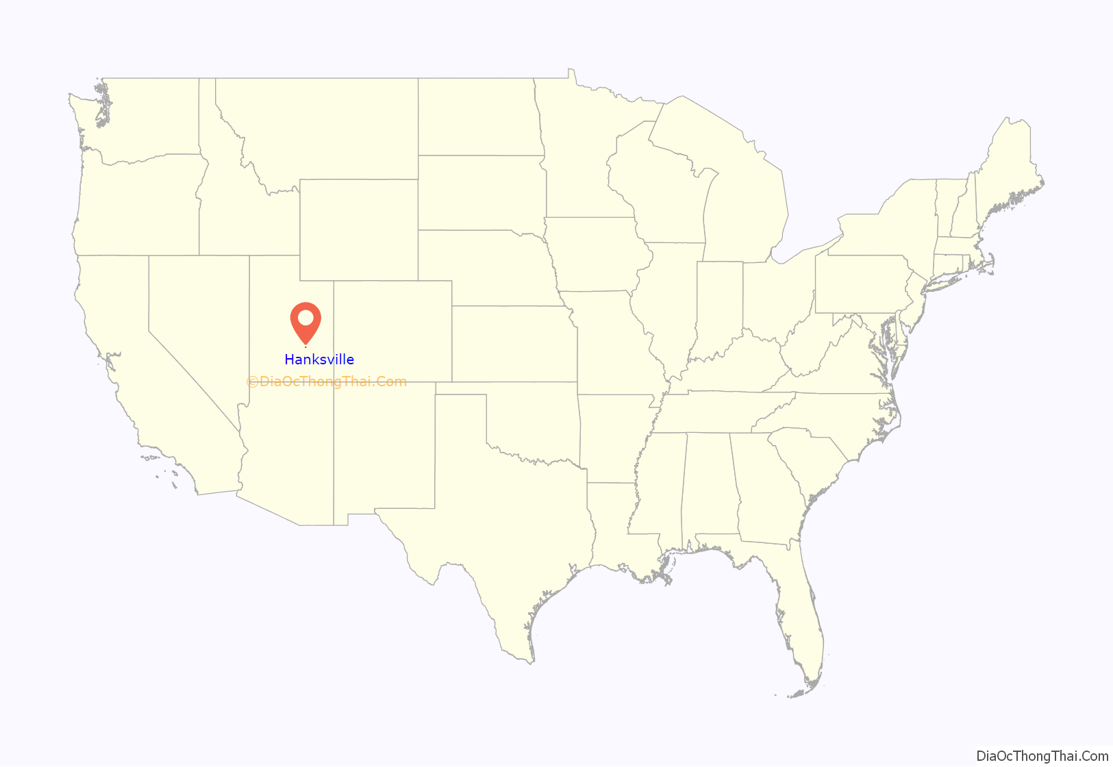
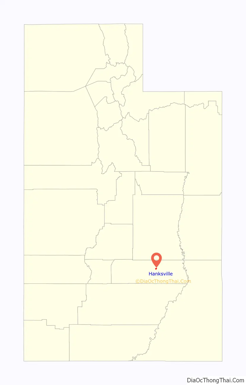
Hanksville location map. Where is Hanksville town?
History
The town was settled in 1882 and known for a time for the name given to the surrounding area, Graves Valley. It took the name of Hanksville in 1885, after Ebenezer Hanks, an early settler. It was not incorporated until January 6, 1999.
The REA brought electricity to the community in 1960. Today agriculture, mining, and tourism are the main drivers to the local economy. Tourism is particularly important with people coming for recreation at Lake Powell, Capitol Reef National Park, the Henry Mountains, the San Rafael Swell, Goblin Valley State Park, and the solitude of the surrounding deserts and slot canyons.
Hanksville was a supply post for Butch Cassidy and the Wild Bunch, who would hide out at Robbers Roost in the desert southeast of town.
During the uranium mining frenzy following World War II, Hanksville became a supply center for the prospectors and miners scouring the deserts of the Colorado Plateau. Many abandoned mines can be found in the deserts surrounding the town.
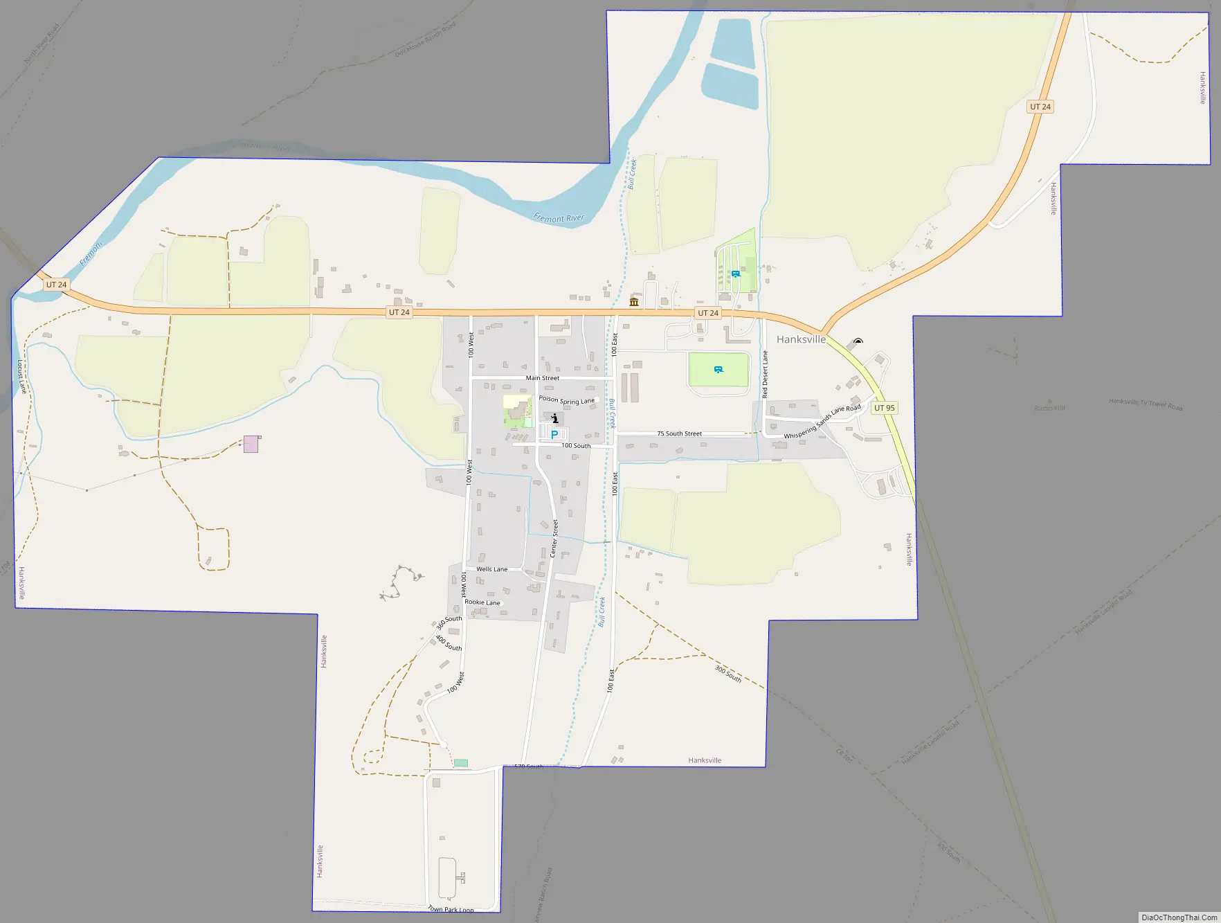
Hanksville Road Map
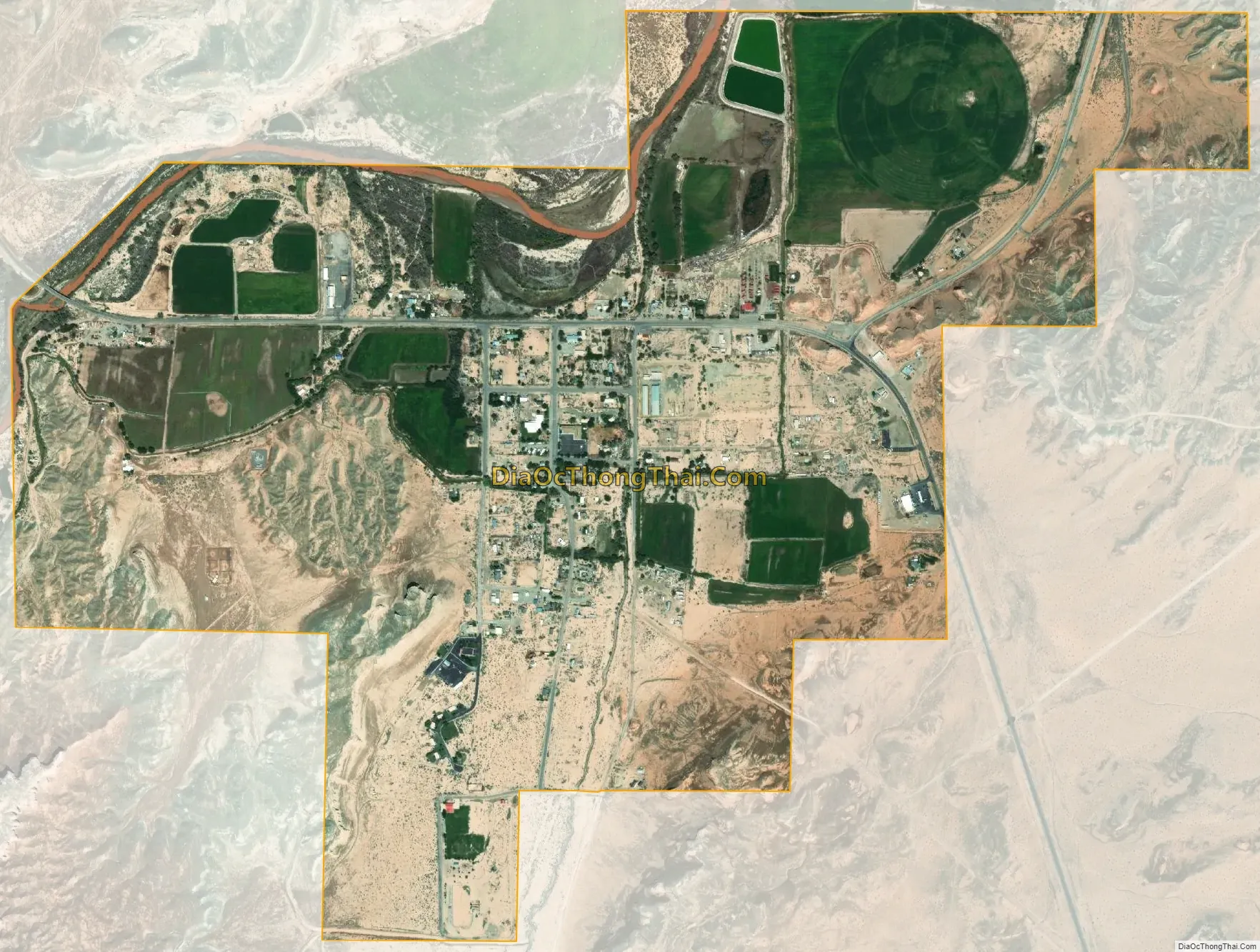
Hanksville city Satellite Map
See also
Map of Utah State and its subdivision: Map of other states:- Alabama
- Alaska
- Arizona
- Arkansas
- California
- Colorado
- Connecticut
- Delaware
- District of Columbia
- Florida
- Georgia
- Hawaii
- Idaho
- Illinois
- Indiana
- Iowa
- Kansas
- Kentucky
- Louisiana
- Maine
- Maryland
- Massachusetts
- Michigan
- Minnesota
- Mississippi
- Missouri
- Montana
- Nebraska
- Nevada
- New Hampshire
- New Jersey
- New Mexico
- New York
- North Carolina
- North Dakota
- Ohio
- Oklahoma
- Oregon
- Pennsylvania
- Rhode Island
- South Carolina
- South Dakota
- Tennessee
- Texas
- Utah
- Vermont
- Virginia
- Washington
- West Virginia
- Wisconsin
- Wyoming