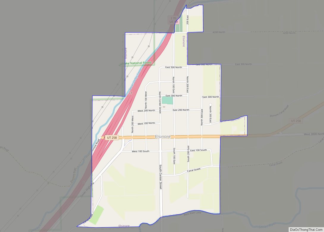
Monroe is a city in Sevier County, Utah, United States. The population was 2,256 at the 2010 United States Census.
| Name: | Monroe city |
|---|---|
| LSAD Code: | 25 |
| LSAD Description: | city (suffix) |
| State: | Utah |
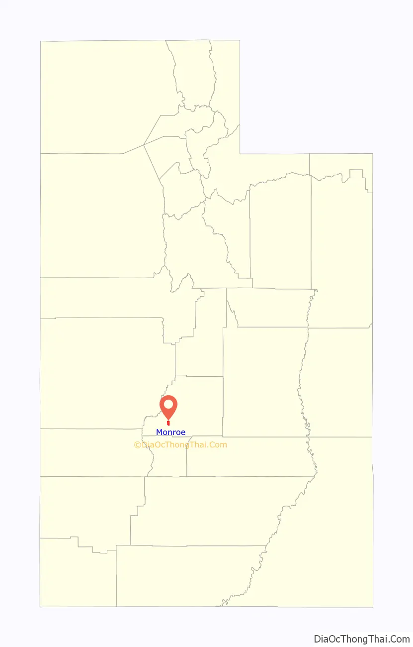
| County: | Sevier County |
| Incorporated: | 1920 |
| Elevation: | 5,394 ft (1,644 m) |
| Total Area: | 3.57 sq mi (9.25 km²) |
| Land Area: | 3.57 sq mi (9.25 km²) |
| Water Area: | 0.00 sq mi (0.00 km²) |
| Total Population: | 2,256 |
| Population Density: | 660.32/sq mi (254.97/km²) |
| ZIP code: | 84754 |
| Area code: | 435 |
| FIPS code: | 4951360 |
| GNISfeature ID: | 1443556 |
| Website: | www.littlegreenvalley.com |
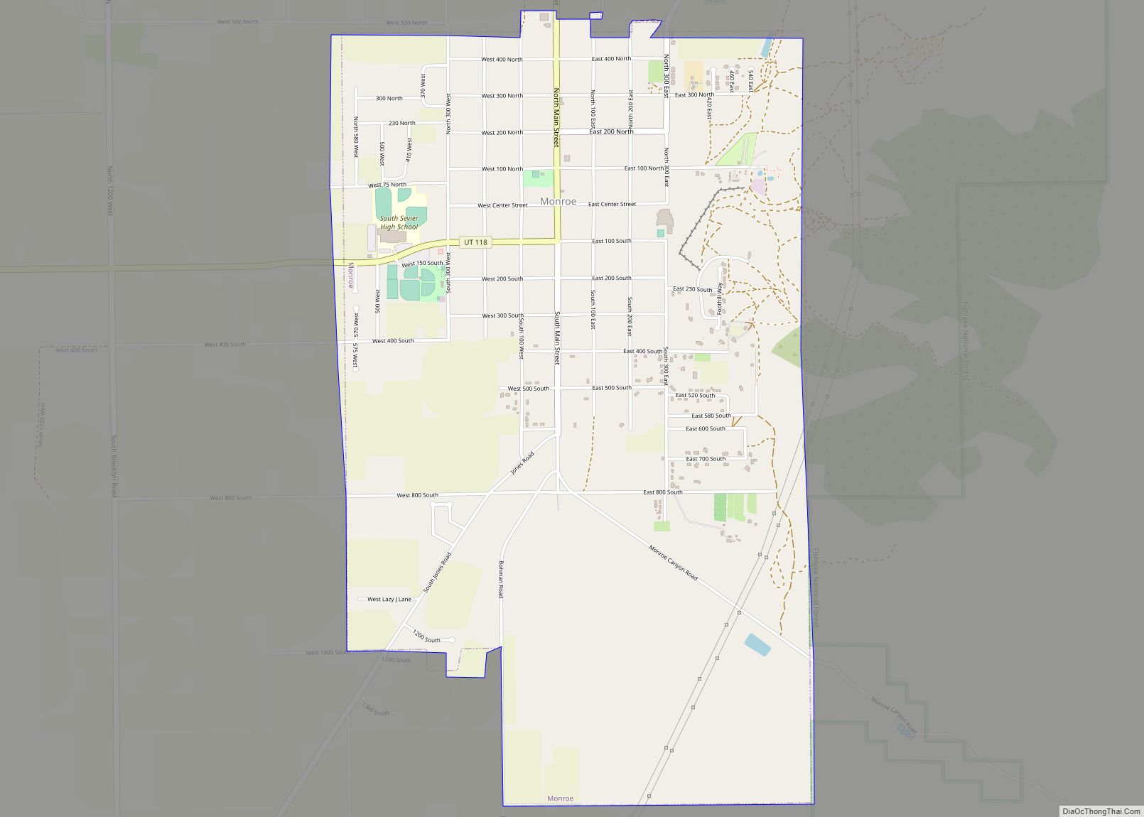
Online Interactive Map
Click on ![]() to view map in "full screen" mode.
to view map in "full screen" mode.
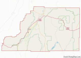
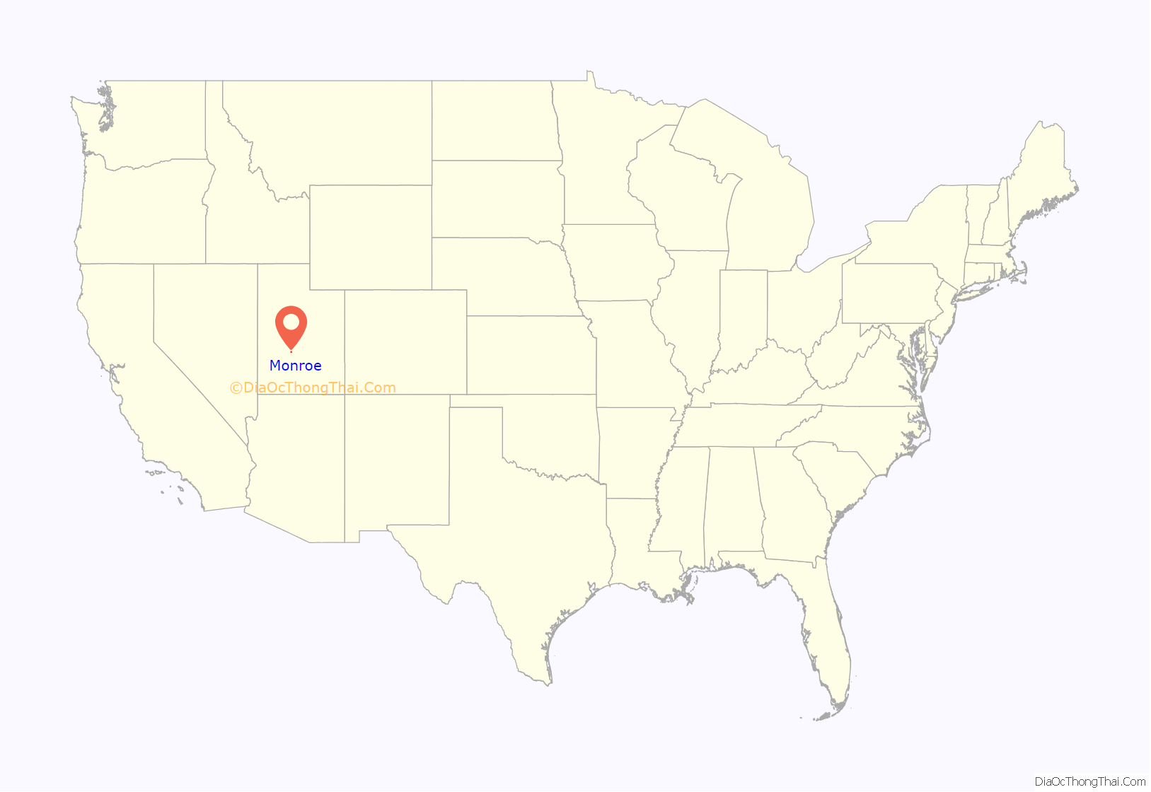
Monroe location map. Where is Monroe city?
History
In late 1863, a few exploratory settlers came to Monroe. This small group included George Wilson, his son David, and two others who were seeking to settle in this valley. They made a dugout and spent the winter at what is now considered near the center of the town. They were followed by the first permanent group of settlers, who arrived in Monroe on 20 February 1864. Most, if not all, of the first Settlers were members of the Church of Jesus Christ of Latter-day Saints (LDS Church), who had immigrated to Utah. Around 4 to 5 months before the first small group of men entered Monroe valley to begin settlement, an advanced team, also led by George Wilson, began to lay some foundation work to help prepare the settlement.
At first the town was called South Bend (due to the proximity to a bend in the Sevier River), but soon after its settlement it was renamed Alma, in honor of the Book of Mormon prophet. It is estimated that by the end of 1864 around 20 families were living in Alma. They spent the first year building small homes and dugouts, along with clearing space for fields and pastures.
Initially settling in the Salt Lake Valley did not provoke the Native Americans to war, but further settlement outside of Salt Lake provoked the Native Americans to more aggressive behavior. As settlement in these valleys increased, the Native Americans were pushed back into the mountains. In April 1865, the Black Hawk War broke out between local Native Americans and the Settlers of both the Sevier and Sanpete counties. The war drastically ended the progress which was being made in creating farms and homes in and around Alma. On the night of 21 April 1866, Walter Barney and Sidney Robinson were on guard watching the public corral when they spotted something lying on the fence when making their nightly rounds. When approached, they realized that it was two Native Americans. After chasing them away, they went back to the fence and realized that they had been digging around the poles to break the boundary around the corral.
Alma had been settled in the middle of the Native American’s hunting grounds and as a result they started to go hungry. During the war Native Americans were constantly trying to steal the Settler’s stock for food, and they were successful during several raids.
Sometime during 1865, work began on a fort to provide protection for both the Settlers and their stock. The fort was completed and contained several homes, a blacksmith shop, along with a corral and stockyard for the animals. This fort, named Fort Alma, provided protection for about two years, but things continued to get more dangerous and in April 1867 the Settlers of Alma were evacuated. Most of the evacuees made temporary homes in Sanpete County, until they could return home.
An attempt to resettle Alma was made during 1868, but the Settlers ran into Native Americans near Cedar Ridge (now Vermillion, Utah) and a battle ensued. They were unsuccessful in resettling Alma, and it was not until March 1871 that Settlers were finally able to return to Alma. The following year they applied for a Post Office under the city name of Monroe, in honor of U.S. President James Monroe. By the end of 1872 the telegraph had been extended through Monroe, which connected it with the rest of Utah. In 1889, Monroe was incorporated as a town and remained that way until 1921, when it was incorporated as a city.
In 1882, Thomas Cooper and his wife homesteaded the area on the east side of town where hot springs water emerged. They built a wood box to collect the water and offered it as a soaking pool. Later, around 1905, a building was erected. There was a dance floor, an indoor swimming pool, and many dressing rooms. Many people came from miles around by horse and buggy to enjoy soaking and dancing. In 1930 Farnsworth bought the hot springs. He was the leader of a band, and it became the house band. The slogan for the Monroe hot springs was, “the home of mirth and merriment”. The hot springs enjoyed many years of prosperity until around 1950. It was revitalized in the 1970s. The name was changed to Mystic Hot Springs in 1995.
Present day
Monroe has many subdivisions and is nicknamed “The Little Green Valley” due to the many fields that surround the city.
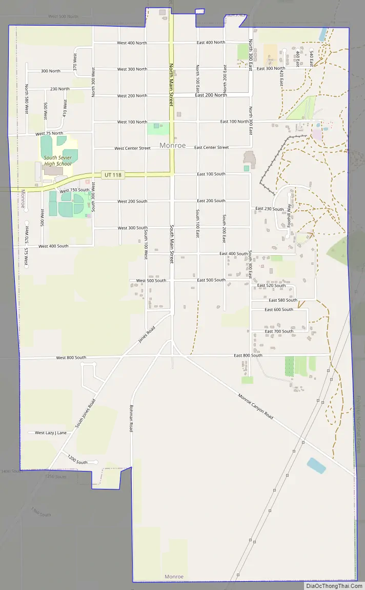
Monroe Road Map
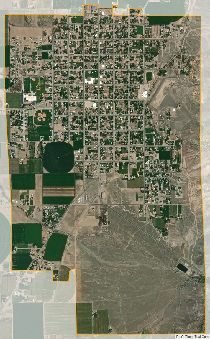
Monroe city Satellite Map
Geography
Monroe is located in rural central Utah. According to the United States Census Bureau, the city has a total area of 3.5 square miles (9.2 km), all land. Monroe is bordered by mountains on the east and south, and farmers’ fields to the west and north.
Monroe is home to naturally occurring hot springs with travertine deposits, a result of the Monroe-Red Hill geothermal system found along the Sevier fault. On the east side of town, hot water surfaces at a temperature of 168 °F and a rate of about 200 gallons per minute. A travertine mound has formed, known as the Monroe Mound. This deposit stretches one mile across, 200 yards wide, and a few hundred feet thick. There is another hot water source about a mile north of town called the Red Hill Hot Springs. It also surfaces at 168 °F, but at a rate of about 100 gallons per minute. The Red Hill mound is about one-third of a mile across, and deep red in color.
See also
Map of Utah State and its subdivision: Map of other states:- Alabama
- Alaska
- Arizona
- Arkansas
- California
- Colorado
- Connecticut
- Delaware
- District of Columbia
- Florida
- Georgia
- Hawaii
- Idaho
- Illinois
- Indiana
- Iowa
- Kansas
- Kentucky
- Louisiana
- Maine
- Maryland
- Massachusetts
- Michigan
- Minnesota
- Mississippi
- Missouri
- Montana
- Nebraska
- Nevada
- New Hampshire
- New Jersey
- New Mexico
- New York
- North Carolina
- North Dakota
- Ohio
- Oklahoma
- Oregon
- Pennsylvania
- Rhode Island
- South Carolina
- South Dakota
- Tennessee
- Texas
- Utah
- Vermont
- Virginia
- Washington
- West Virginia
- Wisconsin
- Wyoming