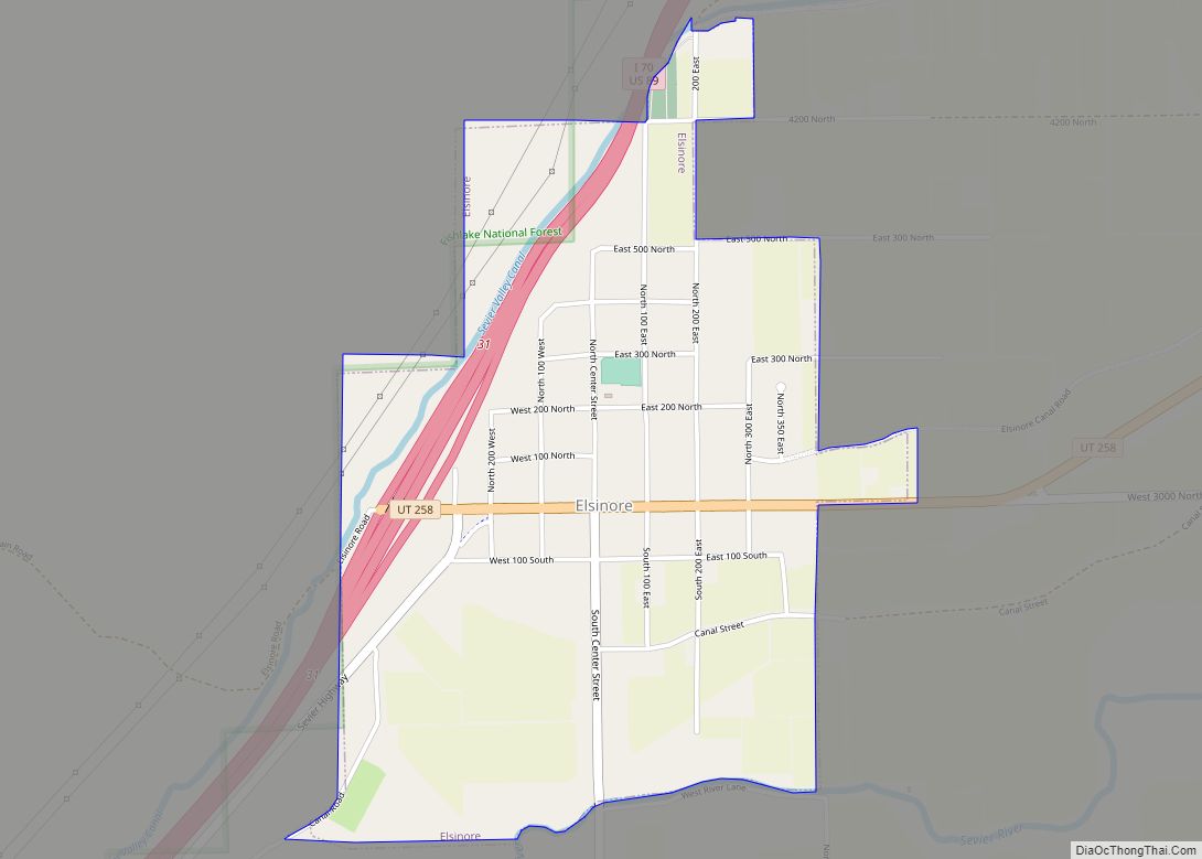
Salina (/səˈlaɪnə/ sə-LY-nə) is a city in Sevier County, Utah, United States. The population was 2,660 at the 2020 census.
| Name: | Salina city |
|---|---|
| LSAD Code: | 25 |
| LSAD Description: | city (suffix) |
| State: | Utah |
| County: | Sevier County |
| Elevation: | 5,161 ft (1,573 m) |
| Total Area: | 5.83 sq mi (15.10 km²) |
| Land Area: | 5.83 sq mi (15.10 km²) |
| Water Area: | 0.00 sq mi (0.00 km²) |
| Total Population: | 2,660 |
| Population Density: | 447.95/sq mi (172.97/km²) |
| ZIP code: | 84654 |
| Area code: | 435 |
| FIPS code: | 4965880 |
| GNISfeature ID: | 1445269 |
| Website: | www.salinacity.org |
Online Interactive Map
Click on ![]() to view map in "full screen" mode.
to view map in "full screen" mode.
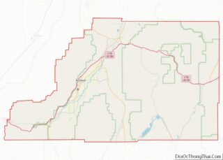
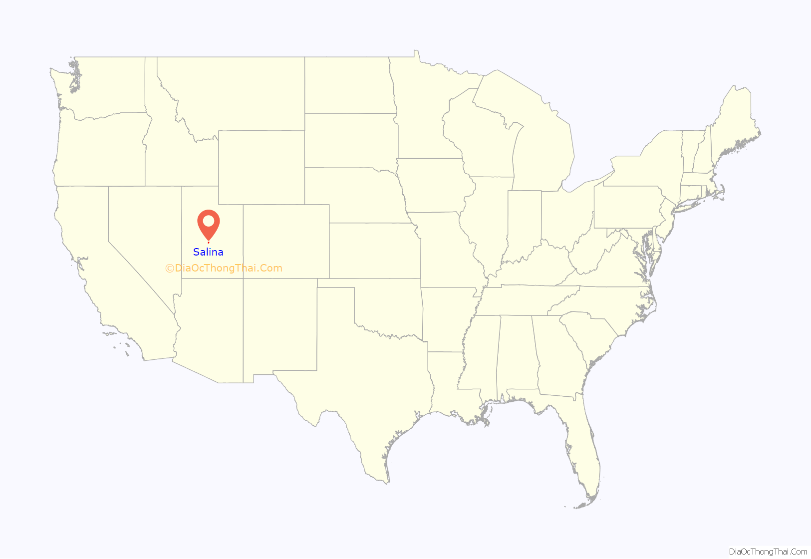
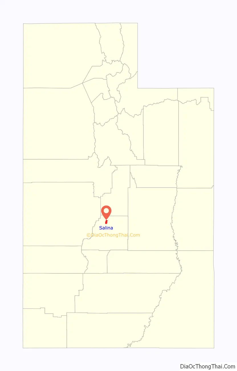
Salina location map. Where is Salina city?
History
The first permanent settlers (about 30 families) moved into the area in 1864 at the direction of leaders of the Church of Jesus Christ of Latter-day Saints. They found abundant salt deposits nearby so they named the area “Salina”.
In 1866, troubles with Native Americans who used the area as their hunting ground (the Black Hawk War (Utah)) forced the white settlers to retreat to the Manti area. They returned to Salina in 1871, organized a militia, and constructed a fort and buildings for a school and a church. At that time they discovered coal deposits in “almost inexhaustible quantities” in the canyon east of the settlement.
A creek north of the settlement was tapped to provide water for irrigation, domestic purposes, and to power various enterprises such as sawmills, grist mills, salt refineries and generation of electricity. The Sevier River was tapped in 1874, and by 1908 the area west of the settlement was being fully cultivated.
In June 1891, the settlement was connected to the state’s railroad system, and that year the central area was incorporated as a town. It soon became the shipping terminal between the area settlements and the rest of the state. In 1913 the town was re-incorporated as a city.
During World War II, Salina contained a POW camp, housing 250 German prisoners, most of them members of Erwin Rommel’s Afrikakorps. On the night of July 8, 1945, Private Clarence Bertucci climbed one of the guard towers and took aim at the tents where the prisoners were sleeping. He fired 250 rounds from a light machine gun and managed to hit some thirty tents in his fifteen-second rampage. By the time a corporal managed to disarm Bertucci, six prisoners were dead and an additional twenty-two were wounded (three later died of their wounds).
This incident was called the Salina Massacre. Bertucci, who was from New Orleans, was declared insane and spent the remainder of his life in an institution.
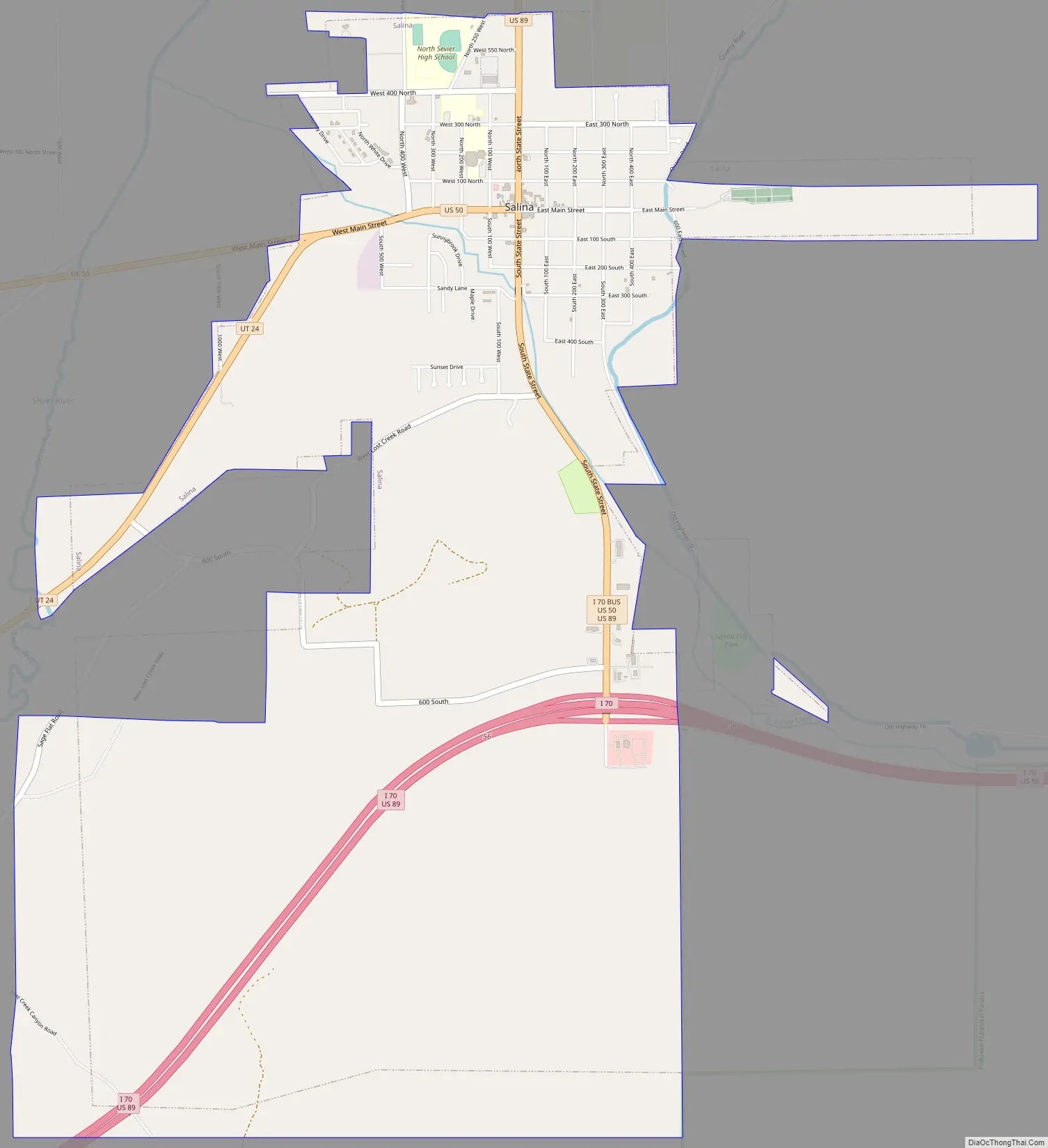
Salina Road Map
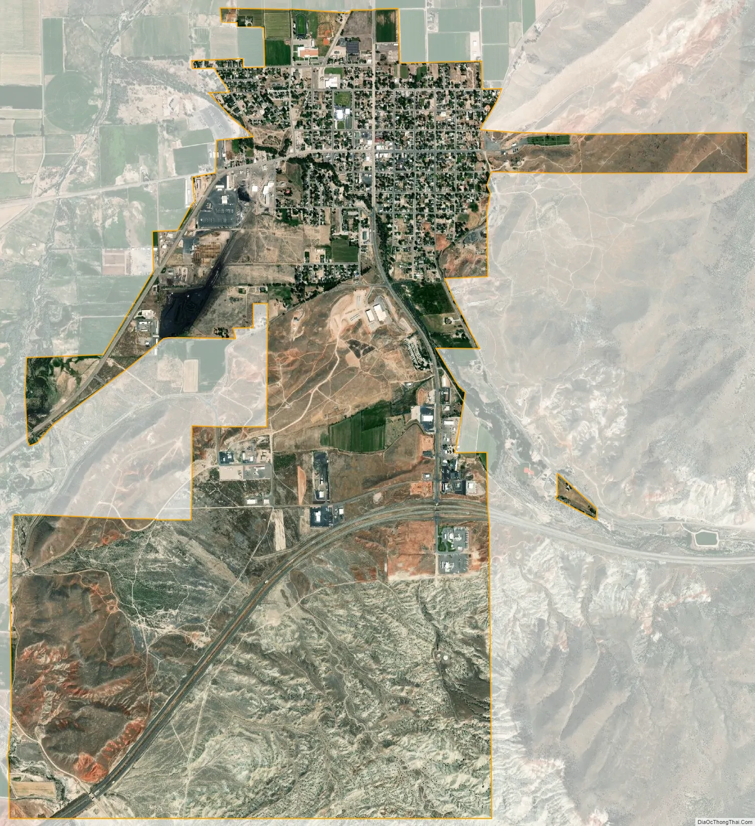
Salina city Satellite Map
Geography
According to the United States Census Bureau, the city has a total area of 6.2 square miles (15.9 km), all land.
Climate
Salina’s annual precipitation averages around 7.82 inches (20 cm), which causes the area to be classified as desert.
See also
Map of Utah State and its subdivision: Map of other states:- Alabama
- Alaska
- Arizona
- Arkansas
- California
- Colorado
- Connecticut
- Delaware
- District of Columbia
- Florida
- Georgia
- Hawaii
- Idaho
- Illinois
- Indiana
- Iowa
- Kansas
- Kentucky
- Louisiana
- Maine
- Maryland
- Massachusetts
- Michigan
- Minnesota
- Mississippi
- Missouri
- Montana
- Nebraska
- Nevada
- New Hampshire
- New Jersey
- New Mexico
- New York
- North Carolina
- North Dakota
- Ohio
- Oklahoma
- Oregon
- Pennsylvania
- Rhode Island
- South Carolina
- South Dakota
- Tennessee
- Texas
- Utah
- Vermont
- Virginia
- Washington
- West Virginia
- Wisconsin
- Wyoming