West Wood is a census-designated place (CDP) in Carbon County, Utah, United States. The population was 844 at the 2010 census.
| Name: | West Wood CDP |
|---|---|
| LSAD Code: | 57 |
| LSAD Description: | CDP (suffix) |
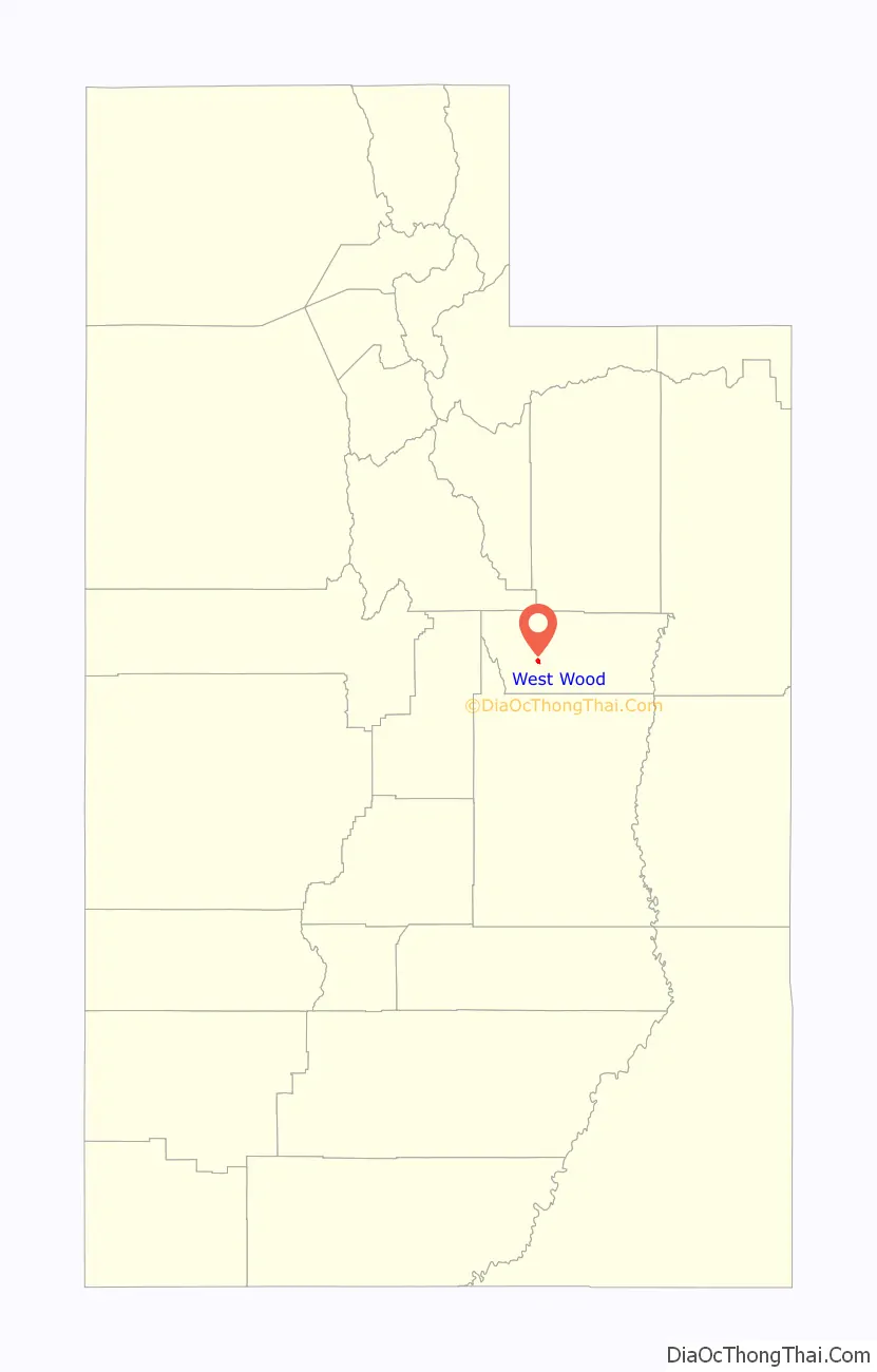
| State: | Utah |
| County: | Carbon County |
| Elevation: | 5,617 ft (1,712 m) |
| Total Area: | 1.0 sq mi (2.7 km²) |
| Land Area: | 1.0 sq mi (2.7 km²) |
| Water Area: | 0.0 sq mi (0.0 km²) |
| Total Population: | 844 |
| Population Density: | 795/sq mi (307.0/km²) |
| ZIP code: | 84501 |
| Area code: | 435 |
| FIPS code: | 4983730 |
| GNISfeature ID: | 2584782 |
Online Interactive Map
Click on ![]() to view map in "full screen" mode.
to view map in "full screen" mode.
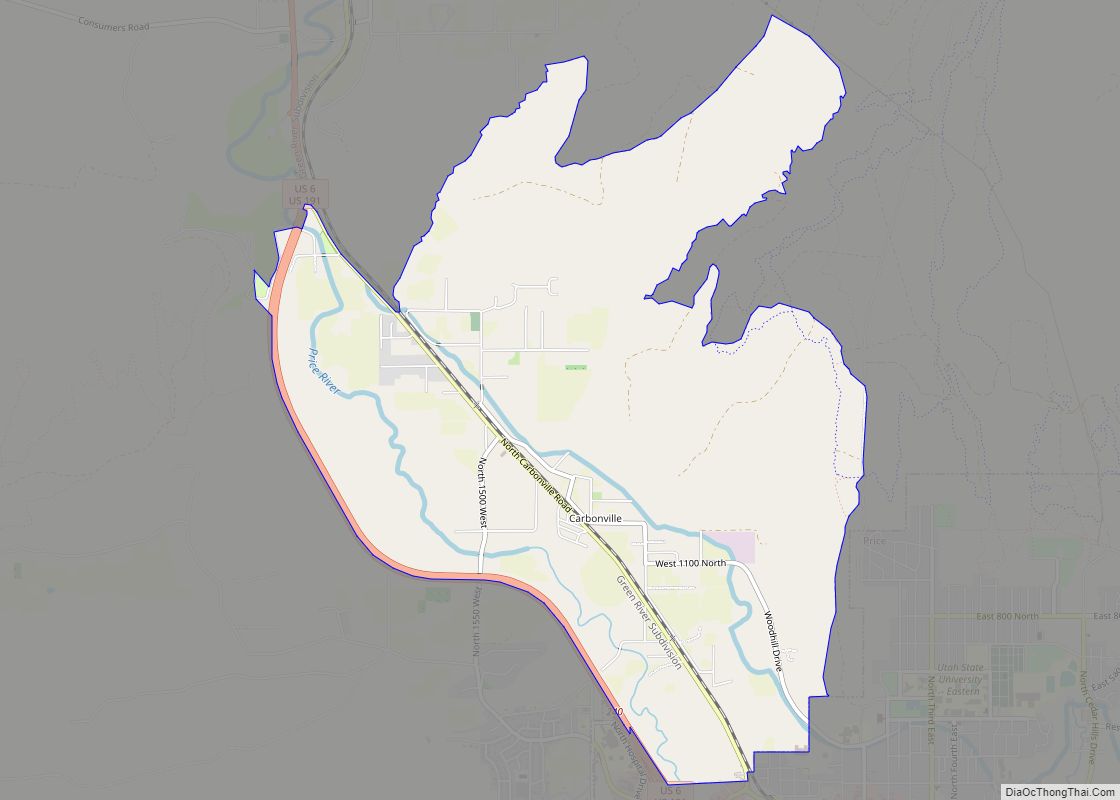
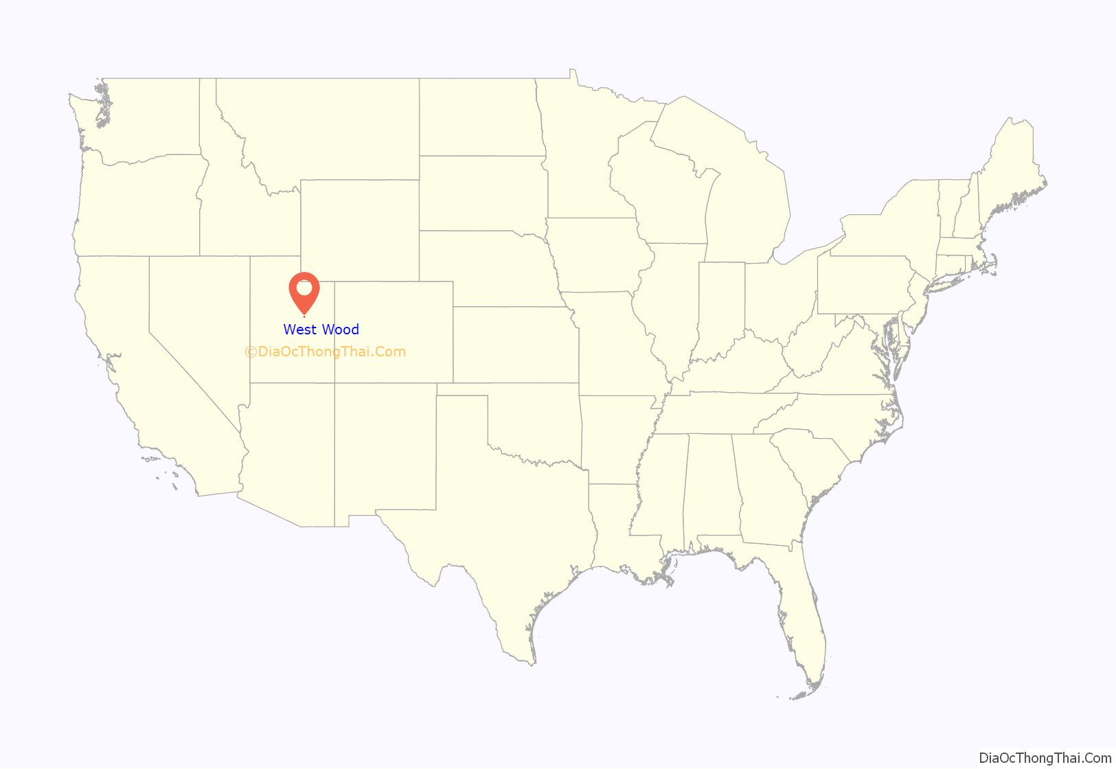
West Wood location map. Where is West Wood CDP?
History
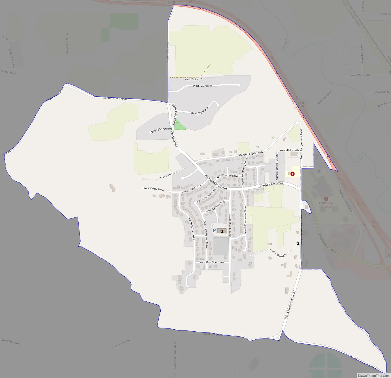
The land west of Price was a sparsely populated rural area until the Westwood subdivision was developed beginning in 1975.
The opening of Castleview Hospital in 1980 brought more people to West Wood. Additional neighborhoods have been built over the years, and planning for West Wood’s future is an important issue in Carbon County government.
West Wood Road Map
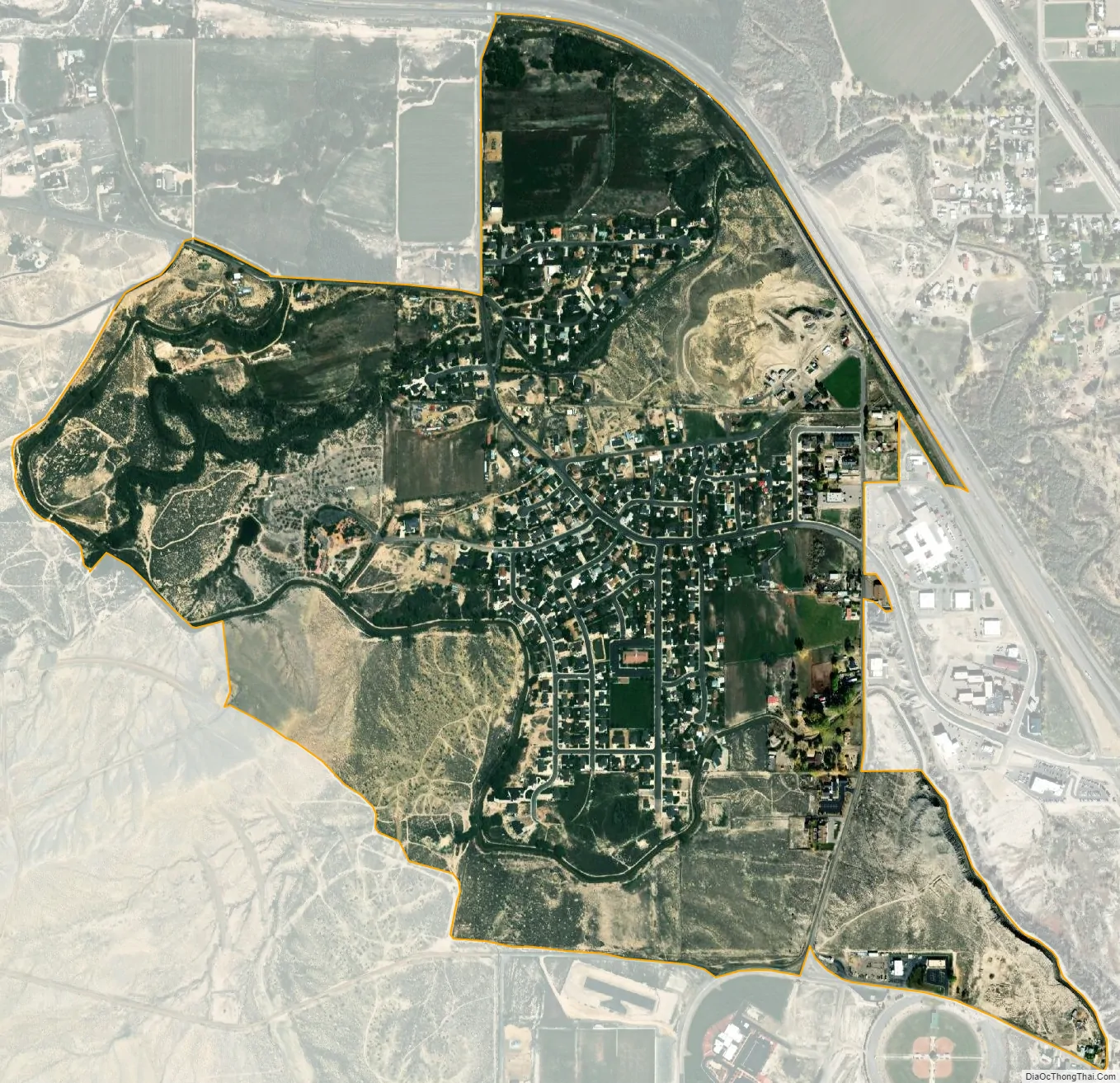
West Wood city Satellite Map
Geography
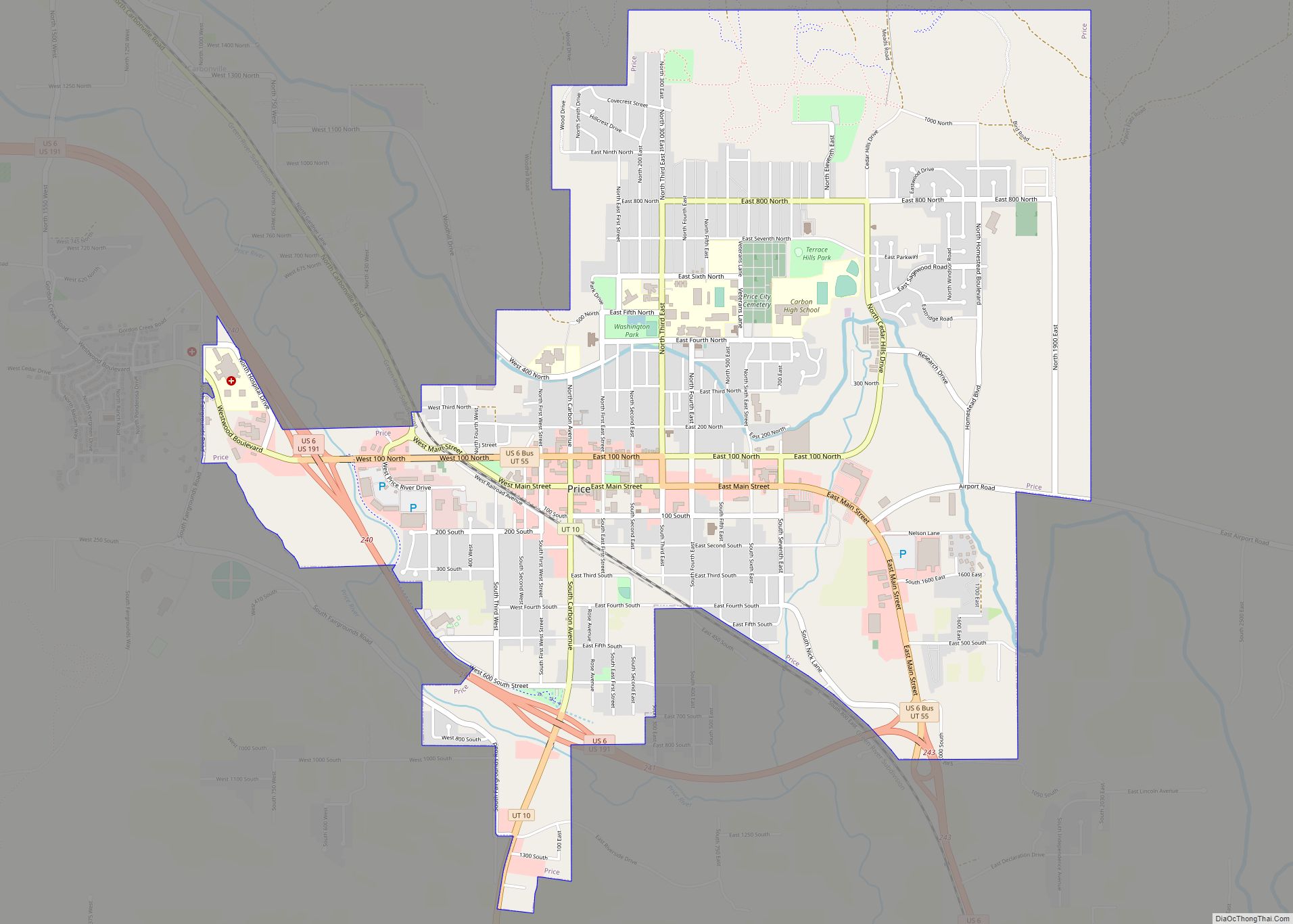
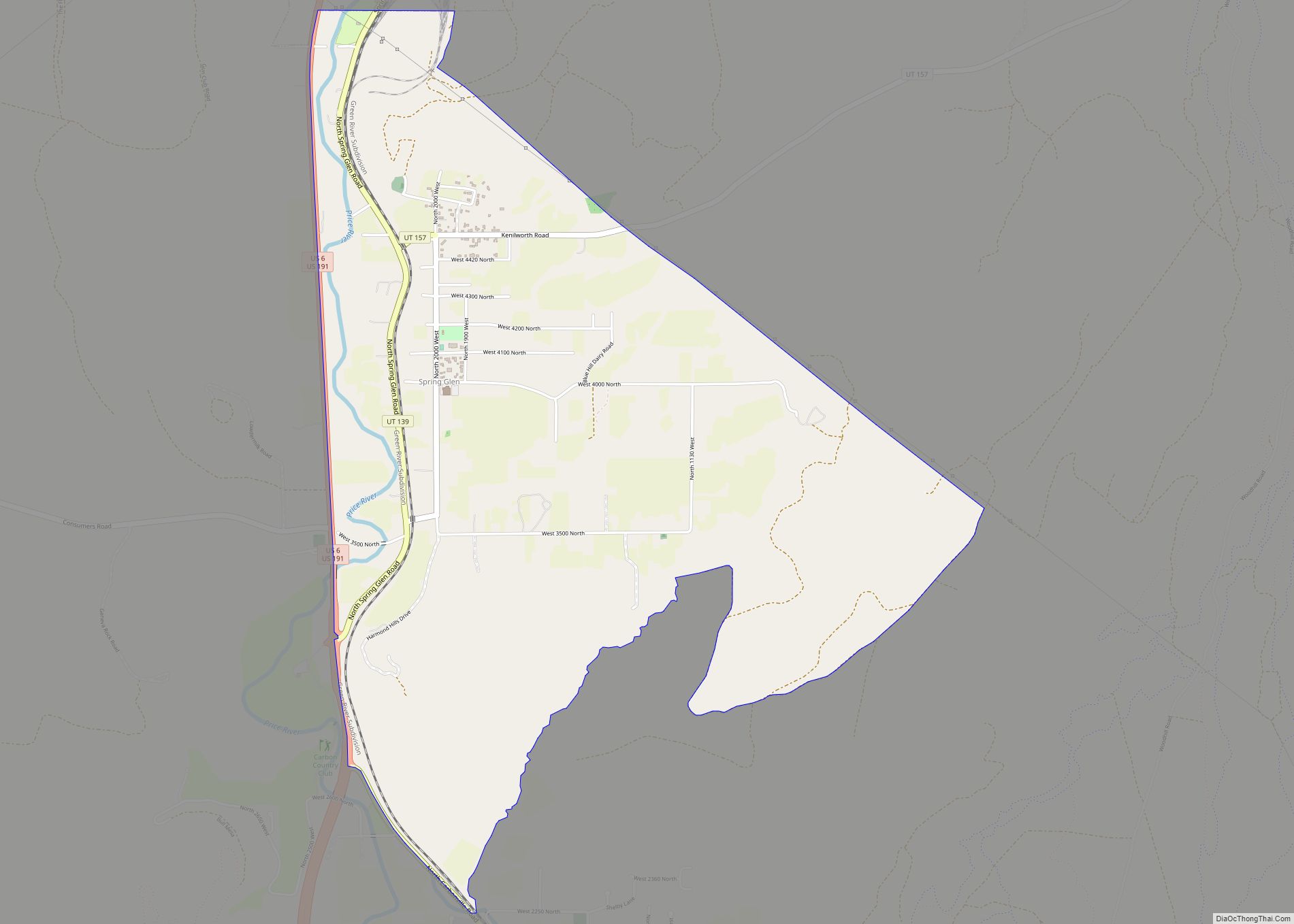
The CDP is just west of Price, the county seat. To the north and northeast, across U.S. Route 6, is Carbonville. The Carbon County Fairgrounds are to the south. To the west are Pinnacle Canyon and Porphyry Bench, part of the Wasatch Plateau. The CDP is named for the Westwood subdivision, a neighborhood to the west of Castleview Hospital. Main streets include Fairgrounds Road and Westwood Boulevard, which passes eastward under the highway to become Utah State Route 55 and 100 North in Price.
Streams flowing through the CDP include Pinnacle Creek and the privately owned Carbon Canal. This is a naturally swampy area with a high water table, and residents have periodic problems with flooding.
According to the United States Census Bureau, the West Wood CDP has a total area of 1.0 square mile (2.7 km), all land.
See also
Map of Utah State and its subdivision: Map of other states:- Alabama
- Alaska
- Arizona
- Arkansas
- California
- Colorado
- Connecticut
- Delaware
- District of Columbia
- Florida
- Georgia
- Hawaii
- Idaho
- Illinois
- Indiana
- Iowa
- Kansas
- Kentucky
- Louisiana
- Maine
- Maryland
- Massachusetts
- Michigan
- Minnesota
- Mississippi
- Missouri
- Montana
- Nebraska
- Nevada
- New Hampshire
- New Jersey
- New Mexico
- New York
- North Carolina
- North Dakota
- Ohio
- Oklahoma
- Oregon
- Pennsylvania
- Rhode Island
- South Carolina
- South Dakota
- Tennessee
- Texas
- Utah
- Vermont
- Virginia
- Washington
- West Virginia
- Wisconsin
- Wyoming