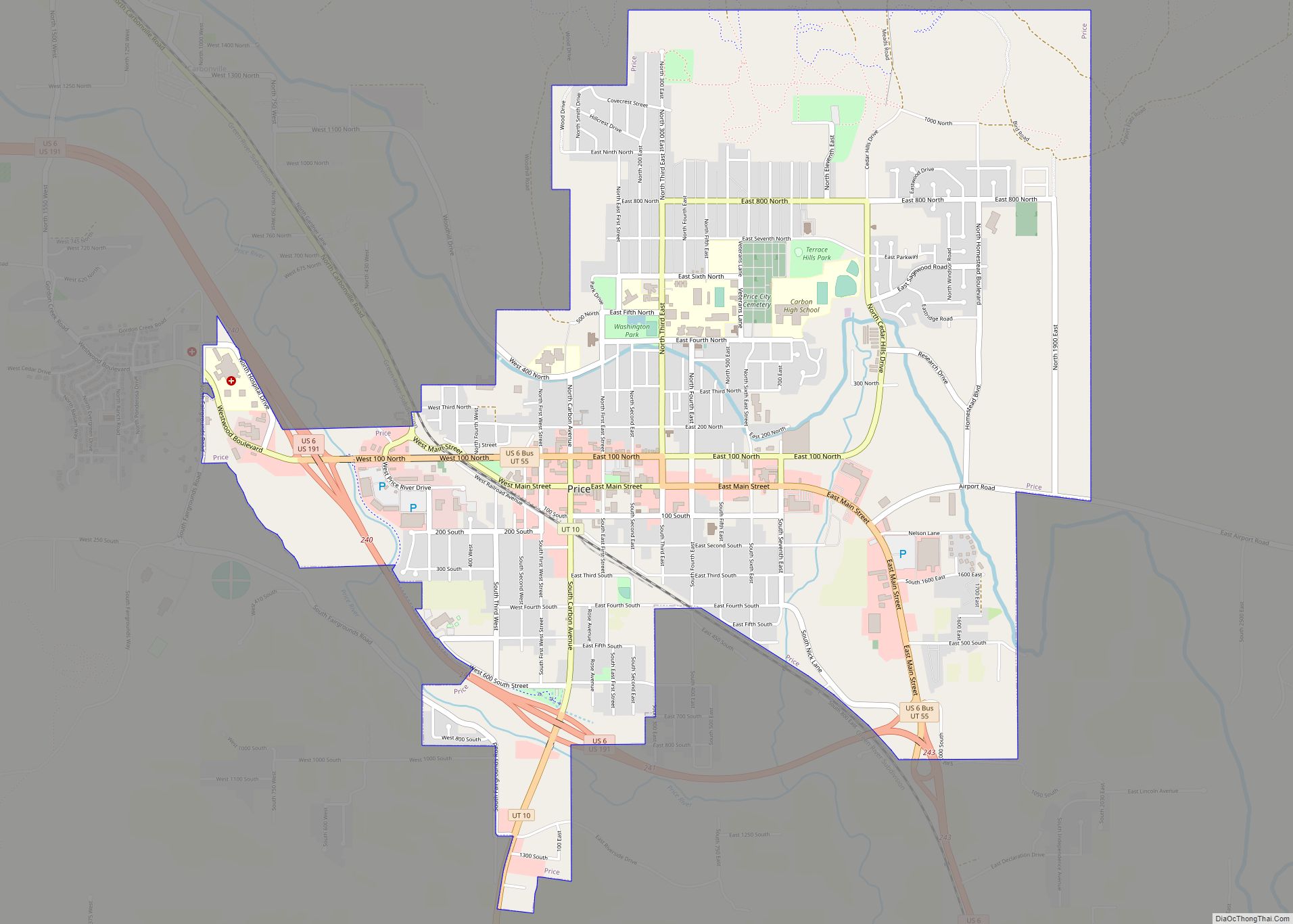
Price is a city in the U.S. state of Utah and the county seat of Carbon County. The city is home to Utah State University Eastern, as well as the USU Eastern Prehistoric Museum. Price is located within short distances of both Nine Mile Canyon and the Manti-La Sal National Forest.
The population was 8,715 at the 2010 census, making it the largest city in Carbon County.
| Name: | Price city |
|---|---|
| LSAD Code: | 25 |
| LSAD Description: | city (suffix) |
| State: | Utah |
| County: | Carbon County |
| Elevation: | 5,624 ft (1,714 m) |
| Total Area: | 5.04 sq mi (13.04 km²) |
| Land Area: | 5.04 sq mi (13.04 km²) |
| Water Area: | 0.00 sq mi (0.00 km²) |
| Total Population: | 8,715 |
| Population Density: | 1,654.82/sq mi (638.88/km²) |
| ZIP code: | 84501 |
| Area code: | 435 |
| FIPS code: | 4962030 |
| GNISfeature ID: | 2411491 |
| Website: | www.pricecityutah.com |
Online Interactive Map
Click on ![]() to view map in "full screen" mode.
to view map in "full screen" mode.
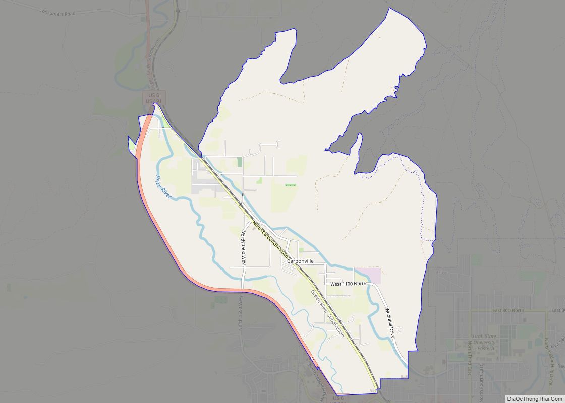
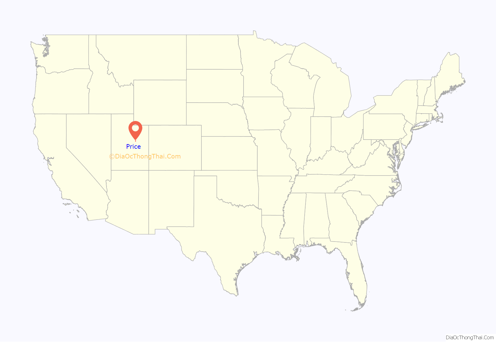
Price location map. Where is Price city?
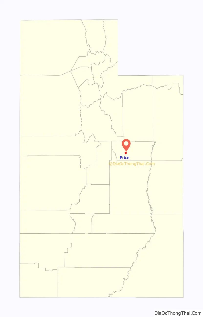
Price Road Map
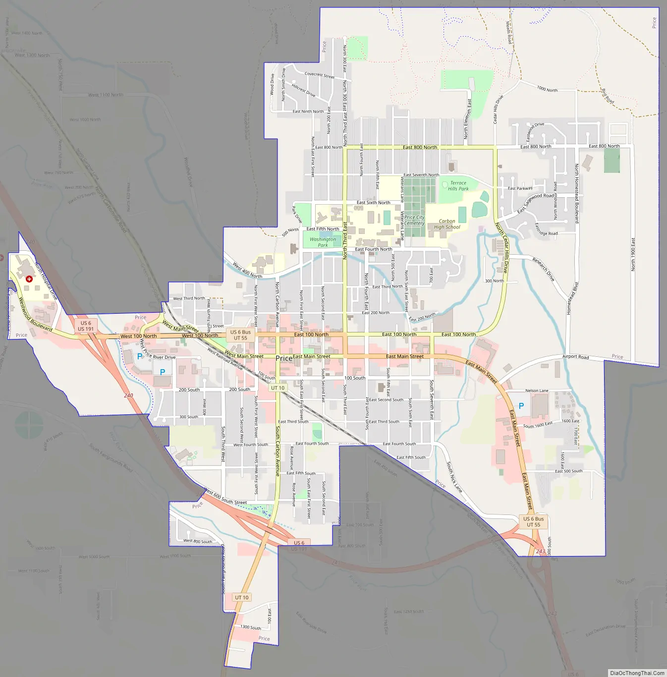
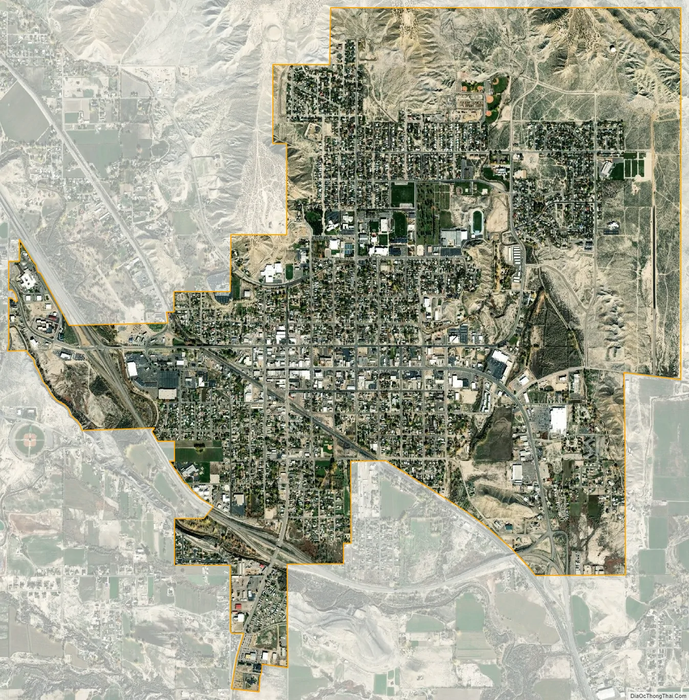
Price city Satellite Map
Geography
Price is located in west-central Carbon County at the northwestern edge of the Colorado Plateau. According to the United States Census Bureau, the city has a total area of 5.1 square miles (13.1 km), all land. The Price River, a tributary of the Green River, flows southeasterly through the city, and the San Rafael Swell is to the south.
The city is on U.S. Route 6 and U.S. Route 191. US 6 leads 67 miles (108 km) northwest to Spanish Fork on the Interstate 15 corridor, while US 191 leads northeast 54 miles (87 km) to Duchesne. The two highways together run southeast 64 miles (103 km) to the city of Green River and Interstate 70. Utah State Route 10 leads southwest from Price 21 miles (34 km) to Huntington.
Price was one of the communities that was served by the Rio Grande Zephyr passenger train. Today Amtrak’s California Zephyr passes once a day each direction with a station about seven miles away in Helper.
Climate
Price is located in an arid climate and features cold winters and relatively moderate summers. The average high in January is 37 °F or 2.8 °C and it rises to 90 °F or 32.2 °C in July. The low in January averages just 13 °F or −10.6 °C, and even in summer the dry climate keeps the nights cool, with an average of just 58 °F or 14.4 °C. The all-time record high is 110 °F (43.3 °C), which was set on August 3, 1918, while the all-time low is −31 °F (−35 °C), set on December 26, 1924. Price lies in the rain shadow of central Utah’s Wasatch Mountains so that precipitation averages only 9.24 inches or 234.7 millimetres annually. Late summer and early fall are the wettest times of year due to the Gulf of California monsoon that brings scattered thunderstorms to the region. The city also sees frequent snow during winter and early spring.
This climatic region is typified by large seasonal temperature differences, with warm to hot (and often humid) summers and cold (sometimes severely cold) winters. According to the Köppen Climate Classification system, Price has a cool semi-arid climate, abbreviated BSk on climate maps.
See also
Map of Utah State and its subdivision: Map of other states:- Alabama
- Alaska
- Arizona
- Arkansas
- California
- Colorado
- Connecticut
- Delaware
- District of Columbia
- Florida
- Georgia
- Hawaii
- Idaho
- Illinois
- Indiana
- Iowa
- Kansas
- Kentucky
- Louisiana
- Maine
- Maryland
- Massachusetts
- Michigan
- Minnesota
- Mississippi
- Missouri
- Montana
- Nebraska
- Nevada
- New Hampshire
- New Jersey
- New Mexico
- New York
- North Carolina
- North Dakota
- Ohio
- Oklahoma
- Oregon
- Pennsylvania
- Rhode Island
- South Carolina
- South Dakota
- Tennessee
- Texas
- Utah
- Vermont
- Virginia
- Washington
- West Virginia
- Wisconsin
- Wyoming