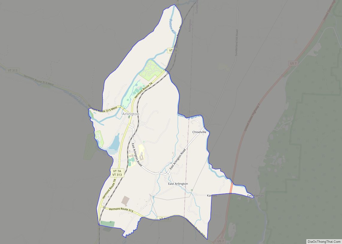
Arlington is a census-designated place (CDP) in the towns of Arlington and Sunderland, Bennington County, Vermont, United States. The population was 1,213 at the 2010 census.
In 1989, the Arlington Village Historic District was listed on the National Register of Historic Places. The district covers an area of 180 acres (73 ha) and includes 190 contributing buildings and sites in the village center. In addition to historical and architectural significance, the district is also noted for being the place where composer Carl Ruggles spent the later years of his life. The buildings in the district provide examples of Colonial Revival, Greek Revival, and Federal styles. The St. James Episcopal Church (1829–30), the second oldest Gothic Revival church in Vermont, is located in Arlington village. In the early 20th century, the village was an important industrial center with several mills and factories, many of which were washed away by flooding in 1927. The village also has unusual sections of marble sidewalks, laid using stone from nearby quarries.
| Name: | Arlington CDP |
|---|---|
| LSAD Code: | 57 |
| LSAD Description: | CDP (suffix) |
| State: | Vermont |
| County: | Bennington County |
| Elevation: | 646 ft (197 m) |
| Total Area: | 3.74 sq mi (9.68 km²) |
| Land Area: | 3.68 sq mi (9.53 km²) |
| Water Area: | 0.06 sq mi (0.15 km²) |
| Total Population: | 1,213 |
| Population Density: | 330/sq mi (127.3/km²) |
| ZIP code: | 05250 |
| Area code: | 802 |
| FIPS code: | 5001375 |
| GNISfeature ID: | 1460530 |
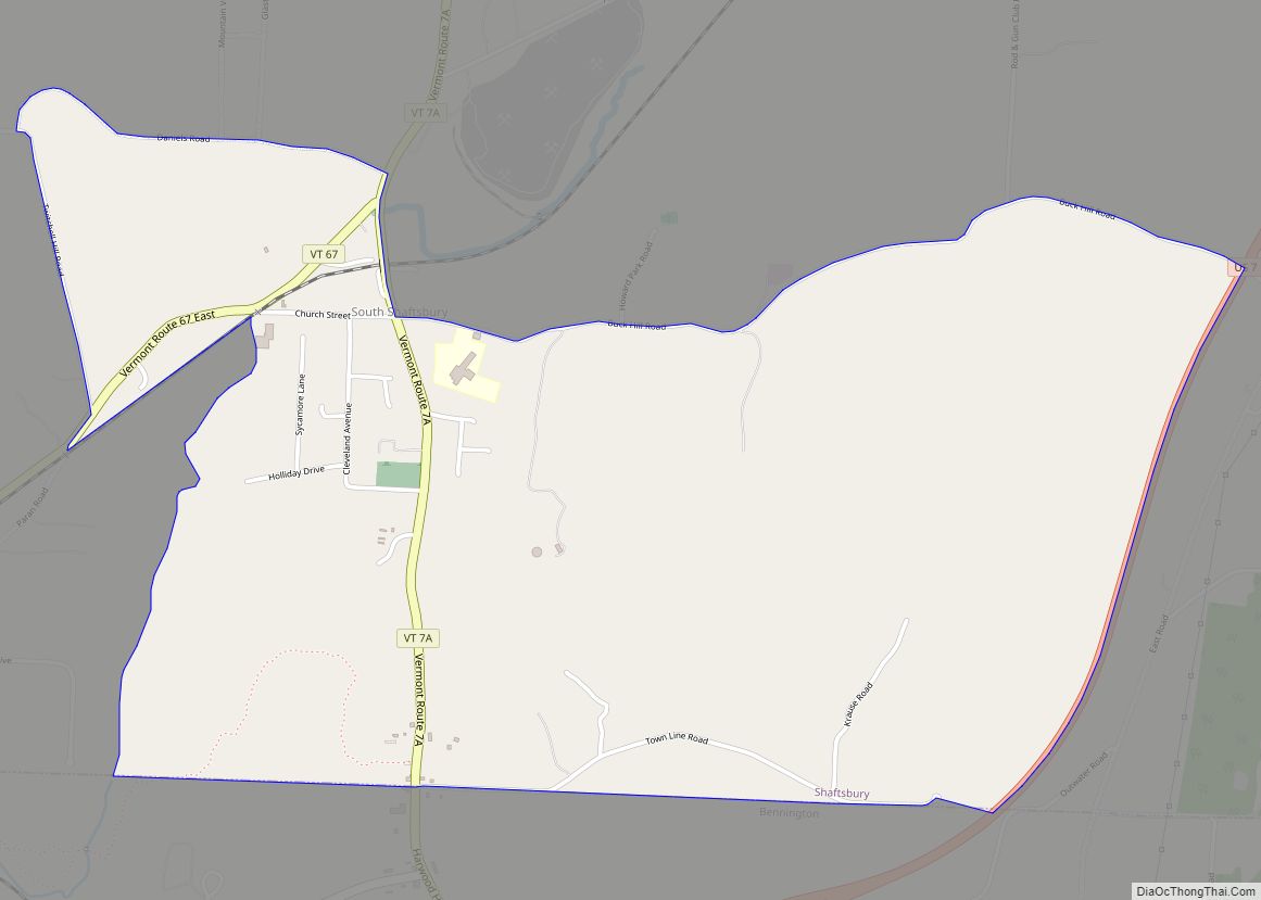
Online Interactive Map
Click on ![]() to view map in "full screen" mode.
to view map in "full screen" mode.
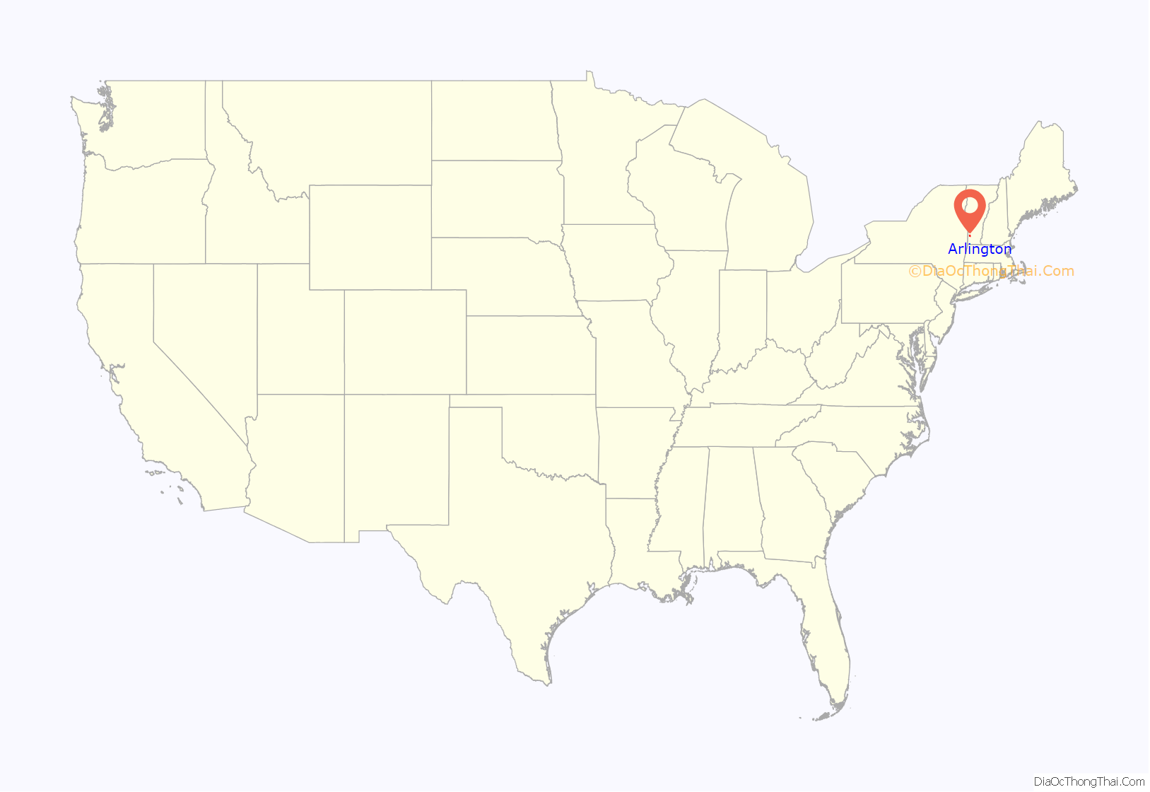
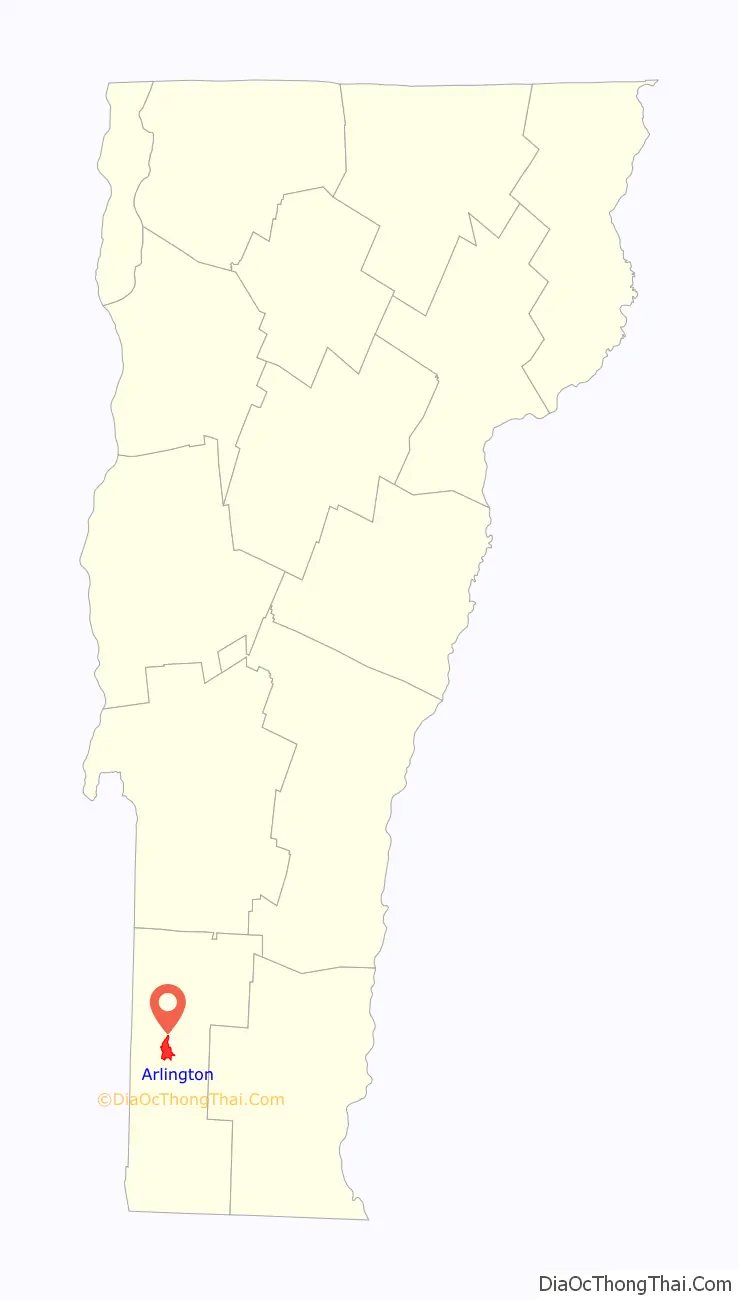
Arlington location map. Where is Arlington CDP?
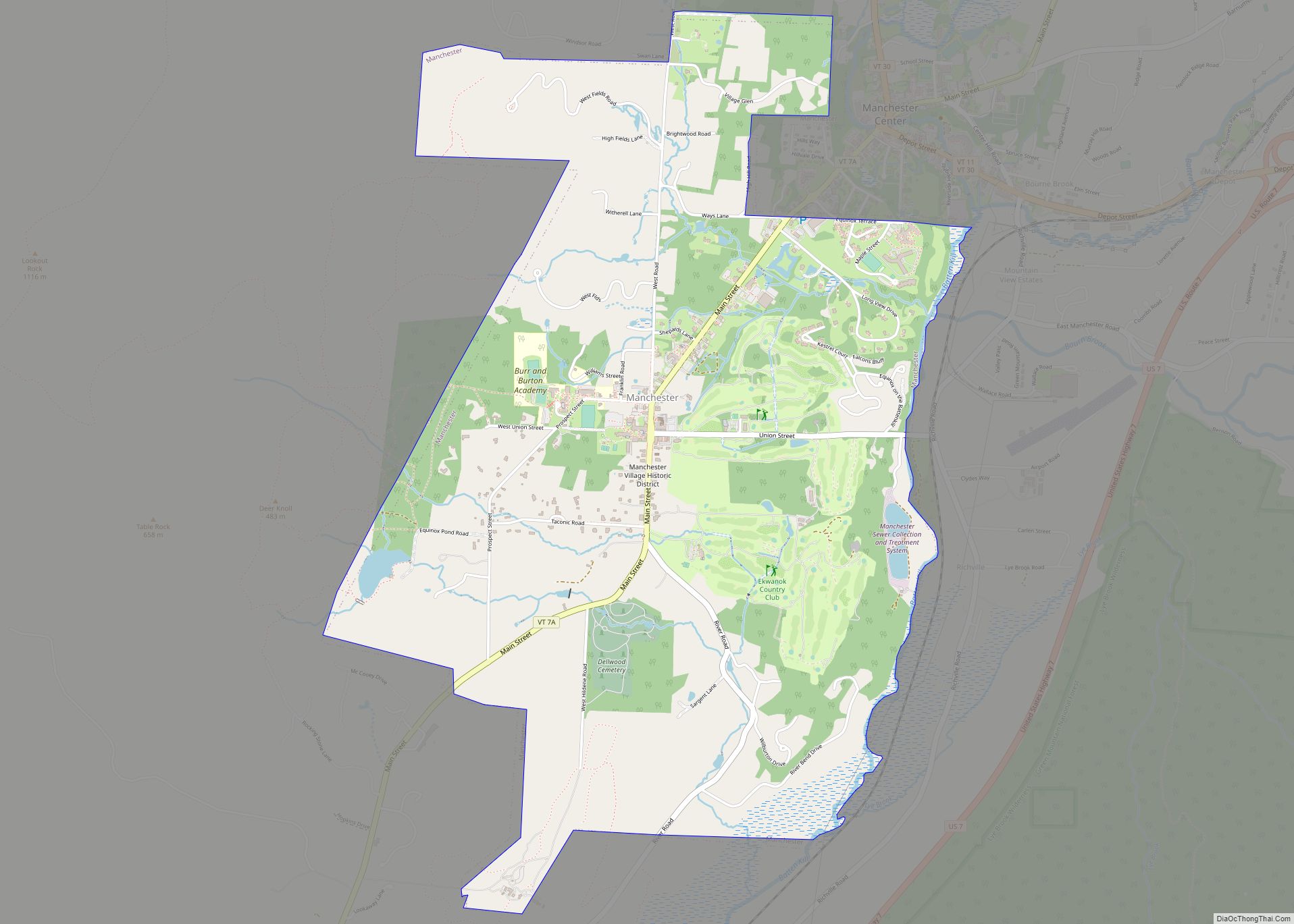
Arlington Road Map

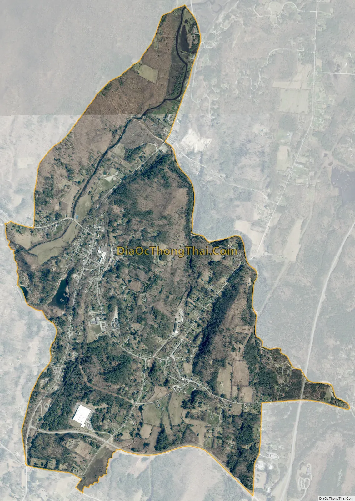
Arlington city Satellite Map
Geography
The Arlington CDP covers Arlington village, the primary settlement in the town of Arlington, and extends eastward to include the community of East Arlington, reaching partially into the town of Sunderland. Arlington village is located on the south bank of the Batten Kill in the Valley of Vermont, with the Taconic Mountains to the west and the Green Mountains to the east.
Vermont Route 7A is the main road through the village, leading north to Manchester and south to Bennington. Vermont Route 313 leads west from the village center, to West Arlington and the New York state line. U.S. Route 7 bypasses the village to the east, with access from VT 313 south of the village.
According to the United States Census Bureau, the CDP has a total area of 3.7 mi (9.6 km), all land.
See also
Map of Vermont State and its subdivision: Map of other states:- Alabama
- Alaska
- Arizona
- Arkansas
- California
- Colorado
- Connecticut
- Delaware
- District of Columbia
- Florida
- Georgia
- Hawaii
- Idaho
- Illinois
- Indiana
- Iowa
- Kansas
- Kentucky
- Louisiana
- Maine
- Maryland
- Massachusetts
- Michigan
- Minnesota
- Mississippi
- Missouri
- Montana
- Nebraska
- Nevada
- New Hampshire
- New Jersey
- New Mexico
- New York
- North Carolina
- North Dakota
- Ohio
- Oklahoma
- Oregon
- Pennsylvania
- Rhode Island
- South Carolina
- South Dakota
- Tennessee
- Texas
- Utah
- Vermont
- Virginia
- Washington
- West Virginia
- Wisconsin
- Wyoming