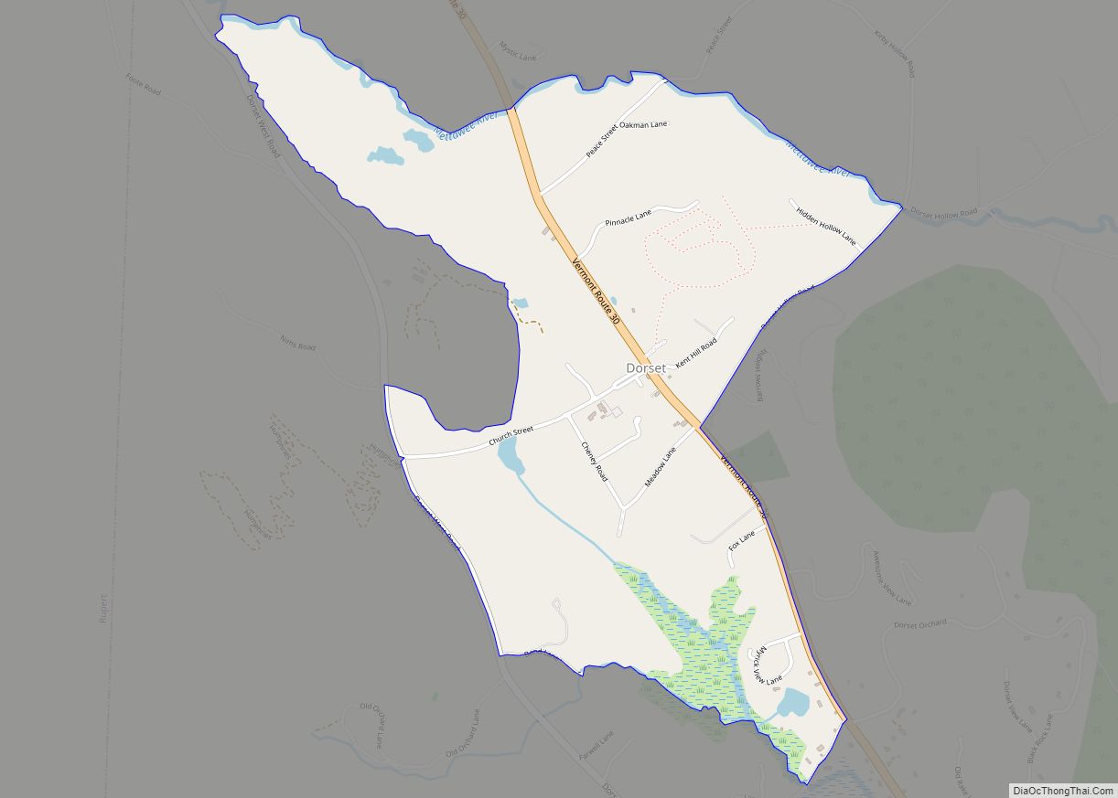
Dorset is the primary settlement and a census-designated place (CDP) in the town of Dorset, Bennington County, Vermont, United States. As of the 2020 census, the CDP had a population of 360, out of 2,133 in the entire town.
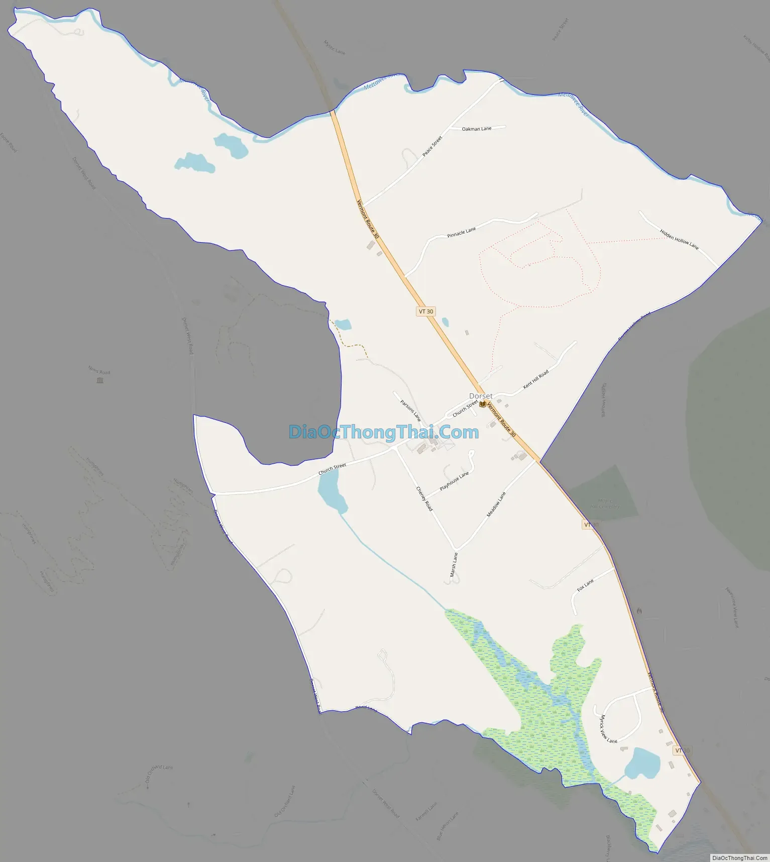
It is in northern Bennington County, in the western part of the town of Dorset, in a valley between Spruce Peak to the west, Mount Aeolus to the southeast, and Dorset Mountain to the northeast. Vermont Route 30 passes through the center of the village, leading southeast 6 miles (10 km) to Manchester Center and northwest 8 miles (13 km) to Pawlet. The Mettawee River runs through the northern part of the CDP, flowing northwest to the southern end of Lake Champlain at Whitehall, New York.
| Name: | Dorset CDP |
|---|---|
| LSAD Code: | 57 |
| LSAD Description: | CDP (suffix) |
| State: | Vermont |
| County: | Bennington County |
| Elevation: | 960 ft (290 m) |
| Total Area: | 2.10 sq mi (5.44 km²) |
| Land Area: | 2.08 sq mi (5.39 km²) |
| Water Area: | 0.02 sq mi (0.05 km²) |
| ZIP code: | 05251 |
| Area code: | 802 |
| FIPS code: | 5017650 |
| GNISfeature ID: | 2586627 |
Online Interactive Map
Click on ![]() to view map in "full screen" mode.
to view map in "full screen" mode.
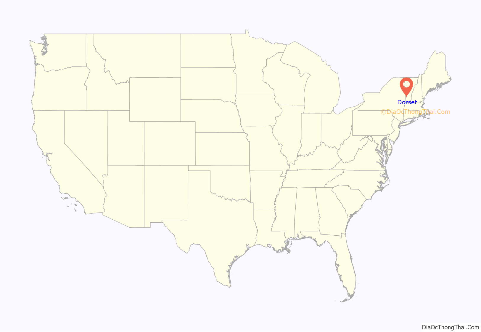
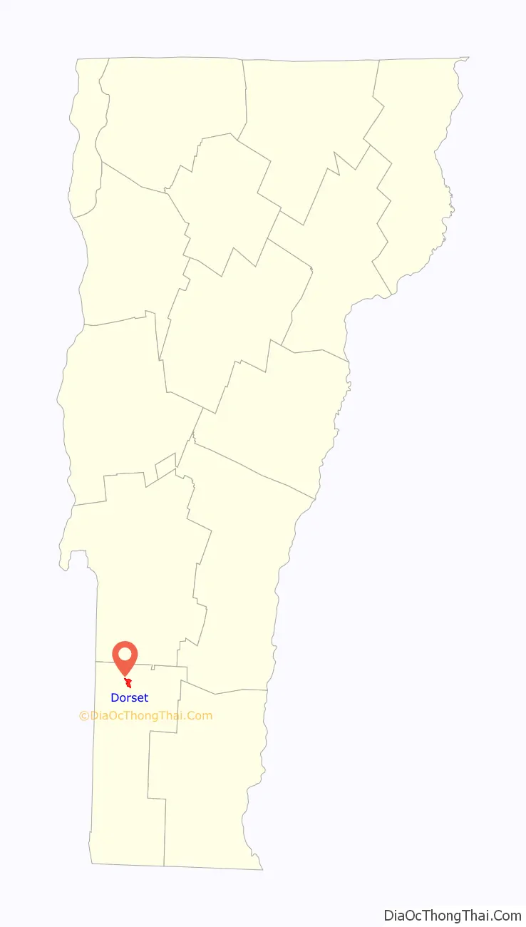
Dorset location map. Where is Dorset CDP?
Dorset Road Map
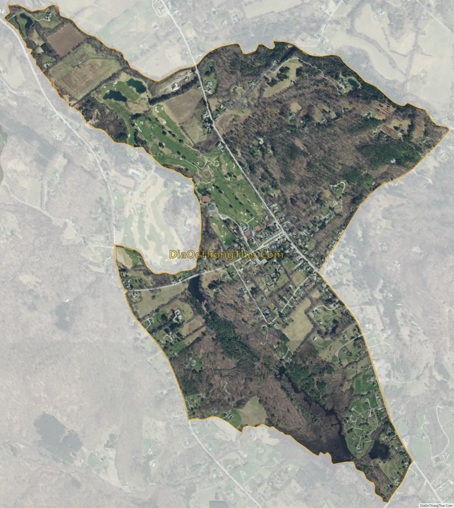
Dorset city Satellite Map
See also
Map of Vermont State and its subdivision: Map of other states:- Alabama
- Alaska
- Arizona
- Arkansas
- California
- Colorado
- Connecticut
- Delaware
- District of Columbia
- Florida
- Georgia
- Hawaii
- Idaho
- Illinois
- Indiana
- Iowa
- Kansas
- Kentucky
- Louisiana
- Maine
- Maryland
- Massachusetts
- Michigan
- Minnesota
- Mississippi
- Missouri
- Montana
- Nebraska
- Nevada
- New Hampshire
- New Jersey
- New Mexico
- New York
- North Carolina
- North Dakota
- Ohio
- Oklahoma
- Oregon
- Pennsylvania
- Rhode Island
- South Carolina
- South Dakota
- Tennessee
- Texas
- Utah
- Vermont
- Virginia
- Washington
- West Virginia
- Wisconsin
- Wyoming