South Shaftsbury is a census-designated place (CDP) in the town of Shaftsbury in Bennington County, Vermont, United States. The population was 681 at the 2020 census.
| Name: | South Shaftsbury CDP |
|---|---|
| LSAD Code: | 57 |
| LSAD Description: | CDP (suffix) |
| State: | Vermont |
| County: | Bennington County |
| Elevation: | 745 ft (227 m) |
| Total Area: | 2.2 sq mi (5.8 km²) |
| Land Area: | 2.2 sq mi (5.8 km²) |
| Water Area: | 0.0 sq mi (0.0 km²) |
| Total Population: | 681 |
| Population Density: | 300/sq mi (120/km²) |
| ZIP code: | 05262 |
| Area code: | 802 |
| FIPS code: | 5068200 |
| GNISfeature ID: | 1461445 |
Online Interactive Map
Click on ![]() to view map in "full screen" mode.
to view map in "full screen" mode.
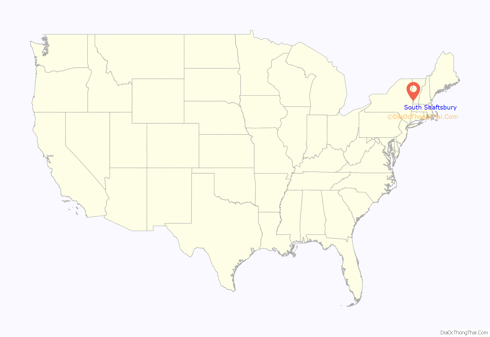
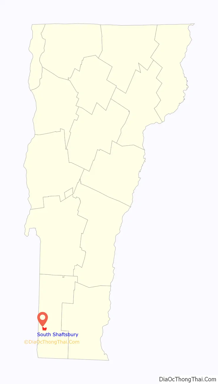
South Shaftsbury location map. Where is South Shaftsbury CDP?
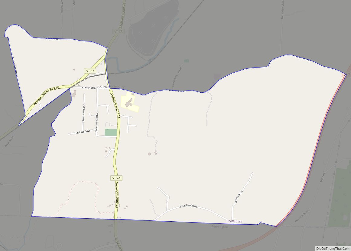
South Shaftsbury Road Map

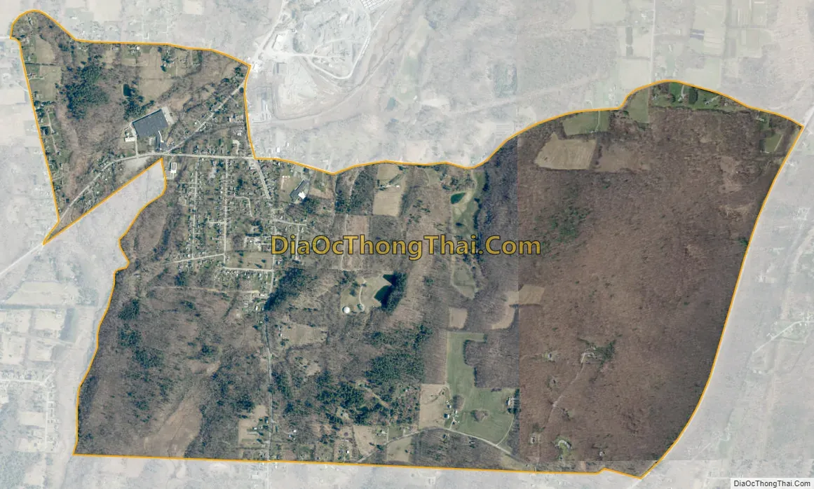
South Shaftsbury city Satellite Map
Geography
South Shaftsbury is located along the southern border of the town of Shaftsbury. It is the largest settlement in the town. The CDP includes the village of South Shaftsbury as well as rural land extending east to U.S. Route 7, a super two freeway. The closest access from US 7 is 1 mile (1.6 km) south of the village in northern Bennington. Vermont Route 7A (the old alignment of US 7) and Vermont Route 67 intersect in the village, with VT 7A leading north to Arlington and Manchester and south into Bennington, while VT 67 leads west to North Bennington and the New York state line.
According to the United States Census Bureau, the CDP has a total area of 2.2 square miles (5.8 km), all land.
See also
Map of Vermont State and its subdivision: Map of other states:- Alabama
- Alaska
- Arizona
- Arkansas
- California
- Colorado
- Connecticut
- Delaware
- District of Columbia
- Florida
- Georgia
- Hawaii
- Idaho
- Illinois
- Indiana
- Iowa
- Kansas
- Kentucky
- Louisiana
- Maine
- Maryland
- Massachusetts
- Michigan
- Minnesota
- Mississippi
- Missouri
- Montana
- Nebraska
- Nevada
- New Hampshire
- New Jersey
- New Mexico
- New York
- North Carolina
- North Dakota
- Ohio
- Oklahoma
- Oregon
- Pennsylvania
- Rhode Island
- South Carolina
- South Dakota
- Tennessee
- Texas
- Utah
- Vermont
- Virginia
- Washington
- West Virginia
- Wisconsin
- Wyoming