Chalkyitsik (Jałgiitsik in Gwich’in), meaning “to fish with a hook, at the mouth of the creek”, is a census-designated place (CDP) in Yukon-Koyukuk Census Area, Alaska, United States. It is located on the left (south) bank of the Black River, 45 miles northeast of Fort Yukon. At the 2010 census the population was 69, down from 83 in 2000.
| Name: | Chalkyitsik CDP |
|---|---|
| LSAD Code: | 57 |
| LSAD Description: | CDP (suffix) |
| State: | Alaska |
| County: | Yukon-Koyukuk Census Area |
| Total Area: | 8.76 sq mi (22.69 km²) |
| Land Area: | 8.50 sq mi (22.02 km²) |
| Water Area: | 0.26 sq mi (0.67 km²) |
| Total Population: | 56 |
| Population Density: | 6.59/sq mi (2.54/km²) |
| ZIP code: | 99788 |
| Area code: | 907 |
| FIPS code: | 0211800 |
Online Interactive Map
Click on ![]() to view map in "full screen" mode.
to view map in "full screen" mode.
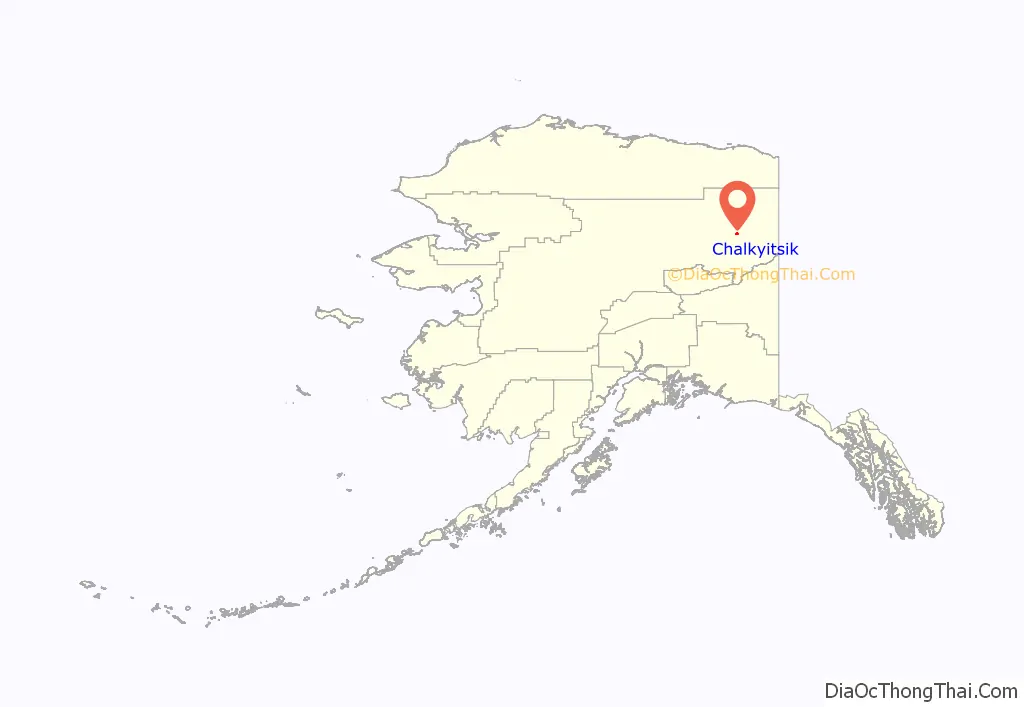
Chalkyitsik location map. Where is Chalkyitsik CDP?
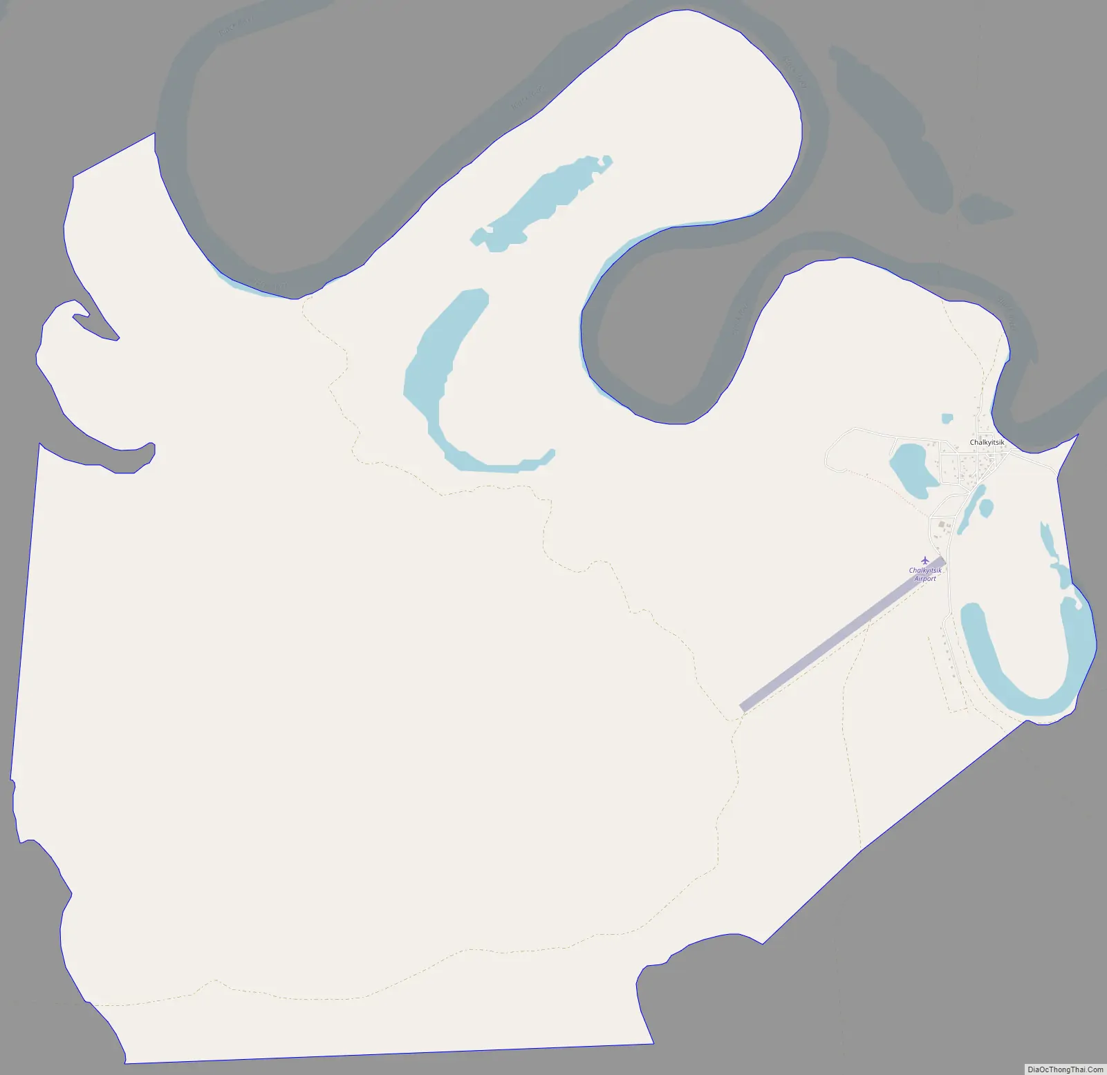
Chalkyitsik Road Map
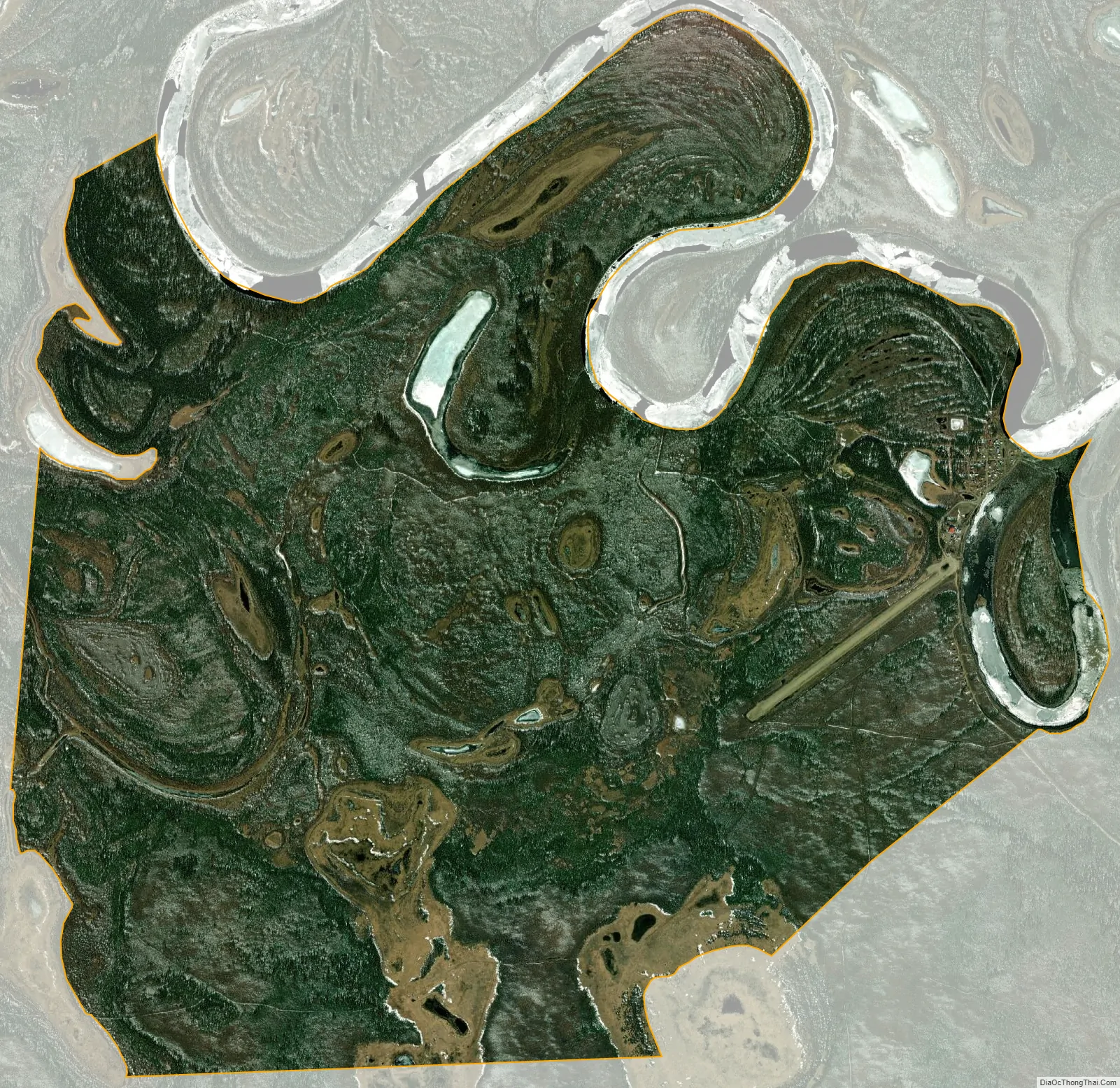
Chalkyitsik city Satellite Map
Geography
Chalkyitsik is located at 66°39′6″N 143°43′38″W / 66.65167°N 143.72722°W / 66.65167; -143.72722 (66.651529, -143.727356).
According to the United States Census Bureau, the CDP has a total area of 9.1 square miles (24 km), of which, 8.7 square miles (23 km) of it is land and 0.3 square miles (0.78 km) of it (3.76%) is water. Chalkystik has a bitter subarctic climate.
Climate
Chalkyitsik has a continental subarctic climate (Köppen climate classification Dwc) with mild summers and cold winters. Precipitation is very low, but significantly higher in summer than at other times of the year. A weather station was operated from August 1962 to November 1972; the weather record is thus very sparse.
See also
Map of Alaska State and its subdivision:- Aleutians East
- Aleutians West
- Anchorage
- Bethel
- Bristol Bay
- Denali
- Dillingham
- Fairbanks North Star
- Haines
- Juneau
- Kenai Peninsula
- Ketchikan Gateway
- Kodiak Island
- Lake and Peninsula
- Matanuska-Susitna
- Nome
- North Slope
- Northwest Arctic
- Prince of Wales-Outer Ketchi
- Sitka
- Skagway-Yakutat-Angoon
- Southeast Fairbanks
- Valdez-Cordova
- Wade Hampton
- Wrangell-Petersburg
- Yukon-Koyukuk
- Alabama
- Alaska
- Arizona
- Arkansas
- California
- Colorado
- Connecticut
- Delaware
- District of Columbia
- Florida
- Georgia
- Hawaii
- Idaho
- Illinois
- Indiana
- Iowa
- Kansas
- Kentucky
- Louisiana
- Maine
- Maryland
- Massachusetts
- Michigan
- Minnesota
- Mississippi
- Missouri
- Montana
- Nebraska
- Nevada
- New Hampshire
- New Jersey
- New Mexico
- New York
- North Carolina
- North Dakota
- Ohio
- Oklahoma
- Oregon
- Pennsylvania
- Rhode Island
- South Carolina
- South Dakota
- Tennessee
- Texas
- Utah
- Vermont
- Virginia
- Washington
- West Virginia
- Wisconsin
- Wyoming


