Coldfoot is a census-designated place (CDP) in Yukon-Koyukuk Census Area in the U.S. state of Alaska. The population was 34 at the 2020 census. It is said that the name was derived from travelers getting “cold feet” about making the 240-some-mile journey north to Deadhorse.
Coldfoot primarily serves as a truck stop on the Dalton Highway from Fairbanks to Prudhoe Bay. North of Coldfoot, there are no services for 240 miles (400 km), until Deadhorse. It has a restaurant and a small number of overnight accommodations (converted pipeline construction camp quarters). Bus tours along the highway typically take two days, with passengers spending the night in Coldfoot. The BLM, USFWS, and NPS jointly staff a small visitor center during the summer. The Coldfoot truck stop was founded by Iditarod champion Dick Mackey, who started his operation by selling hamburgers out of a converted school bus. Truckers helped build the existing truck stop and cafe. The Alaska Department of Transportation & Public Facilities (DOT&PF) has a camp (maintenance station) in Coldfoot.
The town was originally a mining camp named Slate Creek, and around 1900 got its present name when prospectors going up the nearby Middle Fork Koyukuk River would get “cold feet” and turn around. In 1902, Coldfoot had two roadhouses, two stores, seven saloons, and a gambling house. A post office operated from 1902 to 1912, then reopened in 1984.
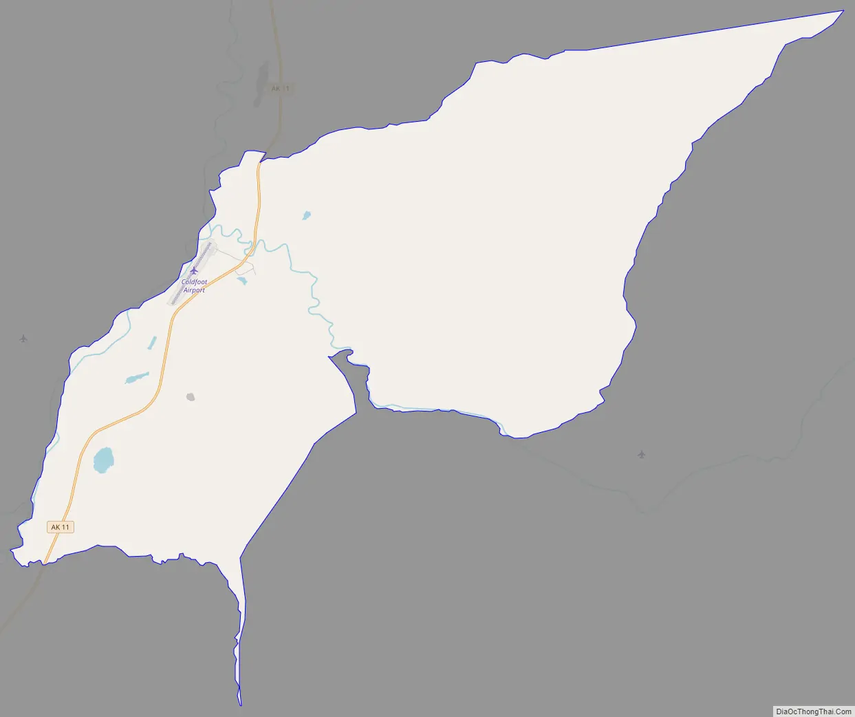
Coldfoot Airport, on the west side of the Dalton Highway, consists of a 4,000-foot (1220 m) gravel strip, used for air taxi and general aviation.
Coldfoot has been featured on Ice Road Truckers, a Canadian reality television series airing on the History Channel. The truck stop was first seen during the show’s third season.
| Name: | Coldfoot CDP |
|---|---|
| LSAD Code: | 57 |
| LSAD Description: | CDP (suffix) |
| State: | Alaska |
| County: | Yukon-Koyukuk Census Area |
| Elevation: | 1,014 ft (309 m) |
| Total Area: | 35.84 sq mi (92.83 km²) |
| Land Area: | 35.84 sq mi (92.83 km²) |
| Water Area: | 0.00 sq mi (0.00 km²) |
| Total Population: | 34 |
| Population Density: | 0.95/sq mi (0.37/km²) |
| Area code: | 907 |
| FIPS code: | 0216630 |
| GNISfeature ID: | 1412829 |
Online Interactive Map
Click on ![]() to view map in "full screen" mode.
to view map in "full screen" mode.
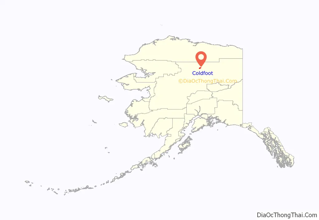
Coldfoot location map. Where is Coldfoot CDP?
Coldfoot Road Map
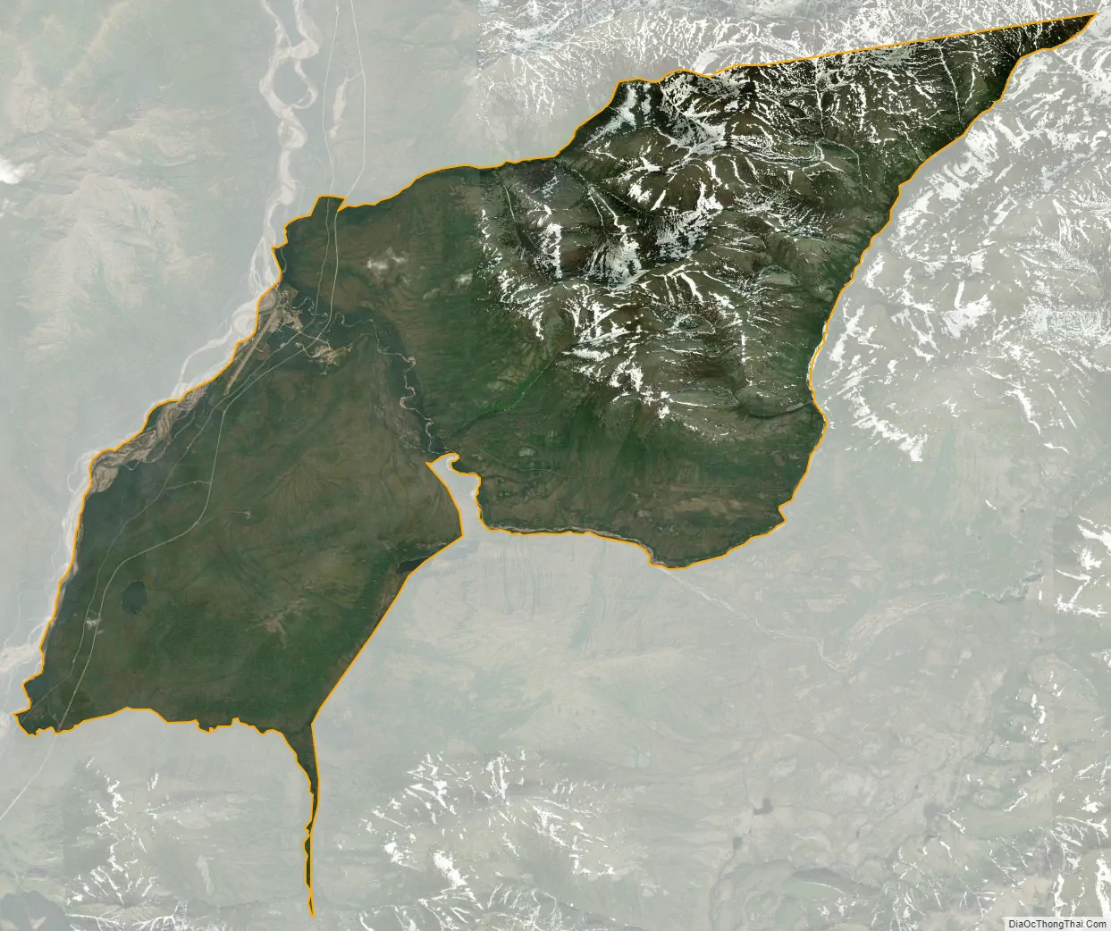
Coldfoot city Satellite Map
Geography
According to the United States Census Bureau, Coldfoot has a total area of 37.0 square miles (96 km), which is all land.
See also
Map of Alaska State and its subdivision:- Aleutians East
- Aleutians West
- Anchorage
- Bethel
- Bristol Bay
- Denali
- Dillingham
- Fairbanks North Star
- Haines
- Juneau
- Kenai Peninsula
- Ketchikan Gateway
- Kodiak Island
- Lake and Peninsula
- Matanuska-Susitna
- Nome
- North Slope
- Northwest Arctic
- Prince of Wales-Outer Ketchi
- Sitka
- Skagway-Yakutat-Angoon
- Southeast Fairbanks
- Valdez-Cordova
- Wade Hampton
- Wrangell-Petersburg
- Yukon-Koyukuk
- Alabama
- Alaska
- Arizona
- Arkansas
- California
- Colorado
- Connecticut
- Delaware
- District of Columbia
- Florida
- Georgia
- Hawaii
- Idaho
- Illinois
- Indiana
- Iowa
- Kansas
- Kentucky
- Louisiana
- Maine
- Maryland
- Massachusetts
- Michigan
- Minnesota
- Mississippi
- Missouri
- Montana
- Nebraska
- Nevada
- New Hampshire
- New Jersey
- New Mexico
- New York
- North Carolina
- North Dakota
- Ohio
- Oklahoma
- Oregon
- Pennsylvania
- Rhode Island
- South Carolina
- South Dakota
- Tennessee
- Texas
- Utah
- Vermont
- Virginia
- Washington
- West Virginia
- Wisconsin
- Wyoming


