False Pass (Aleut: Isanax̂) is a city on Unimak Island, in the Aleutians East Borough of southwestern Alaska, United States. Although the population was marked 397 including seasonal fish processing plant workers at the 2020 census, approximately 35 residents call it home year-round.
| Name: | False Pass city |
|---|---|
| LSAD Code: | 25 |
| LSAD Description: | city (suffix) |
| State: | Alaska |
| County: | Aleutians East Borough |
| Incorporated: | October 19, 1990 |
| Elevation: | 30 ft (9 m) |
| Total Area: | 65.55 sq mi (169.76 km²) |
| Land Area: | 25.07 sq mi (64.93 km²) |
| Water Area: | 40.48 sq mi (104.83 km²) |
| Total Population: | 35 |
| Population Density: | 15.84/sq mi (6.11/km²) |
| ZIP code: | 99583 |
| Area code: | 907 |
| FIPS code: | 0224660 |
| GNISfeature ID: | 1418574 |
Online Interactive Map
Click on ![]() to view map in "full screen" mode.
to view map in "full screen" mode.
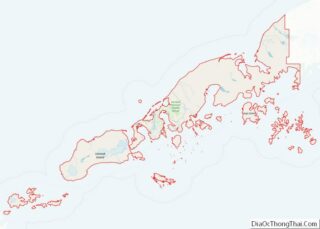
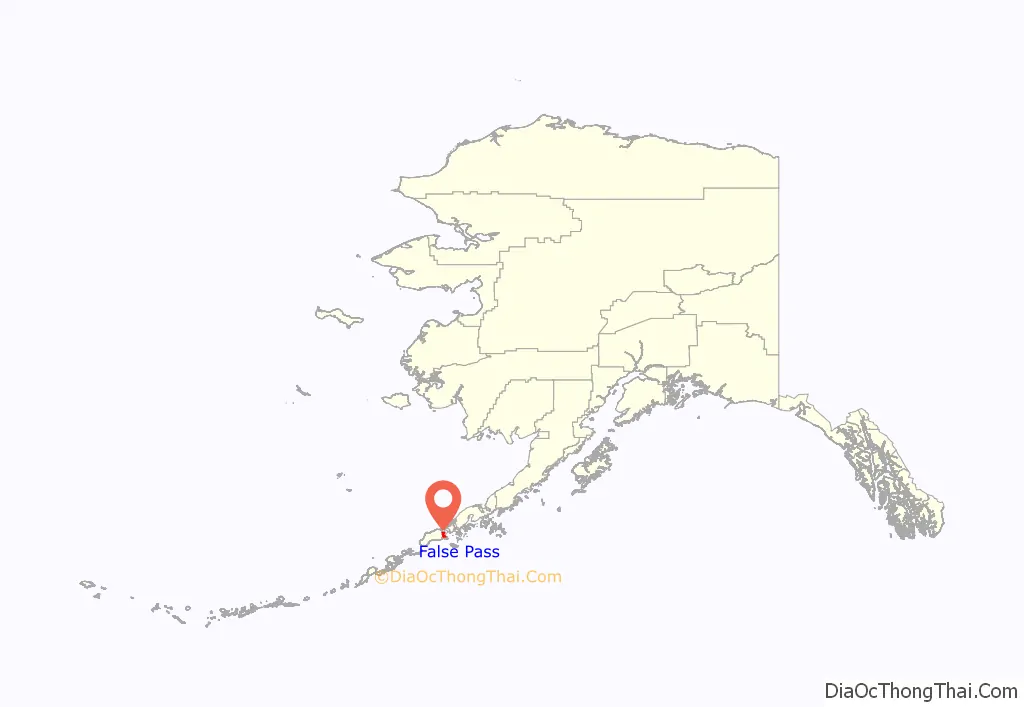
False Pass location map. Where is False Pass city?
History
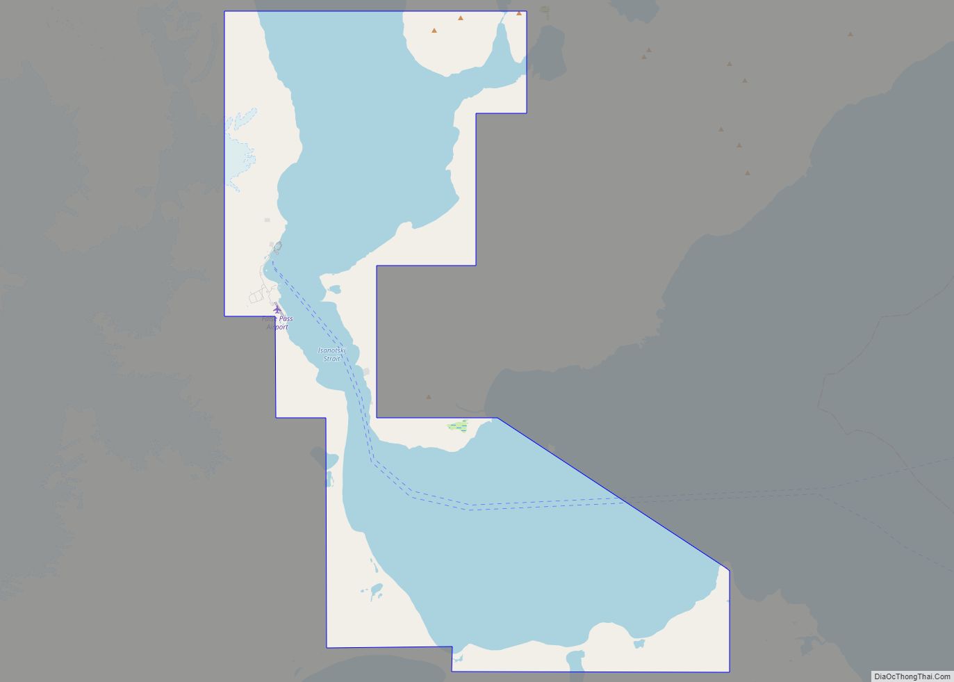
False Pass is an early English name for Isanotski Strait on which the city of False Pass is located. The strait was called “False Pass” by early American sailing ship captains because it was thought to be impassable for their deep draft vessels at the northern end. A salmon cannery was built on the Unimak Island side of the strait in 1919 which provided the nucleus for the modern settlement. A U.S. post office with the name of False Pass was established in 1921 which gave official status to the community.
Commercial fishing for salmon, cod, halibut and crab continues to be the core of the community’s lifestyle and economy.
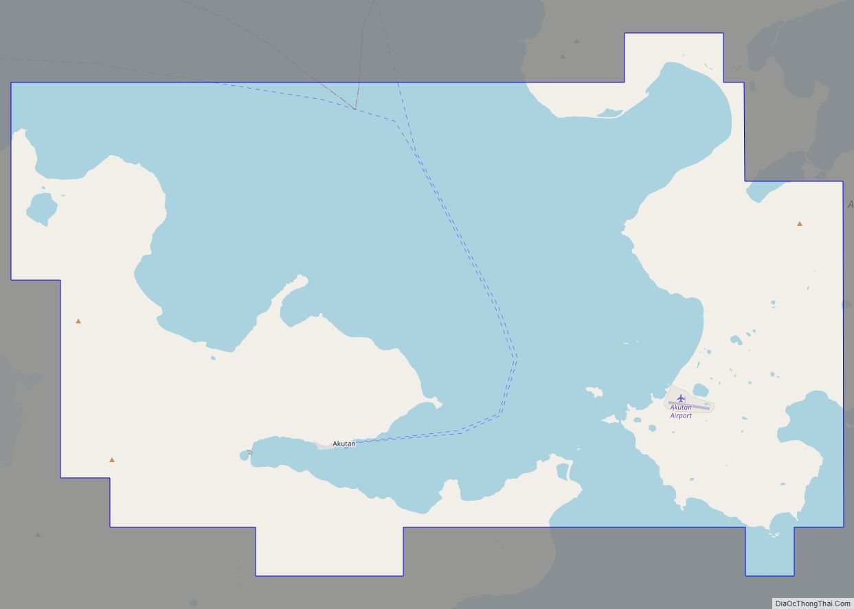
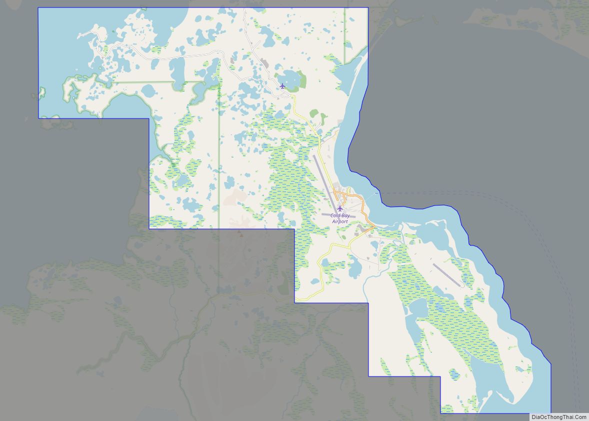
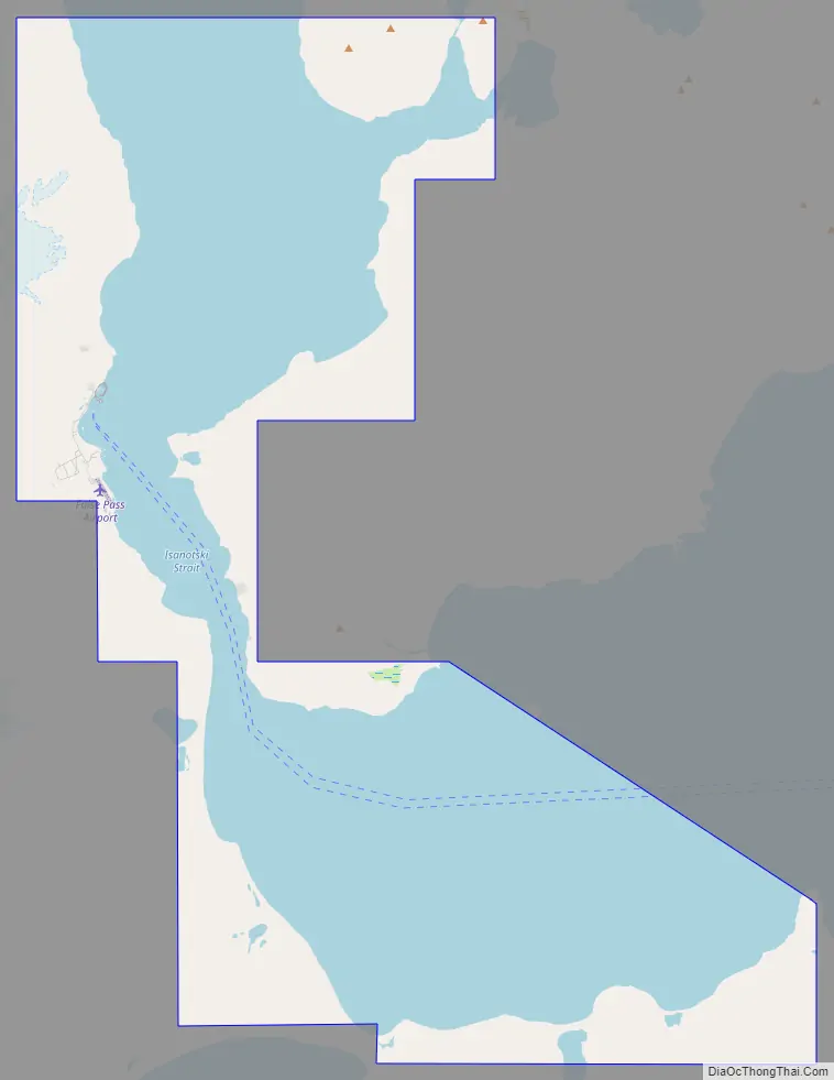
False Pass Road Map
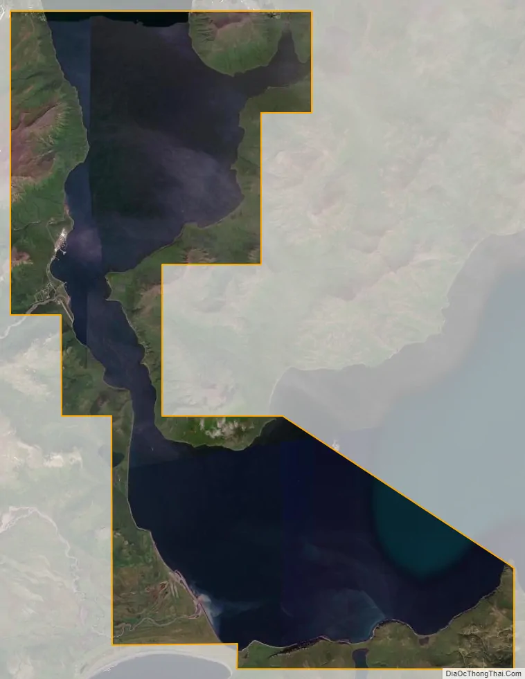
False Pass city Satellite Map
Geography
False Pass is at 54°49′40″N 163°23′57″W / 54.82778°N 163.39917°W / 54.82778; -163.39917 (54.827886, -163.399090). It is near the eastern end of Unimak Island, in the Aleutian Islands chain. Part of the city (26.093 km, or 10.075 sq mi) is on the mainland’s westernmost tip Alaska Peninsula, across the Isanotski Strait (about 600 meters at the closest point), although that section is nearly unpopulated. The city boundaries include the abandoned villages of Morzhovoi and Ikatan.
According to the U.S. Census Bureau, the city has a total area of 68.3 square miles (177 km), of which 26.9 square miles (70 km) is land and 41.4 square miles (107 km) (60.63%) is water.
See also
Map of Alaska State and its subdivision:- Aleutians East
- Aleutians West
- Anchorage
- Bethel
- Bristol Bay
- Denali
- Dillingham
- Fairbanks North Star
- Haines
- Juneau
- Kenai Peninsula
- Ketchikan Gateway
- Kodiak Island
- Lake and Peninsula
- Matanuska-Susitna
- Nome
- North Slope
- Northwest Arctic
- Prince of Wales-Outer Ketchi
- Sitka
- Skagway-Yakutat-Angoon
- Southeast Fairbanks
- Valdez-Cordova
- Wade Hampton
- Wrangell-Petersburg
- Yukon-Koyukuk
- Alabama
- Alaska
- Arizona
- Arkansas
- California
- Colorado
- Connecticut
- Delaware
- District of Columbia
- Florida
- Georgia
- Hawaii
- Idaho
- Illinois
- Indiana
- Iowa
- Kansas
- Kentucky
- Louisiana
- Maine
- Maryland
- Massachusetts
- Michigan
- Minnesota
- Mississippi
- Missouri
- Montana
- Nebraska
- Nevada
- New Hampshire
- New Jersey
- New Mexico
- New York
- North Carolina
- North Dakota
- Ohio
- Oklahoma
- Oregon
- Pennsylvania
- Rhode Island
- South Carolina
- South Dakota
- Tennessee
- Texas
- Utah
- Vermont
- Virginia
- Washington
- West Virginia
- Wisconsin
- Wyoming