Galena (/ɡəˈliːnə/) (Notaalee Denh in Koyukon) is a city in the Yukon-Koyukuk Census Area in the U.S. state of Alaska. At the 2020 census the population was 472, slightly up from 470 in 2010. Galena was established in 1918, and a military airfield was built adjacent to the city during World War II. The city was incorporated in 1971.
| Name: | Galena city |
|---|---|
| LSAD Code: | 25 |
| LSAD Description: | city (suffix) |
| State: | Alaska |
| County: | Yukon-Koyukuk Census Area |
| Incorporated: | October 26, 1971 |
| Elevation: | 128 ft (39 m) |
| Total Area: | 24.51 sq mi (63.47 km²) |
| Land Area: | 17.65 sq mi (45.72 km²) |
| Water Area: | 6.85 sq mi (17.75 km²) |
| Total Population: | 472 |
| Population Density: | 26.74/sq mi (10.32/km²) |
| ZIP code: | 99741 |
| Area code: | 907 |
| FIPS code: | 0227530 |
| GNISfeature ID: | 1402457 |
| Website: | http://www.ci.galena.ak.us/ |
Online Interactive Map
Click on ![]() to view map in "full screen" mode.
to view map in "full screen" mode.
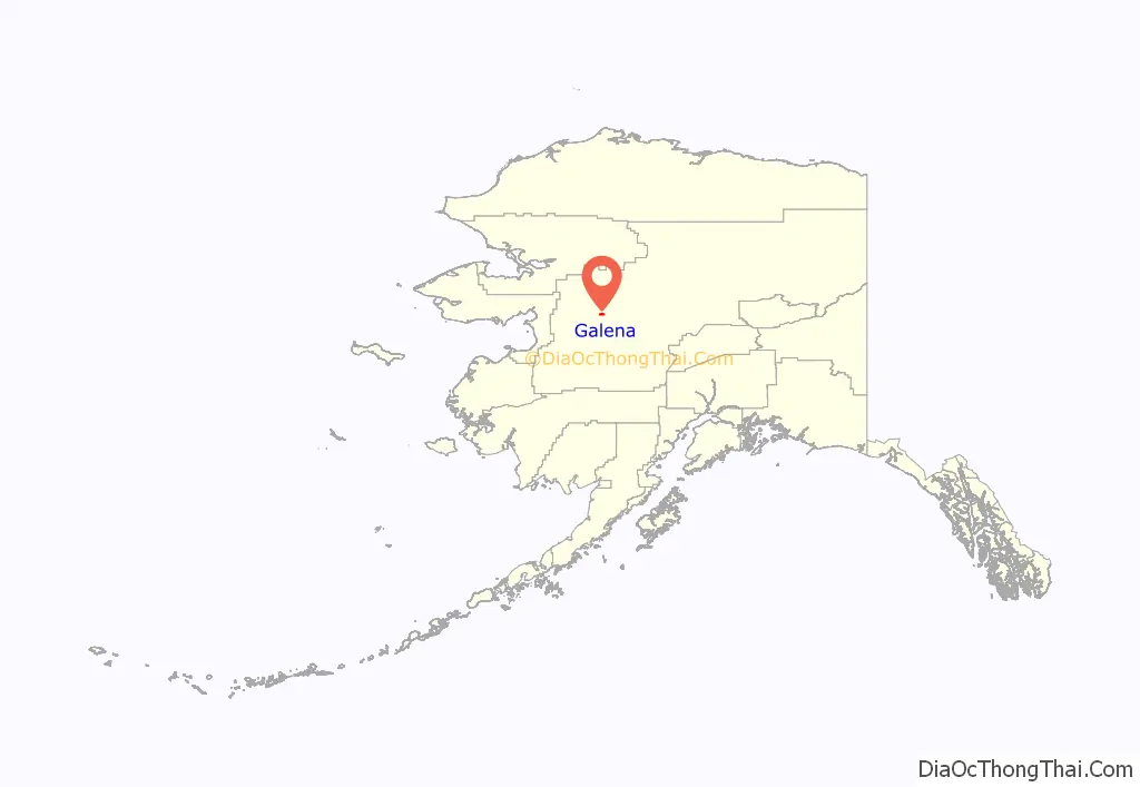
Galena location map. Where is Galena city?
History
Prehistory and early history
The Koyukon Athabascans had seasonal camps in the area and moved as the wild game migrated. In the summer many families floated on rafts to the Yukon River to fish for salmon. There were 12 summer fish camps located on the Yukon River between the Koyukuk River and the Nowitna River. Galena was established in 1920 near an Athabascan fish camp called Henry’s Point. It became a supply and point for nearby lead ore mines that opened in 1918 and 1919, and from which Galena takes its name.
Military air base
In 1941 and 1942, during World War II, a military air field was built adjacent to the civilian airport, and the two facilities shared the runway and flight line facilities. This air field was designated Galena Air Force Station shortly after the split of the United States Air Force from the United States Army, which occurred as a result of the National Security Act of 1947. During the 1950s, the construction of additional military facilities at Galena and the nearby Campion Air Force Station, in support of Galena’s mission as a forward operating base under the auspices of the 5072nd Air Base Group, headquartered at Elmendorf Air Force Base, near Anchorage, provided improvements to the airport and the local infrastructure, causing economic growth for the area.
Following the end of the Cold War, in 1993, operation of Galena Air Force Station was turned over to a contractor, and all military personnel were withdrawn with only small groups of active personnel visiting the base on an as-needed basis. The former military facility remains in use effectively as a forward operating location that is used occasionally by the military. This use came under scrutiny by the Base Realignment and Closure Committee in the late 2000s and was officially closed October 1, 2010. The Air Force retains responsibility for toxin cleanup in the area and engineers from Eielson Air Force Base in Fairbanks still visit the site on occasion. The base is now totally controlled by the City of Galena, the Galena School District and the Alaska Department of Transportation. The Alaska Wing of the Civil Air Patrol (CAP) was pursuing retaining one of the F-16 fighter hangars as a CAP facility for the CAP Wing in Galena, the “Yukon Squadron”.
Modern era
The City of Galena gained notoriety in 2011 when it was noted in media reports as being the US community which received the most benefits from lobbying efforts. The town evaded bankruptcy by aggressively lobbying for state and federal funds for the GILA boarding school in the town, which produced funds that turned the city’s finances around.
In May 2013, Galena suffered a catastrophic flood when the spring breakup on the Yukon River caused an ice jam approximately 20 miles downstream, backing up the river and affecting 90% of homes in the city. This flood was on the scale of a flood never seen before by Galena residents. In the part of town closest to the river, houses were submerged to the roofs in water, and properties on higher ground suffered damage as well. Most of the residents were able to evacuate in thanks to the efforts of the local airlines, volunteer missionary pilots, and the Alaska National Guard. Some of the residents chose to stay behind and took refuge in the few last remaining dry parts of town. The flood dike the Air Force built around both the runway and the GILA boarding school managed to keep the river from reaching them. Efforts were made to help Galena rebuild, with the assistance of the Federal Emergency Management Agency and volunteer groups.
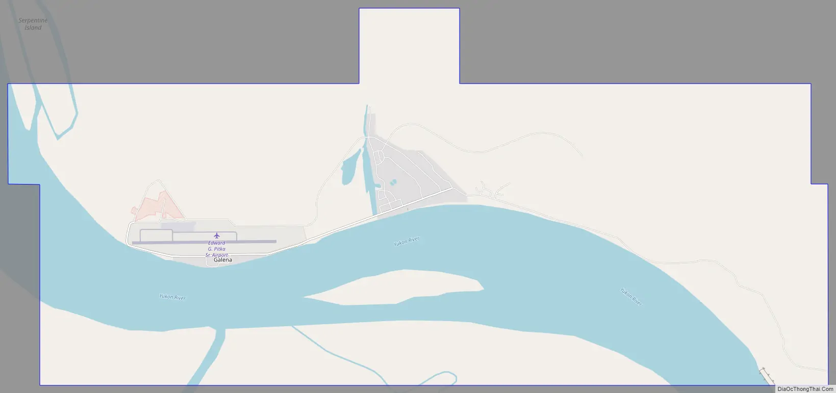
Galena Road Map
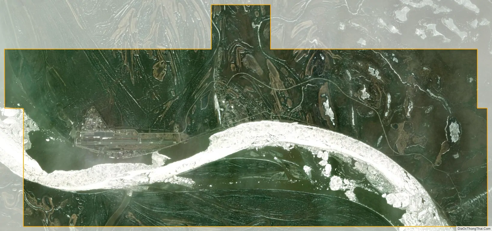
Galena city Satellite Map
Geography
Galena is located at 64°44′26″N 156°53′8″W / 64.74056°N 156.88556°W / 64.74056; -156.88556 (64.740643, -156.885462).
Galena is located on the north bank of the Yukon River, 45 mi (72 km) east of Nulato. The Innoko National Wildlife Refuge is southwest of Galena.
According to the United States Census Bureau, the city has a total area of 24.0 square miles (62 km), of which, 17.9 square miles (46 km) of it is land and 6.1 square miles (16 km) of it (25.41%) is water.
Galena is inaccessible by road to other parts of Alaska. Residents rely on river cargo in the brief summer season for the bulk of their needs, and planes, boats, or snowmachines to access the outside world.
- ^ Mean monthly maxima and minima (i.e. the highest and lowest temperature readings during an entire month or year) calculated based on data at said location from 1991 to 2020.
- ^ Temperature extremes from 1942 to 1993 are recorded by WRCC, and extreme values from 1996 to the present are recorded by NOAA.
See also
Map of Alaska State and its subdivision:- Aleutians East
- Aleutians West
- Anchorage
- Bethel
- Bristol Bay
- Denali
- Dillingham
- Fairbanks North Star
- Haines
- Juneau
- Kenai Peninsula
- Ketchikan Gateway
- Kodiak Island
- Lake and Peninsula
- Matanuska-Susitna
- Nome
- North Slope
- Northwest Arctic
- Prince of Wales-Outer Ketchi
- Sitka
- Skagway-Yakutat-Angoon
- Southeast Fairbanks
- Valdez-Cordova
- Wade Hampton
- Wrangell-Petersburg
- Yukon-Koyukuk
- Alabama
- Alaska
- Arizona
- Arkansas
- California
- Colorado
- Connecticut
- Delaware
- District of Columbia
- Florida
- Georgia
- Hawaii
- Idaho
- Illinois
- Indiana
- Iowa
- Kansas
- Kentucky
- Louisiana
- Maine
- Maryland
- Massachusetts
- Michigan
- Minnesota
- Mississippi
- Missouri
- Montana
- Nebraska
- Nevada
- New Hampshire
- New Jersey
- New Mexico
- New York
- North Carolina
- North Dakota
- Ohio
- Oklahoma
- Oregon
- Pennsylvania
- Rhode Island
- South Carolina
- South Dakota
- Tennessee
- Texas
- Utah
- Vermont
- Virginia
- Washington
- West Virginia
- Wisconsin
- Wyoming


