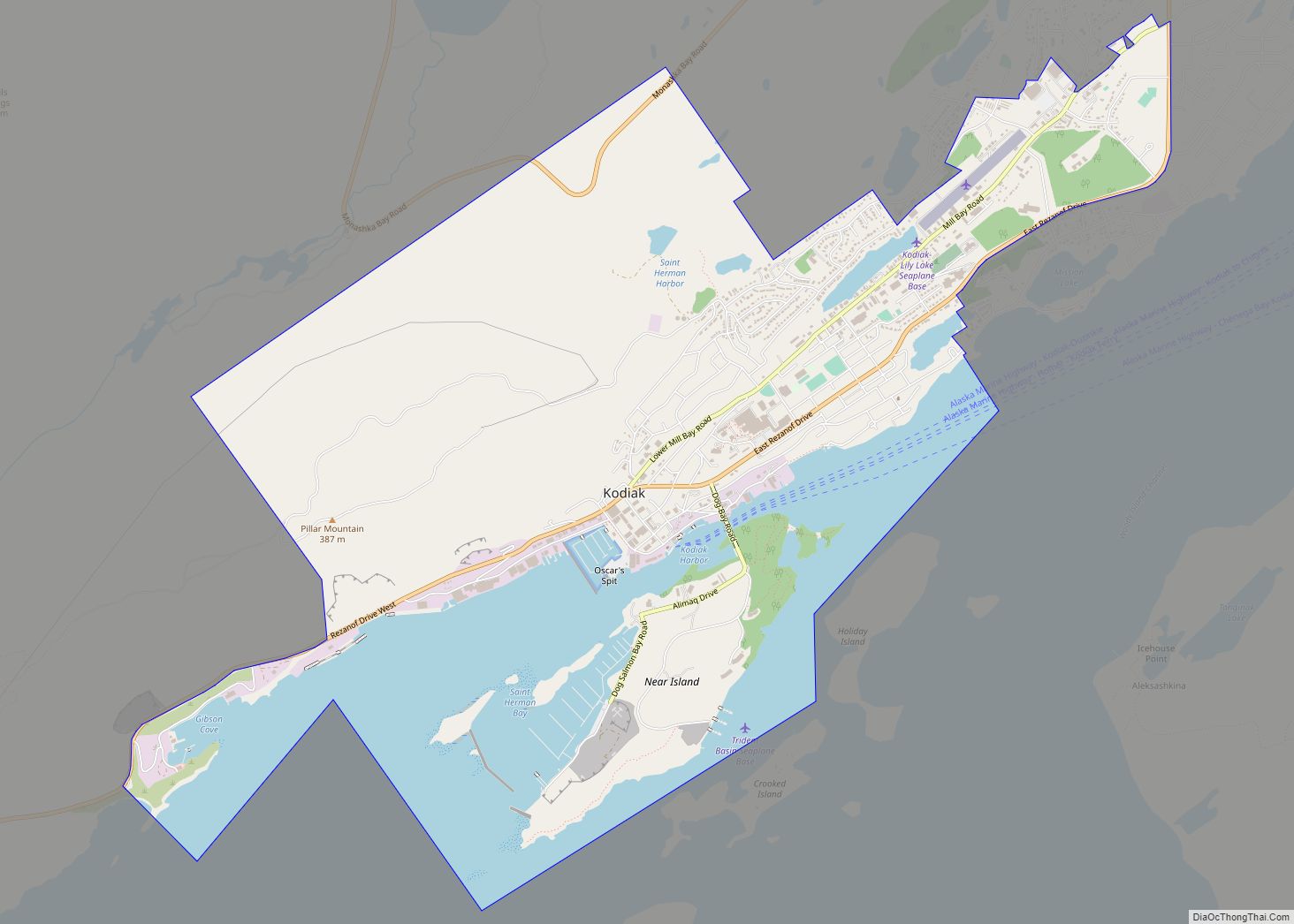
Kodiak (Alutiiq: Sun’aq), formerly Paul’s Harbor, is the main city and one of seven communities on Kodiak Island in Kodiak Island Borough, Alaska. All commercial transportation between the island’s communities and the outside world goes through this city via ferryboat or airline. As of the 2020 census, the population of the city is 5,581, down from 6,130 in 2010. It is the tenth-largest city in Alaska.
Originally inhabited by Alutiiq natives for over 7,000 years, the city was settled in the 18th century by the subjects of the Russian crown and became the capital of Russian Alaska. Russian harvesting of the area’s sea otter pelts led to the near extinction of the animal in the following century and led to wars with and enslavement of the natives for over 150 years. The city has experienced two natural disasters in the last century: a volcanic ashfall from the 1912 eruption of Novarupta and a tsunami from the 1964 Alaska earthquake.
After the Alaska Purchase by the United States in 1867, Kodiak became a commercial fishing center which continues to be the mainstay of its economy. A lesser economic influence includes tourism, mainly by those seeking outdoor adventure trips. Salmon, halibut, the unique Kodiak bear, elk, Sitka deer (black tail), and mountain goats attract hunting tourists as well as fishermen to the Kodiak Archipelago. The Alaska Department of Fish and Game maintains an office in the city and a website to help hunters and fishermen obtain the proper permits and learn about the laws specific to the Kodiak area.
The city has four public elementary schools, a middle and high school, as well as a branch of the University of Alaska. An antenna farm at the summit of Pillar Mountain above the city historically provided communication with the outside world before fiber optic cable was run. Transportation to and from the island is provided by ferry service on the Alaska Marine Highway as well as local commercial airlines.
| Name: | Kodiak city |
|---|---|
| LSAD Code: | 25 |
| LSAD Description: | city (suffix) |
| State: | Alaska |
| County: | Kodiak Island Borough |
| Incorporated: | September 11, 1940 |
| Elevation: | 49 ft (15 m) |
| Total Area: | 5.50 sq mi (14.23 km²) |
| Land Area: | 3.92 sq mi (10.16 km²) |
| Water Area: | 1.57 sq mi (4.07 km²) |
| Total Population: | 5,581 |
| Population Density: | 1,422.27/sq mi (549.11/km²) |
| ZIP code: | 99615, 99619, 99697 |
| Area code: | 907 |
| FIPS code: | 0240950 |
| GNISfeature ID: | 1404875 |
| Website: | www.city.kodiak.ak.us |
Online Interactive Map
Click on ![]() to view map in "full screen" mode.
to view map in "full screen" mode.
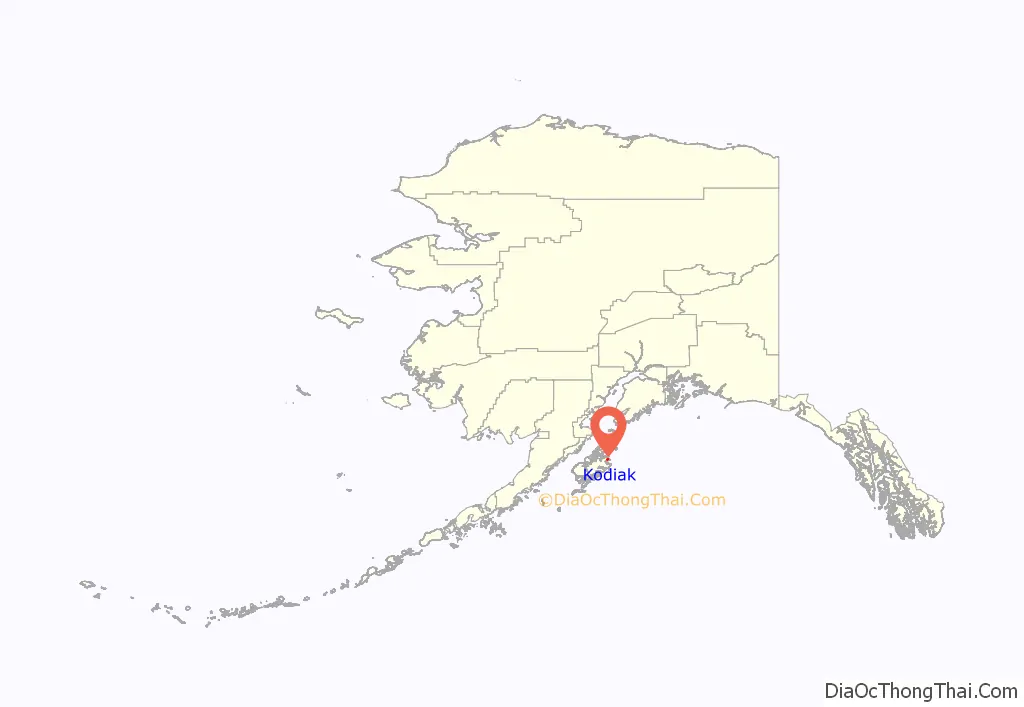
Kodiak location map. Where is Kodiak city?
History
Indigenous peoples
Archaeological evidence suggests that the Kodiak Archipelago has been home to the Alutiiq for at least 7,000 years. In their language, qikertaq means “island”.
Russian control: 1700s–1867
The first Europeans to sight Kodiak Island were the explorers Vitus Bering and Aleksei Chirikov, during the 1741 Second Kamchatka Expedition. In the early 1750s the Russian fur trading merchant and explorer Stepan Glotov met a Kodiak Islander in the Aleutian Islands, who told him about the island. On his next voyage Glotov sailed to Kodiak Island, arriving in 1763. The Russians called the island Kad’yak (Кадьяк), after the Alutiiq word qikertaq. Several other Russians made fur hunting voyages to Kodiak Island in the 1770s. In 1778 the British captain James Cook explored the area and wrote of “Kodiak” in his journals. In 1779 the Spanish explorers Arteaga y Bazán and Bodega y Quadra reached Afognak in the Kodiak Archipelago.
In 1792, the Russian Shelikhov-Golikov Company chief manager Alexander Baranov moved the post at Three Saints Bay (established in 1784) to a new site in Paul’s Harbor (Свято-Павловской гавани, Svyato-Pavlovskoy Gavani). This developed as the nucleus of modern Kodiak. Baranov considered Three Saints Bay a poor location because it was too indefensible. The relocated settlement was first named Pavlovskaya Gavan (Павловская гавань – Paul’s Harbor).
A warehouse was built in what became one of the key posts of the Shelikhov-Golikov Company, a precursor of the Russian-American Company and a center for harvesting the area’s vast population of sea otters for their prized pelts. The warehouse still stands as the Baranov Museum. Because the First Native cultures revered this animal and would never harm it, the Russians had wars with and enslaved the Aleuts during this era.
Eastern Orthodox missionaries settled on the island by the end of the 18th century, continuing European settlement of the island. They held the liturgy in native Tlingit from 1800.
The capital of Russian America was moved to Novoarkhangelsk (modern-day Sitka) in 1804. The Russian-American Company was established in 1799 as a joint-stock company by decree of Emperor Paul to continue the harvest of sea otter and other fur-bearing animals and establish permanent settlements. By the mid-19th century, the sea otter was almost extinct and 85% of the First Native population had disappeared from exposure to European diseases and violence.
American control: 1867–present
When Russia sold Alaska to the United States in 1867, Kodiak developed as a center for commercial fishing, and canneries dotted the island in the early 20th century until global farm-raised salmon eliminated these businesses. New processing centers emerged and the industry continues to evolve. During the presidency of Theodore Roosevelt, animals such as the mountain goat, Sitka deer (black tail), rabbits, muskrats, beavers, squirrels, and others were introduced to the island and the Kodiak National Wildlife Refuge was created.
Kodiak was severely impacted by the 1912 eruption of Novarupta. Though situated 160 miles (260 km) southeast of the eruption center, the town was covered with 1 foot (30 cm) of ash over a short period of time. Townspeople sheltered in the U.S. Revenue Cutter Manning which was docked nearby.
As Kodiak was incorporated in 1941, the U.S. feared attack from Japanese during World War II, and turned the town into a fortress. Roads, the airport, Fort Abercrombie, and gun fortifications improved the island’s infrastructure. When Alaska became a state in 1959, government assistance in housing, transportation, and education added additional benefits.
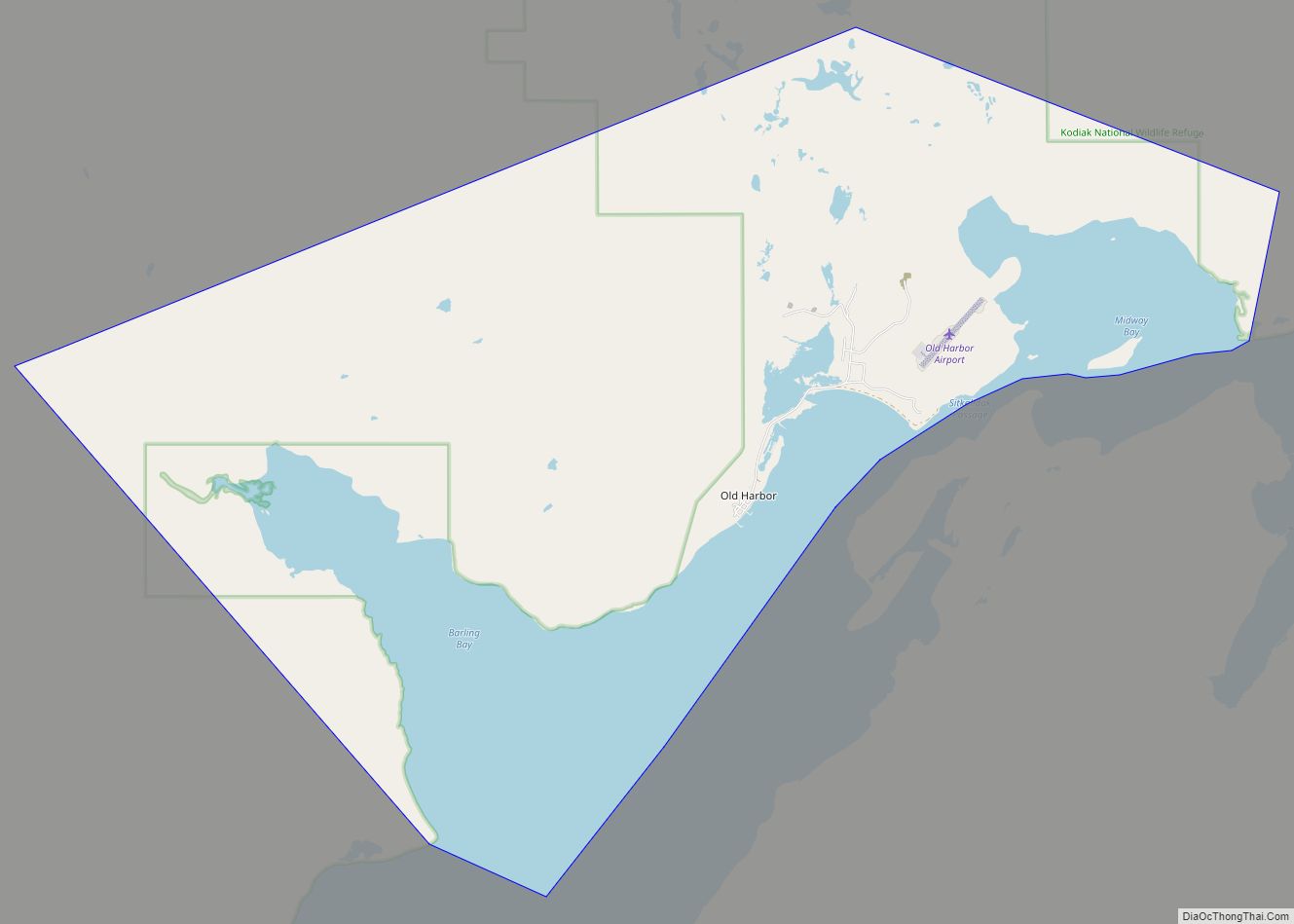
In March 1964, a tectonic tsunami struck the city during the 1964 Alaska earthquake with 30-foot (9.1 m) waves that killed 15 people and caused $11 million in damage. Some areas near Kodiak were permanently raised by 30 feet (9.1 m). It wiped out the neighboring Native villages of Old Harbor and Kaguyak. The Standard Oil Company, the Alaskan King Crab Company, and much of the fishing fleet were also destroyed.
Kodiak, sometime shortly after 1900
Panorama of Kodiak, 1908
Alaska Commercial Company buildings in Kodiak, June 1908
Alaska Commercial Company Superintendent’s residence, 1908
Warehouse and wharf in Kodiak, June 1908
Kodiak Harbor, July 2009
Kodiak Road Map
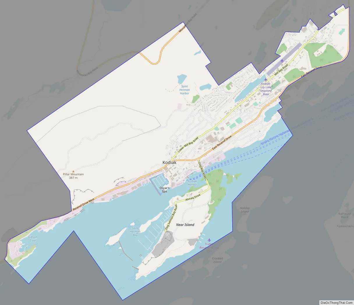
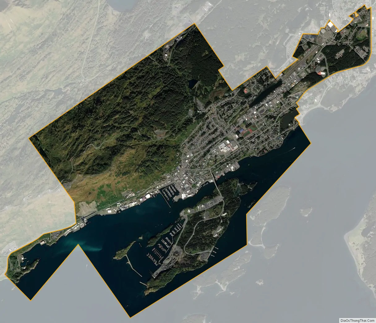
Kodiak city Satellite Map
Geography
Kodiak is located on the eastern shore of Kodiak Island. According to the United States Census Bureau, the city has a total area of 4.9 square miles (12.6 km), divided into 3.5 sq mi (9.0 km) of land and 1.4 sq mi (3.6 km) (28.66%) of water.
Climate
Kodiak has a humid continental climate (Dfb) with cold winters and mild summers. Precipitation is heavy year-round, though markedly less in the summer months, when the Aleutian Low is at its weakest.
See also
Map of Alaska State and its subdivision:- Aleutians East
- Aleutians West
- Anchorage
- Bethel
- Bristol Bay
- Denali
- Dillingham
- Fairbanks North Star
- Haines
- Juneau
- Kenai Peninsula
- Ketchikan Gateway
- Kodiak Island
- Lake and Peninsula
- Matanuska-Susitna
- Nome
- North Slope
- Northwest Arctic
- Prince of Wales-Outer Ketchi
- Sitka
- Skagway-Yakutat-Angoon
- Southeast Fairbanks
- Valdez-Cordova
- Wade Hampton
- Wrangell-Petersburg
- Yukon-Koyukuk
- Alabama
- Alaska
- Arizona
- Arkansas
- California
- Colorado
- Connecticut
- Delaware
- District of Columbia
- Florida
- Georgia
- Hawaii
- Idaho
- Illinois
- Indiana
- Iowa
- Kansas
- Kentucky
- Louisiana
- Maine
- Maryland
- Massachusetts
- Michigan
- Minnesota
- Mississippi
- Missouri
- Montana
- Nebraska
- Nevada
- New Hampshire
- New Jersey
- New Mexico
- New York
- North Carolina
- North Dakota
- Ohio
- Oklahoma
- Oregon
- Pennsylvania
- Rhode Island
- South Carolina
- South Dakota
- Tennessee
- Texas
- Utah
- Vermont
- Virginia
- Washington
- West Virginia
- Wisconsin
- Wyoming