Kotlik (Central Yupik: Qerrulliik, Russian: Котлик) is a city in Kusilvak Census Area, Alaska, United States. At the 2010 census the population was 577, down from 591 in 2000.
| Name: | Kotlik city |
|---|---|
| LSAD Code: | 25 |
| LSAD Description: | city (suffix) |
| State: | Alaska |
| County: | Kusilvak Census Area |
| Incorporated: | October 28, 1970 |
| Elevation: | 0 ft (0 m) |
| Total Area: | 3.50 sq mi (9.06 km²) |
| Land Area: | 2.99 sq mi (7.75 km²) |
| Water Area: | 0.51 sq mi (1.31 km²) |
| Total Population: | 655 |
| Population Density: | 218.77/sq mi (84.47/km²) |
| Area code: | 907 |
| FIPS code: | 0241720 |
| GNISfeature ID: | 1404964 |
Online Interactive Map
Click on ![]() to view map in "full screen" mode.
to view map in "full screen" mode.
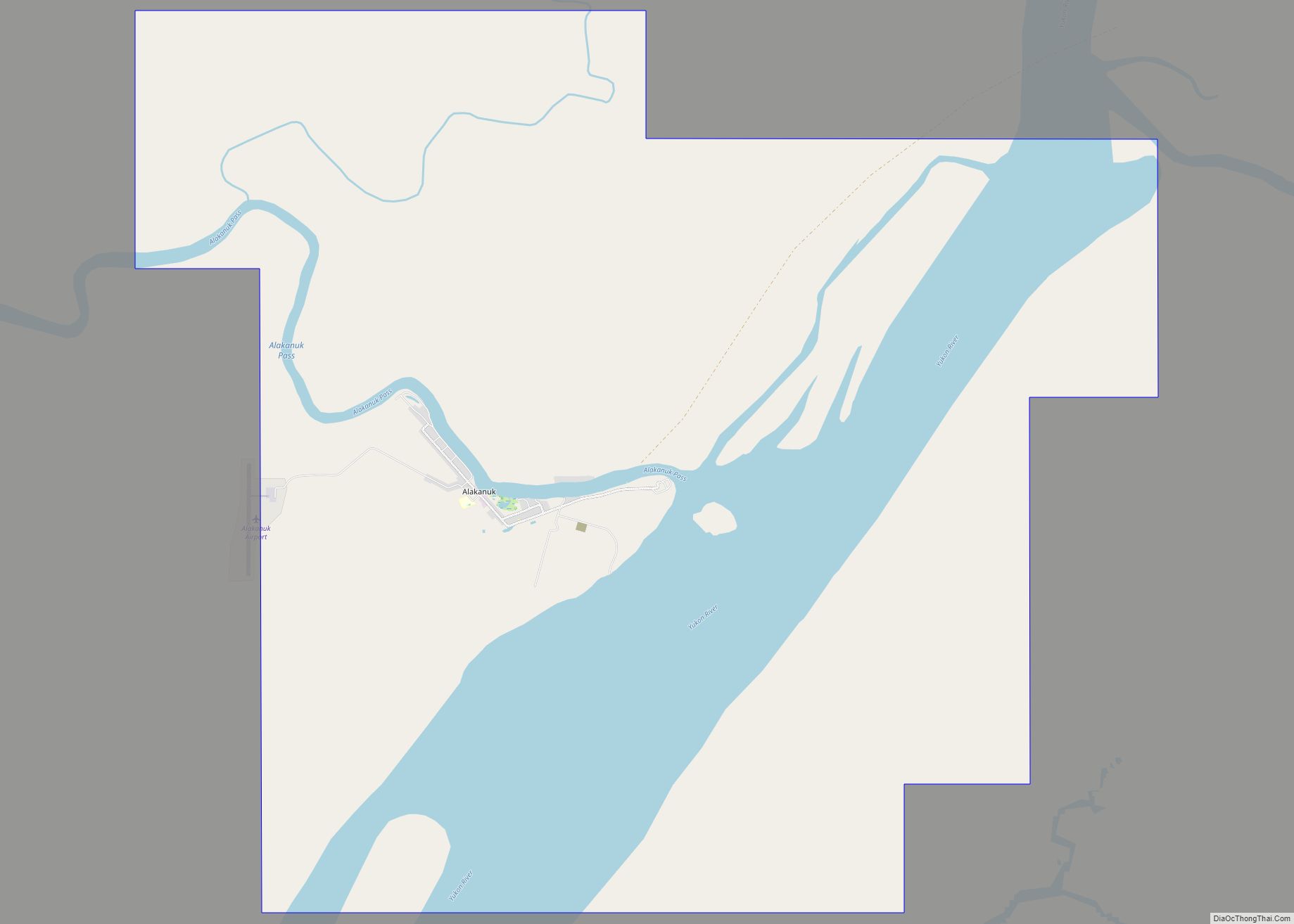
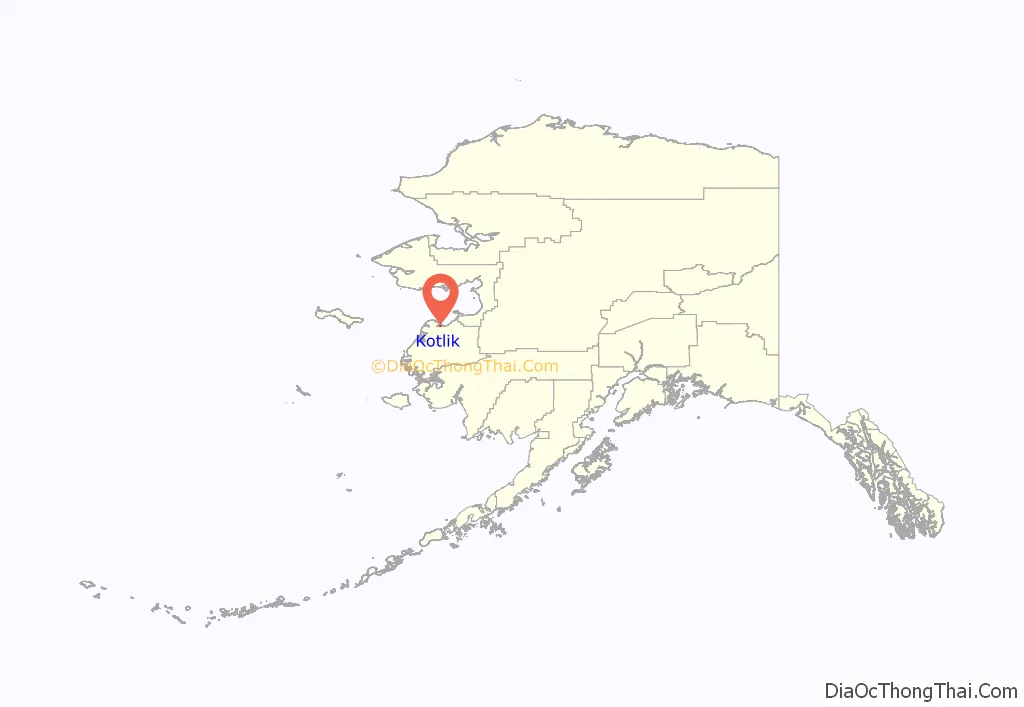
Kotlik location map. Where is Kotlik city?
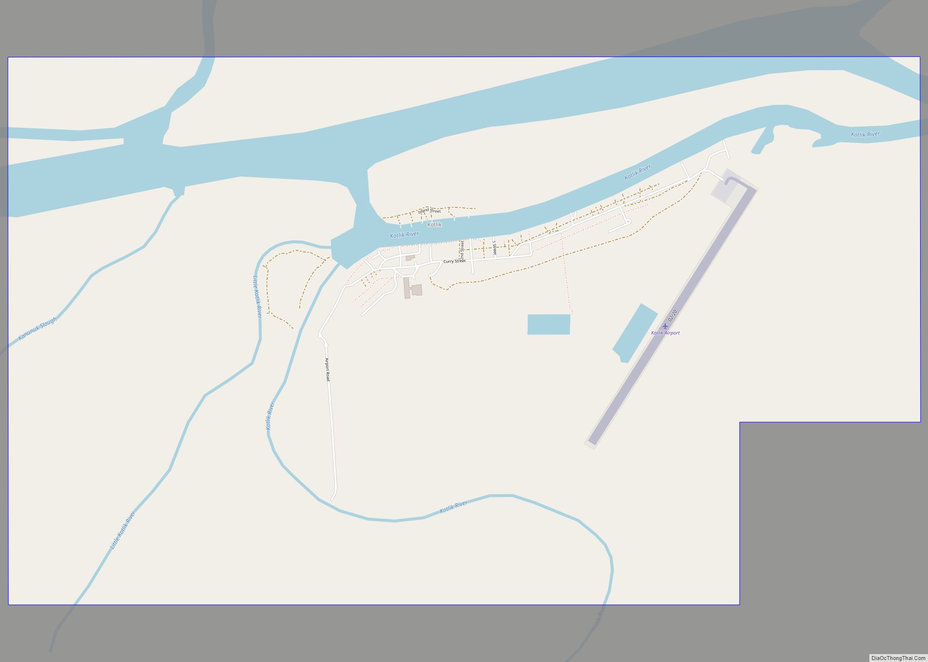
Kotlik Road Map
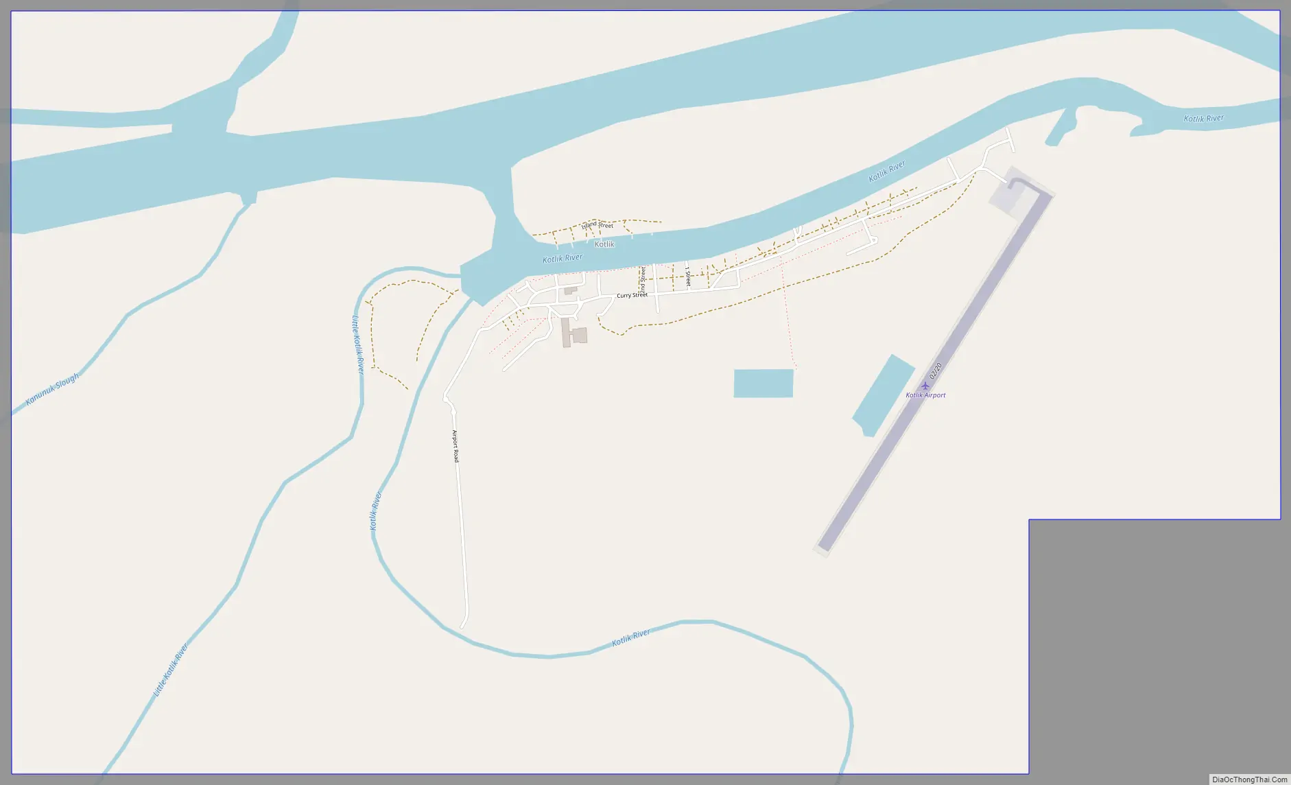
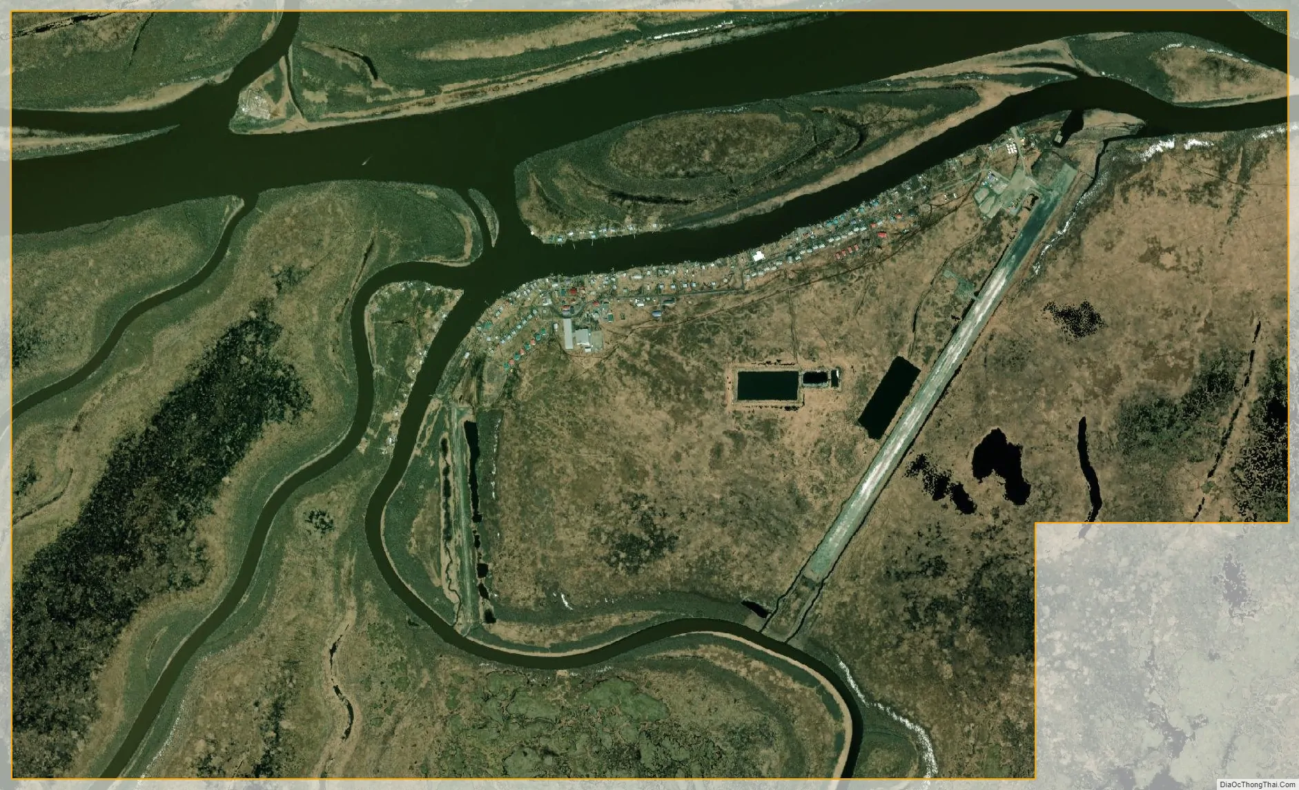
Kotlik city Satellite Map
Geography
Kotlik is located at 63°02′09″N 163°33′37″W / 63.035769°N 163.560177°W / 63.035769; -163.560177. Kotlik is located on the east bank of the Kotlik Slough, 35 miles northeast of Emmonak in the Yukon-Kuskokwim Delta.
According to the United States Census Bureau, the city has a total area of 4.7 square miles (12 km), of which, 3.8 square miles (9.8 km) of it is land and 0.8 square miles (2.1 km) of it (17.85%) is water. The climate of Kotlik is subarctic. Temperatures range between -50 and 87. There is an average of 60 inches of snowfall and 16 inches of precipitation annually.
The Yupik village of Bill Moore’s Slough is contained within Kotlik.
See also
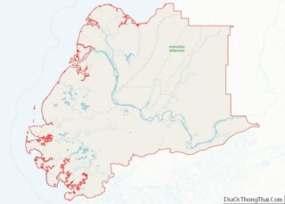
Map of Alaska State and its subdivision:- Aleutians East
- Aleutians West
- Anchorage
- Bethel
- Bristol Bay
- Denali
- Dillingham
- Fairbanks North Star
- Haines
- Juneau
- Kenai Peninsula
- Ketchikan Gateway
- Kodiak Island
- Lake and Peninsula
- Matanuska-Susitna
- Nome
- North Slope
- Northwest Arctic
- Prince of Wales-Outer Ketchi
- Sitka
- Skagway-Yakutat-Angoon
- Southeast Fairbanks
- Valdez-Cordova
- Wade Hampton
- Wrangell-Petersburg
- Yukon-Koyukuk
- Alabama
- Alaska
- Arizona
- Arkansas
- California
- Colorado
- Connecticut
- Delaware
- District of Columbia
- Florida
- Georgia
- Hawaii
- Idaho
- Illinois
- Indiana
- Iowa
- Kansas
- Kentucky
- Louisiana
- Maine
- Maryland
- Massachusetts
- Michigan
- Minnesota
- Mississippi
- Missouri
- Montana
- Nebraska
- Nevada
- New Hampshire
- New Jersey
- New Mexico
- New York
- North Carolina
- North Dakota
- Ohio
- Oklahoma
- Oregon
- Pennsylvania
- Rhode Island
- South Carolina
- South Dakota
- Tennessee
- Texas
- Utah
- Vermont
- Virginia
- Washington
- West Virginia
- Wisconsin
- Wyoming