Nulato (/nuːˈlætoʊ/; Noolaaghe Doh /nuːlaːɣə tɔːχ/ “chum salmon fish camp” in Koyukon; Russian: Нулато) is a city in Yukon-Koyukuk Census Area, Alaska, United States. At the 2020 census, the population was 239.
| Name: | Nulato city |
|---|---|
| LSAD Code: | 25 |
| LSAD Description: | city (suffix) |
| State: | Alaska |
| County: | Yukon-Koyukuk Census Area |
| Incorporated: | April 22, 1963 |
| Elevation: | 115 ft (35 m) |
| Total Area: | 43.79 sq mi (113.40 km²) |
| Land Area: | 41.09 sq mi (106.43 km²) |
| Water Area: | 2.69 sq mi (6.98 km²) |
| Total Population: | 239 |
| Population Density: | 5.82/sq mi (2.25/km²) |
| ZIP code: | 99765 |
| Area code: | 907 |
| FIPS code: | 0256350 |
| GNISfeature ID: | 1407321 |
Online Interactive Map
Click on ![]() to view map in "full screen" mode.
to view map in "full screen" mode.
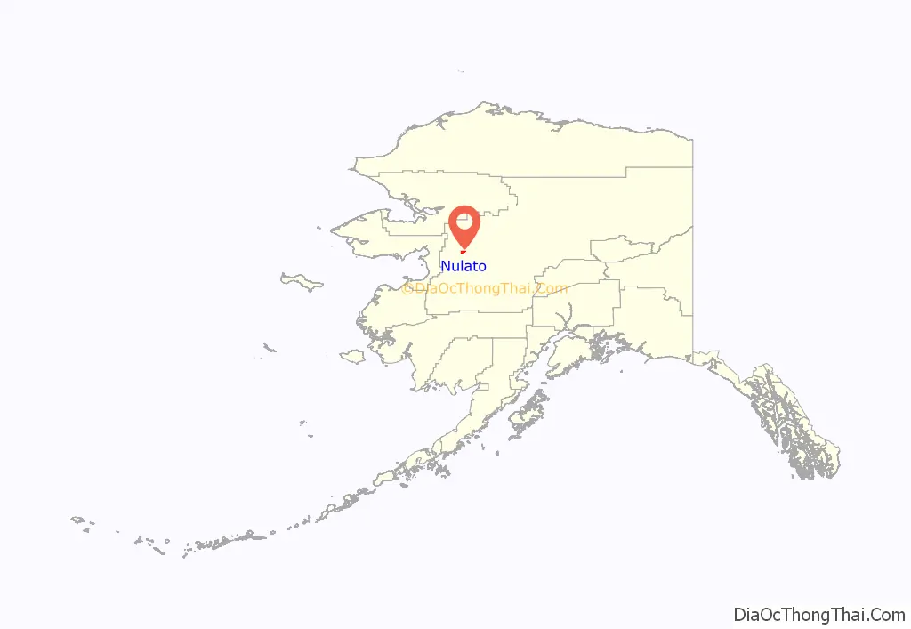
Nulato location map. Where is Nulato city?
History
Nulato was a location for trade between the Koyukon people and Inupiat people of the Kobuk River area before the arrival of Europeans.
In 1838, the Russian explorer Malakov established a trading post in Nulato.
The Kokukuk River people massacred a large part of the population of Nulato on February 16, 1851, during the Athapaskan uprising.
After the Alaska Purchase, a United States military telegraph line was constructed along the north side of the Yukon River. The gold rush along the Yukon River that began in 1884 brought many new diseases to the area and many people died. Our Lady of Snows Roman Catholic mission and school were opened in 1887 and many people moved to Nulato to be near the school. A measles epidemic and food shortages during 1900 reduced the population of the area by one-third. 1900 was also the peak year for steamboat travel on the Yukon River, with 46 boats in operation. That summer, two boats per day stopped at Nulato to purchase firewood.
Gold prospectors left the Yukon River area for Fairbanks and Nome in 1906. Lead mining began around neighboring Galena in 1919.
Nulato incorporated as a city in 1963. In 1981, housing was built at a new townsite 3 km (1.9 mi) from present Nulato.
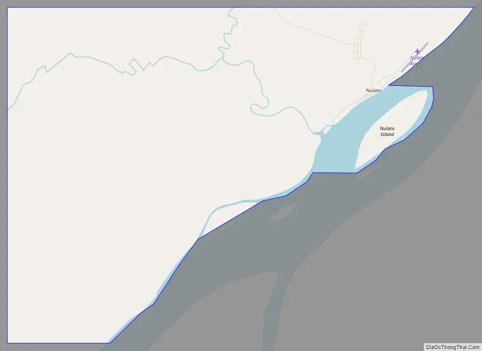
Nulato Road Map
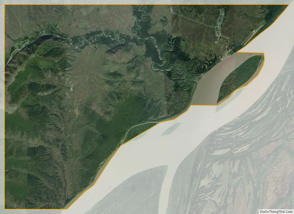
Nulato city Satellite Map
Geography
Nulato is located at 64°43′48″N 158°6′51″W / 64.73000°N 158.11417°W / 64.73000; -158.11417 (64.730011, -158.114101).
Nulato is on the west bank of the Yukon River, 53 km (33 mi) west of Galena, in the Nulato Hills. It is across the Yukon River from the Innoko National Wildlife Refuge.The area experiences a cold, continental climate with extreme temperature differences. Temperatures range from −70 °F (−57 °C) to 80 °F (27 °C). Average precipitation is 15.6 inches (400 mm), with 74 inches (1,900 mm) of snowfall annually.
According to the United States Census Bureau, the city has a total area of 44.8 square miles (116 km), of which, 42.7 square miles (111 km) of it is land and 2.0 square miles (5.2 km) of it (4.56%) is water.
See also
Map of Alaska State and its subdivision:- Aleutians East
- Aleutians West
- Anchorage
- Bethel
- Bristol Bay
- Denali
- Dillingham
- Fairbanks North Star
- Haines
- Juneau
- Kenai Peninsula
- Ketchikan Gateway
- Kodiak Island
- Lake and Peninsula
- Matanuska-Susitna
- Nome
- North Slope
- Northwest Arctic
- Prince of Wales-Outer Ketchi
- Sitka
- Skagway-Yakutat-Angoon
- Southeast Fairbanks
- Valdez-Cordova
- Wade Hampton
- Wrangell-Petersburg
- Yukon-Koyukuk
- Alabama
- Alaska
- Arizona
- Arkansas
- California
- Colorado
- Connecticut
- Delaware
- District of Columbia
- Florida
- Georgia
- Hawaii
- Idaho
- Illinois
- Indiana
- Iowa
- Kansas
- Kentucky
- Louisiana
- Maine
- Maryland
- Massachusetts
- Michigan
- Minnesota
- Mississippi
- Missouri
- Montana
- Nebraska
- Nevada
- New Hampshire
- New Jersey
- New Mexico
- New York
- North Carolina
- North Dakota
- Ohio
- Oklahoma
- Oregon
- Pennsylvania
- Rhode Island
- South Carolina
- South Dakota
- Tennessee
- Texas
- Utah
- Vermont
- Virginia
- Washington
- West Virginia
- Wisconsin
- Wyoming


