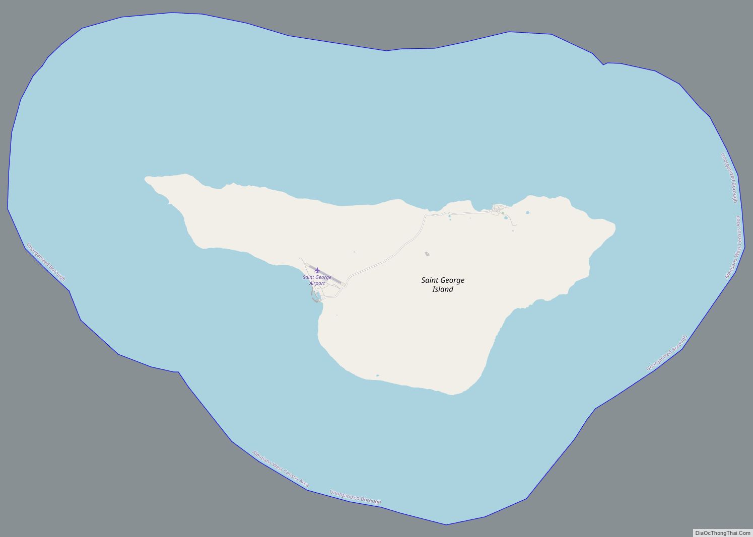
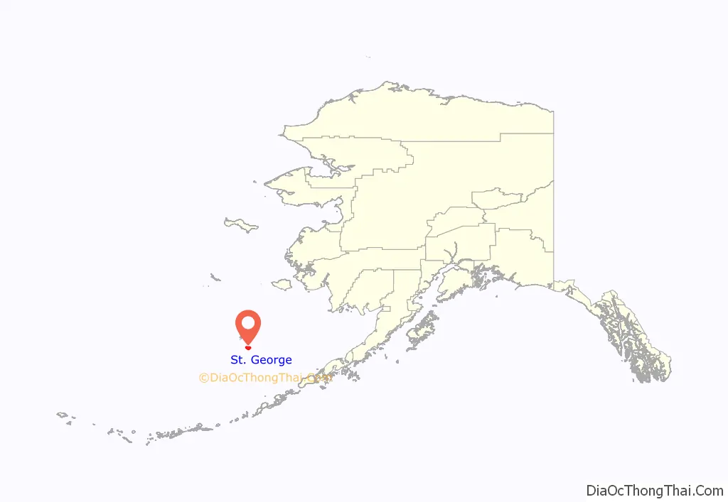
St. George (Aleut: Anĝaaxchalux̂ or Sangiurgiix̂, Russian: Сент-Джордж) is a city in Aleutians West Census Area, Alaska, United States. At the 2010 census the population was 102, down from 152 in 2000. It is the main settlement of St. George Island in the Pribilofs, a small island group in the Bering Sea.
| Name: | St. George city |
|---|---|
| LSAD Code: | 25 |
| LSAD Description: | city (suffix) |
| State: | Alaska |
| County: | Aleutians West Census Area |
| Incorporated: | September 13, 1983 |
| Elevation: | 197 ft (60 m) |
| Total Area: | 182.31 sq mi (472.17 km²) |
| Land Area: | 34.78 sq mi (90.08 km²) |
| Water Area: | 147.52 sq mi (382.09 km²) |
| Total Population: | 67 |
| Population Density: | 1.93/sq mi (0.74/km²) |
| ZIP code: | 99591 |
| Area code: | 907 |
| FIPS code: | 0265800 |
| GNISfeature ID: | 1419161 |
| Website: | www.stgeorgealaska.com/index.asp |
Online Interactive Map
Click on ![]() to view map in "full screen" mode.
to view map in "full screen" mode.
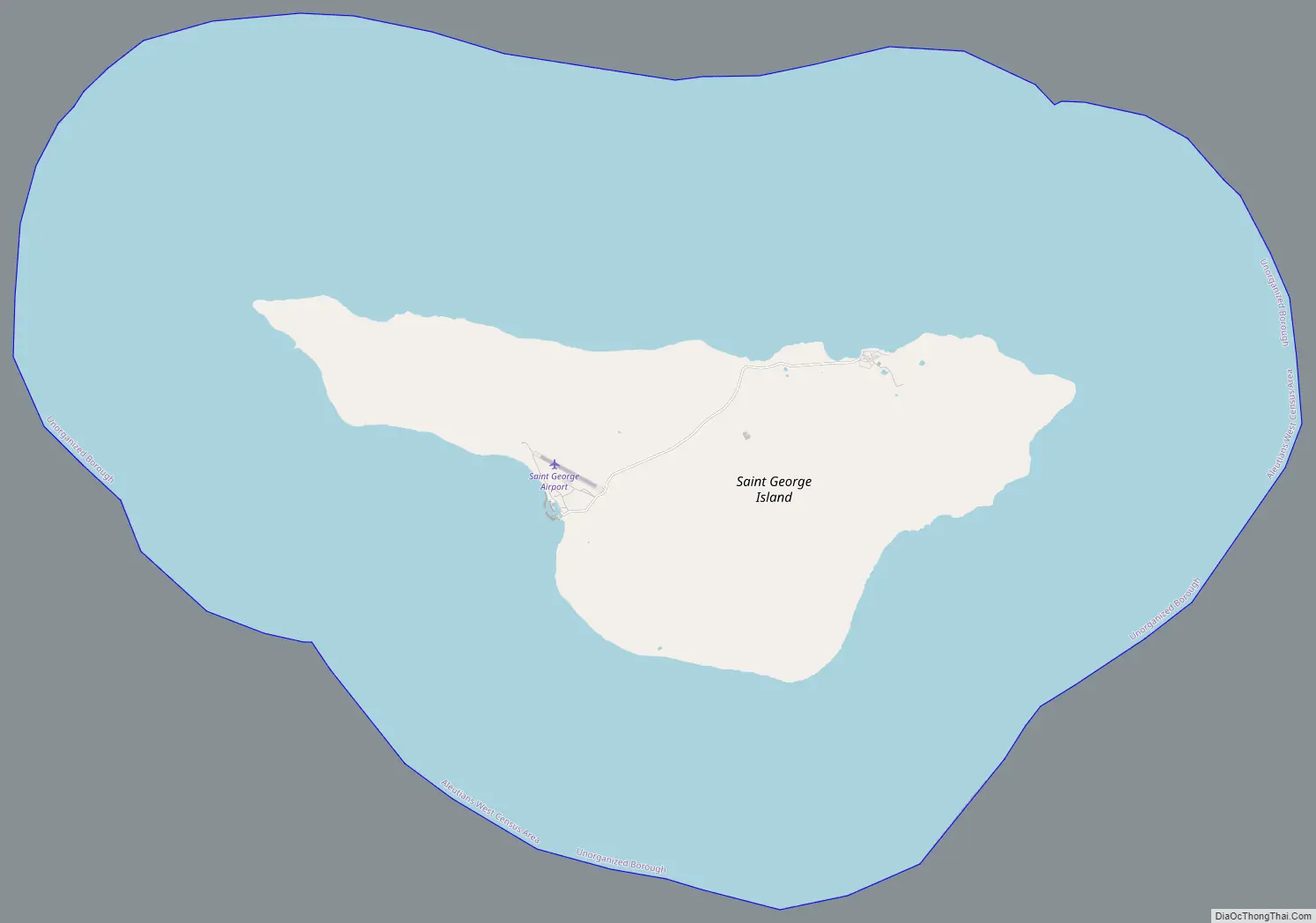
St. George location map. Where is St. George city?
St. George Road Map
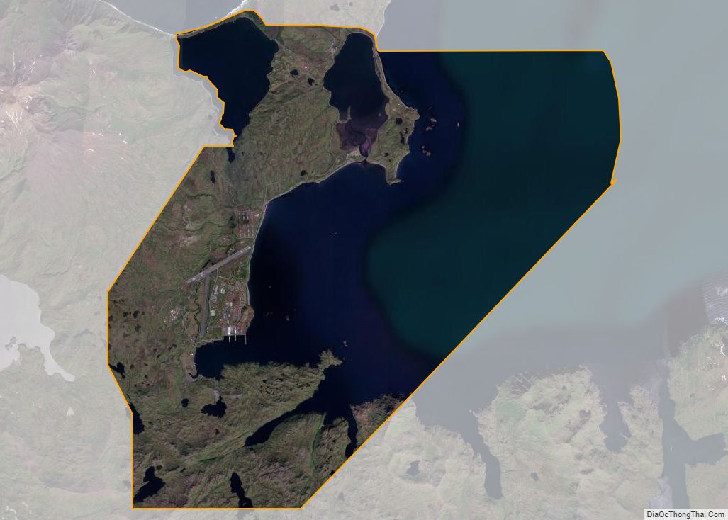
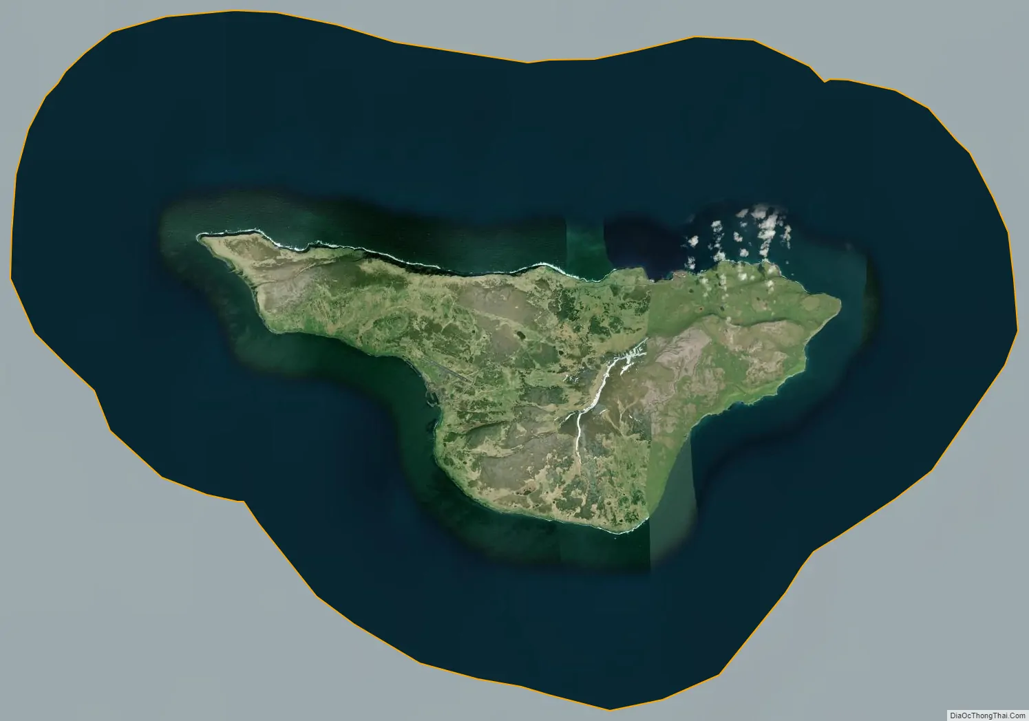
St. George city Satellite Map
Geography
St. George is located at 56°36′20″N 169°33′35″W / 56.60556°N 169.55972°W / 56.60556; -169.55972 (56.605546, −169.559584).
According to the U.S. Census Bureau, the city has a total area of 182.4 square miles (472 km), of which, 34.8 square miles (90 km) of it is land and 147.6 square miles (382 km) of it (80.94%) is water.
The city is served by an airport with scheduled service to St. Paul Island Airport and Unalaska Airport provided by Grant Aviation.
Climate
See also
Map of Alaska State and its subdivision:- Aleutians East
- Aleutians West
- Anchorage
- Bethel
- Bristol Bay
- Denali
- Dillingham
- Fairbanks North Star
- Haines
- Juneau
- Kenai Peninsula
- Ketchikan Gateway
- Kodiak Island
- Lake and Peninsula
- Matanuska-Susitna
- Nome
- North Slope
- Northwest Arctic
- Prince of Wales-Outer Ketchi
- Sitka
- Skagway-Yakutat-Angoon
- Southeast Fairbanks
- Valdez-Cordova
- Wade Hampton
- Wrangell-Petersburg
- Yukon-Koyukuk
- Alabama
- Alaska
- Arizona
- Arkansas
- California
- Colorado
- Connecticut
- Delaware
- District of Columbia
- Florida
- Georgia
- Hawaii
- Idaho
- Illinois
- Indiana
- Iowa
- Kansas
- Kentucky
- Louisiana
- Maine
- Maryland
- Massachusetts
- Michigan
- Minnesota
- Mississippi
- Missouri
- Montana
- Nebraska
- Nevada
- New Hampshire
- New Jersey
- New Mexico
- New York
- North Carolina
- North Dakota
- Ohio
- Oklahoma
- Oregon
- Pennsylvania
- Rhode Island
- South Carolina
- South Dakota
- Tennessee
- Texas
- Utah
- Vermont
- Virginia
- Washington
- West Virginia
- Wisconsin
- Wyoming