St. Paul (Aleut: Tanax̂ Amix̂ or Sanpuulax̂, Russian: Сент-Пол, romanized: Sent-Pol) is a city in the Aleutians West Census Area, Alaska, United States. It is the main settlement of Saint Paul Island in the Pribilofs, a small island group in the Bering Sea. Saint Paul Island is well known as a birdwatching haven. The population was 479 at the 2010 census, down from 532 in 2000.
| Name: | St. Paul city |
|---|---|
| LSAD Code: | 25 |
| LSAD Description: | city (suffix) |
| State: | Alaska |
| County: | Aleutians West Census Area |
| Founded: | 1943 |
| Incorporated: | June 29, 1971 |
| Elevation: | 23 ft (7 m) |
| Total Area: | 295.46 sq mi (765.25 km²) |
| Land Area: | 42.62 sq mi (110.39 km²) |
| Water Area: | 252.84 sq mi (654.86 km²) |
| Total Population: | 413 |
| Population Density: | 9.69/sq mi (3.74/km²) |
| ZIP code: | 99660 |
| Area code: | 907 |
| FIPS code: | 0266470 |
| GNISfeature ID: | 1419163 |
Online Interactive Map
Click on ![]() to view map in "full screen" mode.
to view map in "full screen" mode.
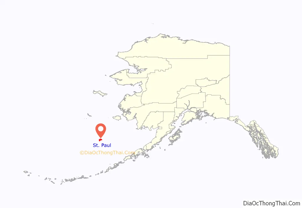
St. Paul location map. Where is St. Paul city?
History
The Pribilofs, named after the Russian navigator, Gavriil Pribylov, were discovered in 1786 by Russian fur traders; no Alaska Natives are known to have lived on the island prior to this point. They landed first on St. George and named the larger island to the north St. Peter and St. Paul Island. In 1788, the Russian-American Company enserfed and relocated Aleuts from Atka and Unalaska to the Pribilofs to hunt fur seals; their descendants live on the two islands today. In 1870, the now-American owned Alaska Commercial Company (formerly the Russian-American Company) was awarded a 20-year sealing lease by the U.S. Government, and provided housing, food and medical care to the Aleuts in exchange for seal harvesting. In 1890, a second 20-year lease was awarded to the North American Commercial Company, however, the fur seals had been severely over-harvested and only an estimated 200,000 fur seals remained. The 1910 Fur Seal Treaty ended private sealing on the islands and placed the community and fur seals under the U.S. Bureau of Fisheries. Food and clothing were scarce, social and racial segregation were practiced, and working conditions were poor.
During World War II, as the Imperial Japanese Army threatened the Aleutians; the 881 Aleuts on the Pribilof islands were forcibly removed, with no more than several hours’ notice, to internment in abandoned salmon canneries and mines in Southeast Alaska until May 1944. The Aleut men were brought back to the islands temporarily in the summer of 1943 to conduct the fur seal harvest for the federal government, seal oil being used in the war effort. Most Aleuts from the Pribilofs were imprisoned at Funter Bay on Admiralty Island in Southeast Alaska. In 1979, the Aleut people from the Pribilof islands received $8.5 million in partial compensation for the unfair and unjust treatment they were subject to under federal administration between 1870 and 1946. In 1983, Congress passed the Fur Seal Act Amendments, which ended government control of the commercial seal harvest and most of the federal presence on the island. Responsibility for providing community services and management of the fur seals was left to local entities. USD$20 million was provided to help develop and diversify the Island economy—USD$12 million to St. Paul and USD$8 million to St. George. Commercial harvesting on St. Paul ceased in 1985. Ownership of fur seal pelts is now prohibited except for subsistence purposes.
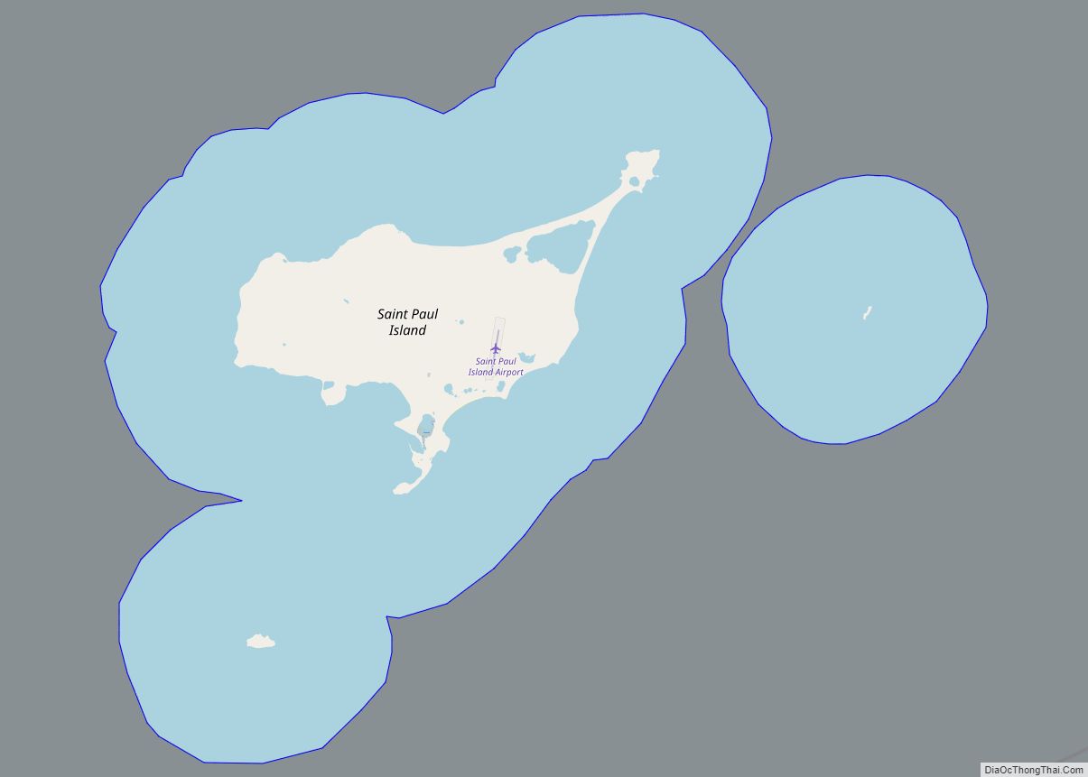
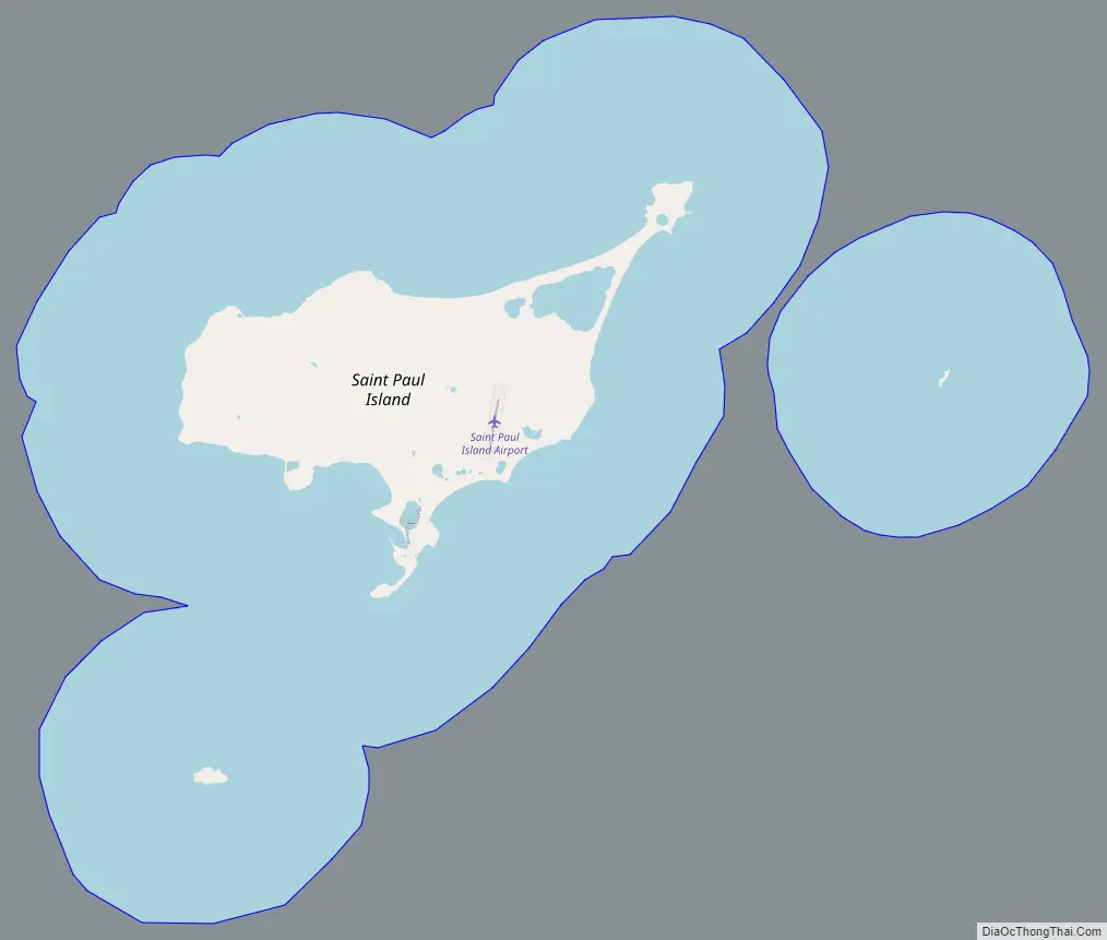
St. Paul Road Map
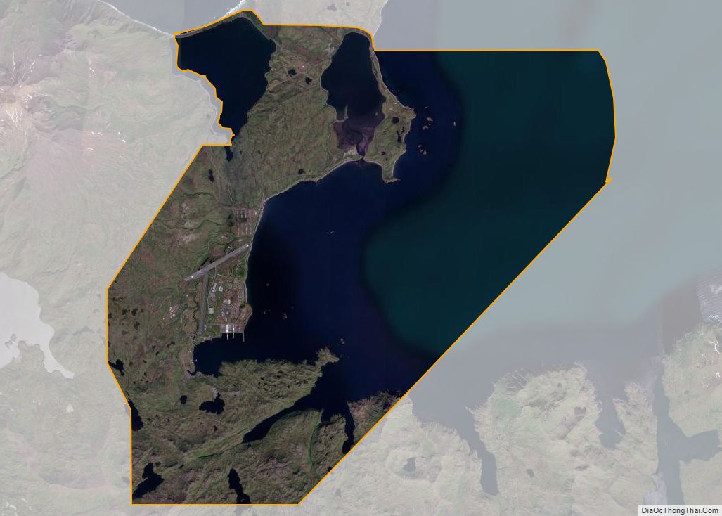
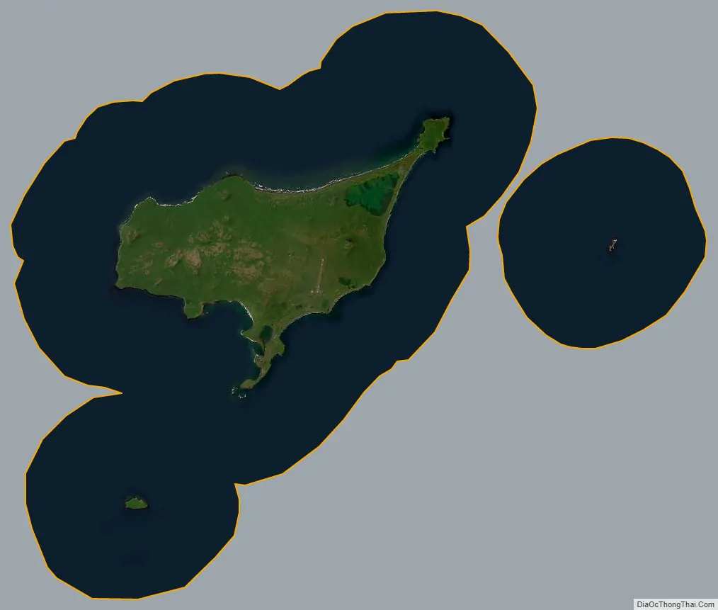
St. Paul city Satellite Map
Geography
St. Paul is located at 57°7′30″N 170°17′3″W / 57.12500°N 170.28417°W / 57.12500; -170.28417 (57.133806, −170.266614).
According to the U.S. Census Bureau, the city has a total area of 295.5 square miles (765 km), of which, 40.3 square miles (104 km) of it is land and 255.2 square miles (661 km) of it (86.36%) is water.
See also
Map of Alaska State and its subdivision:- Aleutians East
- Aleutians West
- Anchorage
- Bethel
- Bristol Bay
- Denali
- Dillingham
- Fairbanks North Star
- Haines
- Juneau
- Kenai Peninsula
- Ketchikan Gateway
- Kodiak Island
- Lake and Peninsula
- Matanuska-Susitna
- Nome
- North Slope
- Northwest Arctic
- Prince of Wales-Outer Ketchi
- Sitka
- Skagway-Yakutat-Angoon
- Southeast Fairbanks
- Valdez-Cordova
- Wade Hampton
- Wrangell-Petersburg
- Yukon-Koyukuk
- Alabama
- Alaska
- Arizona
- Arkansas
- California
- Colorado
- Connecticut
- Delaware
- District of Columbia
- Florida
- Georgia
- Hawaii
- Idaho
- Illinois
- Indiana
- Iowa
- Kansas
- Kentucky
- Louisiana
- Maine
- Maryland
- Massachusetts
- Michigan
- Minnesota
- Mississippi
- Missouri
- Montana
- Nebraska
- Nevada
- New Hampshire
- New Jersey
- New Mexico
- New York
- North Carolina
- North Dakota
- Ohio
- Oklahoma
- Oregon
- Pennsylvania
- Rhode Island
- South Carolina
- South Dakota
- Tennessee
- Texas
- Utah
- Vermont
- Virginia
- Washington
- West Virginia
- Wisconsin
- Wyoming