The City and Borough of Yakutat (/ˈjækətæt/, YAK-ə-tat; Tlingit: Yaakwdáat; Russian: Якутат) is a borough in the state of Alaska and the name of a former city within the borough. The name in Tlingit is Yaakwdáat (meaning “the place where canoes rest”). It is derived from an Eyak name, diyaʼqudaʼt, and was influenced by the Tlingit word yaakw (“canoe, boat”).
The borough covers an area about six times the size of the state of Rhode Island, making it one of the nation’s largest counties or county equivalents. As of the 2020 census the population was 662. As of 2010, it was Alaska’s least populous borough or census area, and the ninth-least populous county nationwide. The population declined from 680 in 2000.
The Borough of Yakutat was incorporated as a non-unified Home Rule Borough on September 22, 1992. Yakutat was previously a city in the Skagway–Yakutat–Angoon Census Area (later renamed the Skagway–Hoonah–Angoon Census Area).
The U.S. Census Bureau has defined the former City of Yakutat as a census-designated place within the borough. The borough’s only other significant population center is the community of Icy Bay, the site of the Icy Bay Airport which is in the west-central part of the borough.
| Name: | Yakutat CDP |
|---|---|
| LSAD Code: | 57 |
| LSAD Description: | CDP (suffix) |
| State: | Alaska |
| County: | Yakutat City and Borough |
| Elevation: | 69 ft (21 m) |
| Population Density: | 6.6/sq mi (2.53/km²) |
| ZIP code: | 99689 |
| FIPS code: | 0286490 |
| GNISfeature ID: | 1415858 |
| Website: | yakutatak.govoffice2.com |
Online Interactive Map
Click on ![]() to view map in "full screen" mode.
to view map in "full screen" mode.
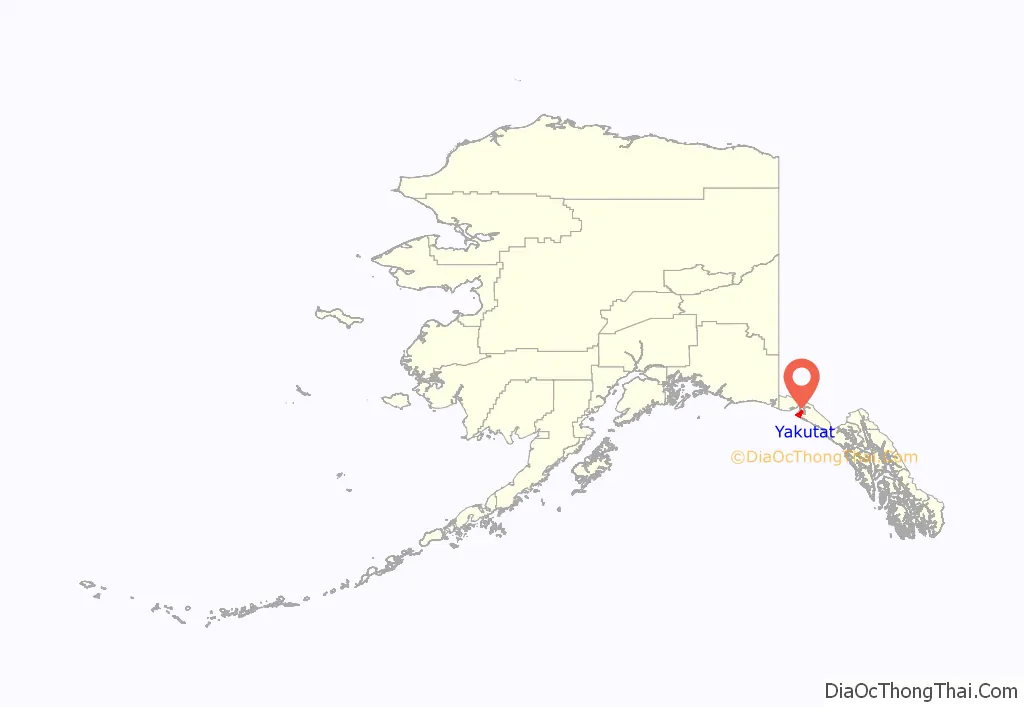
Yakutat location map. Where is Yakutat CDP?
History
The original settlers in the Yakutat area are believed to have been Eyak-speaking people from the Copper River area.Tlingit people migrated into the region and the Eyak were assimilated into the tribe before the arrival of Europeans in Alaska. Yakutat was only one of a number of Tlingit and mixed Tlingit-Eyak settlements in the region. The others have been depopulated or abandoned.
In the 18th and 19th centuries, English, French, Spanish, and Russian explorers came to the region. The Shelikhov-Golikov Company, a precursor of the Russian-American Company, built a fort in Yakutat in 1795 to facilitate trade with the Alaska Natives in sea-otter pelts. The settlement became known as New Russia, Yakutat Colony, or Slavorossiya. After the Russians cut off access to the fisheries nearby, a Tlingit war party attacked and destroyed the fort in 1805.
By 1886, after the 1867 Alaska Purchase by the United States from the Russian Empire, the area’s black sand beaches were being mined for gold. In 1889 the Swedish Free Mission Church opened a school and sawmill in the area.
About 1903 the Stimson Lumber Company constructed a cannery, another sawmill, a store, and a railroad. Many people moved to the current site of Yakutat to be closer to work at the Stimson cannery, which operated through 1970. During World War II, the USAAF stationed a large aviation garrison near Yakutat and built a paved runway. The troops were withdrawn after the war. The runway is still in use as Yakutat Airport, which offers scheduled airline service.
Fishing is the largest economic activity in Yakutat.
In 2004 the Yakutat Tlingit Tribe (YTT) received a Language Preservation Grant from the Administration for Native Americans. With this, they have reinvigorated their efforts to teach the Tlingit language to middle-aged and young people. YTT received another ANA grant in 2007 and is expanding its role in the schools. All the YTT Tlingit language revitalization work focuses on using communicative approaches to second-language teaching, such as TPR and American Sign Language (ASLA).
While working at a local cannery from 1912 to 1941, Seiki Kayamori extensively photographed Yakutat and its area; Yakutat City Hall holds a large set of prints of his work.
Yakutat and Southern Railway was a rail operation in the area. It served several canneries south of Yakutat and primarily hauled fish to the harbor. Service ended in the mid-1960s.
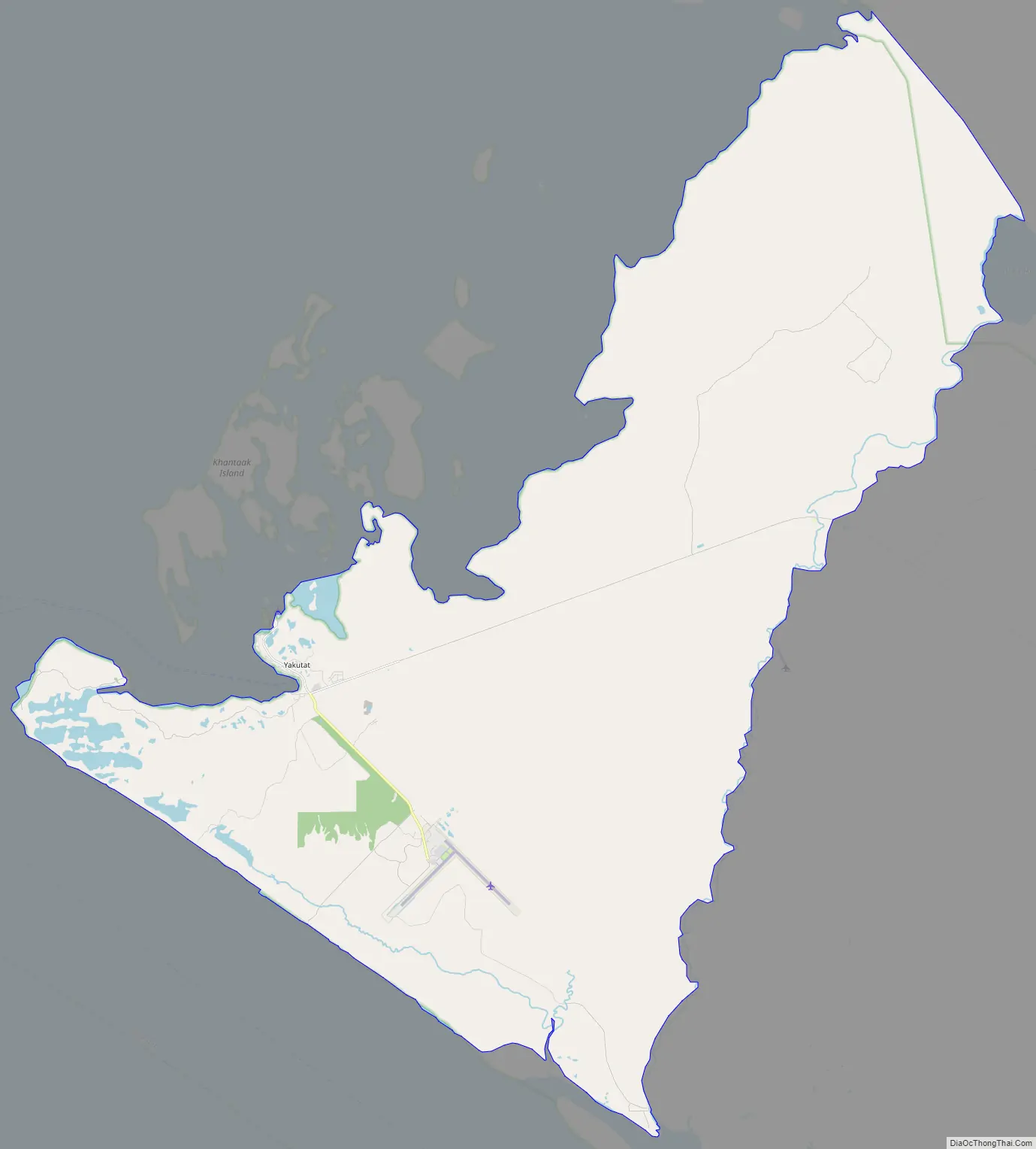
Yakutat Road Map
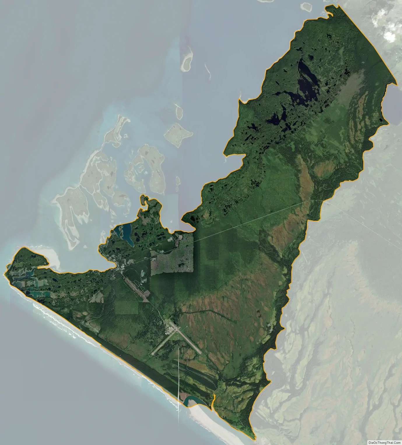
Yakutat city Satellite Map
Geography
According to the U.S. Census Bureau, the borough has an area of 9,463 square miles (24,510 km), of which 7,649 square miles (19,810 km) is land and 1,813 square miles (4,700 km) is water. The 2010 census also defines a smaller census-designated place named Yakutat, which has an area of 104.1 square miles (269.6 km), of which 100.5 square miles (260.3 km) is land and 3.6 square miles (9.3 km) is water.
Yakutat’s population center is located at 59°32′49″N 139°43′38″W / 59.54694°N 139.72722°W / 59.54694; -139.72722, at the mouth of Yakutat Bay. It lies in an isolated location in lowlands along the Gulf of Alaska, 212 miles (341 kilometres)) northwest of Juneau.
Yakutat borders the Gulf of Alaska to the west, Valdez-Cordova Census Area, Alaska to the northwest, Hoonah-Angoon Census Area, Alaska to the southeast, Stikine Region, British Columbia to the northeast-east, and Yukon Territory to the north.
The borough contains part of the protected areas of Chugach National Forest, Glacier Bay National Park, Glacier Bay Wilderness, Tongass National Forest, Wrangell-St. Elias National Park and Preserve, Wrangell-Saint Elias Wilderness, and the Russell Fjord Wilderness.
A unique feature in the borough is Hubbard Glacier, North America’s largest tidewater glacier. In 1986 and 2002, the glacier blocked the entrance to Russell Fjord. The resulting Russell Lake rose 83 feet (25.30 m) and 61 feet (18.59 m) until the glacial dam failed. If Russell Lake rises to 135 feet (41.15 m), the water will spill over a pass and flow into the Situk River. That would have a major impact on a world-class fishery. Yakutat would not be affected unless the glacier advances to the townsite, which could take a thousand years. The area’s vegetation indicates that water was flowing over the pass until about 1860.
Climate
Yakutat has a subarctic climate (Dfc) with characteristics such as high precipitation, absence of permafrost, and temperate rainforest vegetation of the climate zone of the Pacific Coast. It rivals Ketchikan as the wettest “city” in the United States, with an annual precipitation (1991−2020 normals) of 140 inches (3.56 m), which falls on 240 days of the year, including 150 inches (4 m) of snow. Almost all of it falls from November through April and it occurs on 64 days annually. (However, with an annual precipitation of 197.8 inches (5.02 m), the city of Whittier receives significantly more annual precipitation than both Yakutat and Ketchikan, which makes it the wettest city in Alaska and the United States, and Yakutat and Ketchikan the second- and third-wettest cities in Alaska, respectively.) September and October represent, on average, the year’s primary “rainy season” with an average of over 18 inches (0.46 m) of precipitation for both months. On average, the year’s driest period is late April through July, though no month qualifies as a true “dry season.” The monthly daily average temperature ranges from 28.6 °F (−1.9 °C) in January to 55.4 °F (13.0 °C) in July. Extreme temperatures have ranged from −24 °F (−31 °C) on December 30, 1964, up to 88 °F (31 °C) on August 15, 2004, though on average, there are typically 3.9 days of minima reaching to or below 1 °F (−17 °C) and only 5.8 days of maxima at or above 70 °F (21 °C)+ highs annually. Unlike in South Central Alaska, a day with a high temperature under 0 °F (−18 °C) has never been recorded.
- ^ Mean monthly maxima and minima (i.e. the highest and lowest temperature readings during an entire month or year) calculated based on data at said location from 1991 to 2020.
See also
Map of Alaska State and its subdivision:- Aleutians East
- Aleutians West
- Anchorage
- Bethel
- Bristol Bay
- Denali
- Dillingham
- Fairbanks North Star
- Haines
- Juneau
- Kenai Peninsula
- Ketchikan Gateway
- Kodiak Island
- Lake and Peninsula
- Matanuska-Susitna
- Nome
- North Slope
- Northwest Arctic
- Prince of Wales-Outer Ketchi
- Sitka
- Skagway-Yakutat-Angoon
- Southeast Fairbanks
- Valdez-Cordova
- Wade Hampton
- Wrangell-Petersburg
- Yukon-Koyukuk
- Alabama
- Alaska
- Arizona
- Arkansas
- California
- Colorado
- Connecticut
- Delaware
- District of Columbia
- Florida
- Georgia
- Hawaii
- Idaho
- Illinois
- Indiana
- Iowa
- Kansas
- Kentucky
- Louisiana
- Maine
- Maryland
- Massachusetts
- Michigan
- Minnesota
- Mississippi
- Missouri
- Montana
- Nebraska
- Nevada
- New Hampshire
- New Jersey
- New Mexico
- New York
- North Carolina
- North Dakota
- Ohio
- Oklahoma
- Oregon
- Pennsylvania
- Rhode Island
- South Carolina
- South Dakota
- Tennessee
- Texas
- Utah
- Vermont
- Virginia
- Washington
- West Virginia
- Wisconsin
- Wyoming