Ash Fork is a census-designated place in Yavapai County, Arizona, United States. Its population was 396 at the 2010 U.S. Census, down from 457 in 2000.
| Name: | Ash Fork CDP |
|---|---|
| LSAD Code: | 57 |
| LSAD Description: | CDP (suffix) |
| State: | Arizona |
| County: | Yavapai County |
| Elevation: | 5,181 ft (1,579 m) |
| Total Area: | 2.31 sq mi (5.98 km²) |
| Land Area: | 2.31 sq mi (5.98 km²) |
| Water Area: | 0.00 sq mi (0.00 km²) |
| Total Population: | 361 |
| Population Density: | 156.48/sq mi (60.41/km²) |
| ZIP code: | 86320 |
| Area code: | 928 |
| FIPS code: | 0404440 |
| GNISfeature ID: | 2407771 |
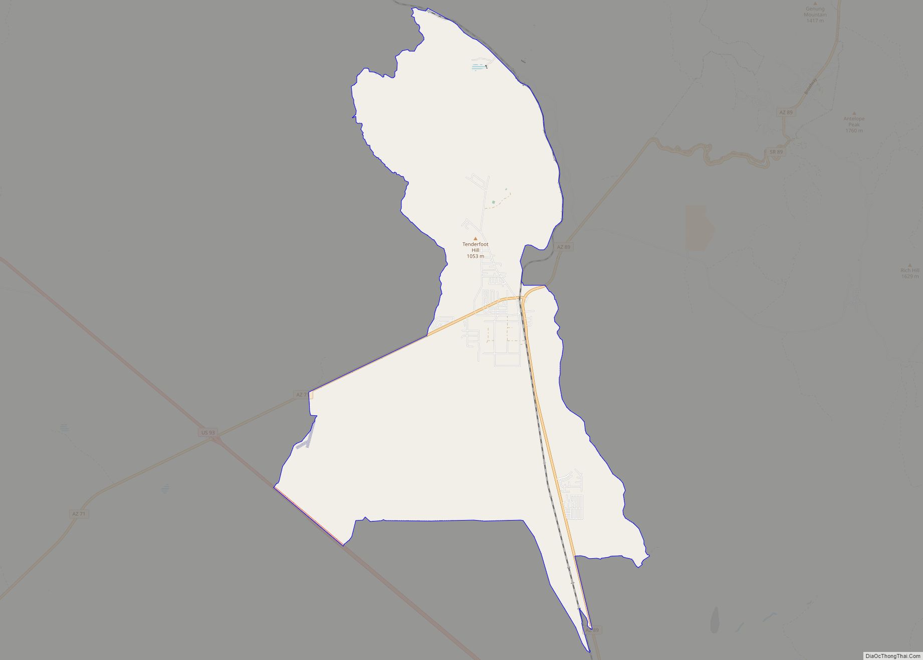
Online Interactive Map
Click on ![]() to view map in "full screen" mode.
to view map in "full screen" mode.
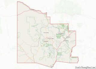
Ash Fork location map. Where is Ash Fork CDP?


History
Ash Fork has proclaimed itself “The Flagstone Capital of the World”, due to the large number of stone quarries and stone yards in and around the town. The title of “Flagstone Capital of the World,” was bestowed upon Ash Fork by the Ash Fork Development Association and Ash Fork Historical Society. The title was officially bestowed upon the town in 2014 by the Arizona House of Representatives with the passage of H.R. 2001.
The community was established as a siding of the Atlantic and Pacific Railroad, later known as the Santa Fe Railroad, in October 1882. It was purportedly named in 1883 by F.W. Smith, general superintendent of the railroad, in reference to a thicket of ash trees at the site. The first official post office was established on April 12, 1883, with one Henry W. Kline serving as the first Postmaster. Following an uncontrollable fire in 1885, the entire town of Ash Fork burned in 1893, and was rebuilt on the opposite side of the railroad tracks from its original location, where it remains today.
In later years, Ash Fork was the location of the Escalante, a large hotel and “Harvey House” built in 1907 and closed in 1948, operated by the Fred Harvey Company. Ash Fork’s convenient location along the railway and later famous U.S. Route 66 made it recognizable to many cross-country travelers, as evidenced by its fleeting mention in several films from the era of classical Hollywood cinema such as 1947’s Dark Passage, starring Humphrey Bogart and Lauren Bacall.
U.S. Route 66 provided a slight boost to the town’s economy in the 1950s, but construction of the divided highway through the town resulted in the destruction of many of the storefronts, sidewalks, and residential streets, forever altering the aesthetic qualities of the downtown area. When the Santa Fe Railroad moved its main line north and away from the town in 1960, Ash Fork lost nearly half its population, as most families employed by the railway were forced to leave the area.
Another large fire, known locally as the “Big Fire”, devastated the community on November 20, 1977, destroying most of the downtown businesses. When I-40 bypassed the town soon after, drastically reducing traffic on Route 66, the local economy never fully recovered. The community’s last major fire occurred on October 7, 1987, destroying nearly all the remaining buildings along the two-block business district located on the south side of Route 66.
Part of what was once Route 66 still runs directly through Ash Fork, though as a divided highway, with Park Avenue running east and Lewis Avenue running west, both serving as a main thoroughfare. Historic buildings, including a false-front structure and old railroad company houses can be seen along these streets. The majority of the town’s limited commercial establishments, including the Oasis Lounge and the Ranch House Cafe, can be found along Park Avenue. The Ash Fork Post Office is also located on this street.
Certain areas of the town were selected to be used as sets in the filming of 1992’s Universal Soldier, supposedly due to the extremely low purchase price and poor condition of several buildings, including an old motel, which were blown up for cinematic effect.
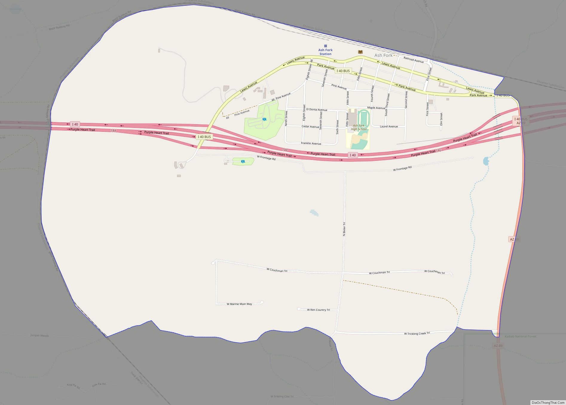
Ash Fork Road Map
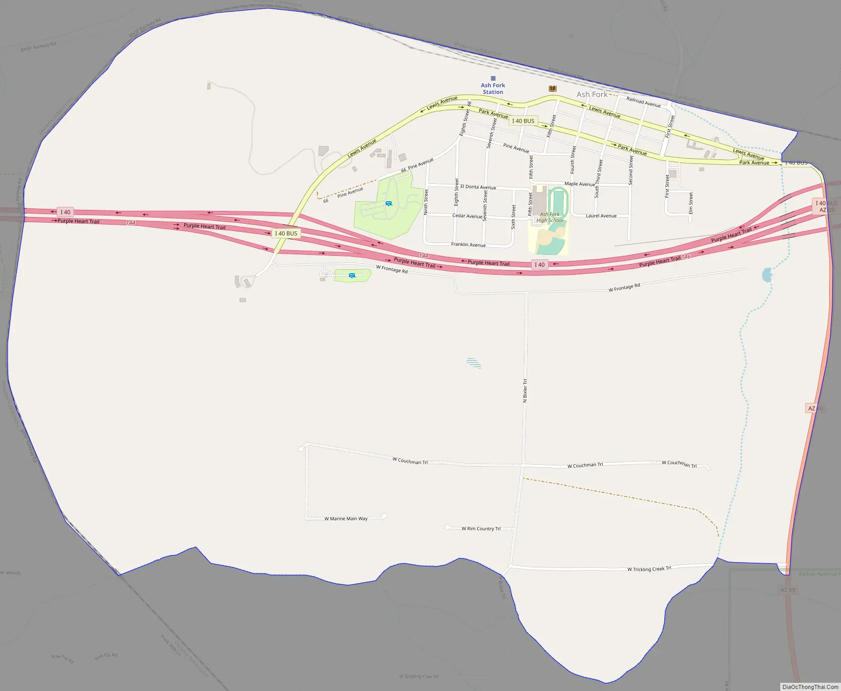
Ash Fork city Satellite Map

Geography
According to the United States Census Bureau, the CDP has a total area of 2.3 sq mi (6.0 km), all land.
Geologic places of interest include the Cathedral Caves, which are about 10 miles (16 km) west of town off Arizona Road, and Dante’s Descent, a 275-foot (84 m) -deep sinkhole also known as “Devil’s Hole”, which is around 5 miles northwest of Ash Fork, off Crookton Road. After its closing by the state, however, Dante’s Descent cannot legally be visited by the public. Pictorial and historic documentation of the natural attraction may be found at the Ash Fork Library.
Ash Fork lies near Kaibab National Forest and Coconino National Forest, and international attractions such as the Grand Canyon are roughly an hour’s drive away using major roads. Service roads allow swifter access to back areas of Grand Canyon National Park, but may not be open to public thoroughfare.
Approximately 15 miles (24 km) to the north of Ash Fork is Beale Road, which has the distinction of being the first federally funded highway. The internationally renowned U.S. Route 66 also runs directly through the town. Notably, the longest original, uninterrupted stretch of Route 66 still in existence (about 9.6 miles (15.4 km) long) can be found between Ash Fork and Seligman, Arizona, beginning just beyond Ash Fork at Crookton Road. The surrounding geographical area and settlements served as inspiration for the 2006 Pixar film Cars.
See also
Map of Arizona State and its subdivision: Map of other states:- Alabama
- Alaska
- Arizona
- Arkansas
- California
- Colorado
- Connecticut
- Delaware
- District of Columbia
- Florida
- Georgia
- Hawaii
- Idaho
- Illinois
- Indiana
- Iowa
- Kansas
- Kentucky
- Louisiana
- Maine
- Maryland
- Massachusetts
- Michigan
- Minnesota
- Mississippi
- Missouri
- Montana
- Nebraska
- Nevada
- New Hampshire
- New Jersey
- New Mexico
- New York
- North Carolina
- North Dakota
- Ohio
- Oklahoma
- Oregon
- Pennsylvania
- Rhode Island
- South Carolina
- South Dakota
- Tennessee
- Texas
- Utah
- Vermont
- Virginia
- Washington
- West Virginia
- Wisconsin
- Wyoming