Eagar is a town in Apache County, Arizona, United States. As of the 2010 census, the population of the town was 4,885.
The area was the home of the Apache people. The town of Eagar was first settled by European Americans in 1871.
| Name: | Eagar town |
|---|---|
| LSAD Code: | 43 |
| LSAD Description: | town (suffix) |
| State: | Arizona |
| County: | Apache County |
| Elevation: | 7,080 ft (2,158 m) |
| Total Area: | 11.59 sq mi (30.02 km²) |
| Land Area: | 11.58 sq mi (30.00 km²) |
| Water Area: | 0.01 sq mi (0.02 km²) |
| Total Population: | 4,395 |
| Population Density: | 379.40/sq mi (146.49/km²) |
| ZIP code: | 85925 |
| Area code: | 928 |
| FIPS code: | 0420960 |
| GNISfeature ID: | 28719 |
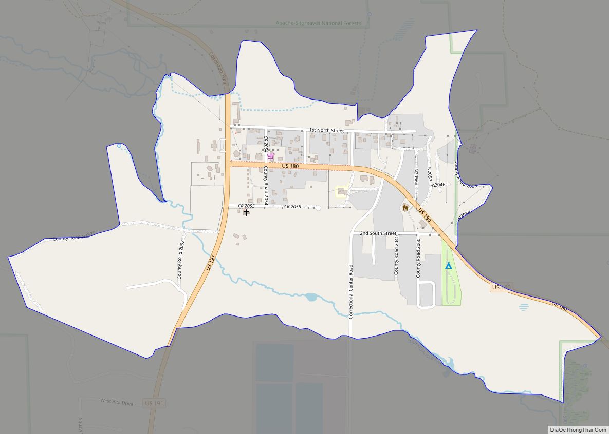
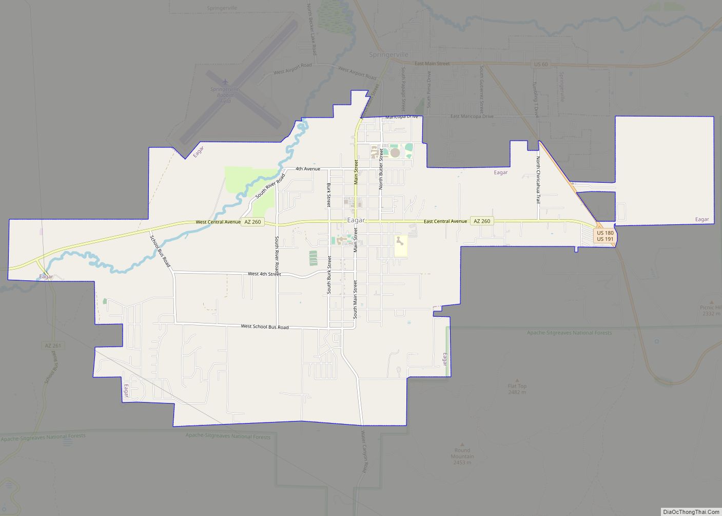
Online Interactive Map
Click on ![]() to view map in "full screen" mode.
to view map in "full screen" mode.
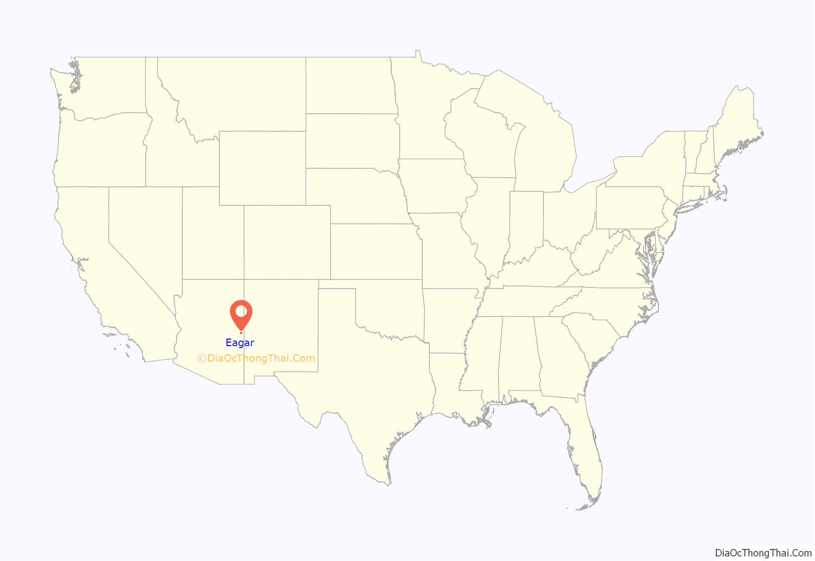
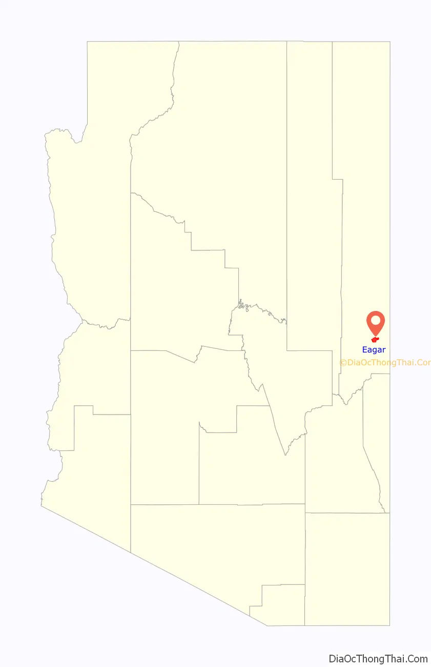
Eagar location map. Where is Eagar town?
History
Brothers William Walter John Thomas and Joel Sixtus settled the area under the direction of The Mormon prophet Brigham Young. They each acquired 160 acres of land under the homestead act. Once they received the deeds to their properties, again under the direction of Brigham Young, they each subdivided their properties to sell at a discounted rate to other church members who were also settling the area.
The first postmistress, Emma Goldsbrough Udall, wanted to name the town “Union”, in a desire for eventually combining the town with other towns such as Amity and Springerville, to unite the small community. However, the US postmaster general rejected the name as too common. Therefore, she submitted the name “Eagarville” to honor the Eagar brothers. However, that name was also changed by the postmaster general to just “Eagar” sometime before December 1892 when the school district was renamed.
A battle took place near what is now the town cemetery in which 9 members of the Snyder gang were killed.
The town of Eagar was incorporated in 1948.
Eagar Road Map
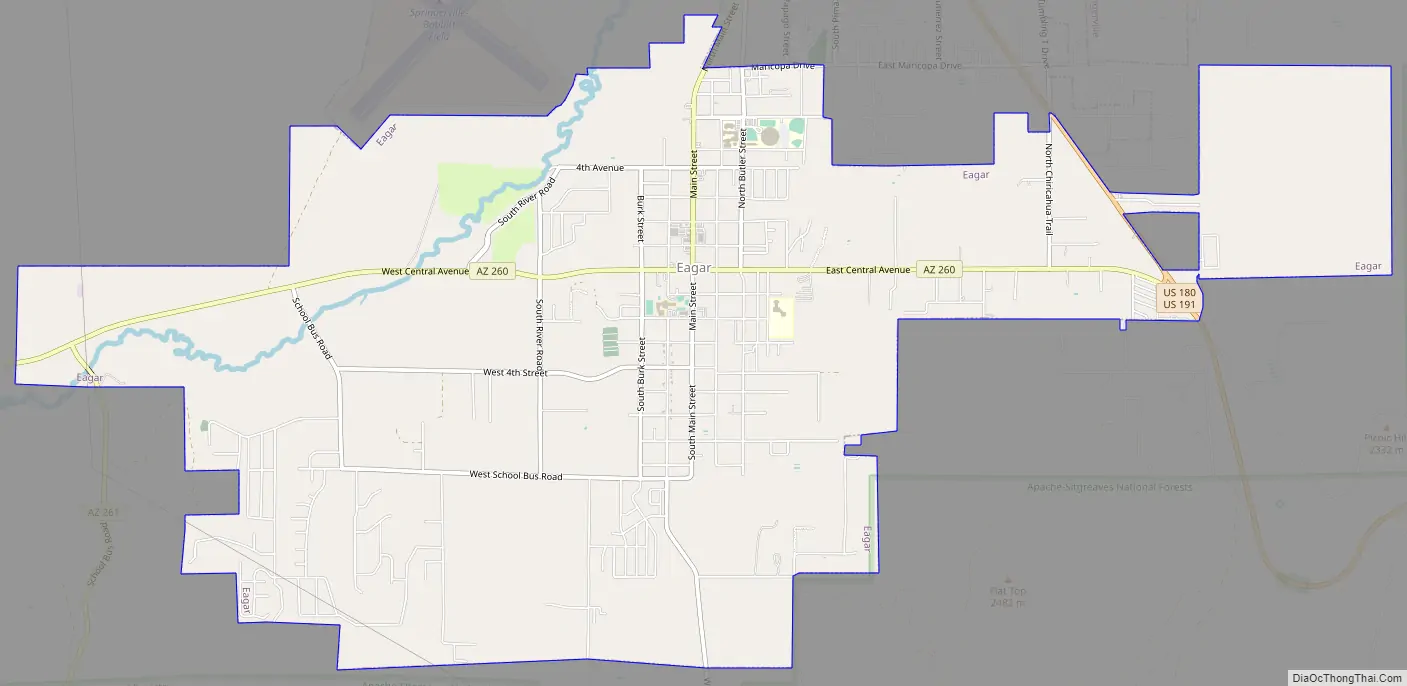
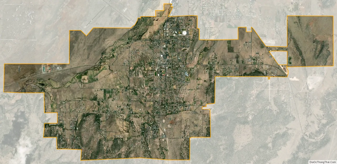
Eagar city Satellite Map
Geography
Eagar is located in southern Apache County, just north of Apache National Forest and at the foot of the White Mountains.
According to the United States Census Bureau, the town has a total area of 11.2 square miles (29.1 km), of which 0.008 square miles (0.02 km), or 0.07%, is water. The town of Springerville borders Eagar to the north.
Climate
This region experiences warm (but not hot) and dry summers, with no average monthly temperatures above 71.6 °F. According to the Köppen Climate Classification system, Eagar has a warm-summer Mediterranean climate, abbreviated “Csb” on climate maps.
See also
Map of Arizona State and its subdivision: Map of other states:- Alabama
- Alaska
- Arizona
- Arkansas
- California
- Colorado
- Connecticut
- Delaware
- District of Columbia
- Florida
- Georgia
- Hawaii
- Idaho
- Illinois
- Indiana
- Iowa
- Kansas
- Kentucky
- Louisiana
- Maine
- Maryland
- Massachusetts
- Michigan
- Minnesota
- Mississippi
- Missouri
- Montana
- Nebraska
- Nevada
- New Hampshire
- New Jersey
- New Mexico
- New York
- North Carolina
- North Dakota
- Ohio
- Oklahoma
- Oregon
- Pennsylvania
- Rhode Island
- South Carolina
- South Dakota
- Tennessee
- Texas
- Utah
- Vermont
- Virginia
- Washington
- West Virginia
- Wisconsin
- Wyoming