Grand Canyon West is a census-designated place (CDP) in Mohave County, Arizona, United States, located on the Hualapai Reservation. The population was reported as 0 at the 2020 census. Grand Canyon West is home to the tribe’s Grand Canyon business operations, including the Grand Canyon West Airport and the Grand Canyon Skywalk. Typically, they are open from 8:00 a.m. – 6:00 p.m., including all holidays.
| Name: | Grand Canyon West CDP |
|---|---|
| LSAD Code: | 57 |
| LSAD Description: | CDP (suffix) |
| State: | Arizona |
| County: | Mohave County |
| Elevation: | 4,737 ft (1,444 m) |
| Total Area: | 17.60 sq mi (45.59 km²) |
| Land Area: | 17.19 sq mi (44.52 km²) |
| Water Area: | 0.41 sq mi (1.07 km²) |
| Total Population: | 0 |
| Population Density: | 0.00/sq mi (0.00/km²) |
| Area code: | 928 |
| FIPS code: | 0428985 |
| GNISfeature ID: | 2582791 |
| Website: | grandcanyonwest.com |
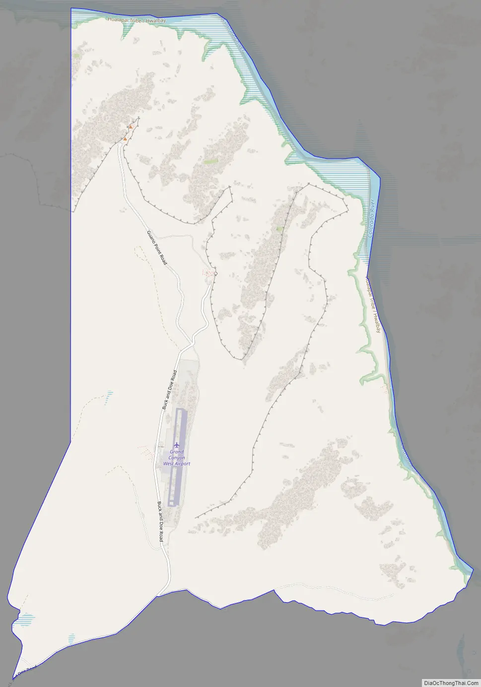
Online Interactive Map
Click on ![]() to view map in "full screen" mode.
to view map in "full screen" mode.
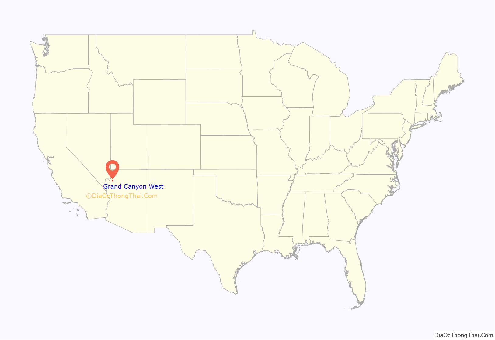
Grand Canyon West location map. Where is Grand Canyon West CDP?
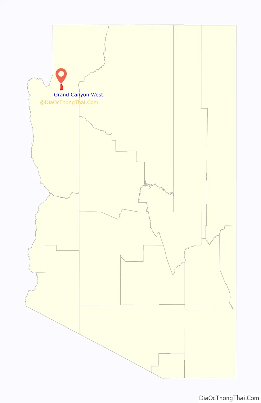
Grand Canyon West Road Map
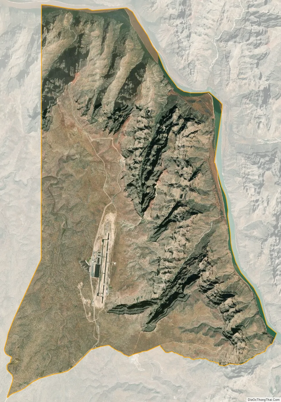
Grand Canyon West city Satellite Map
Geography
Grand Canyon West is located in northern Mohave County at 35°59′59″N 114°48′37″W / 35.99972°N 114.81028°W / 35.99972; -114.81028 (35.999787, -113.810249). The CDP sits on the west side (equivalent to the South Rim) of the Grand Canyon at an elevation of 4,700 to 4,800 feet (1,400 to 1,500 m). The CDP extends east into the canyon as far as the Colorado River, at an elevation of 1,200 feet (370 m). The CDP is served by Diamond Bar Road, which leads southwest 20 miles (32 km) to County Highway 25 near Meadview. According to the United States Census Bureau, the CDP has a total area of 17.6 square miles (46 km), 17.19 square miles (44.5 km) of that being land, with the remaining 0.41 square miles (1.1 km) consisting of water.
See also
Map of Arizona State and its subdivision: Map of other states:- Alabama
- Alaska
- Arizona
- Arkansas
- California
- Colorado
- Connecticut
- Delaware
- District of Columbia
- Florida
- Georgia
- Hawaii
- Idaho
- Illinois
- Indiana
- Iowa
- Kansas
- Kentucky
- Louisiana
- Maine
- Maryland
- Massachusetts
- Michigan
- Minnesota
- Mississippi
- Missouri
- Montana
- Nebraska
- Nevada
- New Hampshire
- New Jersey
- New Mexico
- New York
- North Carolina
- North Dakota
- Ohio
- Oklahoma
- Oregon
- Pennsylvania
- Rhode Island
- South Carolina
- South Dakota
- Tennessee
- Texas
- Utah
- Vermont
- Virginia
- Washington
- West Virginia
- Wisconsin
- Wyoming


