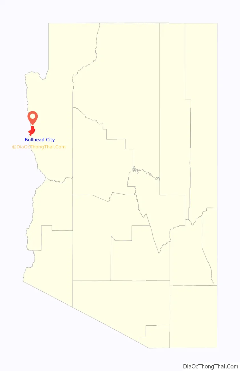
Bullhead City is a city located on the Colorado River in Mohave County, Arizona, United States, 97 miles (156 km) south of Las Vegas, Nevada, and directly across the Colorado River from Laughlin, Nevada, whose casinos and ancillary services supply much of the employment for Bullhead City. Bullhead City is located at the southern end of Lake Mohave.
As of the 2020 census, the population of Bullhead City was 41,348. The nearby communities of Laughlin, Needles, California, Fort Mohave and Mohave Valley bring the Bullhead area’s total population to over 77,000, making it the largest economic region in Mohave County.
With over 60 square miles (160 km), Bullhead City is the largest city in Mohave County in terms of total land area.
In 2011, the Laughlin/Bullhead International Airport was named Airport of the Year by the Arizona Department of Transportation. “More than 115,000 people flew into Laughlin/Bullhead International Airport on casino-sponsored charters in 2010.” In the 1980s the airport was home to the helicopters of the TV show Airwolf.
Feeding homeless people in parks is banned in Bullhead City. In 2022, in an incident described internationally as “criminalizing kindness”, 78-year-old local resident Norma Thornton was arrested and accused of violating an ordinance against sharing food for “charitable purposes” at public parks. The charges were later dropped in July. But the Arizona grandmother said she was warned that if she began sharing food in the park again, she would go to jail.
| Name: | Bullhead City city |
|---|---|
| LSAD Code: | 25 |
| LSAD Description: | city (suffix) |
| State: | Arizona |
| County: | Mohave County |
| Incorporated: | 1984 |
| Elevation: | 540 ft (165 m) |
| Total Area: | 60.15 sq mi (155.79 km²) |
| Land Area: | 59.37 sq mi (153.77 km²) |
| Water Area: | 0.78 sq mi (2.02 km²) |
| Total Population: | 41,348 |
| Population Density: | 696.41/sq mi (268.89/km²) |
| Area code: | 928 |
| FIPS code: | 0408220 |
| GNISfeature ID: | 2409936 |
| Website: | www.bullheadcity.com |
Online Interactive Map
Click on ![]() to view map in "full screen" mode.
to view map in "full screen" mode.
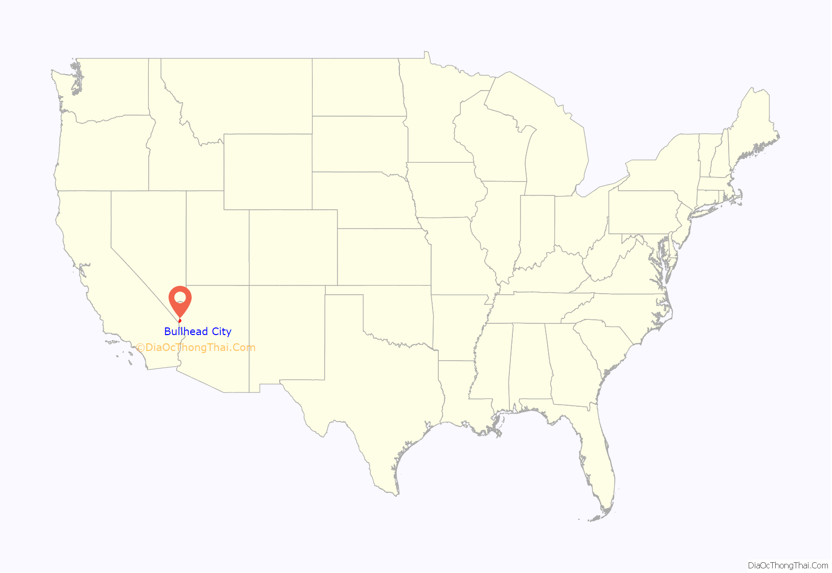
Bullhead City location map. Where is Bullhead City city?
History
The earliest inhabitants of the Colorado River Valley were the Mojave people. The rich soil and plentiful water provided the valley’s natives with the necessities to create a prosperous farming community. According to Mojave legend, life began on Spirit Mountain, the highest peak visible from the Bullhead City area.
The first account of European contact was with Spanish explorer Melchor Díaz, who in 1540 documented his travels in what is now northwestern Mohave County. He recounts meeting a large population of natives who referred to themselves as the Pipa Aha Macav, meaning “People by the River”. From “Aha Macav” came the shortened name “Mojave” (also spelled “Mohave”). While Mohave County uses the modern English spelling, the tribe retains the traditional Spanish spelling “Mojave”. Both are correct, and both are pronounced “Moh-hah-vee”.
Father Francisco Garces, a Franciscan missionary and explorer, crossed the Colorado River in the Bullhead City area in 1774.
Hardyville
In March 1864, the current site of Bullhead City was the location of a settlement called “Hardyville”. It was named for early resident and politician William Harrison Hardy. A New York native and an entrepreneur, Hardy established, with the support of George Alonzo Johnson’s steamboat company, a ferry service and steamboat landing where the Mojave Road crossed the Colorado River. He also built and owned the Hardyville–Prescott Road, a toll road from Hardyville to the new Arizona territorial capital of Prescott, and raised Angora goats. He was a colorful and somewhat controversial figure. He was the town’s first postmaster from January 17, 1865, and is credited with the invention of the riveted mail sack. He was also a Mohave County supervisor and a member of the Arizona Territorial Legislature. In 1864 his personal worth was over $40,000, making him the second-richest man in Arizona.
From 1864 to 1883, steamboats made regular trips up the Colorado River from Port Isabel in Mexico and, after the arrival of the railroad from Yuma, Arizona, stopping at Hardyville regularly to deliver supplies to the mines of the surrounding mining districts and those to the east in the interior of Arizona and carry out their ore for processing and sale. These stern-wheeler riverboats played an important part in the early development of the areas bordering the Colorado River, and Hardyville was considered the low water limit of navigation for the steamboats. Steamboat travel above that point to places in like El Dorado Canyon, Callville and later Rioville was possible only during the few months of the late spring to early summer flood caused by snowmelt in the upper Colorado River watershed. Hardyville was the starting point for wagon roads and pack trails to the mines and other settlements in the upper region of the river. It was also the port for flatboats that ascended the river as far as Callville in the extreme low water time of the year.
In April 1866, Brevet Brigadier General James Fowler Rusling visited the settlement and described it:
Hardyville received a boost in 1867, when it became the county seat of Mohave County and the mills at Eldorado Canyon began operating, stimulating trade up river again. Hardyville had a population of 20 in 1870. The 1870s saw a population boom in Hardyville as mining became more profitable. With the end of hostilities with the Native Americans in Mohave County, mines in the interior boomed again, and the small town later grew with the construction of a general store, a saloon, a blacksmith shop, a billiard hall, and a respectable public hall.
However, in 1873, the county seat was moved to the mining boomtown of Cerbat. In 1877, the Southern Pacific Railroad arrived at Yuma. It bought out Johnson’s Colorado Steam Navigation Company, and by 1878 had built rails into Maricopaville, resulting in wagon traffic moving to that railhead that was closer to the mines in the northern interior than Hardyville. Traffic on the road to the interior mines of the east from Hardyville waned except for that to Cerbat, Mineral Park, and Chloride. In May 1881, Issac Polhamus, captain of one of the Southern Pacific-owned Colorado Steam Navigation Company steamboats, went into competition with Hardy for the trade to those mines, establishing Polhamus Landing, a rival landing five miles up river, closer to the mines, taking away most of its river trade. Worse yet, the construction of the Atlantic and Pacific Railroad to its bridge crossing on the Colorado River near Needles, in May 1883, saw the remaining interior mining trade move away from the Colorado River and Hardyville. The Hardyville post office was discontinued in favor of the one in Mohave City on February 19, 1883. As the silver price declined in the late 1880s and early 1890s, the Hardyville mill, its only remaining economic resource, became idle and the remaining population of the town left, leaving it to become a ghost town. Hardyville still appears with that name on a September 1911 reprint of a U.S. Geological Survey Reconnaissance Map, Arizona, Nevada, California, Camp Mohave Sheet, Edition of March 1892.
Hardyville Pioneer Cemetery, a small cemetery, now a historic landmark at 35°7′16″N 114°35′17″W / 35.12111°N 114.58806°W / 35.12111; -114.58806, is the most significant existing remnant of Hardyville. An unofficial historical marker for the town is in the parking lot across Highway 95 from the cemetery at 35°7′16″N 114°35′17″W / 35.12111°N 114.58806°W / 35.12111; -114.58806. The Hardyville Mill ruins appeared on a USGS topographic map, at 35°7′14″N 114°34′47″W / 35.12056°N 114.57972°W / 35.12056; -114.57972.
Bullhead City
Decades later, Hardyville would be resurrected as Bullhead City with the construction of Davis Dam between 1942 and 1953. The dam was originally called Bullhead Dam after “Bull’s Head Rock”, a well-known rock formation along the Colorado River. Steamboats on the river used the rock as a navigation point. After the construction of Davis Dam, the water level rose and now almost completely covers the landmark. The community that arose during the construction of Bullhead Dam was nicknamed Bullhead. Bullhead City became the headquarters for the construction project, which was completed in 1953. Thus the name Bullhead City was born. As the nearby Lake Mohave developed into a major tourism destination, and as the casino and resort town of Laughlin, Nevada, sprouted up across the river, Bullhead City grew rapidly.
In 1970, Bullhead City was the name of the six blocks that ran north–south along Highway 95 across the river from Don Laughlin’s casino. About a thousand people lived in the original Bullhead City at that time, with about 3,000 people in Riviera. In 1984, the small communities of Bullhead City, Riviera, and Holiday Shores voted to incorporate, choosing the name “Bullhead City” for its historical significance.
Bullhead City and the neighboring town of Laughlin, Nevada, have grown in popularity as tourist destinations, and so has the population. Today, tourism is by far the main economy in Bullhead City. In the summer months, tourists from all over come for water recreation on Lake Mohave and the Colorado River. Starting in the fall, tourists from colder states flock by the thousands in their motor homes because of the mild winters.
Bullhead City is home to an international airport, two full-service hospitals, and a community college. The city has a stabilizing housing market. It also serves as the shopping hub of the tri-state area.
Bullhead City Road Map

Bullhead City city Satellite Map

Geography
Bullhead City is in western Mohave County on the east side of the Colorado River, which forms the Arizona–Nevada state line. It is 34 miles (55 km) west of Kingman, the Mohave county seat, 22 miles (35 km) north of Needles, California, 97 miles (156 km) south of Las Vegas, Nevada, and 216 miles (348 km) northwest of Phoenix. According to the United States Census Bureau, Bullhead City has a total area of 60.2 square miles (156 km), of which 59.4 sq mi (154 km) are land and 0.8 sq mi (2.1 km), or 1.30%, are water.
See also
Map of Arizona State and its subdivision: Map of other states:- Alabama
- Alaska
- Arizona
- Arkansas
- California
- Colorado
- Connecticut
- Delaware
- District of Columbia
- Florida
- Georgia
- Hawaii
- Idaho
- Illinois
- Indiana
- Iowa
- Kansas
- Kentucky
- Louisiana
- Maine
- Maryland
- Massachusetts
- Michigan
- Minnesota
- Mississippi
- Missouri
- Montana
- Nebraska
- Nevada
- New Hampshire
- New Jersey
- New Mexico
- New York
- North Carolina
- North Dakota
- Ohio
- Oklahoma
- Oregon
- Pennsylvania
- Rhode Island
- South Carolina
- South Dakota
- Tennessee
- Texas
- Utah
- Vermont
- Virginia
- Washington
- West Virginia
- Wisconsin
- Wyoming


