Holbrook (Navajo: Tʼiisyaakin) is a city in Navajo County, Arizona, United States. According to the 2010 census, the population of the city was 5,053. The city is the county seat of Navajo County.
Holbrook was founded in 1881 or 1882, when the railroad was built, and named to honor the first chief engineer of the Atlantic and Pacific Railroad, Henry Randolph Holbrook.
| Name: | Holbrook city |
|---|---|
| LSAD Code: | 25 |
| LSAD Description: | city (suffix) |
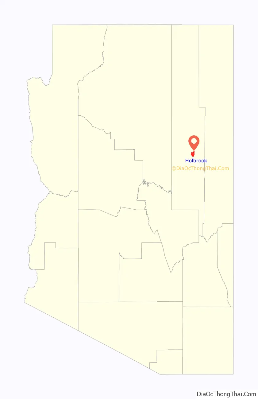
| State: | Arizona |
| County: | Navajo County |
| Incorporated: | 1917 |
| Elevation: | 5,082 ft (1,549 m) |
| Total Area: | 17.37 sq mi (44.99 km²) |
| Land Area: | 17.34 sq mi (44.92 km²) |
| Water Area: | 0.03 sq mi (0.07 km²) |
| Total Population: | 4,858 |
| Population Density: | 280.10/sq mi (108.15/km²) |
| ZIP code: | 86025 |
| Area code: | 928 |
| FIPS code: | 0433280 |
| Website: | www.ci.holbrook.az.us |
Online Interactive Map
Click on ![]() to view map in "full screen" mode.
to view map in "full screen" mode.
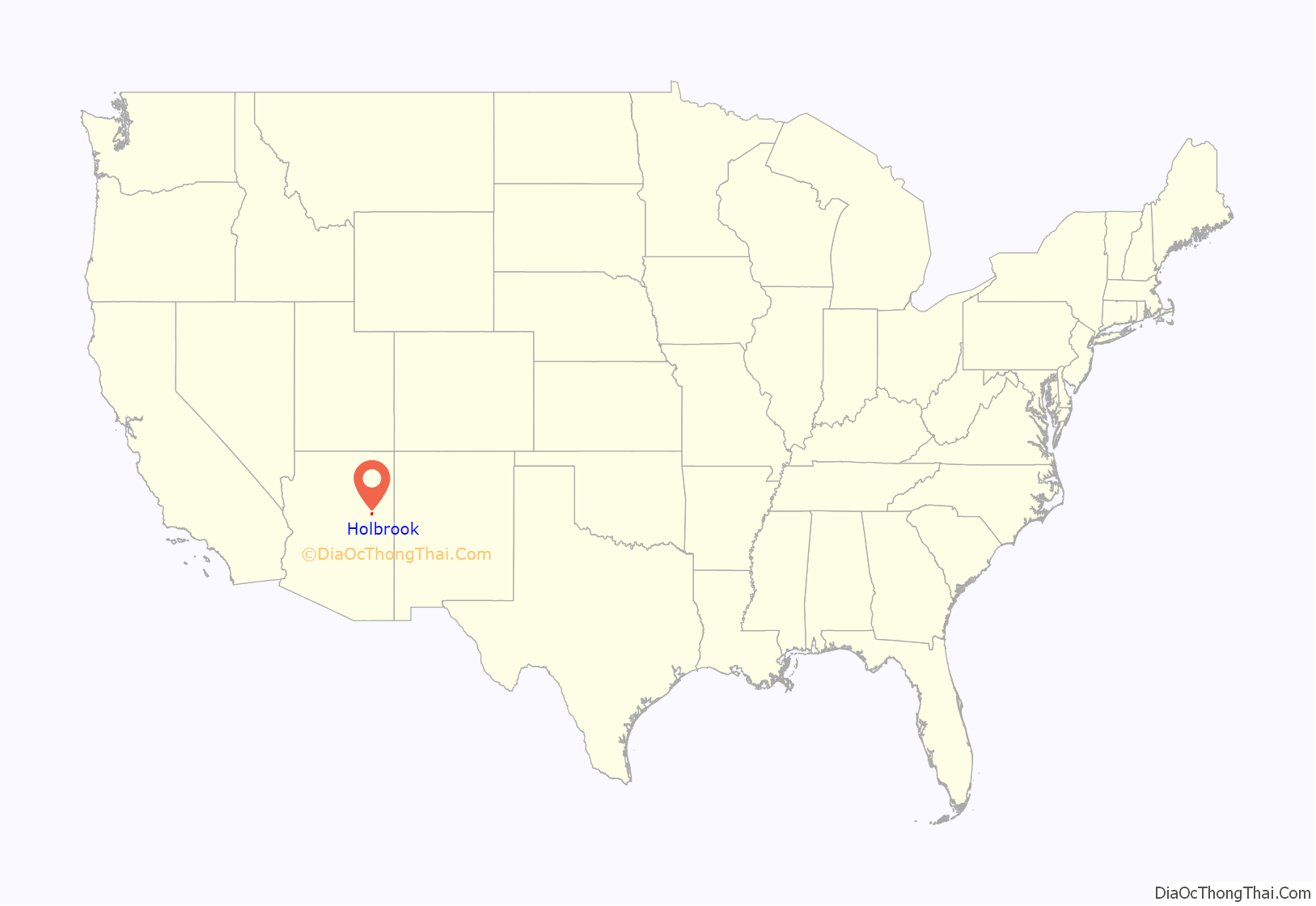
Holbrook location map. Where is Holbrook city?
History
The Holbrook area was inhabited first by the Ancestral Puebloans, then Puebloans, then the Navajo and Apache. In 1540 (some seventy years before Jamestown or the Pilgrims) Coronado searched for the Seven Cities of Cibola and camped some 60 miles east of Holbrook. Coronado sent an expedition west to find the Colorado River, and they crossed the Little Colorado some twenty-five miles east of Holbrook and found a wonderland of colors they named “El Desierto Pintada” – The Painted Desert. The expedition was then led by the Hopis to the Grand Canyon.
U.S. settlements
After the Mexican–American War ended in 1848 the area was ceded to the United States. From 1851 to 1857 the U.S. Army sent three expeditions along the 35th parallel, the third led by Lt. Beale who created a ten foot wide wagon road. The area was known as Navajo Springs, after a spring a dozen miles northeast of Holbrook. Soon afterwards a store and saloon were established at the confluence of the Rio Puerco and Little Colorado Rivers two miles east of Holbrook, and the area became known as Horsehead Crossing.
In 1876, Mormon emigrated from Utah and began settlements near Horsehead Crossing on both the Little Colorado and Rio Puerco rivers. During 1881 and 1882, railroad tracks were laid down and a railroad station was built to supply wood and water and to freight supplies south to Fort Apache. The community was then named Holbrook after the first engineer of the Atlantic and Pacific Railroad. The railroad sold a million acres to a Boston investment group which established the Aztec Land and Cattle Company, better known as the Hashknife Outfit. It leased another million acres of government land and became one of the largest cattle ranches to ever exist. Holbrook became its headquarters and quickly grew into a cow-town.
Wild west cow-town
The Hashknife Outfit hired cowboys, many of whom were wanted men hiding from arrest. Rustling of cattle and horses over two million acres plagued the Hashknife Outfit. With cowmen, sheepmen, farmers, rustlers and outlaws competing for the same land, a range war ensued, called both the Pleasant Valley War and the Tonto Basin War. It likely killed as many men as any of the western range wars. Many of the events that played out during the Pleasant Valley War up to 1887 occurred in and around Holbrook, including the famous Holbrook Shootout.
Holbrook shootout
On September 4, 1887, Commodore Perry Owens, the Apache County Sheriff, came to Holbrook to arrest Andy Blevins, a.k.a. Andy Cooper, for horse theft. Blevins had also recently bragged about killing two men and had killed many more, including two lawmen.
Sheriff Owens insisted on confronting the Blevins brothers alone, knowing there would likely be a shootout. He went to the Blevins’ house, which still stands, knocked on the door, and when Blevins asked what he wanted, announced he’d come to arrest him. Blevins resisted arrest and a shootout occurred. Blevins, two brothers, a friend, and Blevins’ horse were shot; all died, except one brother.
Owens emerged unscathed, despite being shot at from a half-dozen feet away. Owens single-handedly taking on four men made him a western legend rivaling the Earp Brothers and Texas John Slaughter as lawmen of the Old West.
Later development
Holbrook was known as “the town too tough for women and churches” and in 1914 was said to be the only county seat in the U.S. that didn’t have a church (the Mormons had moved 25 miles (40 km) south to Snowflake and Taylor). The original railroad station was replaced by the Santa Fe Depot in 1892.
Navajo County was divided off of Apache County in 1895 and Holbrook became the county seat. Many lawmen and cowboys from the area became Rough Riders with Theodore Roosevelt in the late 1800s. But by 1902, The Hashknife Outfit was bankrupt and the land was sold to the Babbitt brothers.
President Roosevelt named the Petrified Forest (including part of the Painted Desert) a National Monument in 1906. Holbrook was incorporated in 1917. Most of the Beale Wagon Road became Route 66 in 1926 and passed through both the Petrified Forest and Holbrook. Tourism started taking over the economy.
Holbrook meteorite
Arizona is famous for its huge Meteor Crater, but Holbrook also witnessed its own small meteor event. In the evening of July 19, 1912, a smoke trail appeared in the sky and soon after, at 7:15 p.m., a meteorite with an estimated mass of 190 kilograms (419 pounds) exploded high in the atmosphere.
An estimated 16,000 or more minor fragments rained down over Navajo County in an area about 6 miles east of Holbrook. The primary explosion was heard at least 40 miles away and one of the witnesses in Holbrook, then 17-year-old Pauline McCleve, described the event as the loudest sound she ever heard. The largest piece of the Holbrook Meteorite that has been recovered was found shortly after. It weighs 14.5 pounds and resides at Arizona State University in Tempe.
The Holbrook meteorite was found to be of the chondrite (stony) type.
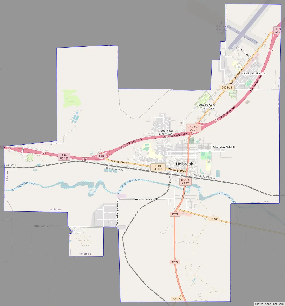
Holbrook Road Map
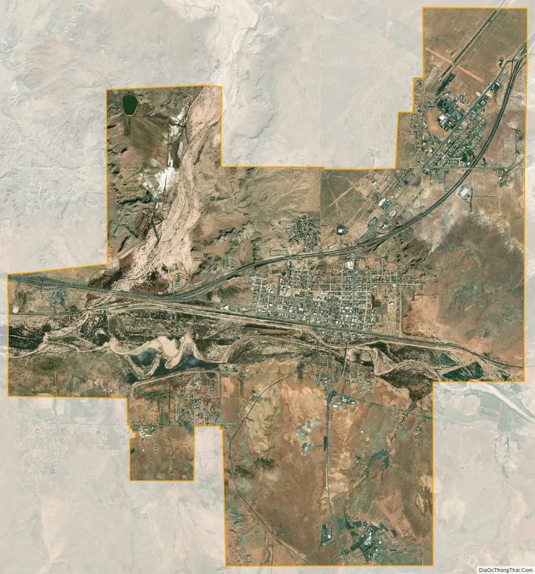
Holbrook city Satellite Map
Geography
Holbrook is located at 34°54′26″N 110°9′46″W / 34.90722°N 110.16278°W / 34.90722; -110.16278 (34.907203, -110.162882).
According to the United States Census Bureau, the city has a total area of 15.4 square miles (40 km), all land.
Climate
Holbrook has a cold desert climate (BWk) with cold to cool winters and hot summers. Although the mean snowfall is 0.16 metres (6.30 in), the median is zero, so the majority of winters do not have measurable snow. There are high diurnal temperature variations year-round.
See also
Map of Arizona State and its subdivision: Map of other states:- Alabama
- Alaska
- Arizona
- Arkansas
- California
- Colorado
- Connecticut
- Delaware
- District of Columbia
- Florida
- Georgia
- Hawaii
- Idaho
- Illinois
- Indiana
- Iowa
- Kansas
- Kentucky
- Louisiana
- Maine
- Maryland
- Massachusetts
- Michigan
- Minnesota
- Mississippi
- Missouri
- Montana
- Nebraska
- Nevada
- New Hampshire
- New Jersey
- New Mexico
- New York
- North Carolina
- North Dakota
- Ohio
- Oklahoma
- Oregon
- Pennsylvania
- Rhode Island
- South Carolina
- South Dakota
- Tennessee
- Texas
- Utah
- Vermont
- Virginia
- Washington
- West Virginia
- Wisconsin
- Wyoming