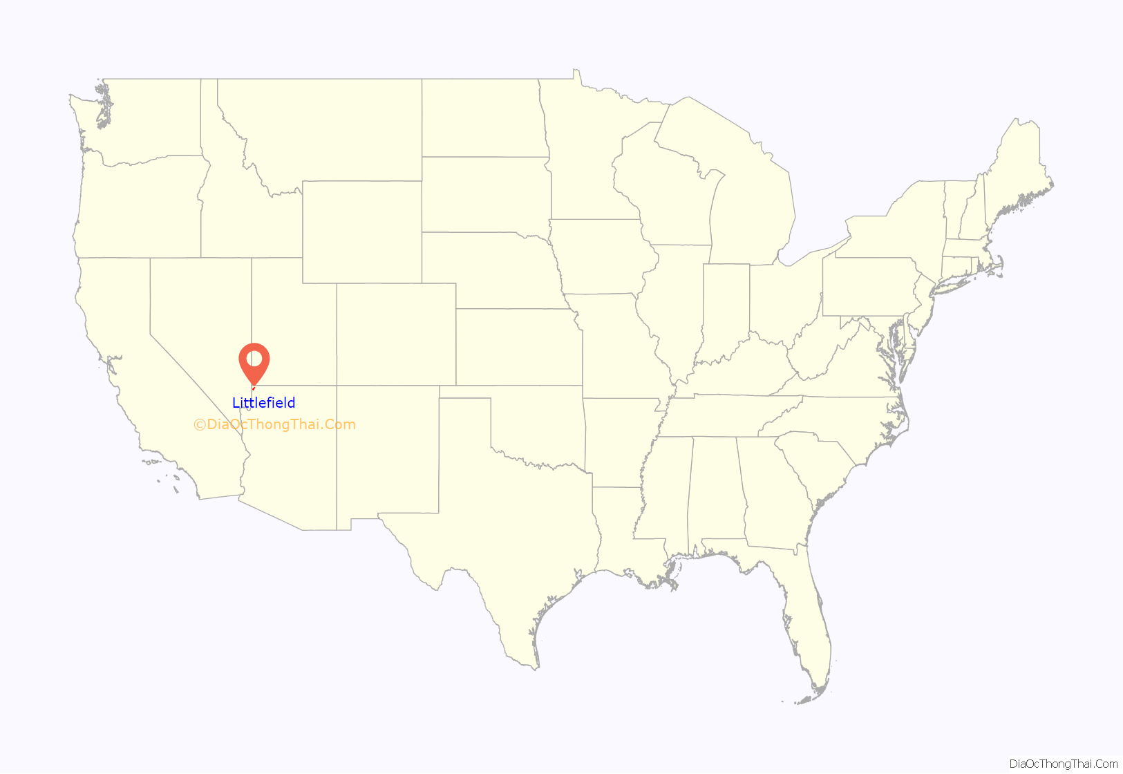
Littlefield is an unincorporated community and census-designated place in Mohave County, Arizona, United States, that is located in the Arizona Strip region. As of the 2020 census, its population was 256, down from 308 in 2010. It lies just south of Interstate 15, next to the Virgin River, approximately 10 miles (16 km) northeast of Mesquite, Nevada. Littlefield is located in the 86432 ZIP Code.
| Name: | Littlefield CDP |
|---|---|
| LSAD Code: | 57 |
| LSAD Description: | CDP (suffix) |
| State: | Arizona |
| County: | Mohave County |
| Founded: | 1865 |
| Elevation: | 1,850 ft (560 m) |
| Total Area: | 11.80 sq mi (30.55 km²) |
| Land Area: | 11.80 sq mi (30.55 km²) |
| Water Area: | 0.00 sq mi (0.00 km²) |
| Total Population: | 256 |
| Population Density: | 21.70/sq mi (8.38/km²) |
| ZIP code: | 86432 |
| FIPS code: | 0441470 |
| GNISfeature ID: | 7237 |
Online Interactive Map
Click on ![]() to view map in "full screen" mode.
to view map in "full screen" mode.
Littlefield location map. Where is Littlefield CDP?

History
Littlefield was first settled by Latter-day Saints, also known as Mormons, in 1865.
Littlefield is the former home of the Littlefield Unified School District, the geographically largest school district in Arizona. The only remnant of the school district in Littlefield itself is the historic adobe Littlefield Schoolhouse, currently under renovation.
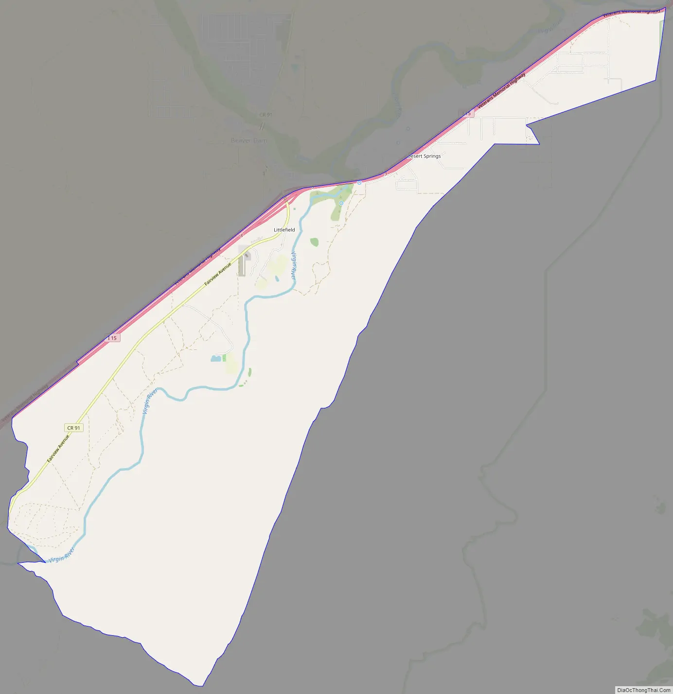
Littlefield Road Map
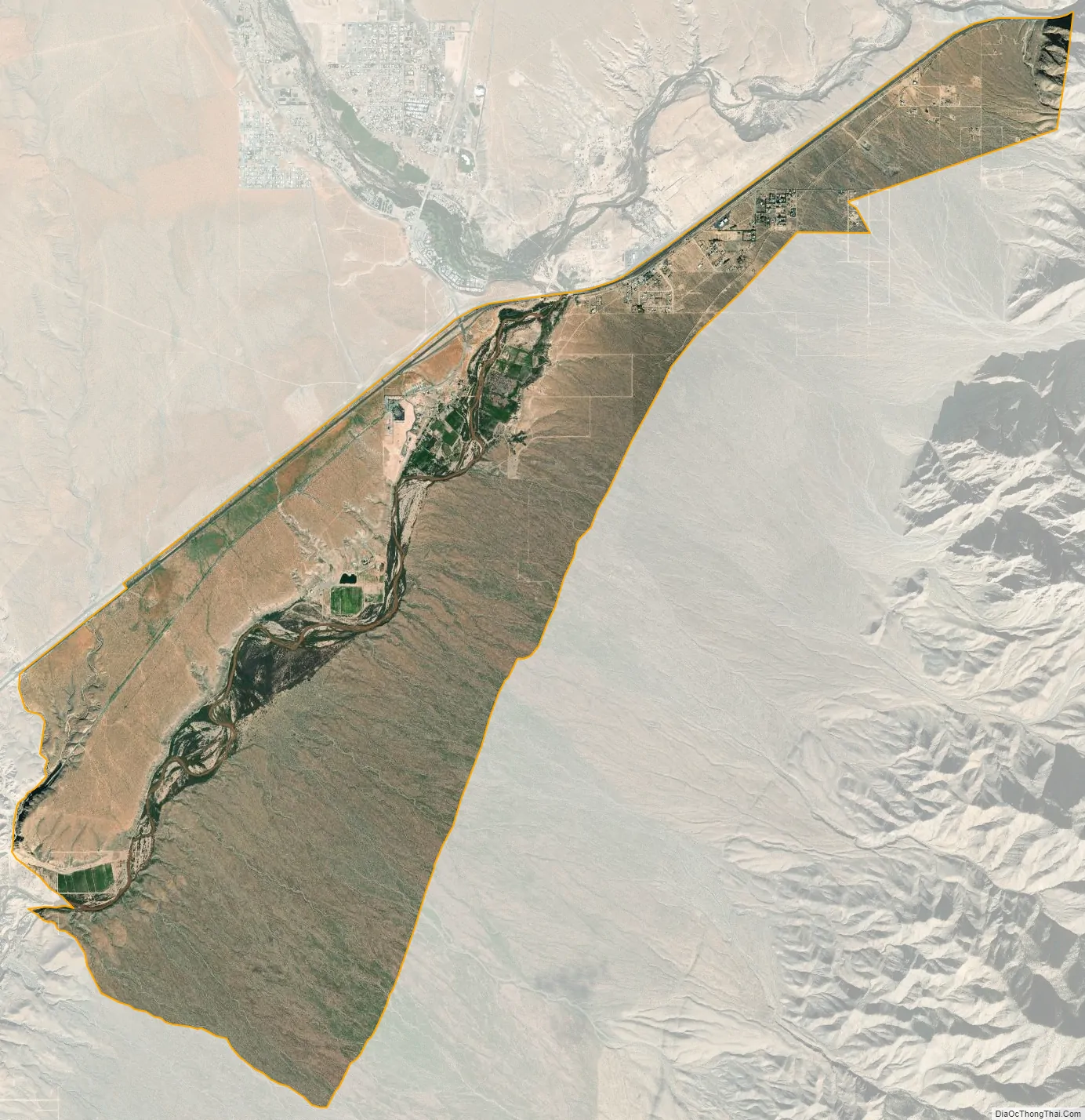
Littlefield city Satellite Map
Geography
Littlefield is in the northwest corner of Mohave County (and the state of Arizona), along Interstate 15, with access from Exit 8. It is bordered to the north, across I-15, by the community of Beaver Dam. I-15 leads southwest 10 miles (16 km) to Mesquite, Nevada, and 90 miles (140 km) to Las Vegas, while to the northeast the highway enters the Virgin River Gorge and leads 29 miles (47 km) to St. George, Utah.
Littlefield, Beaver Dam, and Scenic have the distinction of being the only towns in Arizona along I-15. Owing to its location in the Arizona Strip, northwest of Grand Canyon National Park and west of the Virgin River, it is isolated by hundreds of miles from the rest of the state. Travel to other towns within Arizona requires crossing through either Nevada or Utah, or driving on unpaved roads to the rest of Arizona’s road network.
See also
Map of Arizona State and its subdivision: Map of other states:- Alabama
- Alaska
- Arizona
- Arkansas
- California
- Colorado
- Connecticut
- Delaware
- District of Columbia
- Florida
- Georgia
- Hawaii
- Idaho
- Illinois
- Indiana
- Iowa
- Kansas
- Kentucky
- Louisiana
- Maine
- Maryland
- Massachusetts
- Michigan
- Minnesota
- Mississippi
- Missouri
- Montana
- Nebraska
- Nevada
- New Hampshire
- New Jersey
- New Mexico
- New York
- North Carolina
- North Dakota
- Ohio
- Oklahoma
- Oregon
- Pennsylvania
- Rhode Island
- South Carolina
- South Dakota
- Tennessee
- Texas
- Utah
- Vermont
- Virginia
- Washington
- West Virginia
- Wisconsin
- Wyoming


