Morenci is a census-designated place (CDP) and company town in Greenlee County, Arizona, United States, and was founded by the Detroit Copper Mining Company of Arizona. The population was 2000 at the 2000 census and 1,489 at the 2010 census. The biggest employer in Morenci (and in nearby Clifton) and the owner of the town is Freeport-McMoRan, the owner of the Morenci Mine, the largest copper mining operation in North America, and one of the largest copper mines in the world. The town was a site of the Arizona Copper Mine Strike of 1983. The large open-pit mine is north of the town.
| Name: | Morenci CDP |
|---|---|
| LSAD Code: | 57 |
| LSAD Description: | CDP (suffix) |
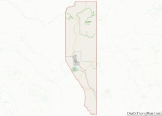
| State: | Arizona |
| County: | Greenlee County |
| Elevation: | 4,747 ft (1,447 m) |
| Total Area: | 0.93 sq mi (2.40 km²) |
| Land Area: | 0.91 sq mi (2.34 km²) |
| Water Area: | 0.02 sq mi (0.06 km²) |
| Total Population: | 2,028 |
| Population Density: | 2,240.88/sq mi (865.22/km²) |
| ZIP code: | 85540 |
| Area code: | 928 |
| FIPS code: | 0447610 |
| GNISfeature ID: | 0032021 |
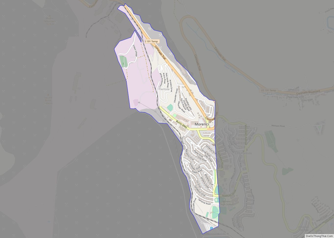
Online Interactive Map
Click on ![]() to view map in "full screen" mode.
to view map in "full screen" mode.
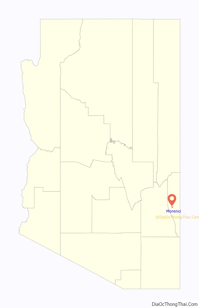
Morenci location map. Where is Morenci CDP?

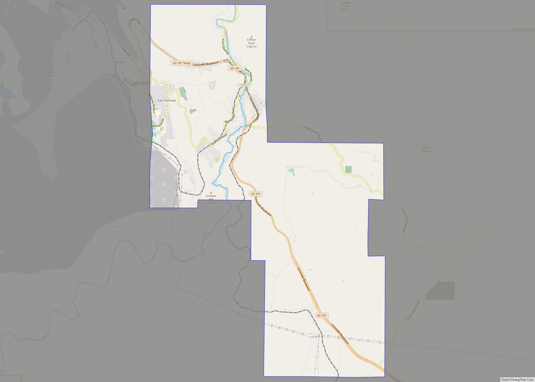
Morenci Road Map

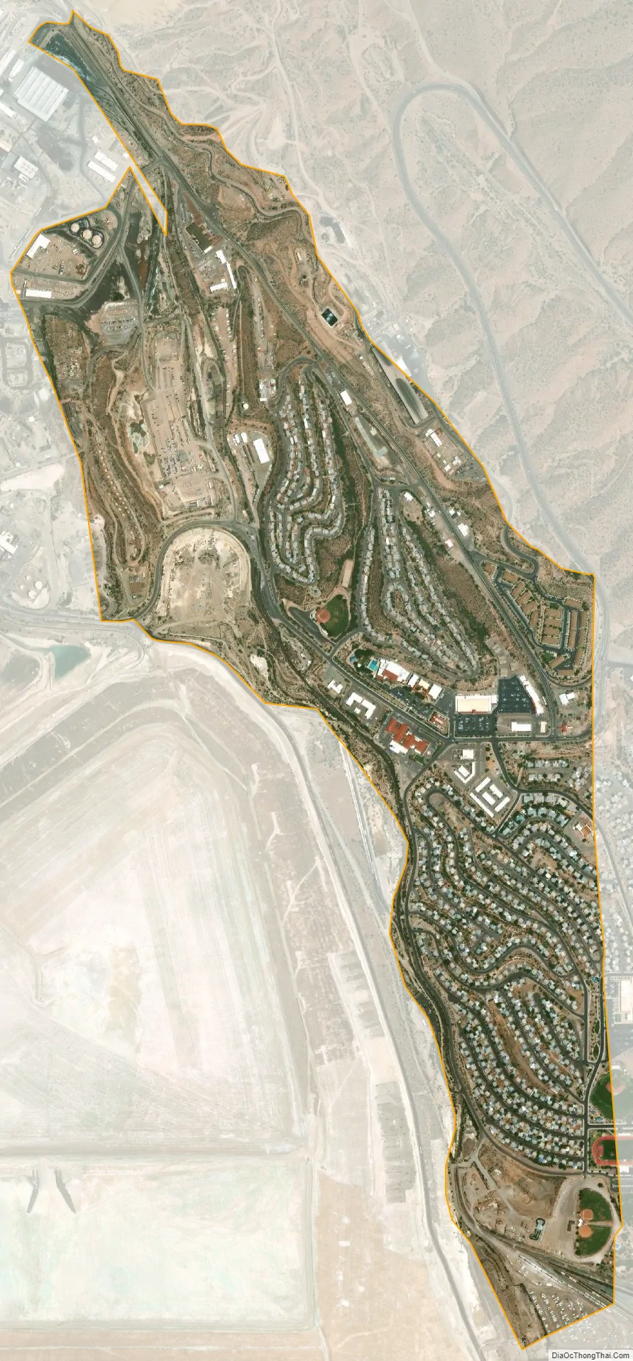
Morenci city Satellite Map
Geography
Morenci is located in central Greenlee County at 33°2′59″N 109°19′40″W / 33.04972°N 109.32778°W / 33.04972; -109.32778 (33.049804, -109.327856). It lies on the northeaster border of the town of Clifton, the county seat. U.S. Route 191 (the Coronado Trail) passes through the northern part of the community, leading east and downhill into Clifton and north through the Apache National Forest 117 miles (188 km) to Eagar.
According to the United States Census Bureau, the Morenci CDP has a total area of 0.98 square miles (2.55 km), of which 0.96 square miles (2.49 km) is land and 0.02 square miles (0.06 km), or 2.23%, is water.
Climate
This region experiences hot and dry summers, with average monthly high temperatures above 80 °F for seven months a year. According to the Köppen Climate Classification system, Morenci has a warm-summer Mediterranean climate, abbreviated “Csb” on climate maps.
See also
Map of Arizona State and its subdivision: Map of other states:- Alabama
- Alaska
- Arizona
- Arkansas
- California
- Colorado
- Connecticut
- Delaware
- District of Columbia
- Florida
- Georgia
- Hawaii
- Idaho
- Illinois
- Indiana
- Iowa
- Kansas
- Kentucky
- Louisiana
- Maine
- Maryland
- Massachusetts
- Michigan
- Minnesota
- Mississippi
- Missouri
- Montana
- Nebraska
- Nevada
- New Hampshire
- New Jersey
- New Mexico
- New York
- North Carolina
- North Dakota
- Ohio
- Oklahoma
- Oregon
- Pennsylvania
- Rhode Island
- South Carolina
- South Dakota
- Tennessee
- Texas
- Utah
- Vermont
- Virginia
- Washington
- West Virginia
- Wisconsin
- Wyoming