Pine is an unincorporated community and census-designated place (CDP) in Gila County, Arizona, United States. The population was 1,963 at the 2010 census. Pine was established by four Mormon families in 1879.
Pine and the adjacent community of Strawberry are rapidly growing vacation and retirement centers in north-central Arizona, below the Mogollon Rim. Pine’s elevation is 5,448 feet (1,661 m), and the Pine post office was established in 1884.
| Name: | Pine CDP |
|---|---|
| LSAD Code: | 57 |
| LSAD Description: | CDP (suffix) |
| State: | Arizona |
| County: | Gila County |
| Elevation: | 5,369 ft (1,636 m) |
| Total Area: | 32.42 sq mi (83.97 km²) |
| Land Area: | 32.41 sq mi (83.95 km²) |
| Water Area: | 0.01 sq mi (0.02 km²) |
| Total Population: | 1,953 |
| Population Density: | 60.25/sq mi (23.26/km²) |
| ZIP code: | 85544 |
| Area code: | 928 |
| FIPS code: | 0455700 |
| GNISfeature ID: | 32916 |
Online Interactive Map
Click on ![]() to view map in "full screen" mode.
to view map in "full screen" mode.
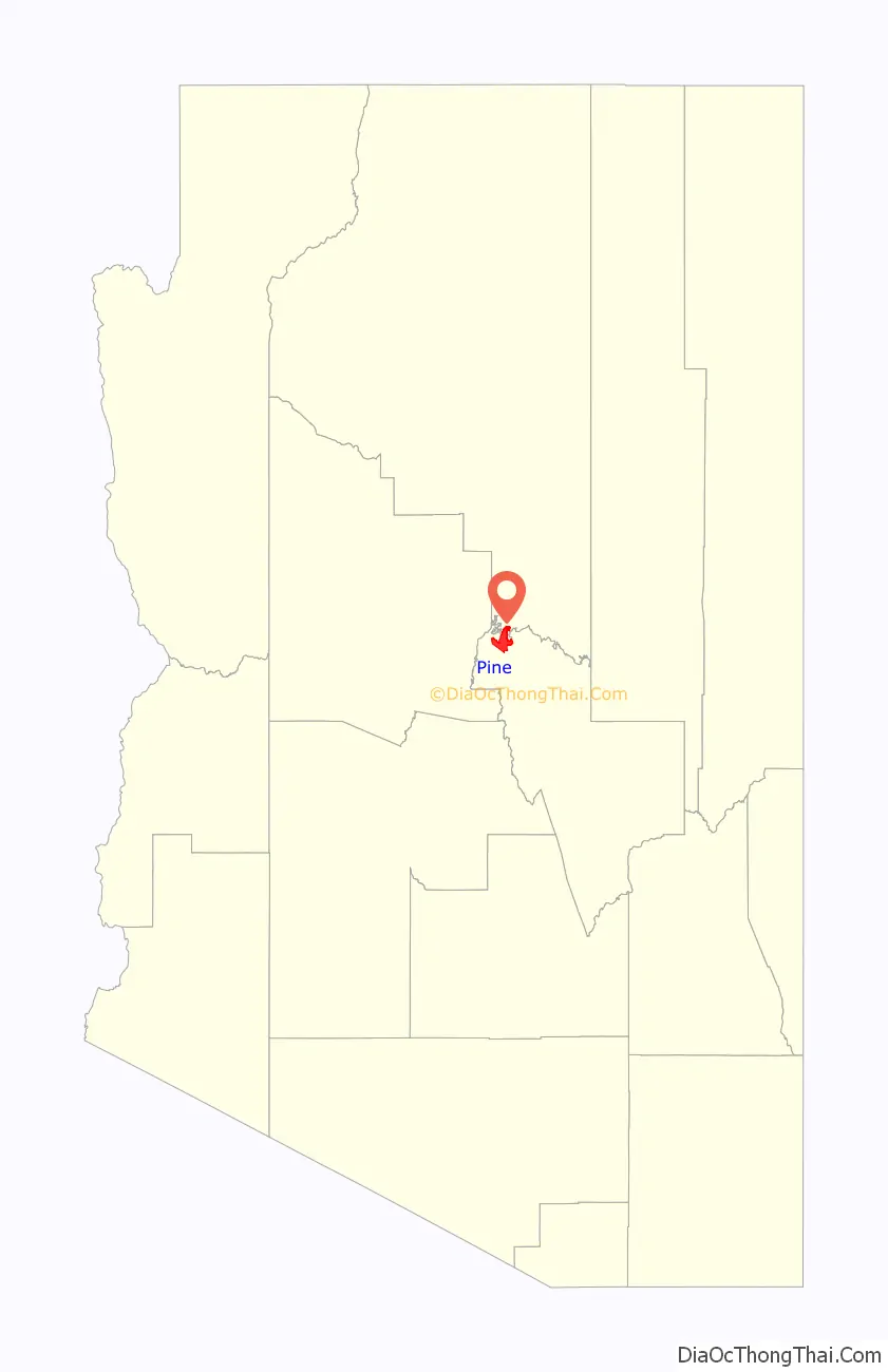
Pine location map. Where is Pine CDP?

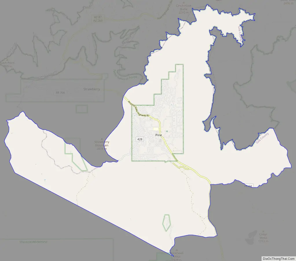
Pine Road Map
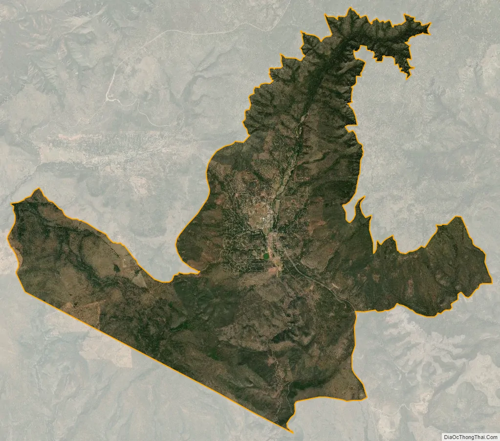
Pine city Satellite Map
Geography
Pine is located in northwestern Gila County at 34°23′6″N 111°27′28″W / 34.38500°N 111.45778°W / 34.38500; -111.45778 (34.385067, -111.457709). It is bordered to the north by the Coconino County line, which follows the edge of the Mogollon Rim. To the northwest, Pine is bordered by the community of Strawberry, also in Gila County. Arizona State Route 87 passes through Pine, leading northeast 74 miles (119 km) to Winslow and southeast 15 miles (24 km) to Payson.
According to the United States Census Bureau, the CDP has a total area of 32.4 square miles (84.0 km), of which 0.01 square miles (0.02 km), or 0.02%, is water. The built-up part of Pine is situated in the valley of Pine Creek, which flows past Tonto Natural Bridge to the East Verde River 10 miles (16 km) south of town.
See also
Map of Arizona State and its subdivision: Map of other states:- Alabama
- Alaska
- Arizona
- Arkansas
- California
- Colorado
- Connecticut
- Delaware
- District of Columbia
- Florida
- Georgia
- Hawaii
- Idaho
- Illinois
- Indiana
- Iowa
- Kansas
- Kentucky
- Louisiana
- Maine
- Maryland
- Massachusetts
- Michigan
- Minnesota
- Mississippi
- Missouri
- Montana
- Nebraska
- Nevada
- New Hampshire
- New Jersey
- New Mexico
- New York
- North Carolina
- North Dakota
- Ohio
- Oklahoma
- Oregon
- Pennsylvania
- Rhode Island
- South Carolina
- South Dakota
- Tennessee
- Texas
- Utah
- Vermont
- Virginia
- Washington
- West Virginia
- Wisconsin
- Wyoming


