San Luis is a city in Yuma County, Arizona, United States. The population was 25,505 at the 2010 census. It is part of the Yuma Metropolitan Statistical Area. San Luis, located in the southwest corner of the state directly adjacent to Mexico‘s Federal Highway 2 at San Luis Rio Colorado, was the second fastest-growing city or town in Arizona from 1990 to 2000. According to 2019 Census Bureau estimates, the population of the city is 34,778.
| Name: | San Luis city |
|---|---|
| LSAD Code: | 25 |
| LSAD Description: | city (suffix) |
| State: | Arizona |
| County: | Yuma County |
| Founded: | 1930 |
| Incorporated: | 1979 |
| Elevation: | 130 ft (40 m) |
| Total Area: | 34.10 sq mi (88.32 km²) |
| Land Area: | 34.02 sq mi (88.13 km²) |
| Water Area: | 0.07 sq mi (0.19 km²) 0.11% |
| Total Population: | 35,257 |
| Population Density: | 1,036.21/sq mi (400.08/km²) |
| ZIP code: | 85349, 85336, 85350 |
| Area code: | 928 |
| FIPS code: | 0463470 |
| Website: | www.sanluisaz.gov |
Online Interactive Map
Click on ![]() to view map in "full screen" mode.
to view map in "full screen" mode.
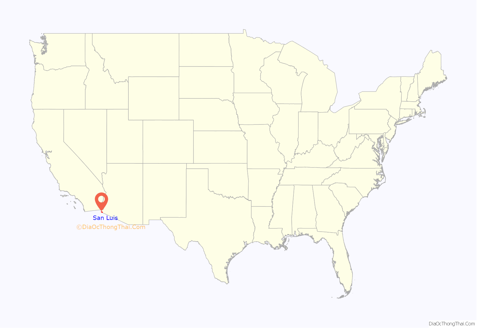
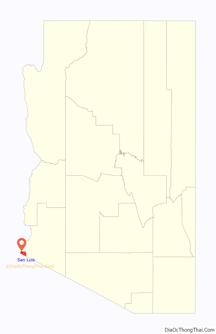
San Luis location map. Where is San Luis city?
History
The city was established in 1930 with the opening of a border-crossing station. In the last twenty years it has registered an accelerated population increase, going from 1,946 inhabitants in 1980, to approximately 20,000 in the year 2005. The city annexed over 16,000 acres (65 km) of land between 2006 and 2012, thereby increasing the availability of land for residential, commercial and industrial growth in the eastern part of town where the new commercial port of entry will be constructed.
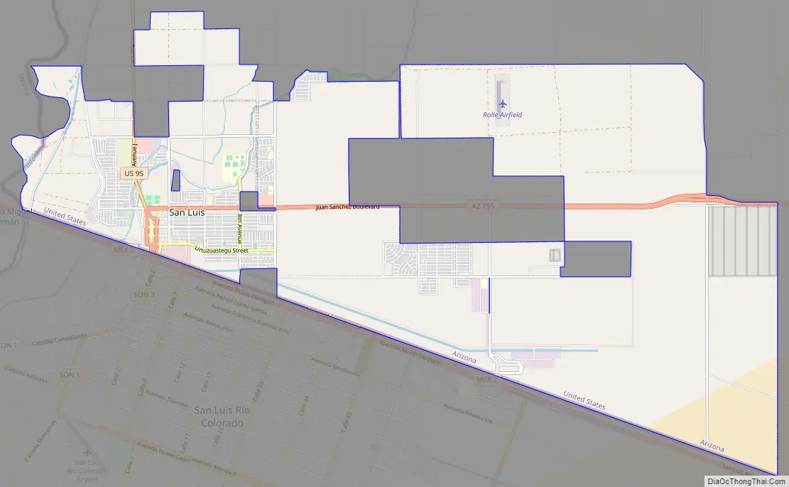
San Luis Road Map
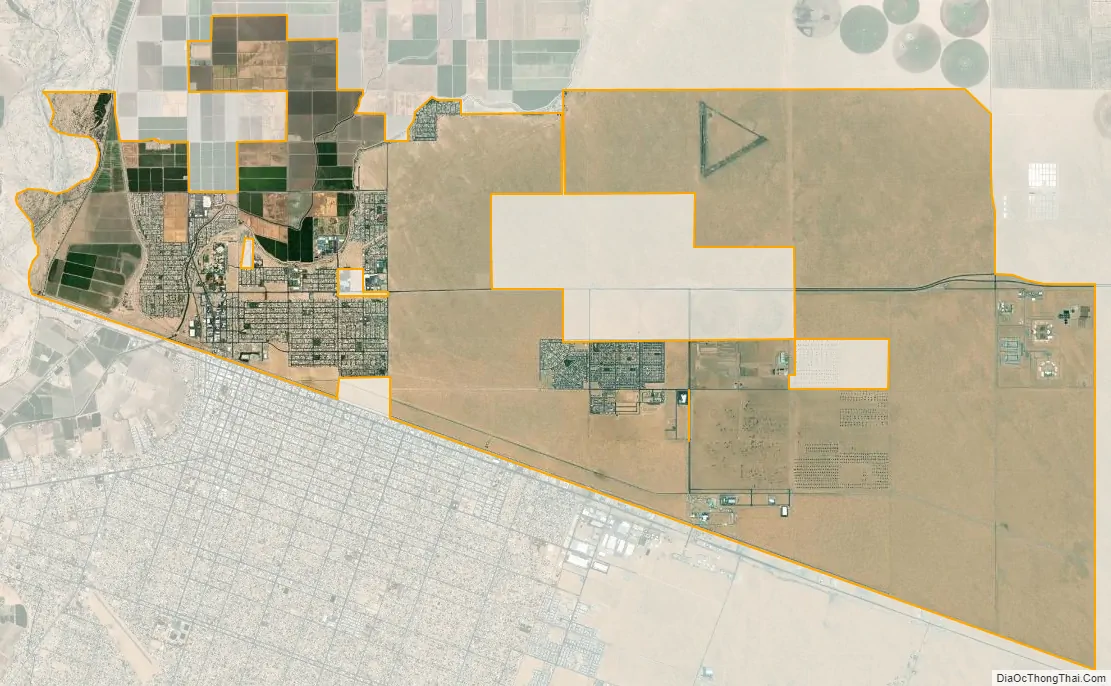
San Luis city Satellite Map
Geography
San Luis is located at 32°29′46″N 114°46′6″W / 32.49611°N 114.76833°W / 32.49611; -114.76833 (32.496116, -114.768327). It stands on the U.S.-Mexico border, opposite San Luis Río Colorado, Sonora. The lowest point in Arizona is located on the Colorado River in San Luis, where it flows out of Arizona and into Sonora.
According to the United States Census Bureau, the city has a total area of 26.5 square miles (68.63 km), of which 26.4 square miles (68.38 km) is land and 0.04 square miles (0.10 km) (0.11%) is water.
The Gulf of Santa Clara is located 70 miles (110 km) south of San Luis and sits on the northernmost point of the Gulf of California, at its confluence with the Colorado River. Large holiday crowds converge here to ride all-terrain vehicles on 30 miles (50 km) of undeveloped beach.
See also
Map of Arizona State and its subdivision: Map of other states:- Alabama
- Alaska
- Arizona
- Arkansas
- California
- Colorado
- Connecticut
- Delaware
- District of Columbia
- Florida
- Georgia
- Hawaii
- Idaho
- Illinois
- Indiana
- Iowa
- Kansas
- Kentucky
- Louisiana
- Maine
- Maryland
- Massachusetts
- Michigan
- Minnesota
- Mississippi
- Missouri
- Montana
- Nebraska
- Nevada
- New Hampshire
- New Jersey
- New Mexico
- New York
- North Carolina
- North Dakota
- Ohio
- Oklahoma
- Oregon
- Pennsylvania
- Rhode Island
- South Carolina
- South Dakota
- Tennessee
- Texas
- Utah
- Vermont
- Virginia
- Washington
- West Virginia
- Wisconsin
- Wyoming


