Top-of-the-World is a census-designated place (CDP) in Gila and Pinal counties in the U.S. state of Arizona. The population was 231 at the 2010 census, down from 330 at the 2000 census.
| Name: | Top-of-the-World CDP |
|---|---|
| LSAD Code: | 57 |
| LSAD Description: | CDP (suffix) |
| State: | Arizona |
| County: | Gila County, Pinal County |
| Elevation: | 4,528 ft (1,380 m) |
| Total Area: | 6.06 sq mi (15.70 km²) |
| Land Area: | 6.06 sq mi (15.70 km²) |
| Water Area: | 0.00 sq mi (0.00 km²) |
| Total Population: | 189 |
| Population Density: | 31.18/sq mi (12.04/km²) |
| FIPS code: | 0474820 |
| GNISfeature ID: | 1853171 |
Online Interactive Map
Click on ![]() to view map in "full screen" mode.
to view map in "full screen" mode.
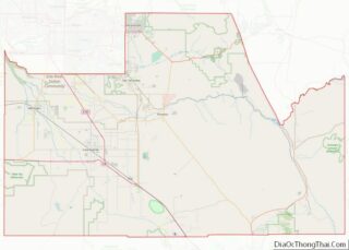
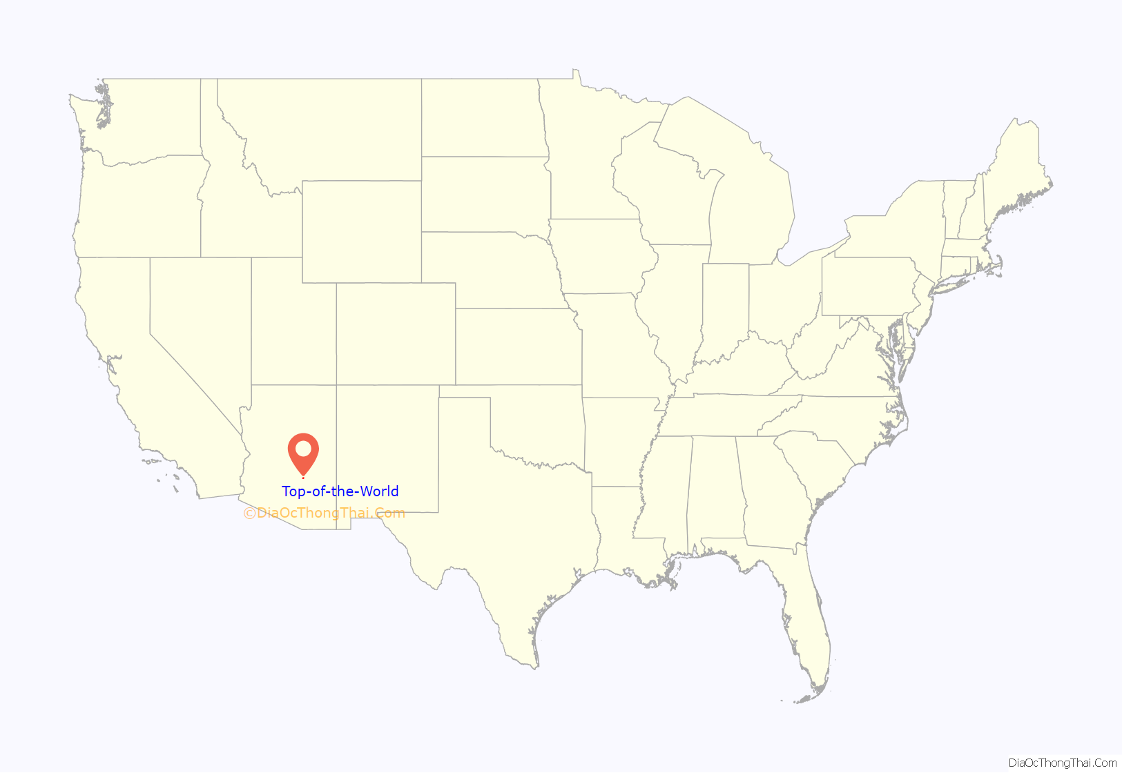
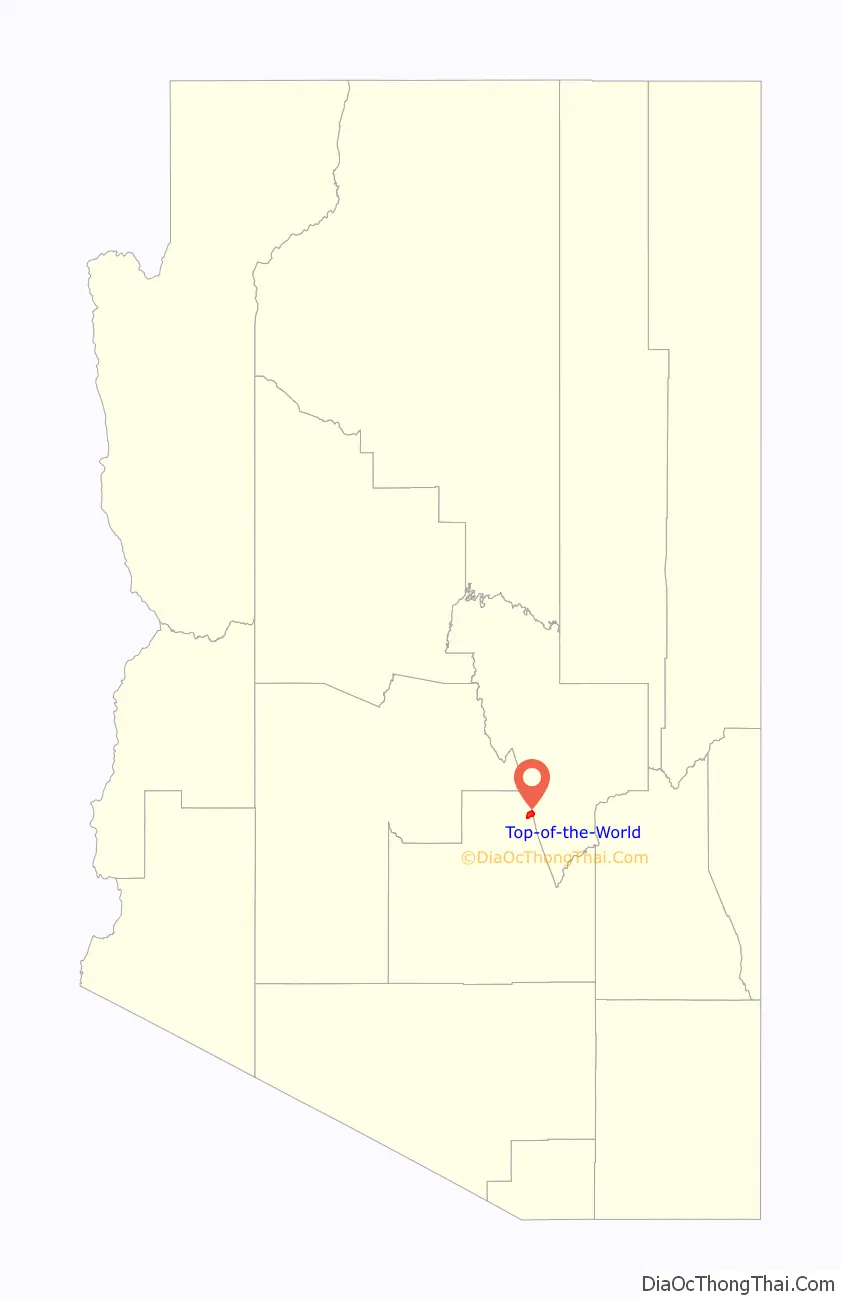
Top-of-the-World location map. Where is Top-of-the-World CDP?
History
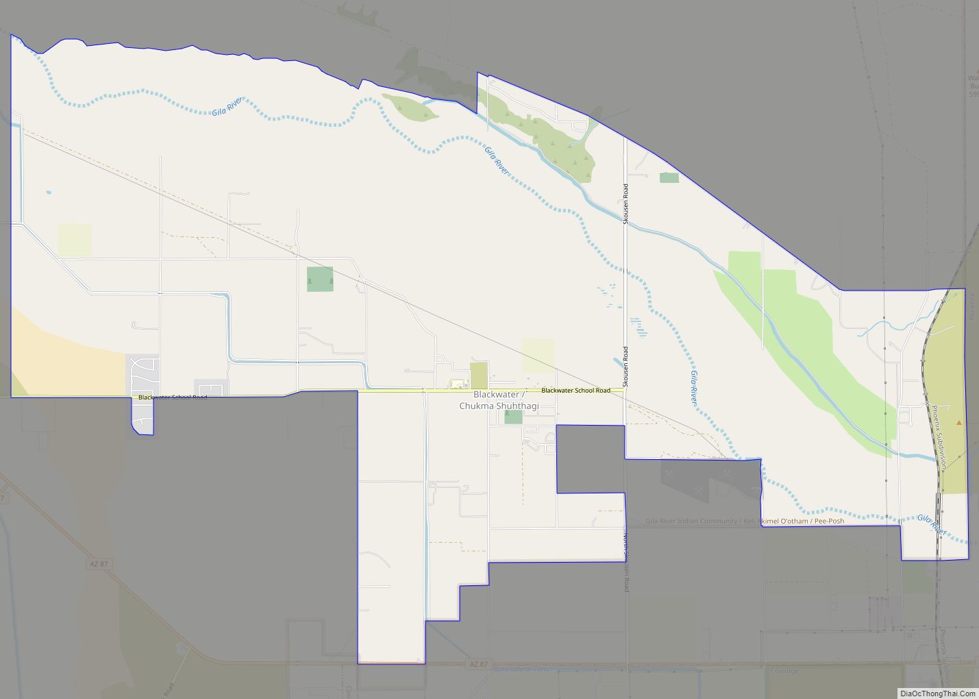
Located on US-60, 9.1 miles (14 km) west of Miami at the divide between Miami and Superior at the 4,600-foot (1,400 m) level. This area is mostly in Pinal County. Mason’s Valley, named after Charles G. Mason an early settler in Florence, Arizona and a prospector who with others discovered the Globe mining district and also developed the fabulous Silver King Mine north of Superior. “We crossed the lofty Pinal Range over into the beautiful little nook known as Mason’s Valley.” Today Mason’s Valley is often called both Pinal Ranch and Top-of-the-World, the latter being an unfortunate misnomer from a much later camping and recreation facility that was created in 1922 located on the old alignment of US-60 in Gila County about two miles west, not in Mason’s Valley.
The name “Pinal” is taken from Pinar Spanish for “pine groves in the mountains,” and is the name of the Mountain Range South of Globe, west to Superior, and north to the Salt River. These Mountains were home to the Western Apache Pinal Band of Native Americans, whom the US Military found particularly vexing for their frequent raids to surrounding settlements, ranches, and mines. “(the troops) at Camp Pinal, and it’s dependencies will clear the country (of Indians) lying between the Gila and Salt Rivers and the western boundary of the White Mountain Reservation.” As a consequence in 1870 a camp was ordered built in the Pinal Mountains to house an infantry camp to serve as a supply post and bivouac camp for Cavalry fighting the Apaches in the mountains. The two dependent camps of Camp Pinal were Camp Picket Post ten miles east on Queen Creek, and a small detachment at a construction camp on the Upper Stoneman Grade called Camp Supply where stone ovens were built and bread for both camps was baked.
The original camp, called Infantry Camp, was located four miles southeast of Mason’s Valley on the divide between Mineral Creek and Pinto Creek at the location of the future Gibson Mine and Bellevue settlement. “A military post is ordered established in the Pinal Mountains, some 50 miles north of Grant, to be called ‘Infantry Camp.’.” “INFANTRY CAMP, Mason’s Valley, A.T.,. – …on one of the many dry forks at the head of Mineral Creek, a tributary of the Gila. …estimated distance from Camp Grant, fifty-two miles.” “…Stores continue to arrive regular per ‘Hog Express’ as package was marked”. The camp was there a very short time before being relocated to Mason’s Valley, but was still called Infantry Camp. Five months after relocation the Military ordered the name changed to Camp Pinal, and a picket post of Camp Pinal to be located at the foot of Tortilla Mountain on Queen Creek, General Stoneman established both camps and constructed the mule trail between the famously known of Stoneman’s Grade.
The site was abandoned in late in 1871, the last printed mention of troops there was October 20. The troops started the Stoneman Grade at Camp Picket Post at the foot of Picket post Mountain on Queen Creek. It did not enter Queen Creek Canyon. The trail traveled north from Camp Picket Post, up the face of Kings Crown Mountain, around the peak across the headwaters of Queen Creek, across Oak Flats, Devil’s Canyon, and up Irion Canyon to Camp Pinal. The military efforts of Stoneman cleared the Southern Pinal Mountains of Apaches, and the Stoneman Grade was the way most early miners and settlers traveled to the Globe-Miami District.
The Pinal Ranch was built at the site of Camp Pinal. The ranch was begun before 1874. First owned by Andy Hawkins and partner Thomas Buchanan. “They built a fine juniper house, corrals and outbuildings. In 1877 they produced 30,000 pounds of potatoes.” Hospitality business was good providing shelter and food for travelers on the Stoneman Trail to Globe. In 1877 Mr. and Mrs. Robert A. Irion and Mrs. Irion’s young son Dudley Craig bought out Andy Hawkins.16 The Irion’s improved upon the ranch, and around 1880 bought Buchanan’s share and it remained in the Craig family until the 1970s. The large adobe ranch house is still in good condition, in spite of its 100+ years. They had productive fields for corn and vegetables, and planted a large and productive apple orchard in addition to running cattle on their range. His stepson Dudley Craig continued the ranching tradition in the area after Irion’s death.
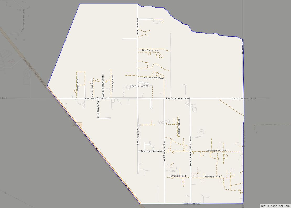
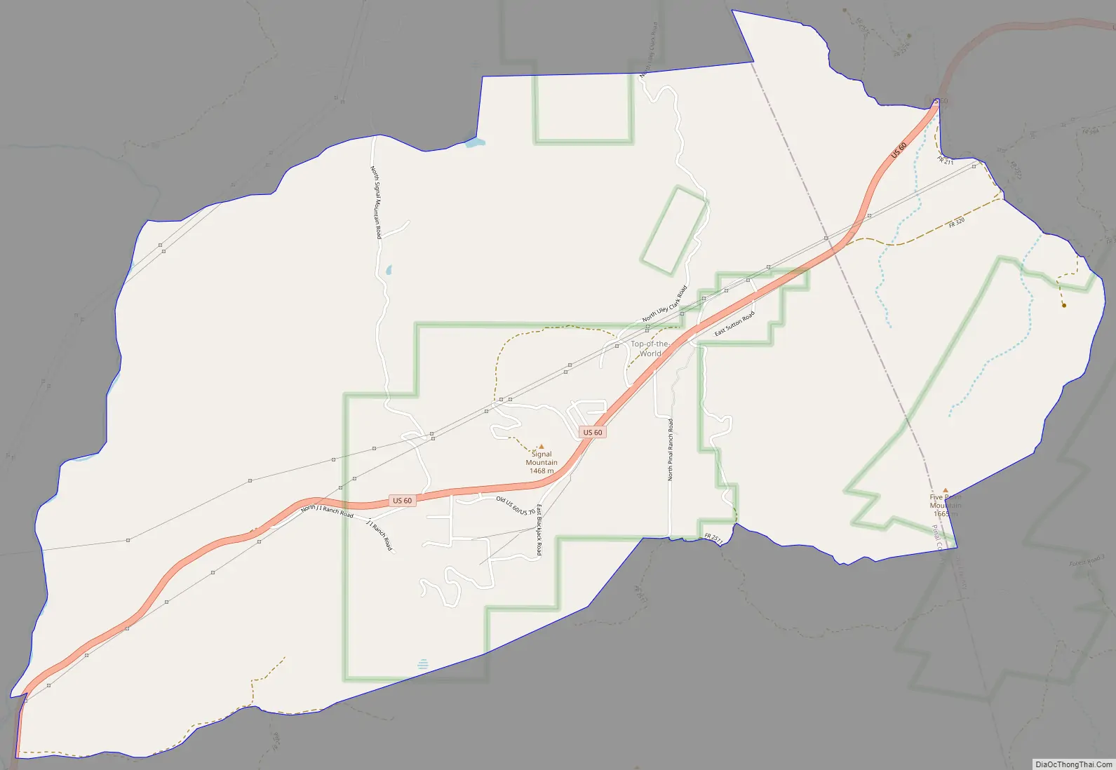
Top-of-the-World Road Map
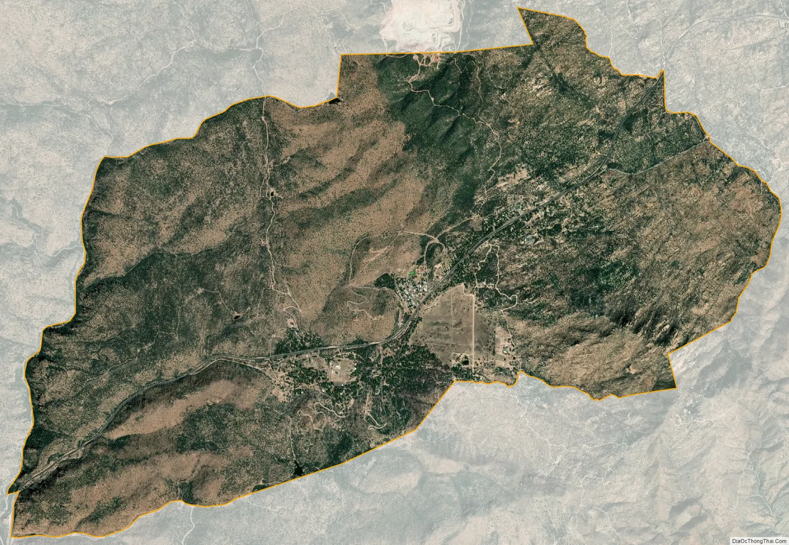
Top-of-the-World city Satellite Map
Geography
Top-of-the-World is located in eastern Pinal County at 33°20′49″N 110°59′43″W / 33.34694°N 110.99528°W / 33.34694; -110.99528 (33.346856, -110.995172). The CDP extends east into Gila County. U.S. Route 60 passes through the center of the community, leading east 15 miles (24 km) to Globe and southwest 8 miles (13 km) to Superior. The center of Phoenix is 72 miles (116 km) to the west.
According to the United States Census Bureau, the CDP has a total area of 6.1 square miles (15.7 km), all land.
See also
Map of Arizona State and its subdivision: Map of other states:- Alabama
- Alaska
- Arizona
- Arkansas
- California
- Colorado
- Connecticut
- Delaware
- District of Columbia
- Florida
- Georgia
- Hawaii
- Idaho
- Illinois
- Indiana
- Iowa
- Kansas
- Kentucky
- Louisiana
- Maine
- Maryland
- Massachusetts
- Michigan
- Minnesota
- Mississippi
- Missouri
- Montana
- Nebraska
- Nevada
- New Hampshire
- New Jersey
- New Mexico
- New York
- North Carolina
- North Dakota
- Ohio
- Oklahoma
- Oregon
- Pennsylvania
- Rhode Island
- South Carolina
- South Dakota
- Tennessee
- Texas
- Utah
- Vermont
- Virginia
- Washington
- West Virginia
- Wisconsin
- Wyoming