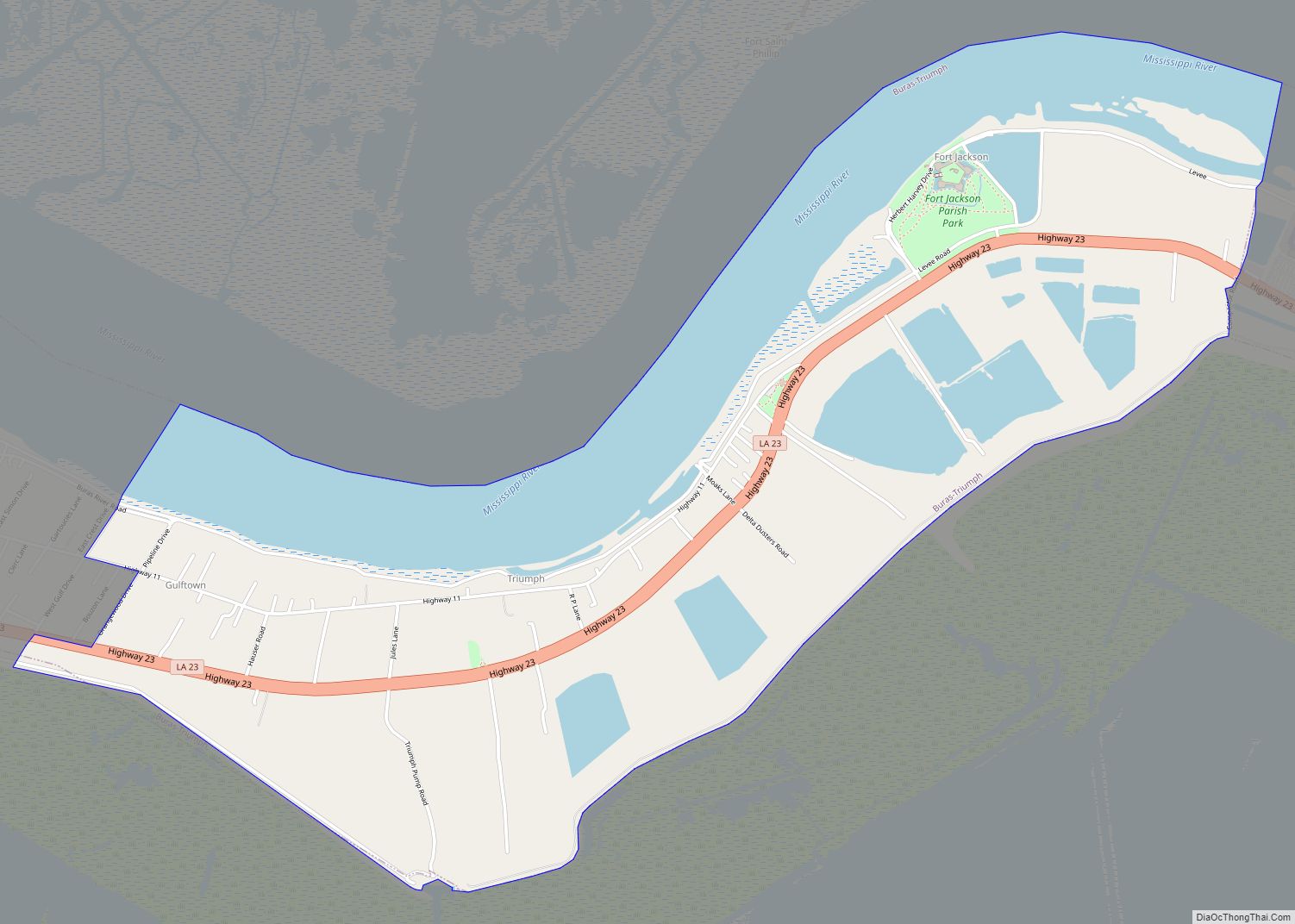
Triumph (French: Ville de Triomphe) is an unincorporated community and census-designated place in Plaquemines Parish, Louisiana, United States. It is located on the south bank of the Mississippi River. As of the 2020 census, its population was 268.
It is the closest town to two National Historic Landmarks: Fort Jackson (down river from the town; though due to a bend in the river to the north east) and (across the river) Fort St. Philip.
The 1960 U.S Census listed Triumph as having a population of 900. Until 2010, the Census did not count Triumph as a separate community, including it as part of the census-designated place (CDP) of Buras-Triumph.
According to tradition, the community was named for its “triumph” over a rival town when they secured a post office.
Like most of Plaquemines Parish, Triumph was severely damaged by the massive storm surge from Hurricane Katrina in 2005.
| Name: | Triumph CDP |
|---|---|
| LSAD Code: | 57 |
| LSAD Description: | CDP (suffix) |
| State: | Louisiana |
| County: | Plaquemines Parish |
| Elevation: | 7 ft (2 m) |
| Total Area: | 4.02 sq mi (10.42 km²) |
| Land Area: | 2.78 sq mi (7.21 km²) |
| Water Area: | 1.24 sq mi (3.21 km²) |
| Total Population: | 268 |
| Population Density: | 96.26/sq mi (37.17/km²) |
| Area code: | 504 |
| FIPS code: | 2276440 |
| GNISfeature ID: | 558335 |
Online Interactive Map
Click on ![]() to view map in "full screen" mode.
to view map in "full screen" mode.
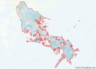
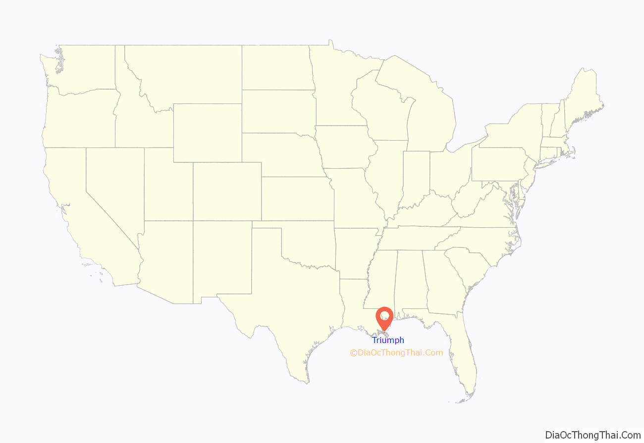
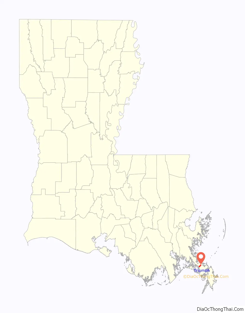
Triumph location map. Where is Triumph CDP?
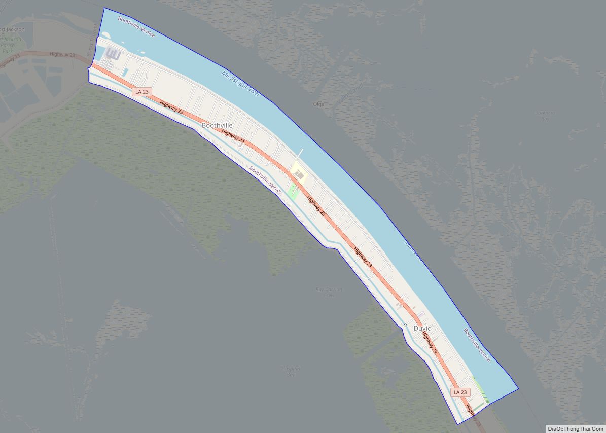
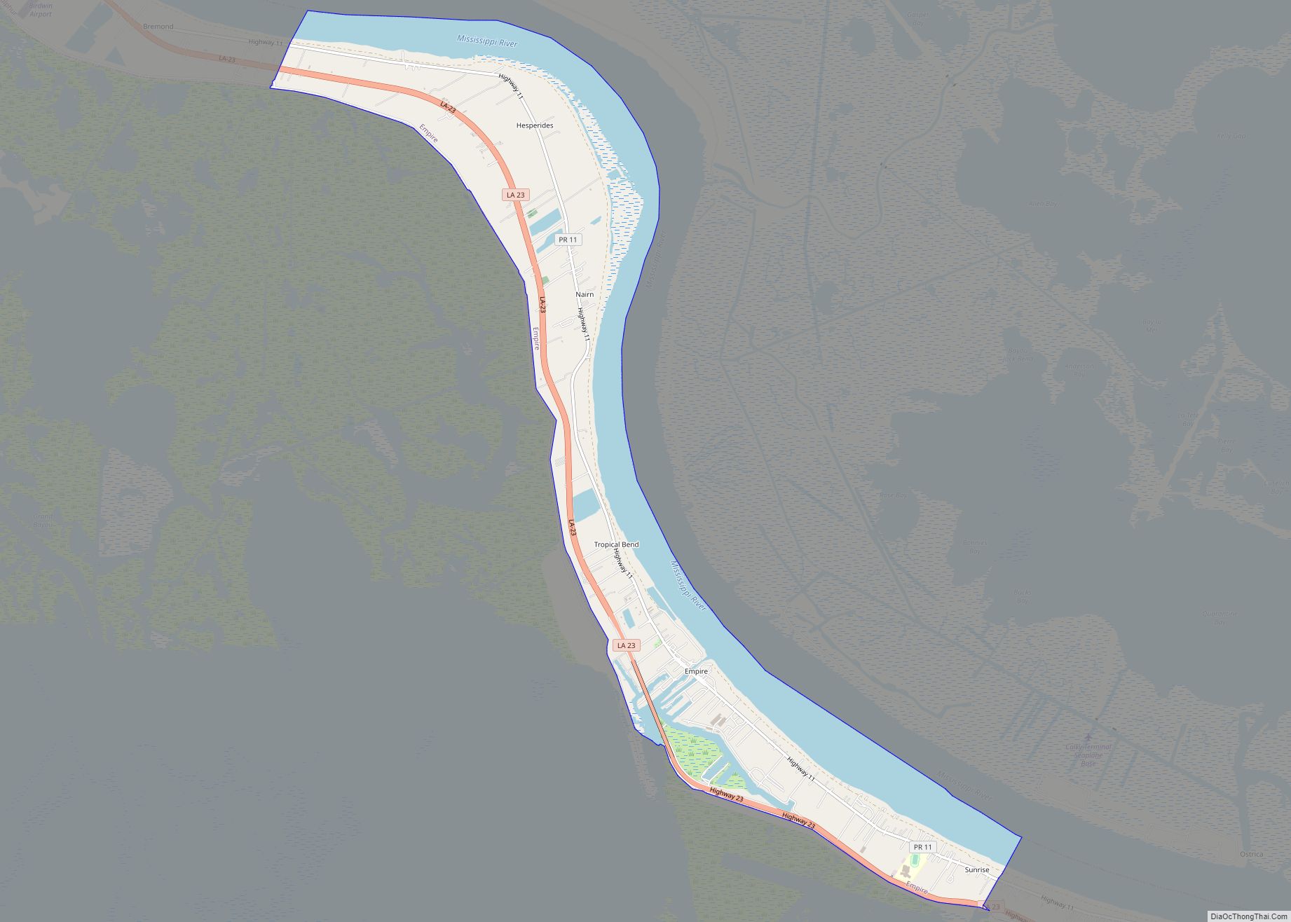
Triumph Road Map
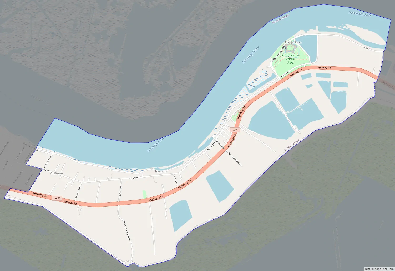
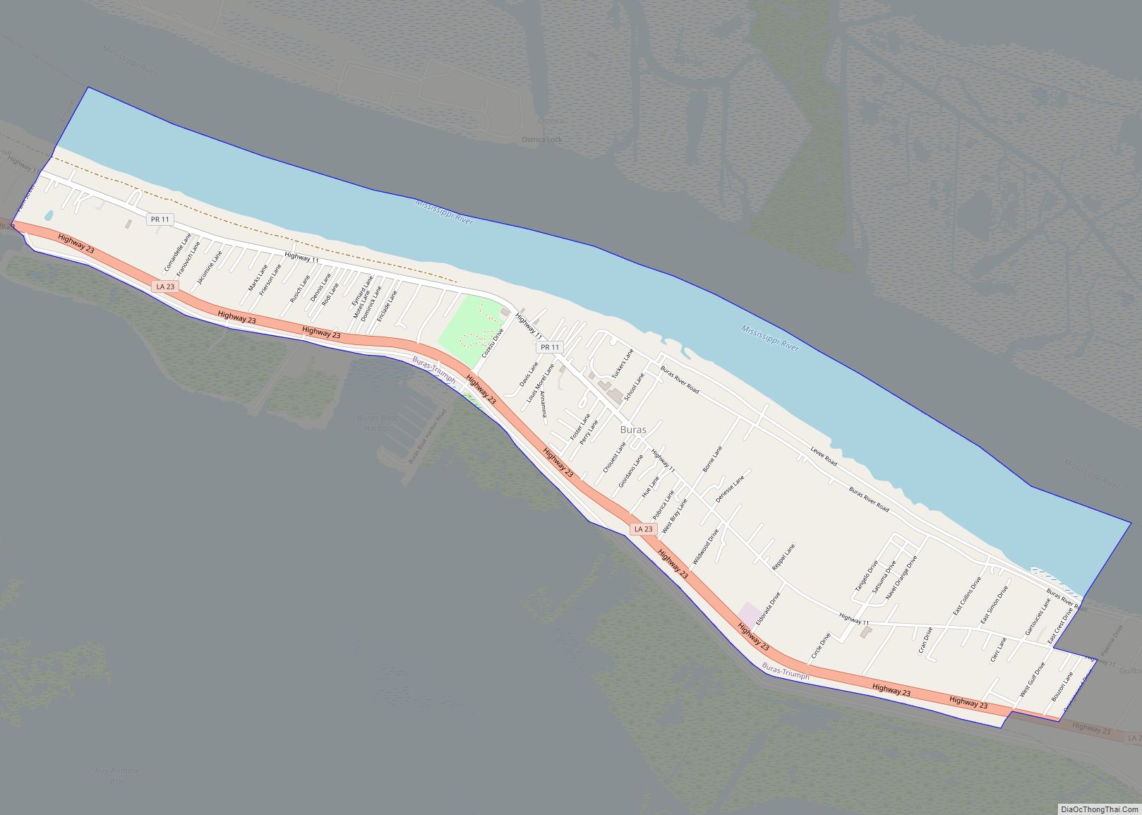
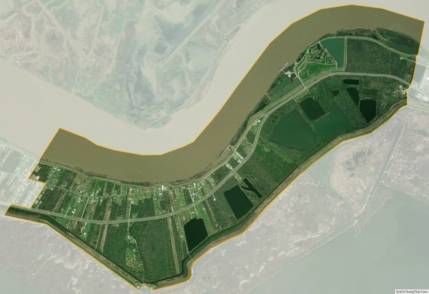
Triumph city Satellite Map
See also
Map of Louisiana State and its subdivision:- Acadia
- Allen
- Ascension
- Assumption
- Avoyelles
- Beauregard
- Bienville
- Bossier
- Caddo
- Calcasieu
- Caldwell
- Cameron
- Catahoula
- Claiborne
- Concordia
- De Soto
- East Baton Rouge
- East Carroll
- East Feliciana
- Evangeline
- Franklin
- Grant
- Iberia
- Iberville
- Jackson
- Jefferson
- Jefferson Davis
- La Salle
- Lafayette
- Lafourche
- Lincoln
- Livingston
- Madison
- Morehouse
- Natchitoches
- Orleans
- Ouachita
- Plaquemines
- Pointe Coupee
- Rapides
- Red River
- Richland
- Sabine
- Saint Bernard
- Saint Charles
- Saint Helena
- Saint James
- Saint John the Baptist
- Saint Landry
- Saint Martin
- Saint Mary
- Saint Tammany
- Tangipahoa
- Tensas
- Terrebonne
- Union
- Vermilion
- Vernon
- Washington
- Webster
- West Baton Rouge
- West Carroll
- West Feliciana
- Winn
- Alabama
- Alaska
- Arizona
- Arkansas
- California
- Colorado
- Connecticut
- Delaware
- District of Columbia
- Florida
- Georgia
- Hawaii
- Idaho
- Illinois
- Indiana
- Iowa
- Kansas
- Kentucky
- Louisiana
- Maine
- Maryland
- Massachusetts
- Michigan
- Minnesota
- Mississippi
- Missouri
- Montana
- Nebraska
- Nevada
- New Hampshire
- New Jersey
- New Mexico
- New York
- North Carolina
- North Dakota
- Ohio
- Oklahoma
- Oregon
- Pennsylvania
- Rhode Island
- South Carolina
- South Dakota
- Tennessee
- Texas
- Utah
- Vermont
- Virginia
- Washington
- West Virginia
- Wisconsin
- Wyoming