| Name: | Lawrence city |
|---|---|
| LSAD Code: | 25 |
| LSAD Description: | city (suffix) |
| State: | Massachusetts |
| County: | Essex County |
| Incorporated: | 1847 |
| Elevation: | 16 ft (5 m) |
| Total Area: | 7.43 sq mi (19.24 km²) |
| Land Area: | 6.93 sq mi (17.95 km²) |
| Water Area: | 0.50 sq mi (1.29 km²) |
| Total Population: | 89,143 |
| Population Density: | 12,863.35/sq mi (4,966.73/km²) |
| Area code: | 351/978 |
| FIPS code: | 2534550 |
| Website: | www.cityoflawrence.com |
Online Interactive Map
Click on ![]() to view map in "full screen" mode.
to view map in "full screen" mode.
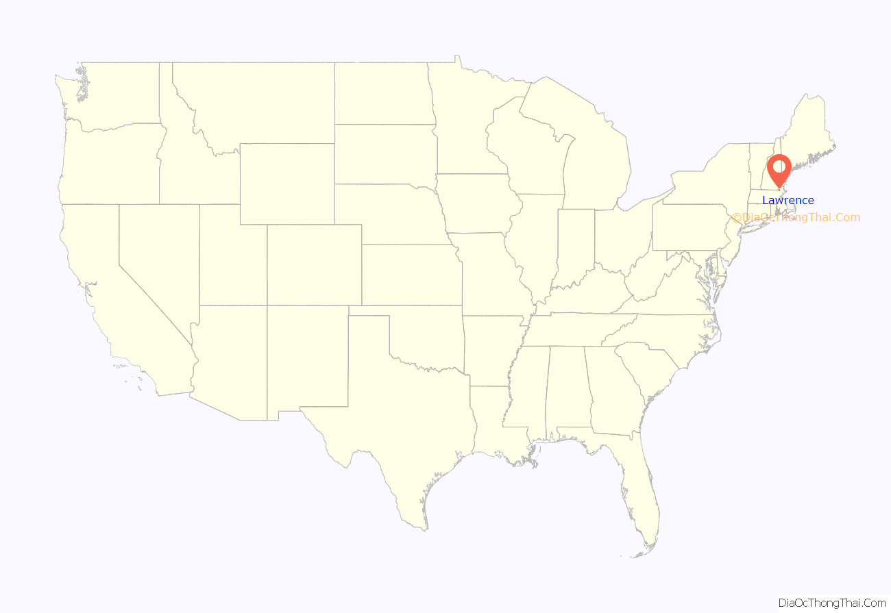
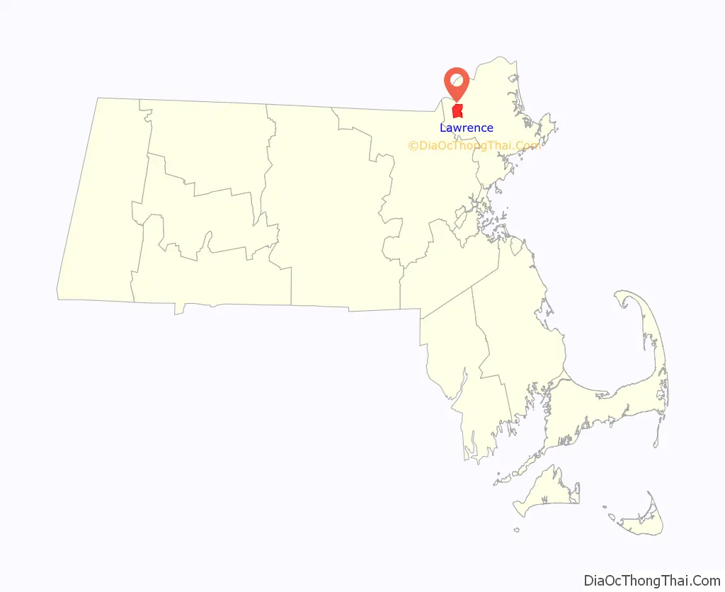
Lawrence location map. Where is Lawrence city?
History
Indigenous history
Native Americans lived along the Merrimack River for thousands of years prior to European colonization of the Americas. Evidence of farming at Den Rock Park and arrowhead manufacturing on the site of where the Wood Mill now sits have been discovered.
At the time of contact in the early 1600s, the Pennacook or Pentucket had a presence north of the Merrimack, while Massachusett, Naumkeag, and Agawam controlled territory south of the river. The territory which would later be aggregated into the city of Lawrence was purchased from Pennacooks Sagahew and Passaquo in 1642 for the English settlement of Haverhill, and from Massachusett sachem Cutshamekin in 1646 as a post-hoc payment for the lands surrounding the English settlement of Andover (modern day North Andover center).
Founding and rise as a textile center
Europeans first settled the Haverhill area in 1640, colonists from Newbury following the Merrimack River in from the coast. The area that would become Lawrence was then part of Methuen and Andover. The first settlement within present-day city limits came in 1655 with the establishment of a blockhouse in Shawsheen Fields, now South Lawrence.
The future site of the city (formerly parts of Andover and Methuen), was purchased by a consortium of local industrialists. The Water Power Association members: Abbott Lawrence, Edmund Bartlett, Thomas Hopkinson of Lowell, John Nesmith and Daniel Saunders, had purchased control of Peter’s Falls on the Merrimack River and hence controlled Bodwell’s Falls the site of the present Great Stone Dam. The group allotted fifty thousand dollars to buy land along the river to develop. In 1844, the group petitioned the legislature to act as a corporation, known as the Essex Company, which incorporated on April 16, 1845. The first excavations for the Great Stone Dam to harness the Merrimack River’s water power were done on August 1, 1845. The Essex Company would sell the water power to corporations such as the Arlington Mills, as well as organize construction of mills and build to suit. Until 1847, when the state legislature recognized the community as a town, it was called interchangeably the “New City”, “Essex” or “Merrimac”. The post office, built in 1846, used the designation “Merrimac”. Incorporation as a city would come in 1853, and the name “Lawrence”, merely chosen as a token of respect to Abbott Lawrence, who it cannot be verified ever saw the city named after him.
Canals were dug on both the north and the south banks to provide power to the factories that would soon be built on its banks as both mill owners and workers from across the city and the world flocked to the city in droves; many were Irish laborers who had experience with similar building work. The work was dangerous: injuries and even death were common.
Working conditions in the mills were unsafe and in 1860 the Pemberton Mill collapsed, killing 145 workers. As immigrants flooded into the United States in the mid to late 19th century, the population of Lawrence abounded with skilled and unskilled workers from several countries. Protesting conditions, in 1912 they walked out of the mills. The action, sometimes celebrated as the Bread and Roses Strike, was one of the more important, widely reported, labor struggles in American history.
The Industrial Workers of the World (the “One Big Union”, the “Wobblies”) defied the common wisdom that a largely female and ethnically divided workforce could not be organized, and the strike held through two bitterly cold winter months. The young 15 year mill hand Fred Beal, who was drawn by the experience into a lifetime of labor organizing, recalls that, contrary to expectations, it was the most recent immigrant groups, “the Italians, Poles, Syrians [Lebanese] and Franco-Belgians”, who “kept it alive.
After hundreds of the strikers’ hungry children had been sent to sympathetic families in New York, New Jersey, and Vermont, and the U.S. Congress was induced to hold hearings, the mill owners decided to settle, giving workers in Lawrence and throughout New England raises of up to 20 percent. However, as a young Massachusetts Senator, John F. Kennedy was later to record, in the decades that followed the mill owners moved their capital and employment out of Lawrence and the region to the non-union South.
Post-War history
Lawrence was a great wool-processing center until that industry declined in the 1950s. The decline left Lawrence a struggling city. The population of Lawrence declined from over 80,000 residents in 1950 (and a high of 94,270 in 1920) to approximately 64,000 residents in 1980, the low point of Lawrence’s population. Much of the population relocated to nearby Methuen.
Like other northeastern cities suffering from the effects of post-World War II industrial decline, Lawrence has often made efforts at revitalization, some of them controversial. For example, half of the enormous Wood Mill, powered by the Great Stone Dam and once the largest mills in the world, was knocked down in the 1950s. The Lawrence Redevelopment Authority and city officials utilized eminent domain for a perceived public benefit, via a top-down approach, to revitalize the city throughout the 1960s. Known first as urban redevelopment, and then urban renewal, Lawrence’s local government’s actions towards vulnerable immigrant and poor communities, contained an undercurrent of gentrification which lies beneath the goals to revitalize Lawrence. There was a clash of differing ideals and perceptions of blight, growth, and what constituted a desirable community. Ultimately the discussion left out those members of the community who would be directly impacted by urban redevelopment.
Under the guise of urban renewal, large tracts of downtown Lawrence were razed in the 1970s, and replaced with parking lots and a three-story parking garage connected to a new Intown Mall intended to compete with newly constructed suburban malls. The historic Theater Row along Broadway was also razed, destroying ornate movie palaces of the 1920s and 1930s that entertained mill workers through the Great Depression and the Second World War. The city’s main post office, an ornate federalist style building at the corner of Broadway and Essex Street, was razed. Most of the structures were replaced with one-story, steel-frame structures with large parking lots, housing such establishments as fast food restaurants and chain drug stores, fundamentally changing the character of the center of Lawrence.
Lawrence also attempted to increase its employment base by attracting industries unwanted in other communities, such as waste treatment facilities and incinerators. From 1980 until 1998, private corporations operated two trash incinerators in Lawrence. Activist residents successfully blocked the approval of a waste treatment center on the banks of the Merrimack River near the current site of Salvatore’s Pizza on Merrimack Street.
Recently the focus of Lawrence’s urban renewal has shifted to preservation rather than sprawl.
Immigrants from the Dominican Republic and migrants from Puerto Rico began arriving in Lawrence in significant numbers in the late 1960s, attracted by cheap housing and a history of tolerance toward immigrants. In 1984, tensions between remaining working class whites and increasing numbers of Hispanic youth flared into a riot, centered at the intersection of Haverhill Street and Oxford Street, where a number of buildings were destroyed by Molotov cocktails and over 300 people were arrested.
Lawrence saw further setbacks during the recession of the early 1990s as a wave of arson plagued the city. Over 200 buildings were set alight in an eighteen-month period in 1991–1992, many of them abandoned residences and industrial sites. The Malden Mills factory burned down on December 11, 1995. CEO Aaron Feuerstein decided to continue paying the salaries of all the now-unemployed workers while the factory was being rebuilt.
A sharp reduction in violent crime starting in 2004 and massive private investment in former mill buildings along the Merrimack River, including the remaining section of the historic Wood Mill—to be converted into commercial, residential and education uses – have lent encouragement to boosters of the city. One of the final remaining mills in the city is Malden Mills. Lawrence’s downtown has seen a resurgence of business activity as Hispanic-owned businesses have opened along Essex Street, the historic shopping street of Lawrence that remained largely shuttered since the 1970s. In June 2007, the city approved the sale of the Intown Mall, largely abandoned since the early 1990s recession, to Northern Essex Community College for the development of a medical sciences center, the construction of which commenced in 2012 when the InTown Mall was finally removed. A large multi-structure fire in January 2008 destroyed many wooden structures just south of downtown. A poor financial situation that has worsened with the recent global recession and has led to multiple municipal layoffs had Lawrence contemplating receivership. On February 9, 2019, in recognition of the role the town has played in the labor movement, Senator Elizabeth Warren officially announced her candidacy for President of the United States in Lawrence.
On September 13, 2018, a series of gas explosions and fires broke out in as many as 40 homes in Lawrence, Andover, and North Andover. The disaster killed one resident and caused over 30,000 customers to evacuate their homes. A year after this first incident on September 27, 2019 there was another gas leak causing people to evacuate their homes again.
Timeline
- 1845
- Essex Company begins construction of dam and canal on Merrimack River.
- 1846
- Essex Company Machine Shop built.
- Lawrence Street Church organized.
- Church of the Immaculate Conception established.
- 1847
- Town of Lawrence incorporated from Methuen and Andover; named after businessman Abbott Lawrence.
- Lawrence Courier newspaper in publication.
- Bellevue Cemetery established.
- Franklin Library Association formed.
- First Baptist Church, First Free Baptist Church, First Unitarian Society, Church of the Good Shepherd, and First Methodist Episcopal Church established
- 1848
- Boston & Maine Railroad depot established in South Lawrence.
- Lawrence Dam constructed across Merrimack River.
- Bay State woollen mills begin operating.
- St. Mary’s Church organized.
- 1849
- Manchester and Lawrence Railroad begins operating.
- Lawrence Sentinel newspaper begins publication.
- Central Church organized.
- Atlantic Cotton Mills starts in business.
- Lawrence Gas Company formed.
- Lawrence Brass Band formed.
- 1850 – Population: 8,282.
- 1851 – Grace Episcopal Church built.
- 1853
- City of Lawrence incorporated as a municipal government.
- Charles S. Storrow becomes first city mayor.
- Lawrence Duck Company in business.
- Garden Street Methodist Episcopal Church organized as a congregation of the Methodist Episcopal Church.
- 1854
- Additional part of Methuen annexed to the City of Lawrence.
- Pacific Mills starts operating bin business.
- Lawrence Paper Company incorporated.
- 1855 – Pemberton Company in business.
- 1860
- January – Pemberton Mill building collapse.
- Population according to decennial United States Census: 17,639.
- 1861 – Massachusetts state militia called up by Governor in response to proclamation by 16th President Abraham Lincoln of a state of rebellion in the South following firing on Fort Sumter in Charleston harbor in South Carolina Confederate forces on April 12. Sixth Regiment earliest to respond with men from Lawrence, Lowell, Methuen, Stoneham, Boston. Heads south by train and is attacked by mobs of Southern sympathizers in Baltimore along Pratt Street while being pulled through on horse cars and later marching between the President Street Station of the Philadelphia, Wilmington and Baltimore Railroad on the east of the harbor to the Camden Street Station of the Baltimore and Ohio Railroad on way to the national capital at Washington, D.C. on Friday, April 19. Four soldiers killed and numerous wounded and among Baltimorean civilians as city police and officials attempt to escort troops. Considered the “First Bloodshed of the Civil War”.
- Second Baptist Church established.
- 1864 – Moseley Truss Bridge built.
- 1865
- Eliot Congregational Church organized.
- Arlington Mills in business.
- Wright Manufacturing Co. formed.
- 1867 – Lawrence Flyer and Spindle Works in business.
- 1868
- Lawrence Daily Eagle newspaper begins publication.
- South Congregational Church and First Presbyterian Church established.
- 1871
- Archibald Wheel Co. incorporated.
- Parker Street Methodist Episcopal Church and St. Anne’s Church organized.
- 1872 – Free Public Library established
- 1873 – St. Laurence’s Church dedicated.
- 1876 – YMCA formed.
- 1877
- Lawrence Bleachery established.
- Tower Hill Congregational Church organized.
- 1878 – German Methodist Episcopal Church organized.
- 1879
- Parts of Andover and North Andover annexed to Lawrence.
- German Presbyterian Church organized.
- Lawrence Bicycle Club formed.
- 1880
- Globe Worsted Co. incorporated.
- Bodwell Street M.E. Church organized.
- 1881
- Lawrence Line Company incorporated.
- Munroe Felt and Paper Company incorporated.
- Merrimac Paper Company incorporated.
- 1882
- L’Institute Canadien Francais founded.
- Stanley Manufacturing Co. incorporated.
- 1884 – Emmons Loom Harness Company organized.
- 1887 – Lawrence Experiment Station established by the Massachusetts State Board of Health.
- 1888
- Duck Bridge built.
- Board of Trade organized.
- 1896 – High Service Water Tower built
- 1890
- Public Library building constructed.
- Evening Tribune newspaper begins publication.
- July – Cyclone.
- 1899 – 20,899 people employed in manufacturing in Lawrence.
- 1905 – American Woolen Company builds Wood Mill.
- 1910 – Everett Mill constructed.
- 1911 – Lawrence bathhouse tragedy
- 1912 – Famous nationally known 1912 Lawrence Textile Strike occurs with strife and casualties. Later known as the “Bread and Roses Strike”.
- 1918 – Central Bridge constructed.
- 1919 – 30,319 people employed in manufacturing in Lawrence.
- 1920 – Population: 94,270.
- 1927 – Stadium opens.
- 1931 – Boston & Maine Railroad depot active off Parker Street.
- 1934
- Lawrence Municipal Airport established.
- Walter A. Griffin becomes mayor.
- 1935 – Central Catholic High School opens.
- 1943 – Climatic Research Laboratory for United States Army in operation.
- 1966 – Daniel P. Kiley, Jr. becomes mayor.
- 1972 – John J. Buckley becomes mayor.
- 1975 – Paul Tsongas becomes Massachusetts’s 5th congressional district representative.
- 1978
- Immigrant City Archives at Lawrence History Center established for local history and culture with exhibitions.
- Lawrence P. LeFebre becomes mayor.
- 1985 – Greater Lawrence Habitat for Humanity organized.
- 1986 – Kevin J. Sullivan becomes mayor.
- 1991 – Northern Essex Community College active in Lawrence.
- 1995 – Malden Mills fire.
- 2001 – Michael J. Sullivan becomes mayor.
- 2004 – Notre Dame Cristo Rey High School opens.
- First observance of Civil War Weekend at central Compeigne Common in October remembering local casualties then nationally famous and considered first “martyrs for the Union” of the noted Sixth Massachusetts volunteer state militia regiment in infamous Baltimore riot of 1861 (also known as the “Pratt Street Riots”) as the “First Bloodshed of the Civil War” on April 19, 1861. Various military reenactment units and heritage groups including from the Baltimore Civil War Museum at the historic President Street Station participate with memorial ceremonies at Soldiers Monument in Common and gravesites at historic Bellevue Cemetery, sponsored by the Lawrence Civil War Memorial Guard.
- 2005 – Lawrence (MBTA station) reopens for the Boston commuter train, subway and transit system.
- 2007 – Niki Tsongas becomes Massachusetts’s 5th congressional district representative.
- 2010
- Population: 76,377.
- William Lantigua becomes mayor of Lawrence, first of Hispanic ancestry.
- 2012
- School Superintendent convicted of fraud and embezzlement.
- Centennial observed of infamous 1912 Lawrence Textile Strike, later known as “Bread and Roses” labor strife.
History of Lawrence immigrant communities
Lawrence has been aptly nicknamed the “Immigrant City”. It has been home to numerous different immigrant communities, most of whom arrived during the great wave of European immigration to America that ended in the 1920s.
Lawrence became home to large groups of immigrants from Europe, beginning with the Irish in 1845, Germans after the social upheaval in Germany in 1848, Swedes fleeing an overcrowded Sweden, and French Canadians seeking to escape hard northern farm life from the 1850s onward. A second wave began arriving after 1900, as part of the great mass of Italian and Eastern European immigrants, including Jews from Russia, Poland, Lithuania and neighboring regions. Immigration to the United States was severely curtailed in the 1920s with the Immigration Act of 1924, when foreign-born immigration to Lawrence virtually ceased for over 40 years.
In 1890, the foreign-born population of 28,577 was divided as follows, with the significant remainder of the population being children of foreign born residents: 7,058 Irish; 6,999 French Canadians; 5,131 English; 2,465 German; 1,683 English Canadian. In 1920, toward the end of the first wave of immigration, most ethnic groups had numerous social clubs in the city. The Portuguese had 2; the English had 2; the Jews had 3; the Armenians, 5; the Lebanese and Syrians, 6; the Irish, 8; the Polish, 9; the French Canadians and Belgian-French, 14; the Lithuanians, 18; the Italians, 32; and the Germans, 47. However, the center of social life, even more than clubs or fraternal organizations, was churches. Lawrence is dotted with churches, many now closed, torn down or converted into other uses. These churches signify, more than any other artifacts, the immigrant communities that once lived within walking distance of each church.
The first sizable German community arrived following the revolutions of 1848. However, a larger German community was formed after 1871, when industrial workers from Saxony were displaced by economic competition from new industrial areas like the Ruhr. The German community was characterized by numerous school clubs, shooting clubs, national and regional clubs, as well as men’s choirs and mutual aid societies, many of which were clustered around the Turn Verein, a major social club on Park Street. Germans had a considerable number of churches in Lawrence, including Church of the Assumption of Mary (German Catholic) parish formed in 1887 on Lawrence Street, as well as a number of Protestant churches including The German Methodist Episcopal Church, Vine street, organized in 1878; and the German Presbyterian, East Haverhill street, organized 1872 from which the Methodist church split in 1878.
Some Italian immigrants celebrated Mass in the basement chapel of the largely Irish St. Laurence O’Toole Church, at the intersection of East Haverhill Street and Newbury Street, until they had collected sufficient funds to erect the Holy Rosary Church in 1909 nearby at the intersection of Union Street and Essex Street. Immigrants from Lentini (a comune in the Sicilian province of Syracuse) and from the Sicilian province of Catania maintained a particular devotion to three Catholic martyrs, Saint Alfio, Saint Filadelfo and Saint Cirino, and in 1923 began celebrating a procession on their feast day. Although most of the participants live in neighboring towns, the Feast of Three Saints festival continues in Lawrence today. Many of the Italians who lived in the Newbury Street area had immigrated from Trecastagni, Viagrande, Acireale, and Nicolosi, Italy.
French Canadians were the second major immigrant group to settle in Lawrence. In 1872, they erected their first church, St. Anne’s, at the corner of Haverhill and Franklin streets. Within decades, St. Anne’s established a “missionary church”, Sacred Heart on South Broadway, to serve the burgeoning Québécois community in South Lawrence. Later it would also establish the “missionary” parishes in Methuen: Our Lady of Mount Carmel and St. Theresa’s (Notre-Dame du Mont Carmel et St-Thérèse). The French-Canadians arrived from various farming areas of Quebec where the old parishes were overpopulated: some people moved up north (Abitibi and Saguenay–Lac-Saint-Jean), while others moved to industrial towns to find work (Montreal, Quebec; but also in the United States). Others who integrated themselves into these French-Canadian communities were actually Acadians who had left the Canadian Maritimes of New Brunswick and Nova Scotia also in search of work.
Lawrence residents frequently referred to their Arabic-speaking Middle Eastern community as “Syrian”. In fact, most so-called Syrians in Lawrence were from present-day Lebanon and were largely Maronite Christian. Lebanese and Syrians mostly settled in the neighborhoods of North Lawrence such as Tower Hill along with Prospect Hill. Lebanese immigrants organized St. Anthony’s Maronite Church in 1903 on the corner of Lebanon Street and Lawrence Street, and St. Joseph’s Melkite Greek-Catholic Church, as well as St. George’s Antiochian Orth
Lawrence Road Map
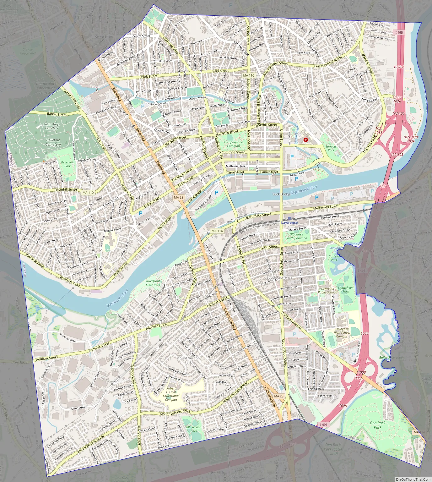
Lawrence city Satellite Map

Geography
According to the United States Census Bureau, the city has a total area of 7.4 square miles (19 km), of which 7.0 square miles (18 km) is land and 0.4 square miles (1.0 km) (6.07%) is water. Lawrence is on both sides of the Merrimack River, approximately 26 miles (42 km) upstream from the Atlantic Ocean. On the north side of the river, it is surrounded by Methuen. On the south side of the river, the town is bordered by North Andover to the east, and Andover to the south and southwest. Lawrence is approximately 20 miles (32 km) southwest of Newburyport, 30 miles (48 km) north-northwest of Boston and 27 miles (43 km) southeast of Manchester, New Hampshire.
Aside from the Merrimack River, other water features include the Spicket River, which flows into the Merrimack from Methuen, and the Shawsheen River, which forms the southeastern border of the city. Lawrence has two power canals that were formerly used to provide hydropower to the mills—one on the north bank of the river, the other on the south. Channeling water into these canals is the Great Stone Dam, which lies across the entire Merrimack and was, at the time of its construction in the 1840s, the largest dam in the world. The highest point in Lawrence is the top of Tower Hill in the northwest corner of the city, rising approximately 240 feet (73 m) above sea level. Other prominent hills include Prospect Hill, in the northeast corner of the city, and Mount Vernon, along the southern edge of the city. Most industrial activity was concentrated in the flatlands along the rivers. Den Rock Park, a wooded conservation district on the southern edge of Lawrence that spans the Lawrence-Andover town line, provides recreation for nature lovers and rock-climbers alike. There are also several small parks throughout town.
Climate
Lawrence has a humid continental climate (Köppen climate classification Dfa), which is typical for the southern Merrimack valley region in eastern Massachusetts.
See also
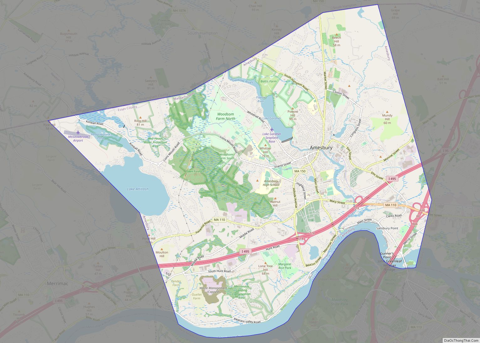
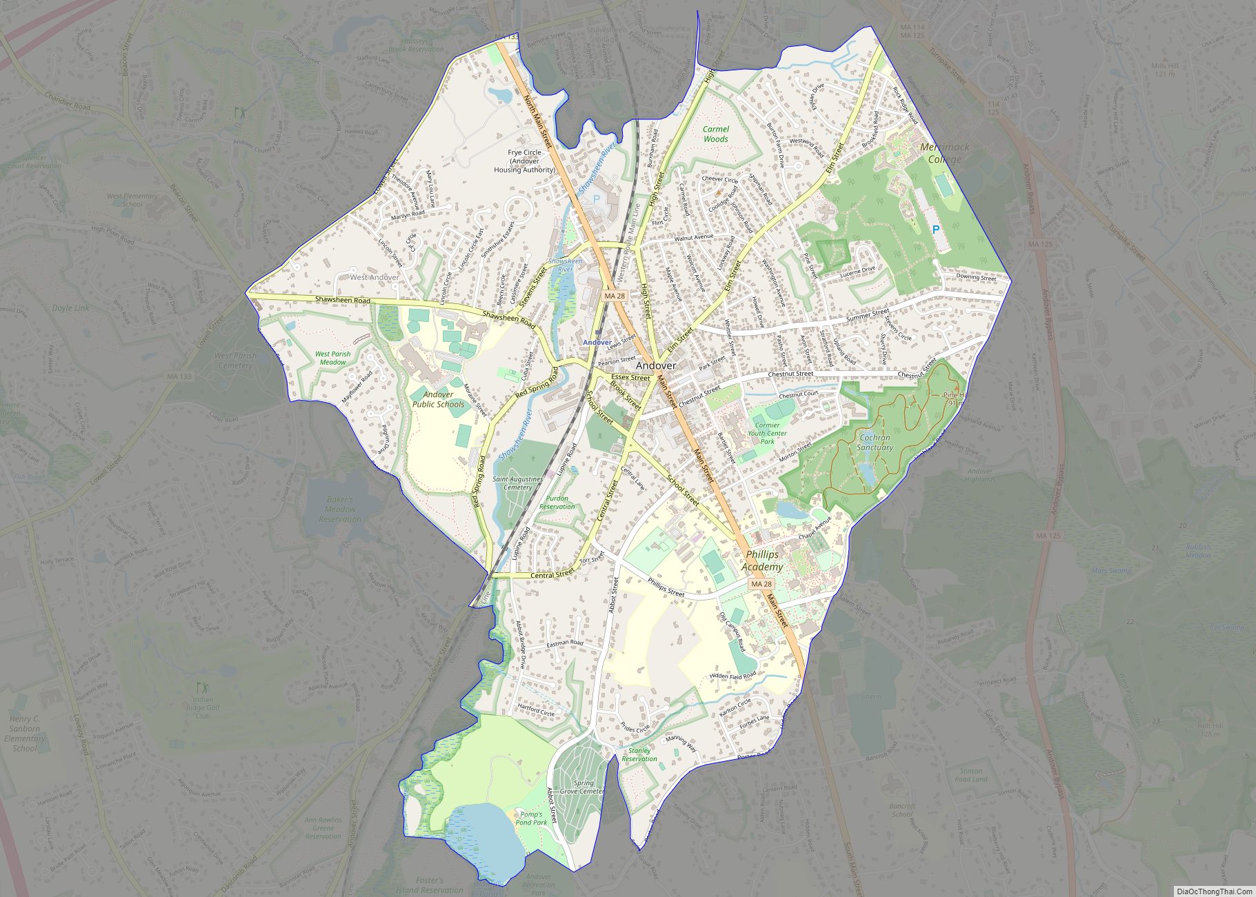
Map of Massachusetts State and its subdivision: Map of other states:- Alabama
- Alaska
- Arizona
- Arkansas
- California
- Colorado
- Connecticut
- Delaware
- District of Columbia
- Florida
- Georgia
- Hawaii
- Idaho
- Illinois
- Indiana
- Iowa
- Kansas
- Kentucky
- Louisiana
- Maine
- Maryland
- Massachusetts
- Michigan
- Minnesota
- Mississippi
- Missouri
- Montana
- Nebraska
- Nevada
- New Hampshire
- New Jersey
- New Mexico
- New York
- North Carolina
- North Dakota
- Ohio
- Oklahoma
- Oregon
- Pennsylvania
- Rhode Island
- South Carolina
- South Dakota
- Tennessee
- Texas
- Utah
- Vermont
- Virginia
- Washington
- West Virginia
- Wisconsin
- Wyoming