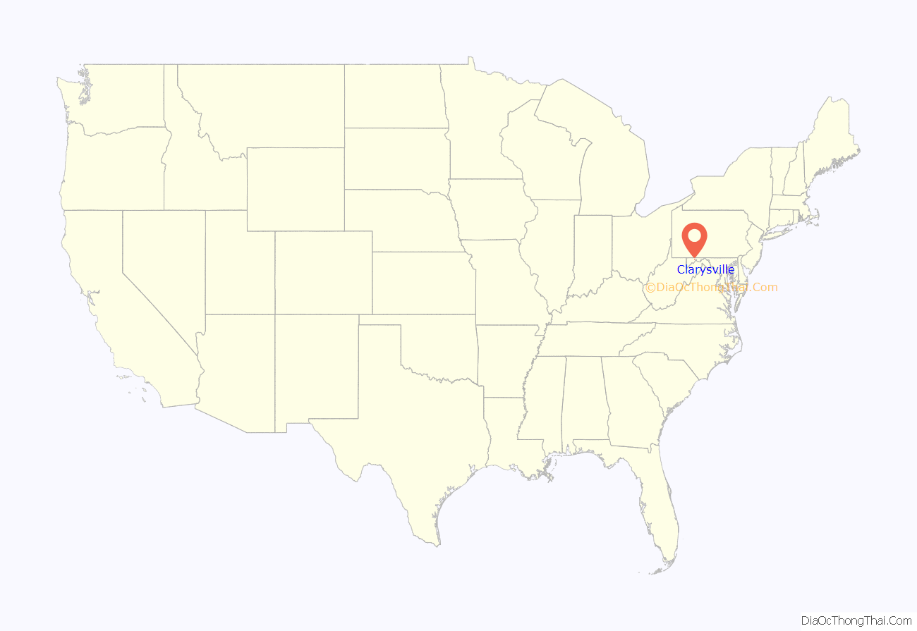
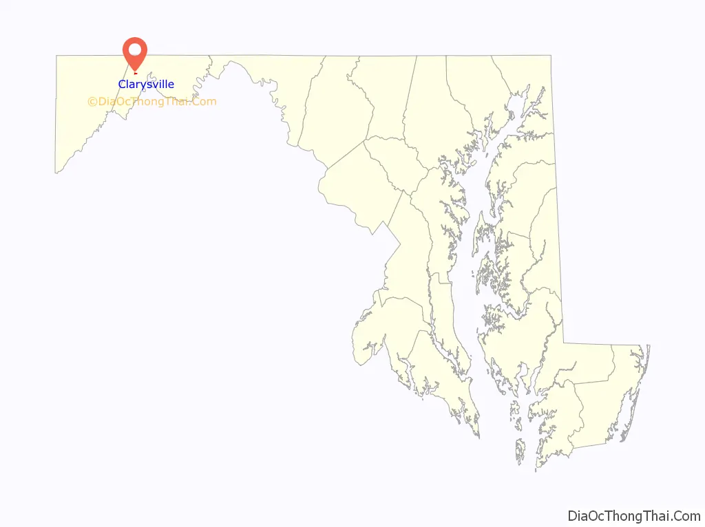
Clarysville is an unincorporated community and census-designated place (CDP) in Allegany County, Maryland, United States. As of the 2010 census it had a population of 73.
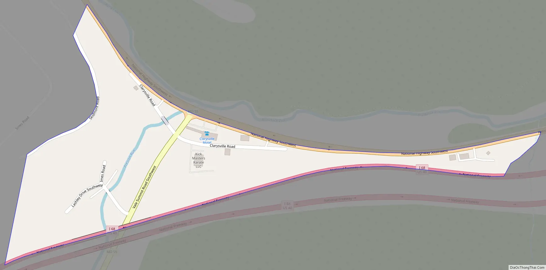
It is located along U.S. Route 40 Alternate at its intersection with Maryland Route 55. Frostburg is 2 miles (3 km) to the west, and Cumberland is 7 miles (11 km) to the east along Route 40 Alt.
Clarysville was known around the region for the Clarysville Inn, a historic building which stood from 1807 until it burned in 1999. During the American Civil War, the inn served as a military hospital, treating wounded soldiers.
The exit of the Hoffman drainage tunnel, constructed to drain several coal mines, is near Clarysville.
| Name: | Clarysville CDP |
|---|---|
| LSAD Code: | 57 |
| LSAD Description: | CDP (suffix) |
| State: | Maryland |
| County: | Allegany County |
| Elevation: | 1,500 ft (500 m) |
| Total Area: | 0.12 sq mi (0.30 km²) |
| Land Area: | 0.12 sq mi (0.30 km²) |
| Water Area: | 0.00 sq mi (0.00 km²) |
| Total Population: | 67 |
| Population Density: | 572.65/sq mi (221.28/km²) |
| FIPS code: | 2417475 |
| GNISfeature ID: | 2583599 |
Online Interactive Map
Click on ![]() to view map in "full screen" mode.
to view map in "full screen" mode.
Clarysville location map. Where is Clarysville CDP?
Clarysville Road Map
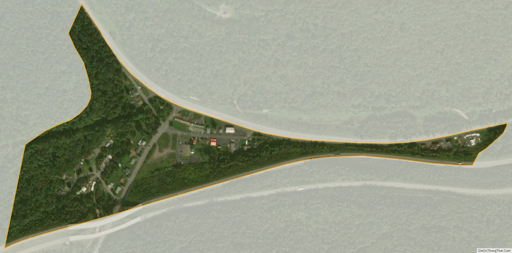
Clarysville city Satellite Map
See also
Map of Maryland State and its subdivision: Map of other states:- Alabama
- Alaska
- Arizona
- Arkansas
- California
- Colorado
- Connecticut
- Delaware
- District of Columbia
- Florida
- Georgia
- Hawaii
- Idaho
- Illinois
- Indiana
- Iowa
- Kansas
- Kentucky
- Louisiana
- Maine
- Maryland
- Massachusetts
- Michigan
- Minnesota
- Mississippi
- Missouri
- Montana
- Nebraska
- Nevada
- New Hampshire
- New Jersey
- New Mexico
- New York
- North Carolina
- North Dakota
- Ohio
- Oklahoma
- Oregon
- Pennsylvania
- Rhode Island
- South Carolina
- South Dakota
- Tennessee
- Texas
- Utah
- Vermont
- Virginia
- Washington
- West Virginia
- Wisconsin
- Wyoming


