Cresaptown is an unincorporated community and census-designated place (CDP) located in Allegany County, Maryland, United States. As of the 2010 census it had a population of 6,247. Prior to 2010 it was part of the Cresaptown-Bel Air CDP. Cresaptown’s post office was established December 22, 1800. Cresaptown is located 6 miles (10 km) southwest of Cumberland.
| Name: | Cresaptown CDP |
|---|---|
| LSAD Code: | 57 |
| LSAD Description: | CDP (suffix) |
| State: | Maryland |
| County: | Allegany County |
| Elevation: | 775 ft (236 m) |
| Total Area: | 2.77 sq mi (7.16 km²) |
| Land Area: | 2.66 sq mi (6.88 km²) |
| Water Area: | 0.11 sq mi (0.28 km²) |
| Total Population: | 5,442 |
| Population Density: | 2,047.40/sq mi (790.58/km²) |
| ZIP code: | 21502 |
| Area code: | 301, 240 |
| FIPS code: | 2420525 |
| GNISfeature ID: | 2633177 |
Online Interactive Map
Click on ![]() to view map in "full screen" mode.
to view map in "full screen" mode.
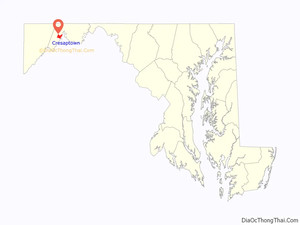
Cresaptown location map. Where is Cresaptown CDP?

History
Prior to 1728, Cresaptown was the site of a Shawnee village along the Potomac River. The inhabitants of this region were a portion of the Shawanese tribe, a sub-division of the Algonquian group, one of the most warlike combinations of that period. The warriors engaged in hunting and fishing for food and furs, while their families were left at home to tend the maize and grass that grew in the rich soil of the Potomac valley. The maize was ground into corn meal and made into Shawnee cake, a popular diet of the Shawnees living in the valley.
The Shawanees in the valley lived in shelters composed of two forked posts that were driven into the ground, and on these was laid a ridge pole. Small saplings, cut to a length of about 8 feet (2.4 m), were laid against the pole, one end resting on the ground, forming a shelter similar to a V-shaped tent. This was covered with bark and skins and made tight enough to protect against rain or snow. The floors were spread with furs, which made sure for seats or beds. Emanuel Custer, father of George Armstrong Custer, was born in Cresaptown 1806, and moved to Ohio in 1845, finally settling in Michigan.
Cresaptown was named for the family of Daniel Cresap, early settlers.
Cresaptown Road Map

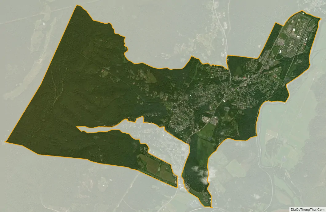
Cresaptown city Satellite Map
See also
Map of Maryland State and its subdivision: Map of other states:- Alabama
- Alaska
- Arizona
- Arkansas
- California
- Colorado
- Connecticut
- Delaware
- District of Columbia
- Florida
- Georgia
- Hawaii
- Idaho
- Illinois
- Indiana
- Iowa
- Kansas
- Kentucky
- Louisiana
- Maine
- Maryland
- Massachusetts
- Michigan
- Minnesota
- Mississippi
- Missouri
- Montana
- Nebraska
- Nevada
- New Hampshire
- New Jersey
- New Mexico
- New York
- North Carolina
- North Dakota
- Ohio
- Oklahoma
- Oregon
- Pennsylvania
- Rhode Island
- South Carolina
- South Dakota
- Tennessee
- Texas
- Utah
- Vermont
- Virginia
- Washington
- West Virginia
- Wisconsin
- Wyoming


