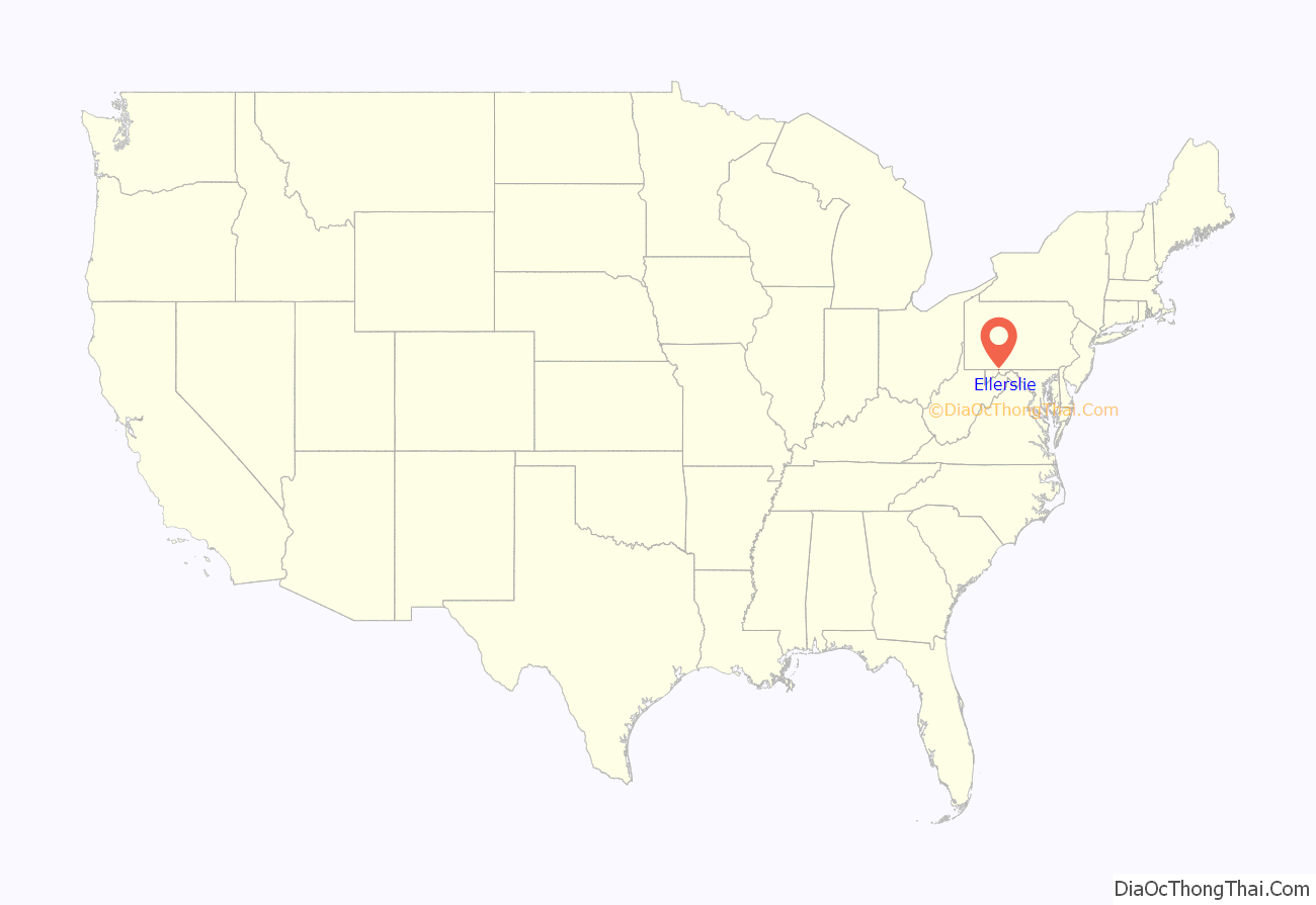
Ellerslie is an unincorporated community and census-designated place (CDP) in Allegany County, Maryland, United States. As of the 2010 census it had a population of 572. Ellerslie is part of the Cumberland, MD-WV Metropolitan Statistical Area.
The community is named for Elderslie, Scotland, the birthplace of Scottish hero William Wallace.
| Name: | Ellerslie CDP |
|---|---|
| LSAD Code: | 57 |
| LSAD Description: | CDP (suffix) |
| State: | Maryland |
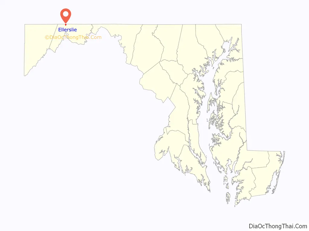
| County: | Allegany County |
| Elevation: | 733 ft (223 m) |
| Total Area: | 0.95 sq mi (2.46 km²) |
| Land Area: | 0.92 sq mi (2.39 km²) |
| Water Area: | 0.03 sq mi (0.06 km²) |
| Total Population: | 651 |
| Population Density: | 705.31/sq mi (272.34/km²) |
| ZIP code: | 21529 |
| Area code: | 301, 240 |
| FIPS code: | 2425925 |
| GNISfeature ID: | 2583613 |
Online Interactive Map
Click on ![]() to view map in "full screen" mode.
to view map in "full screen" mode.
Ellerslie location map. Where is Ellerslie CDP?
History
In the early twentieth century, Ellerslie contained a planing mill and a Standard Oil Company pumping station.
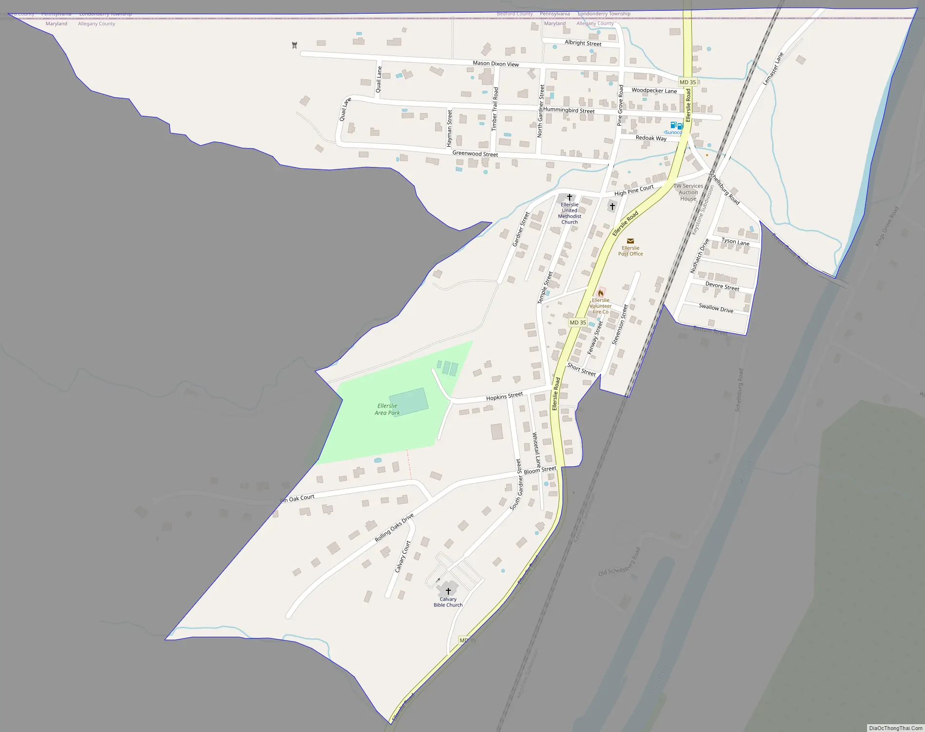
Ellerslie Road Map
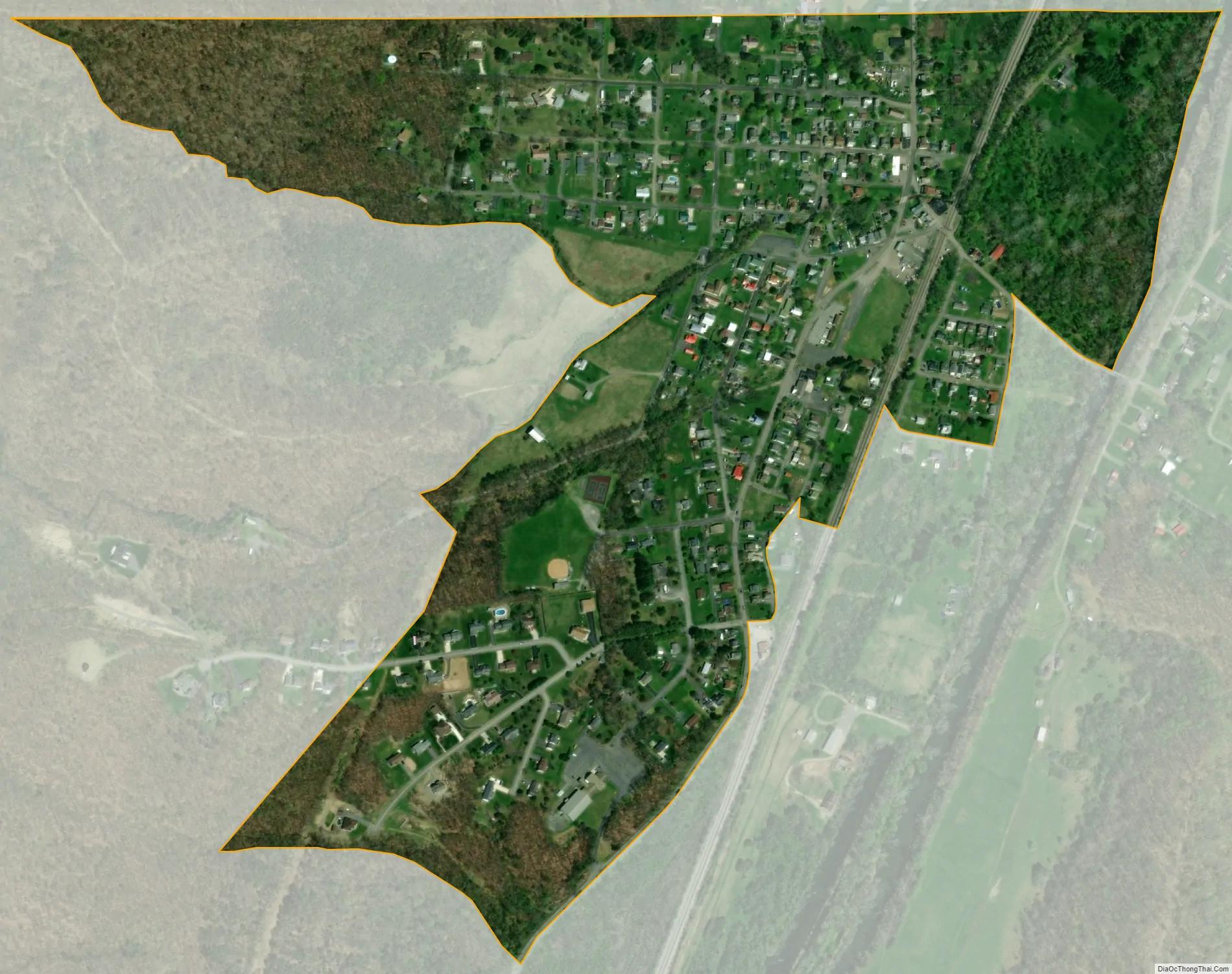
Ellerslie city Satellite Map
Geography
Ellerslie lies along Maryland Route 35, 7 miles (11 km) north of Cumberland and is next to the Pennsylvania-Maryland state line. To the north, Pennsylvania Route 96 extends 8 miles (13 km) to Hyndman and 31 miles (50 km) to Bedford. The town is situated in the valley of Wills Creek, between the parallel ridges of Little Allegheny Mountain to the west and Wills Mountain to the east.
See also
Map of Maryland State and its subdivision: Map of other states:- Alabama
- Alaska
- Arizona
- Arkansas
- California
- Colorado
- Connecticut
- Delaware
- District of Columbia
- Florida
- Georgia
- Hawaii
- Idaho
- Illinois
- Indiana
- Iowa
- Kansas
- Kentucky
- Louisiana
- Maine
- Maryland
- Massachusetts
- Michigan
- Minnesota
- Mississippi
- Missouri
- Montana
- Nebraska
- Nevada
- New Hampshire
- New Jersey
- New Mexico
- New York
- North Carolina
- North Dakota
- Ohio
- Oklahoma
- Oregon
- Pennsylvania
- Rhode Island
- South Carolina
- South Dakota
- Tennessee
- Texas
- Utah
- Vermont
- Virginia
- Washington
- West Virginia
- Wisconsin
- Wyoming


