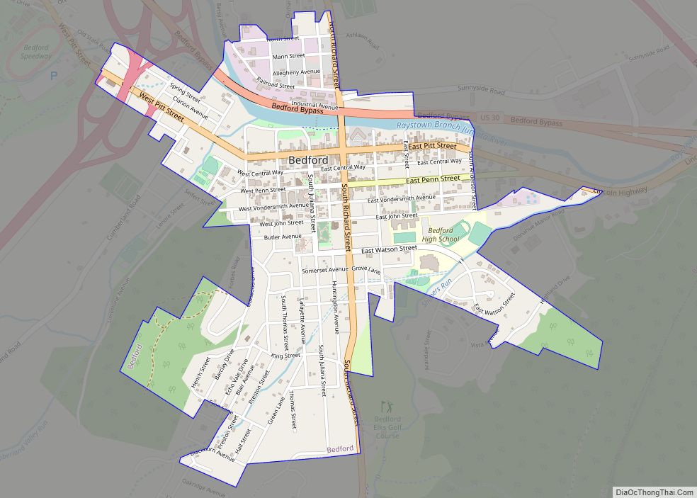
Bedford is a borough and spa town in and the county seat of Bedford County in the U.S. state of Pennsylvania. It is located 102 miles (164 km) west of Harrisburg, the state capital, and 107 miles (172 km) east of Pittsburgh. Bedford’s population was 2,861 at the 2020 census.
| Name: | Bedford borough |
|---|---|
| LSAD Code: | 21 |
| LSAD Description: | borough (suffix) |
| State: | Pennsylvania |
| County: | Bedford County |
| Incorporated: | March 13, 1795 |
| Elevation: | 1,100 ft (300 m) |
| Total Area: | 1.11 sq mi (2.88 km²) |
| Land Area: | 1.08 sq mi (2.81 km²) |
| Water Area: | 0.03 sq mi (0.07 km²) |
| Total Population: | 2,865 |
| Population Density: | 2,640.55/sq mi (1,019.45/km²) |
| ZIP code: | 15522 |
| Area code: | 814 |
| FIPS code: | 4204944 |
| Website: | bedboro.com |
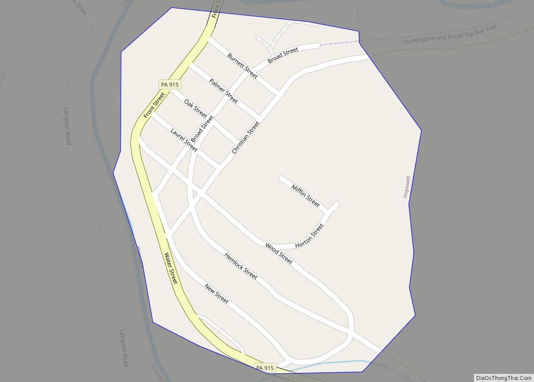
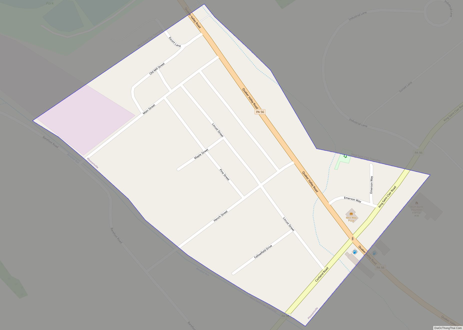
Online Interactive Map
Click on ![]() to view map in "full screen" mode.
to view map in "full screen" mode.
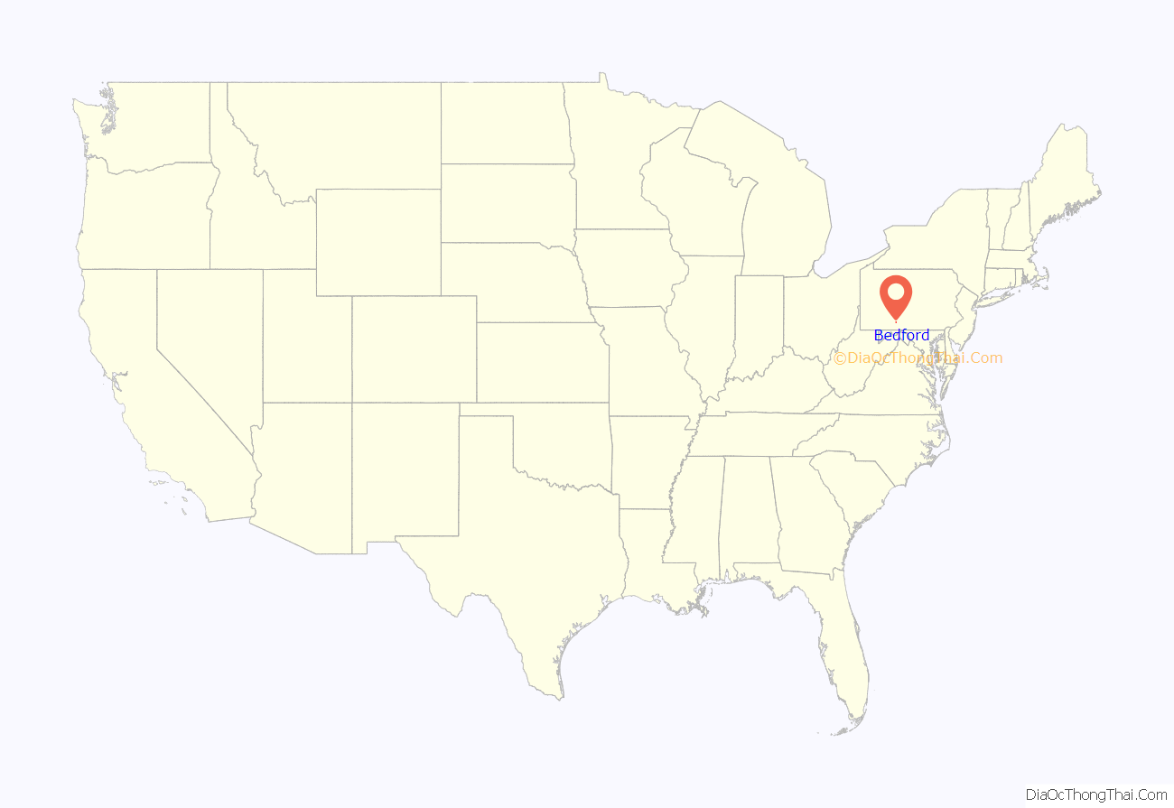
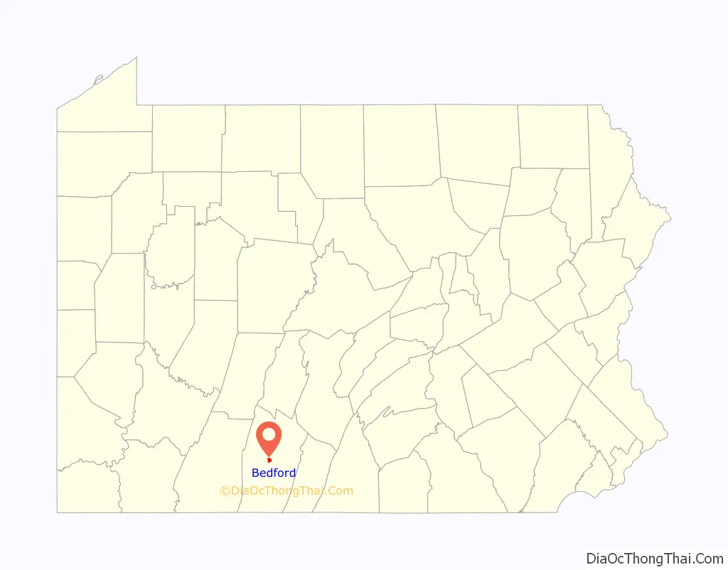
Bedford location map. Where is Bedford borough?
History
The vicinity of Bedford was inhabited by Euro-American “Indian” traders in the late 1740s and early 1750s. Actual settlers did not appear in the region until after Forbes Road was cut to enable the Forbes Expedition to reach Fort Duquesne in 1758.
In 1758, the British Army under General John Forbes came to the vicinity of John Ray’s trading post to set up Fort Bedford as a supply depot on “the Communication:, the line of fortifications and supply depots between Carlisle and the Forks of the Allegheny River. The fort was named for John Russell, the politically powerful 4th Duke of Bedford in England. Some believe this is how the town later got its name. Fort Bedford was built as one of the many British Army stepping stones through the state from Carlisle leading west to the Forks of the Ohio River. The Forks of the Ohio were claimed by the French who constructed Fort Duquesne on the site of an earlier British fort. The French wanted to control fur trading in the Ohio Valley and along the Mississippi River and its tributary, the Ohio River (formed by the merging of the Monongahela and Allegheny Rivers). Fort Bedford provided a refuge for settlers escaping Indian raids throughout the American Revolutionary War.
A myth about Fort Bedford claims that it was liberated ten years before the Revolution by American rebels, James Smith’s Black Boys, making it the “first British fort to fall to American rebels” during the Revolution. The problem with this myth is that the fort was abandoned by the British Army in 1766 when Pontiac’s Rebellionwas put down, while the Smith raid took place in 1769. A group of men attacked a pack train and stole guns, ammunition, and other goods intended for trade with Indians in the Ohio valley. Those men were captured and were placed under guard in the only public building large enough to serve as an impromptu jail. Smith and his Black Boys attacked the fort, which was being guarded by three local settlers (not the British Army) and they set the legally imprisoned men free, stole some rifles, and left. In his memoirs, the myth’s source, Smith tried to paint himself as a modern-day Robin Hood.
in 1766, the village of Bedford was laid out by John Lukens; it would be incorporated on March 13, 1795. But because the citizens failed to fill the required posts at the time, the town had to be re-incorporated in 1816.
The fort later fell into ruin and collapsed. In 1958, a building would be constructed in the manner of one of the fort’s five blockhouses; it currently houses the Fort Bedford Museum. The fort itself, which stood to the east of the museum structure was never reconstructed.
In 1794, some 13,000 Federal Army troops were mustered by President George Washington to put down the Whiskey Rebellion. They are believed to have assembled near the Jean Bonnet Tavern just four miles west of Bedford; Washington himself used the Espy House in Bedford is notable as his headquarters. There was much more at stake than quieting the uprising of rebels angered by a tax on whiskey; Washington felt the Constitution itself was at risk. The rebellion mainly consisted of farmers who claimed that they could, due to the high cost of pack mule transport to the eastern cities, earn more selling whiskey instead of grain. (The fact of the matter is that a pound of whiskey weighs the same as a pound of grain.) The rebellion spread fast, and when it reached Pittsburgh some rebels threatened to burn the city to the ground. Anarchy was on its way; the British and French watched every move hoping they could come back and take over. Washington knew he had to act and make a statement; the laws of America would be obeyed. 12,950 militiamen were called to the south-western corner of the state, leaving the rebels without many choices. One historian later said, “It was at Bedford that the new federal government was finally to establish itself as sovereign in its own time and place.”
Bedford County, at one time, was famous for its medicinal springs. Three resorts were developed in the county: Bedford Springs (in Bedford Township to the south of Bedford Borough), Chalybeate Springs (in Bedford Township to the east of Bedford Borough) and the White Sulphur Springs (In Harrison Township to the southwest of Bedford Borough). At the Bedford Springs Resort there is a mineral spring, a chalybeate spring, a limestone spring, a sulfur spring and two sweet springs. In the year 1804, a mechanic from Bedford, Jacob Fletcher, drank some of the water. The rheumatic pains and ulcers he had been suffering from troubled him less that night. From then on he often drank from the spring and soaked his limbs in the water. In a few weeks he was entirely cured. News spread and the “healing springs” quickly became popular.
The discovery of the curative springs at what would become known as the Bedford Springs Resort led Dr. John Anderson to purchase the nearby land and build a spa in 1804. Due to the lack of medicines in that time, people from great distances flocked to the hotel in search of a cure for their illness. They would come to Bedford Springs to “take the waters”. The Bedford Springs Hotel was the first place in America to have an Olympic sized pool. President James Buchanan made it his “summer White House”. While Buchanan was there the first trans-Atlantic cable message was sent to his room from Queen Victoria on August 17, 1858. The hotel, in 1855, also housed the only Supreme Court hearing ever to be held outside of the capital.
Chalybeate Springs Hotel, along with the nearby Bedford Springs Hotel, were popular resorts during the 19th century among the wealthy. Notable visitors to Bedford Springs included William Henry Harrison, James Polk, Zachary Taylor, Thaddeus Stevens. Rutherford B. Hayes, and Benjamin Harrison visited Chalybeate Springs Hotel, as did many other notable people.
U.S. Route 30, also known as the Lincoln Highway, passes through Bedford. Up until the opening of the Pennsylvania Turnpike in 1940, U.S. Route 30 was the key east-west route connecting Philadelphia to the west. In 1927, David Koontz built a coffee pot-shaped building, which was originally a diner. This building, a landmark in Bedford, was moved in 2003 to the Bedford County Fairgrounds.
The Bedford Historic District was added to the National Register of Historic Places in 1983.
Bedford Road Map
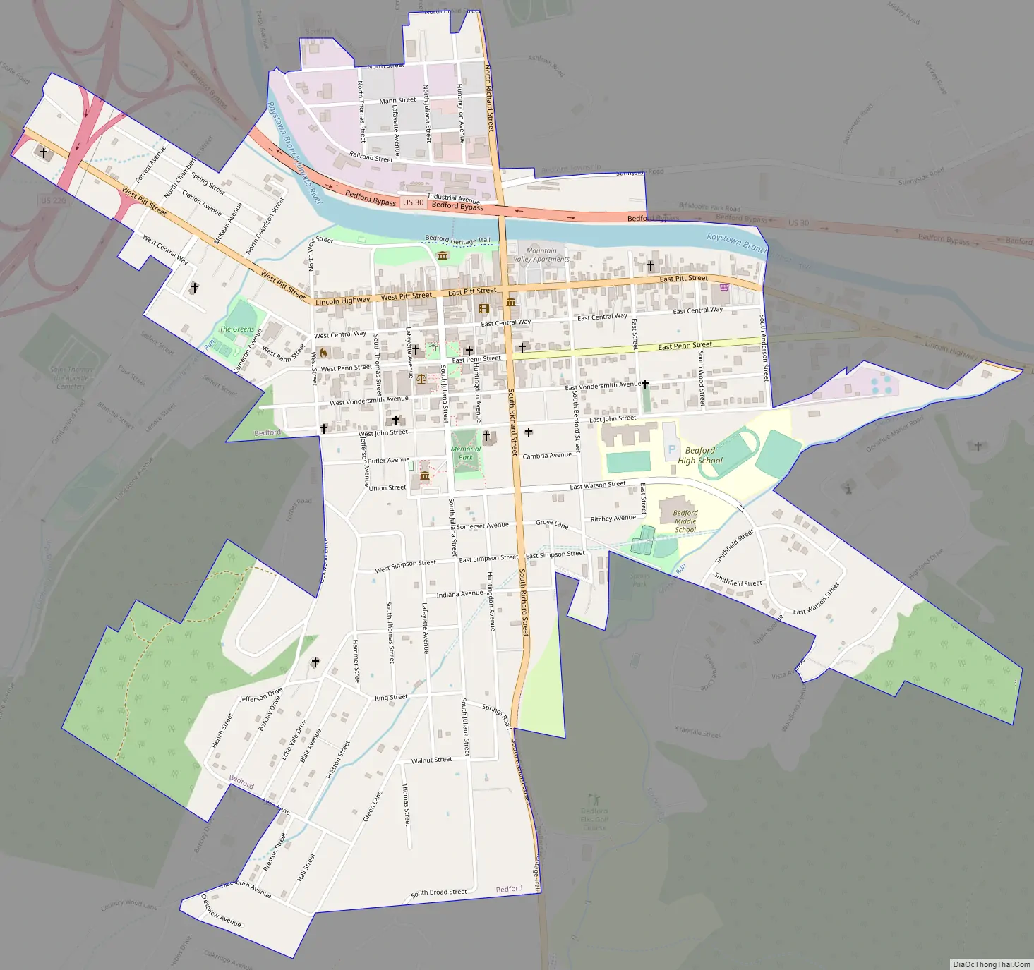
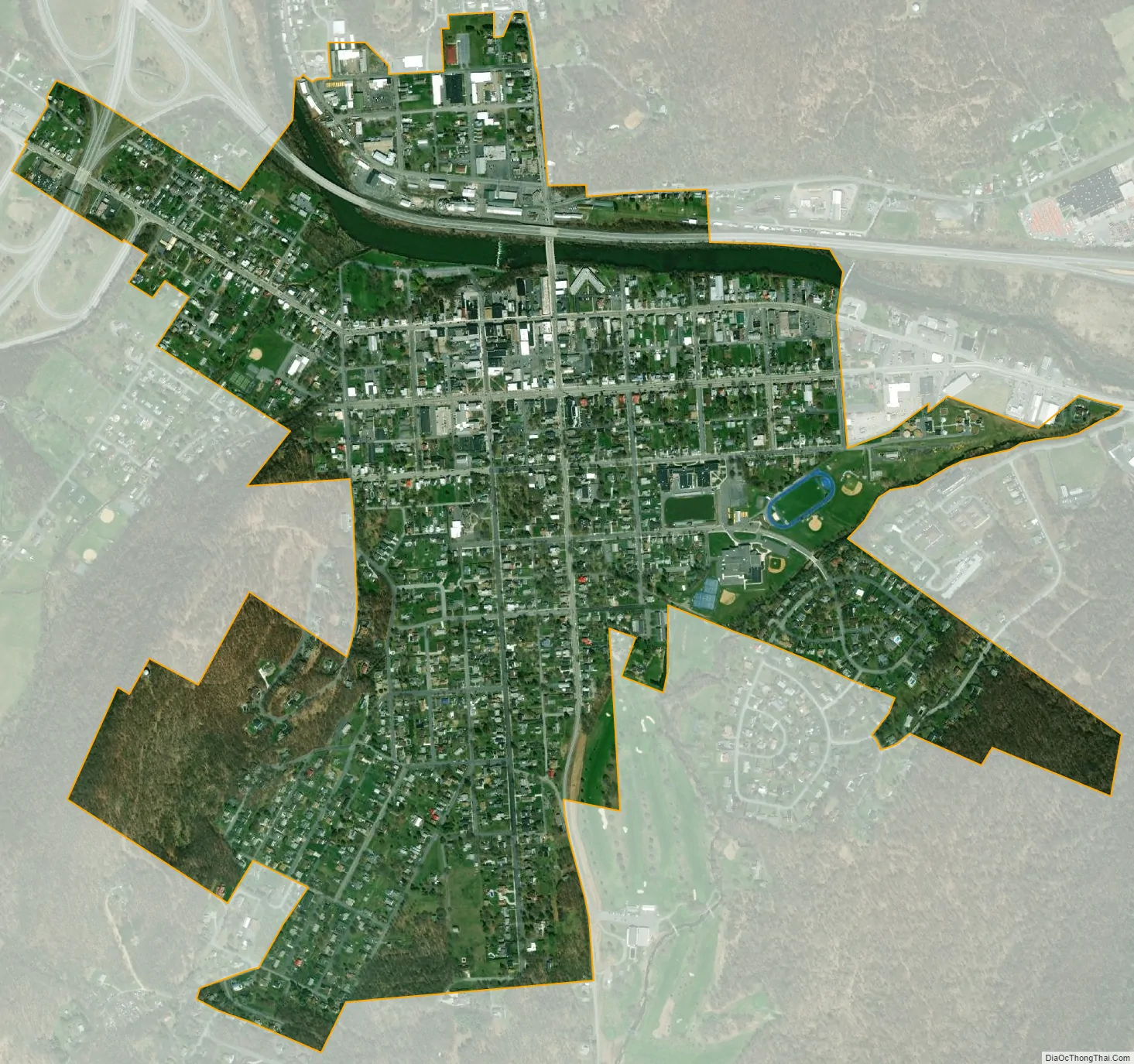
Bedford city Satellite Map
Geography
Bedford is located in the center of Bedford County at 40°0′59″N 78°30′15″W / 40.01639°N 78.50417°W / 40.01639; -78.50417 (40.016361, −78.504071). It is completely surrounded by Bedford Township.
The borough is accessible from Exit 146 of the Pennsylvania Turnpike at the midpoint between Harrisburg and Pittsburgh. U.S. Route 220 is a four-lane north-south highway that bypasses Bedford to the west and becomes Interstate 99 just north of town where it crosses the Pennsylvania Turnpike. US-220 Business passes through the center of Bedford as Richard Street. The Raystown Branch of the Juniata River, a tributary of the Susquehanna River, flows west to east through the center of Bedford.
According to the United States Census Bureau, the borough has a total area of 1.11 square miles (2.88 km), of which 0.03 square miles (0.07 km), or 2.51%, is water.
See also
Map of Pennsylvania State and its subdivision:- Adams
- Allegheny
- Armstrong
- Beaver
- Bedford
- Berks
- Blair
- Bradford
- Bucks
- Butler
- Cambria
- Cameron
- Carbon
- Centre
- Chester
- Clarion
- Clearfield
- Clinton
- Columbia
- Crawford
- Cumberland
- Dauphin
- Delaware
- Elk
- Erie
- Fayette
- Forest
- Franklin
- Fulton
- Greene
- Huntingdon
- Indiana
- Jefferson
- Juniata
- Lackawanna
- Lancaster
- Lawrence
- Lebanon
- Lehigh
- Luzerne
- Lycoming
- Mc Kean
- Mercer
- Mifflin
- Monroe
- Montgomery
- Montour
- Northampton
- Northumberland
- Perry
- Philadelphia
- Pike
- Potter
- Schuylkill
- Snyder
- Somerset
- Sullivan
- Susquehanna
- Tioga
- Union
- Venango
- Warren
- Washington
- Wayne
- Westmoreland
- Wyoming
- York
- Alabama
- Alaska
- Arizona
- Arkansas
- California
- Colorado
- Connecticut
- Delaware
- District of Columbia
- Florida
- Georgia
- Hawaii
- Idaho
- Illinois
- Indiana
- Iowa
- Kansas
- Kentucky
- Louisiana
- Maine
- Maryland
- Massachusetts
- Michigan
- Minnesota
- Mississippi
- Missouri
- Montana
- Nebraska
- Nevada
- New Hampshire
- New Jersey
- New Mexico
- New York
- North Carolina
- North Dakota
- Ohio
- Oklahoma
- Oregon
- Pennsylvania
- Rhode Island
- South Carolina
- South Dakota
- Tennessee
- Texas
- Utah
- Vermont
- Virginia
- Washington
- West Virginia
- Wisconsin
- Wyoming