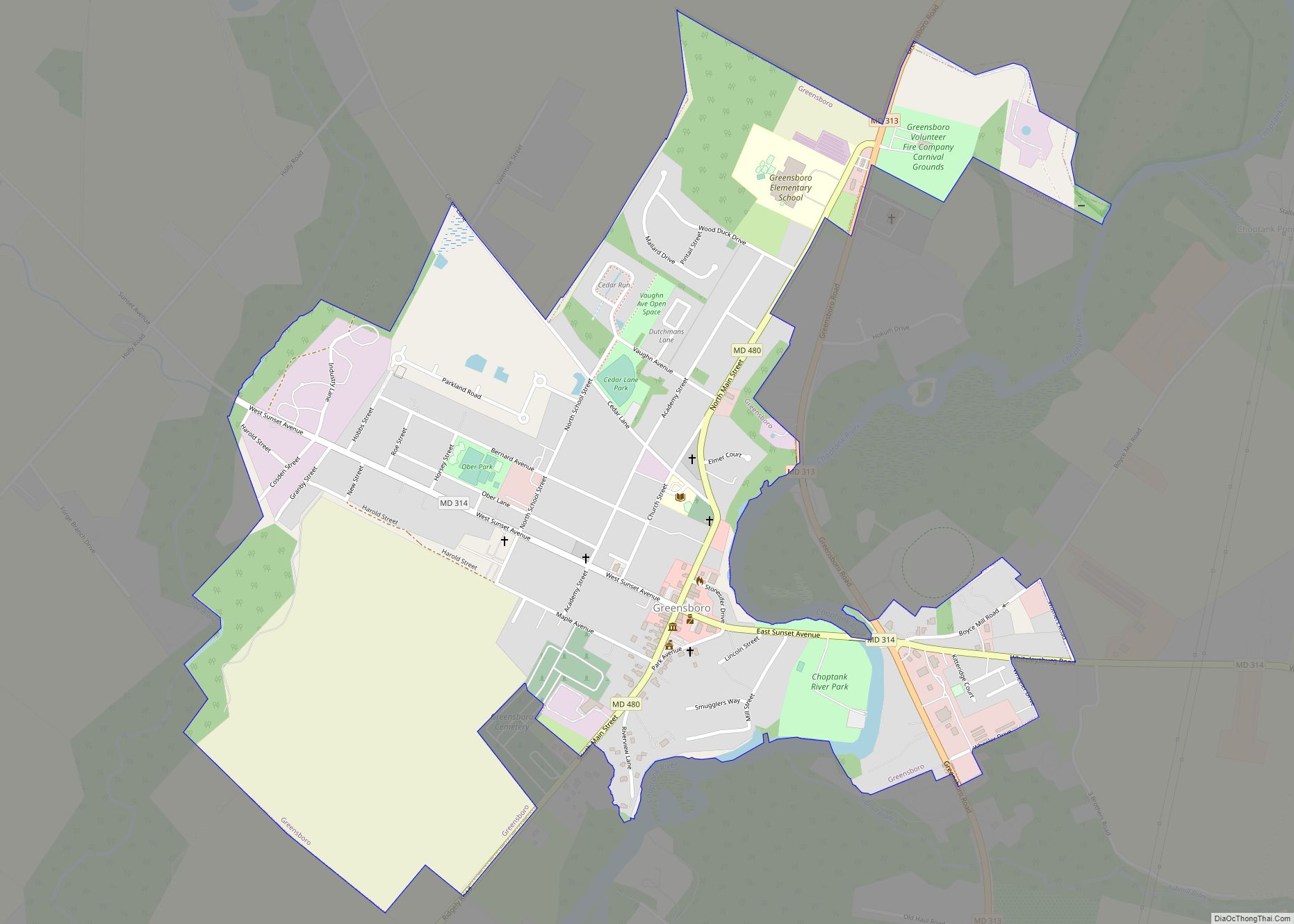
Greensboro is a town located on the banks of the Choptank River in Caroline County, Maryland, United States. The population was 1,931 at the 2010 United States Census. The ZIP code is 21639. The primary phone exchange is 482 and the area code is 410. The town is served by Maryland Routes 480 and 313.
Greensboro hosted the Caroline County Softball League, which produced both state and national champions.
Willow Grove was listed on the National Register of Historic Places in 1972. Leonard House was listed in 1988 and Brick House Farm in 2009.
| Name: | Greensboro town |
|---|---|
| LSAD Code: | 43 |
| LSAD Description: | town (suffix) |
| State: | Maryland |
| County: | Caroline County |
| Incorporated: | 1826 |
| Elevation: | 16 ft (5 m) |
| Total Area: | 1.07 sq mi (2.78 km²) |
| Land Area: | 1.07 sq mi (2.78 km²) |
| Water Area: | 0.00 sq mi (0.00 km²) |
| Total Population: | 1,919 |
| Population Density: | 1,786.78/sq mi (689.73/km²) |
| ZIP code: | 21639 |
| Area code: | 410 |
| FIPS code: | 2435200 |
| GNISfeature ID: | 0590381 |
| Website: | www.greensboromd.com |
Online Interactive Map
Click on ![]() to view map in "full screen" mode.
to view map in "full screen" mode.
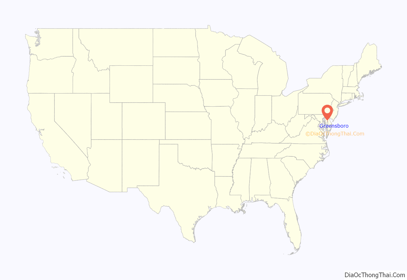
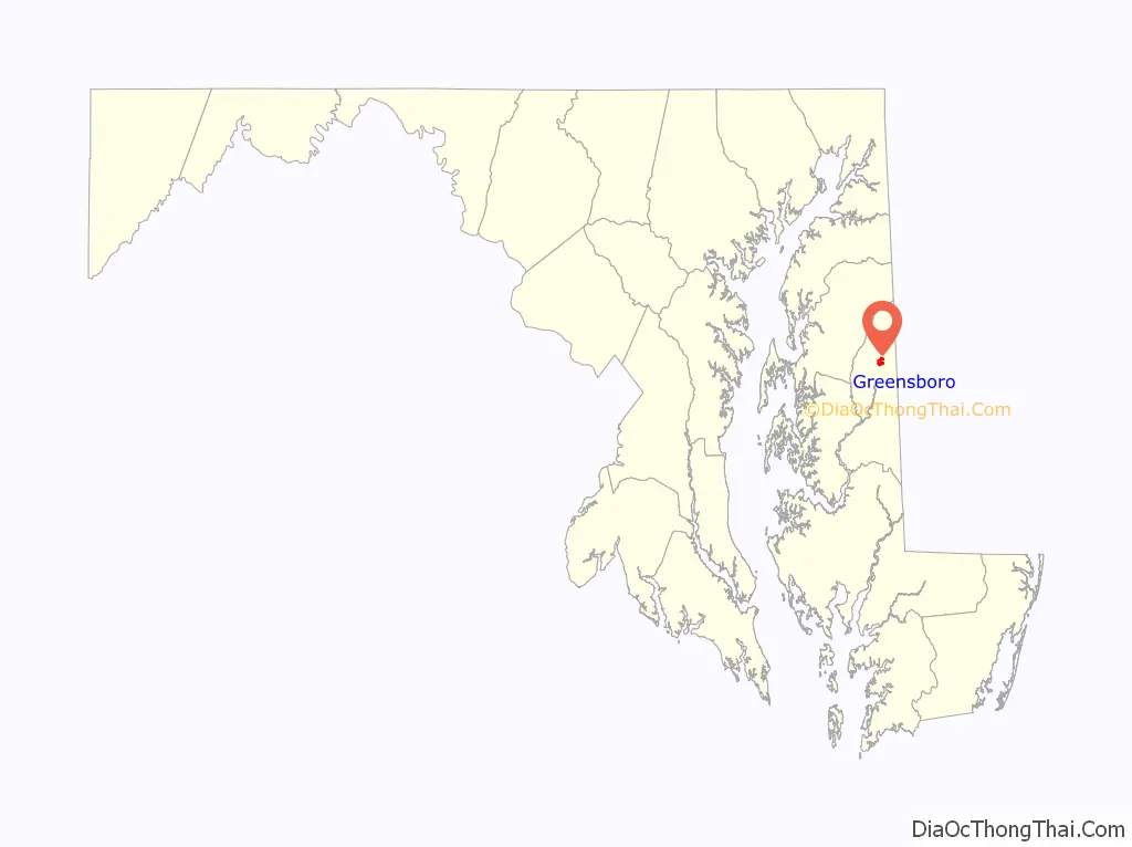
Greensboro location map. Where is Greensboro town?
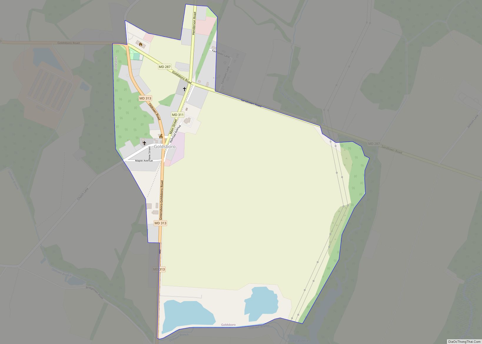
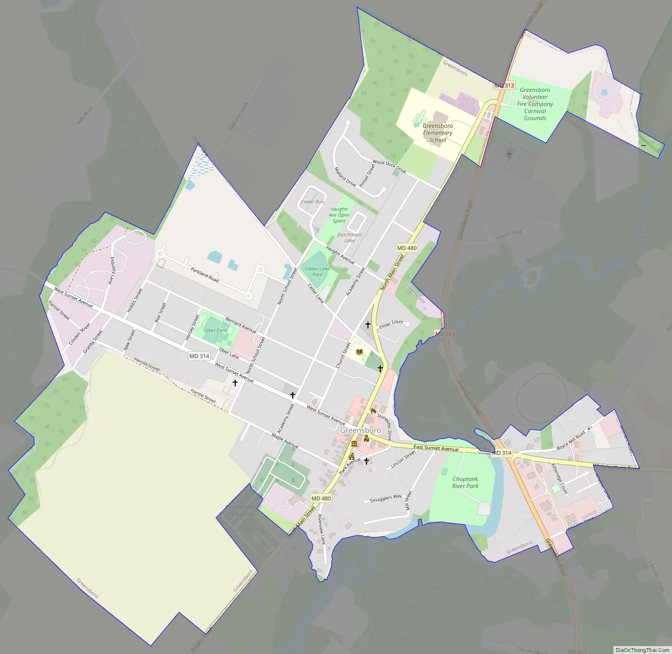
Greensboro Road Map
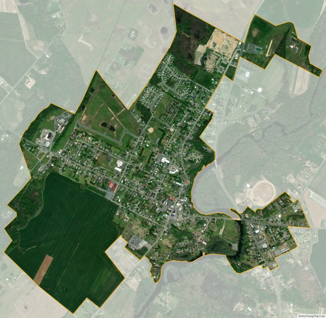
Greensboro city Satellite Map
Geography
Greensboro is located at 38°58′32″N 75°48′25″W / 38.975441°N 75.806982°W / 38.975441; -75.806982.
According to the United States Census Bureau, the town has a total area of 1.05 square miles (2.72 km), all land.
See also
Map of Maryland State and its subdivision: Map of other states:- Alabama
- Alaska
- Arizona
- Arkansas
- California
- Colorado
- Connecticut
- Delaware
- District of Columbia
- Florida
- Georgia
- Hawaii
- Idaho
- Illinois
- Indiana
- Iowa
- Kansas
- Kentucky
- Louisiana
- Maine
- Maryland
- Massachusetts
- Michigan
- Minnesota
- Mississippi
- Missouri
- Montana
- Nebraska
- Nevada
- New Hampshire
- New Jersey
- New Mexico
- New York
- North Carolina
- North Dakota
- Ohio
- Oklahoma
- Oregon
- Pennsylvania
- Rhode Island
- South Carolina
- South Dakota
- Tennessee
- Texas
- Utah
- Vermont
- Virginia
- Washington
- West Virginia
- Wisconsin
- Wyoming