Linganore is a census-designated place (CDP) in Frederick County, in the U.S. state of Maryland. It consists of the area around Lake Linganore, a residential community governed by a homeowners association, located east of the city of Frederick. As of the 2020 census the CDP had a population of 12,351. Prior to 2010, the area was part of the Linganore-Bartonsville CDP. The mailing address for the area is Lake Linganore, with a ZIP code of 21774.
| Name: | Linganore CDP |
|---|---|
| LSAD Code: | 57 |
| LSAD Description: | CDP (suffix) |
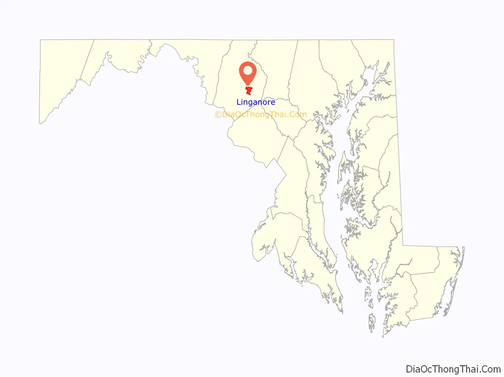
| State: | Maryland |
| County: | Frederick County |
| Elevation: | 440 ft (130 m) |
| Total Area: | 8.56 sq mi (22.18 km²) |
| Land Area: | 8.28 sq mi (21.44 km²) |
| Water Area: | 0.29 sq mi (0.75 km²) |
| Total Population: | 12,351 |
| Population Density: | 1,492.21/sq mi (576.12/km²) |
| ZIP code: | 21774 |
| Area code: | 301 and 240 |
| FIPS code: | 2447040 |
| GNISfeature ID: | 0588687 |
| Website: | www.lakelinganore.org |
Online Interactive Map
Click on ![]() to view map in "full screen" mode.
to view map in "full screen" mode.
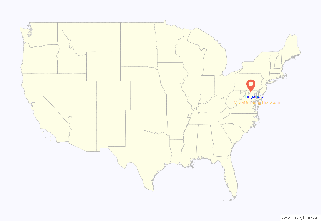
Linganore location map. Where is Linganore CDP?
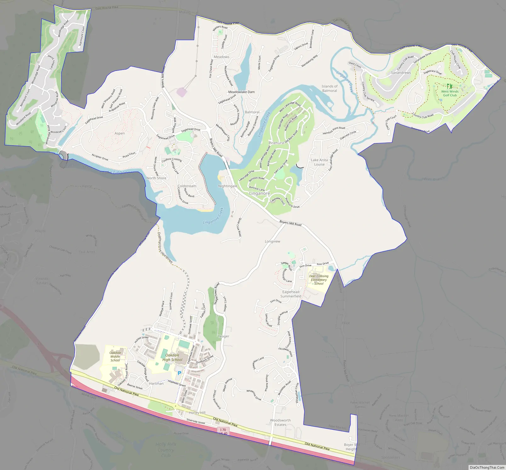
Linganore Road Map
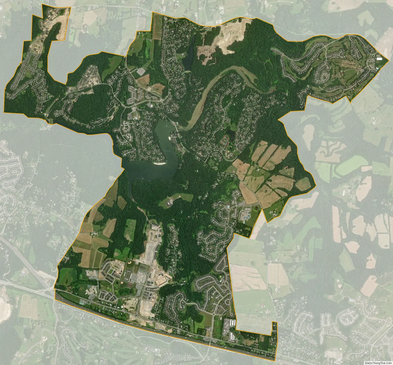
Linganore city Satellite Map
Geography
The community is in eastern Frederick County, on both sides of Linganore Creek, a west-flowing tributary of the Monocacy River and part of the Potomac River watershed. The neighborhoods of the community surround Lake Linganore, an impoundment on the creek, and extend south to Interstate 70, between New Market to the east and Bartonsville and Spring Ridge to the west. Downtown Frederick is 7 miles (11 km) west of the center of Linganore.
According to the U.S. Census Bureau, the Linganore CDP has a total area of 6.0 square miles (15.5 km), of which 5.8 square miles (14.9 km) is land and 0.2 square miles (0.6 km), or 4.15%, is water.
See also
Map of Maryland State and its subdivision: Map of other states:- Alabama
- Alaska
- Arizona
- Arkansas
- California
- Colorado
- Connecticut
- Delaware
- District of Columbia
- Florida
- Georgia
- Hawaii
- Idaho
- Illinois
- Indiana
- Iowa
- Kansas
- Kentucky
- Louisiana
- Maine
- Maryland
- Massachusetts
- Michigan
- Minnesota
- Mississippi
- Missouri
- Montana
- Nebraska
- Nevada
- New Hampshire
- New Jersey
- New Mexico
- New York
- North Carolina
- North Dakota
- Ohio
- Oklahoma
- Oregon
- Pennsylvania
- Rhode Island
- South Carolina
- South Dakota
- Tennessee
- Texas
- Utah
- Vermont
- Virginia
- Washington
- West Virginia
- Wisconsin
- Wyoming


