Marydel is an incorporated town in Caroline County, Maryland, United States. The population was 141 at the 2010 United States Census. Its name is a portmanteau, after its location, being partially located in Maryland and partially in Delaware. Marydel was originally known as Halltown.
Publisher James Gordon Bennett Jr. participated in a duel near Marydel in 1877.
| Name: | Marydel town |
|---|---|
| LSAD Code: | 43 |
| LSAD Description: | town (suffix) |
| State: | Maryland |
| County: | Caroline County |
| Incorporated: | 1929 |
| Elevation: | 59 ft (18 m) |
| Total Area: | 0.12 sq mi (0.31 km²) |
| Land Area: | 0.12 sq mi (0.31 km²) |
| Water Area: | 0.00 sq mi (0.00 km²) |
| Total Population: | 176 |
| Population Density: | 1,491.53/sq mi (574.91/km²) |
| ZIP code: | 21649 |
| Area code: | 410 |
| FIPS code: | 2451025 |
| GNISfeature ID: | 0590751 |
Online Interactive Map
Click on ![]() to view map in "full screen" mode.
to view map in "full screen" mode.
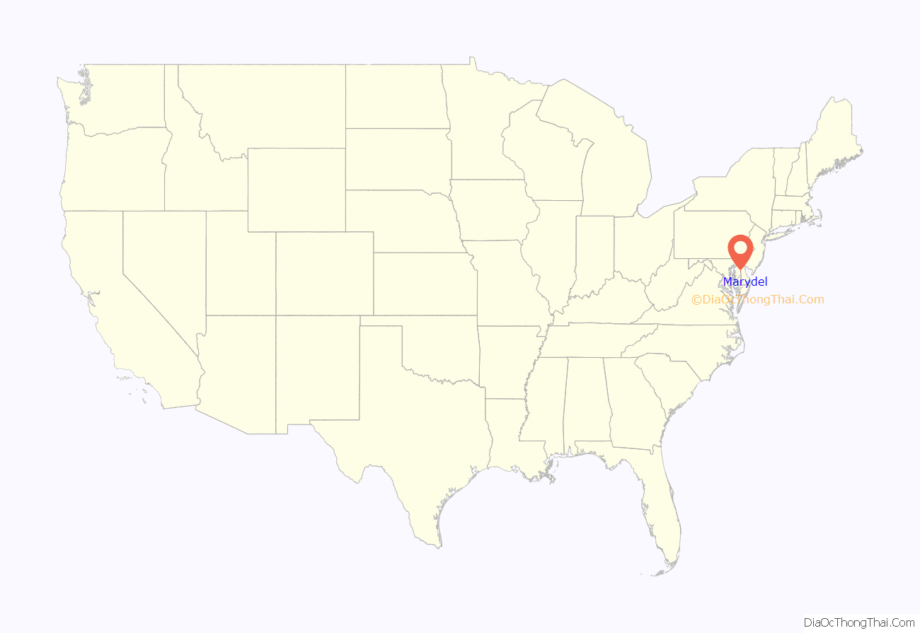
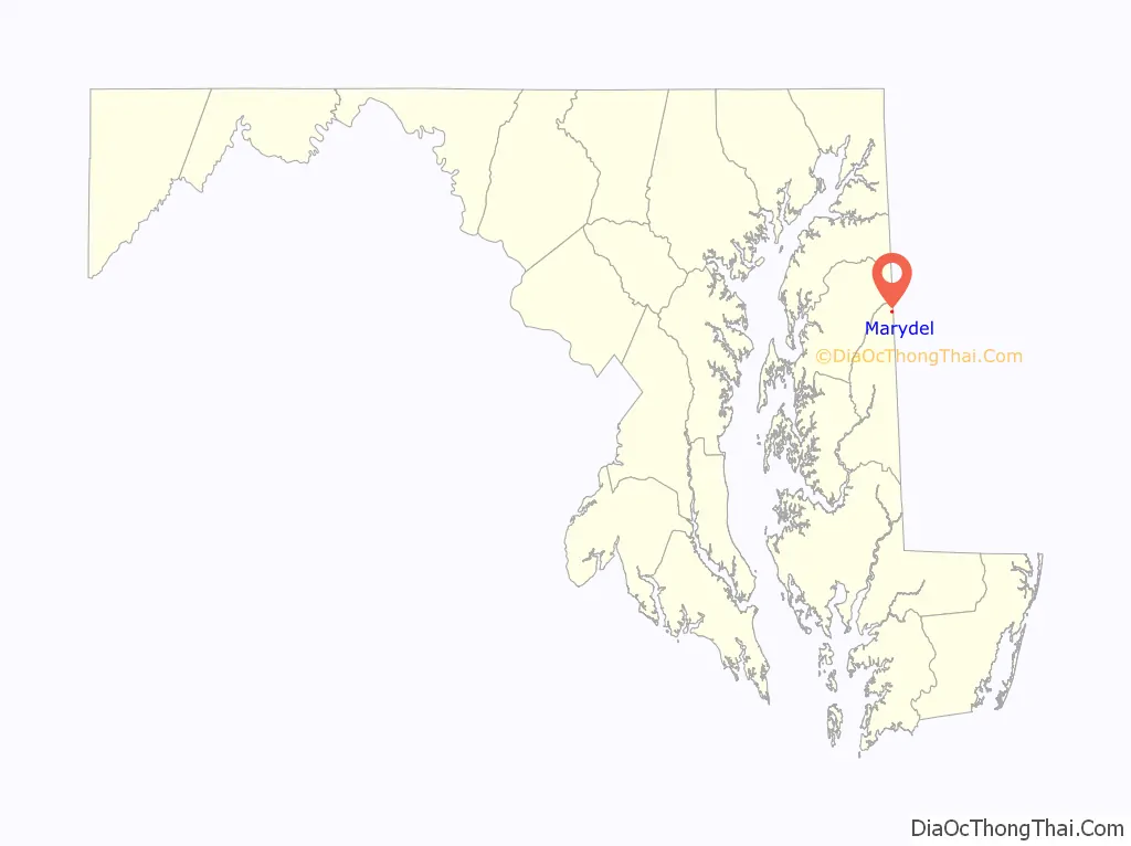
Marydel location map. Where is Marydel town?
History
The town of Marydel was settled by Austro-Hungarian Catholic farmers circa 1914, around the time that the Austro-Hungarian Empire was about to plunge Europe into World War I, and some immigrants from that area came to the United States. In recent times, beginning in the 1990s, the town became home to a large community of Hispanic immigrants of Guatemalan descent. The majority of these Guatemalan immigrants came from an agricultural, rural, mountainous regions in Guatemala (specifically rural San Marcos), making them feel at home in rural, agricultural (though not mountainous) Caroline County. This community is primarily Spanish speaking, with some of the Guatemalan Mam dialect mixed in. Many of Marydel’s Guatemalans have become permanent residents and American citizens.
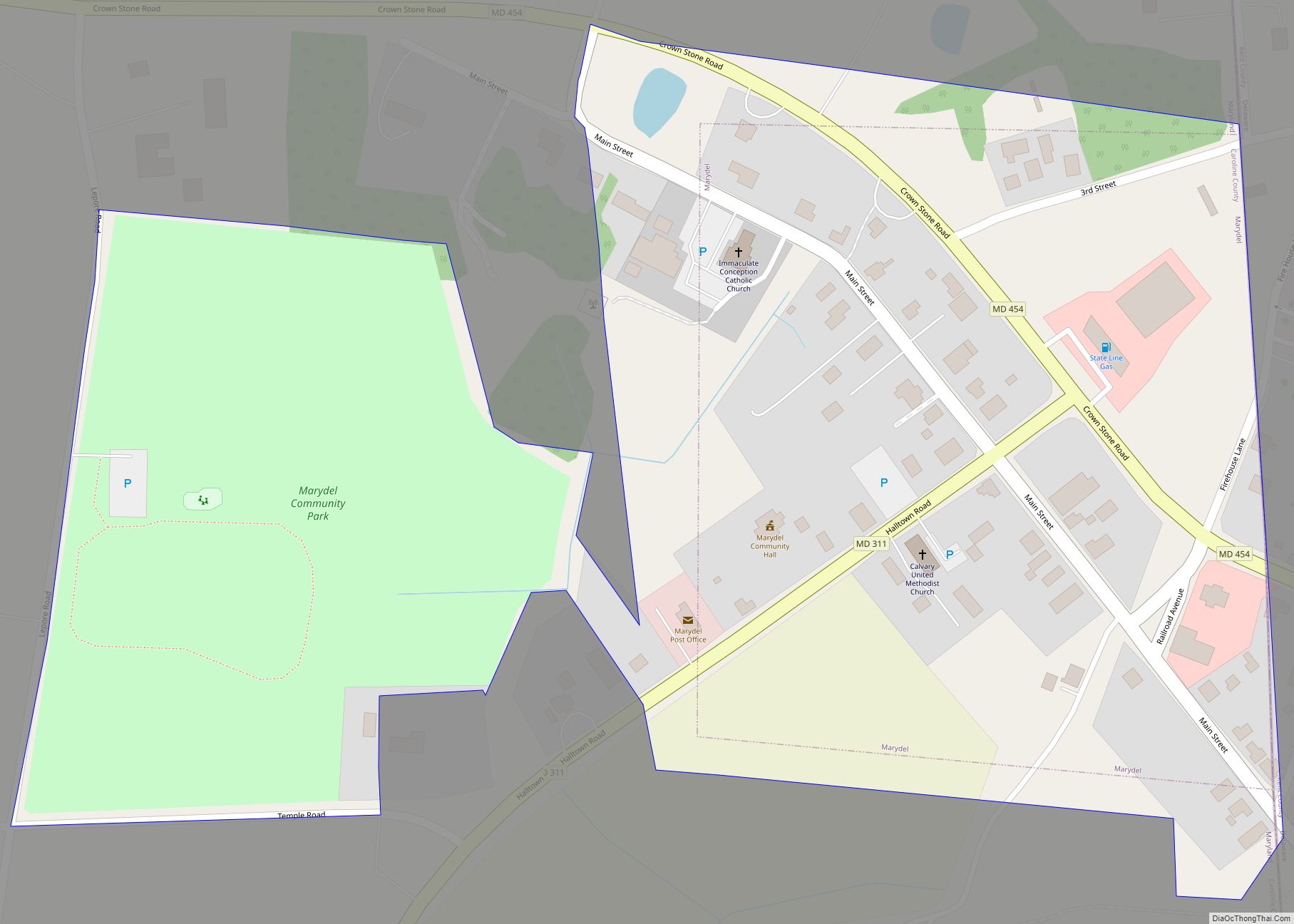
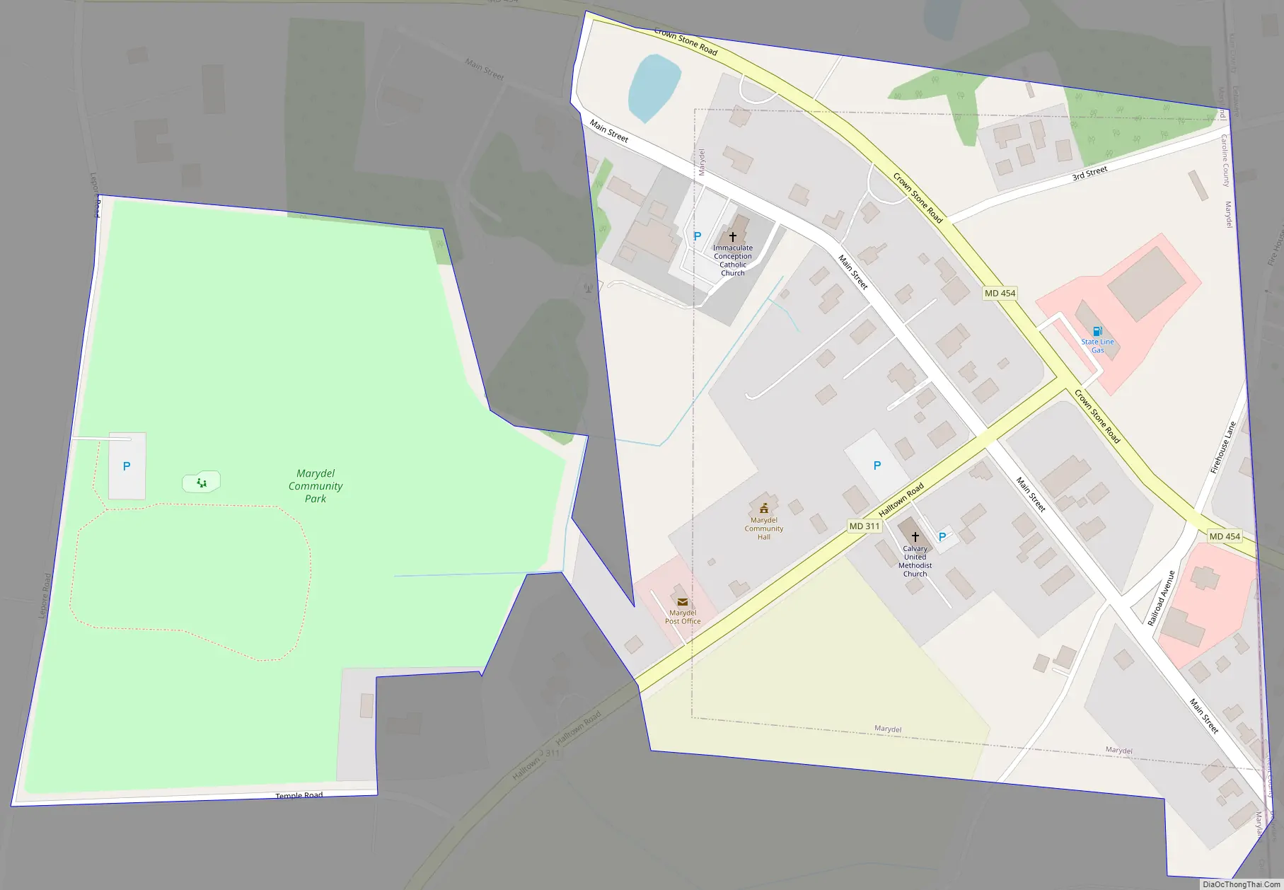
Marydel Road Map
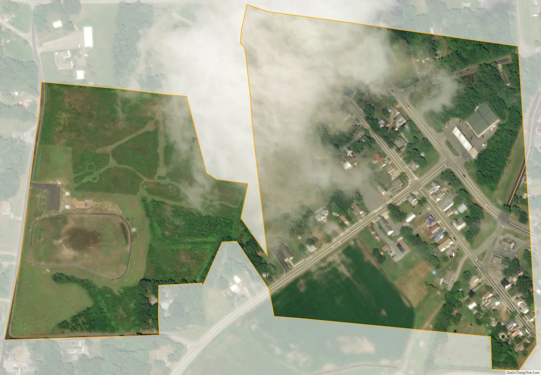
Marydel city Satellite Map
Geography
Marydel is located at 39°6.8′N 75°44.8′W / 39.1133°N 75.7467°W / 39.1133; -75.7467 (39.1130, -75.7468).
According to the United States Census Bureau, the town has a total area of 0.08 square miles (0.21 km), all land.
See also
Map of Maryland State and its subdivision: Map of other states:- Alabama
- Alaska
- Arizona
- Arkansas
- California
- Colorado
- Connecticut
- Delaware
- District of Columbia
- Florida
- Georgia
- Hawaii
- Idaho
- Illinois
- Indiana
- Iowa
- Kansas
- Kentucky
- Louisiana
- Maine
- Maryland
- Massachusetts
- Michigan
- Minnesota
- Mississippi
- Missouri
- Montana
- Nebraska
- Nevada
- New Hampshire
- New Jersey
- New Mexico
- New York
- North Carolina
- North Dakota
- Ohio
- Oklahoma
- Oregon
- Pennsylvania
- Rhode Island
- South Carolina
- South Dakota
- Tennessee
- Texas
- Utah
- Vermont
- Virginia
- Washington
- West Virginia
- Wisconsin
- Wyoming