North Beach is a town in Calvert County, Maryland, United States. The population was 1,978 at the 2010 U.S. Census.
In addition to a boardwalk, North Beach has multiple parks including Wetlands Overlook Park, Sunrise Garden, Callis Park, and the Walton Beach Nature Preserve. It is also the home of the Boys & Girls Club of Southern Maryland and is slated to be the new home of the Twin Beachs Public Library.
| Name: | North Beach town |
|---|---|
| LSAD Code: | 43 |
| LSAD Description: | town (suffix) |
| State: | Maryland |
| County: | Calvert County |
| Incorporated: | 1910 |
| Elevation: | 0 ft (0 m) |
| Total Area: | 0.34 sq mi (0.89 km²) |
| Land Area: | 0.33 sq mi (0.85 km²) |
| Water Area: | 0.01 sq mi (0.04 km²) |
| Total Population: | 2,146 |
| Population Density: | 6,522.80/sq mi (2,515.59/km²) |
| ZIP code: | 20714 |
| Area code: | 410 |
| FIPS code: | 2456300 |
| GNISfeature ID: | 0590888 |
Online Interactive Map
Click on ![]() to view map in "full screen" mode.
to view map in "full screen" mode.
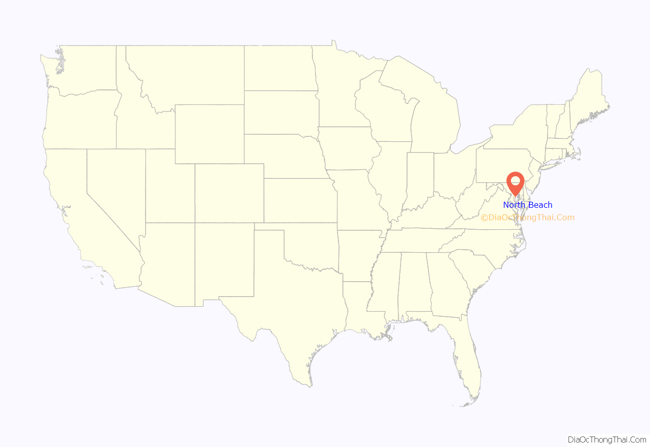
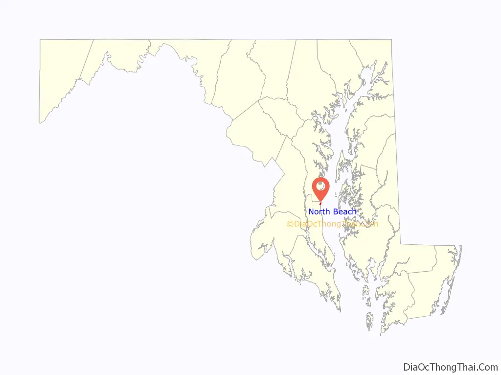
North Beach location map. Where is North Beach town?
History
The Town of North Beach was originally platted in 1900 and then re-platted in 1908. It was formally incorporated in 1910. It was established as strictly a residential town with ads running in local newspapers proclaiming North Beach as “Washington’s most popular salt water resort.”
Early visitors arrived to the Town via steamboat, railroad, oxen carts, trolley car and automobiles. For more than one hundred years residents and visitors alike have enjoyed the Town’s numerous amenities which included: swimming, crabbing, boating, gambling, fine local restaurants, pier, boardwalk, top named bands, carnivals, parades, hunting, trapping, fun, beauty contests, motor cycles, numerous festivals, search for sharks teeth, fossils, farmer’s market and summer breezes.
Revitalization began in the 1980s, and escalated in the 1990s. Tropical Storm Isabel destroyed many of the waterfront homes and boardwalk in 2003. Since then, the waterfront of North Beach has been rebuilt with multi-story homes and a condominium.
North Beach Road Map
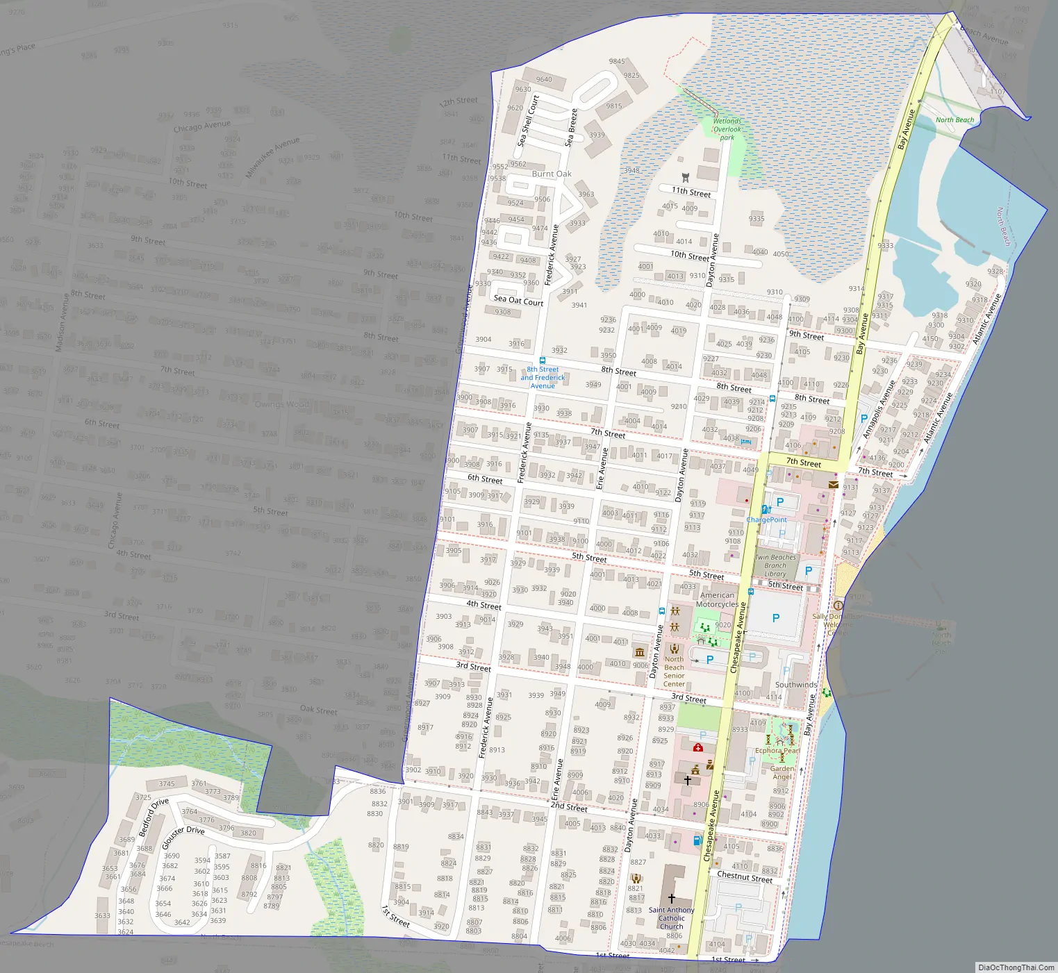
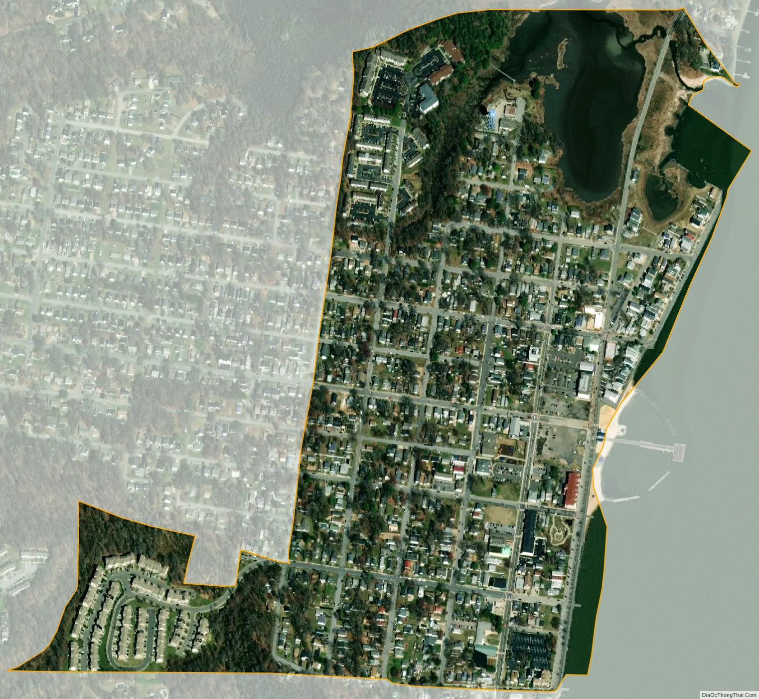
North Beach city Satellite Map
Geography
North Beach is located at 38°42′27″N 76°32′4″W / 38.70750°N 76.53444°W / 38.70750; -76.53444 (38.707423, -76.534450).
According to the United States Census Bureau, the town has a total area of 0.34 square miles (0.88 km), of which 0.33 square miles (0.85 km) is land and 0.01 square miles (0.03 km) is water.
See also
Map of Maryland State and its subdivision: Map of other states:- Alabama
- Alaska
- Arizona
- Arkansas
- California
- Colorado
- Connecticut
- Delaware
- District of Columbia
- Florida
- Georgia
- Hawaii
- Idaho
- Illinois
- Indiana
- Iowa
- Kansas
- Kentucky
- Louisiana
- Maine
- Maryland
- Massachusetts
- Michigan
- Minnesota
- Mississippi
- Missouri
- Montana
- Nebraska
- Nevada
- New Hampshire
- New Jersey
- New Mexico
- New York
- North Carolina
- North Dakota
- Ohio
- Oklahoma
- Oregon
- Pennsylvania
- Rhode Island
- South Carolina
- South Dakota
- Tennessee
- Texas
- Utah
- Vermont
- Virginia
- Washington
- West Virginia
- Wisconsin
- Wyoming